Valparaiso Street Art and Stuff

Valparaiso was a bit of a mystery.  Other than the meagre tidbit that it is a large international sea port, I knew very little about the place, so I had booked us a tour with Patagonia Shorex – which I should probably admit, I booked so long ago, that as I got off the ship this morning, I had no recollection whatsoever as to where the tour was taking us.  So yeah, today, as a travel agent I’d probably make a good brick layer.

We were met by our lovely guide, Dixianna (Dixie for short), who was going to be showing us around.  Dixie turned out to be full of interesting information, which of course is a very desirable trait in a tour guide!  Valparaiso has been an important Chilean city throughout modern history, as it served as a major stopover point for ships traveling between the Atlantic and Pacific Oceans, as they passed through the Straits of Magellan and around the Cape.  The city’s ‘golden age’ saw the area grow enormously as it attracted many European immigrants, from Britain, France, Italy, Germany, and Switzerland – all of these European influences are evidence in the architecture throughout the city.

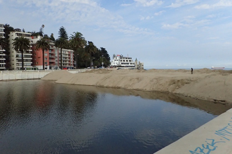
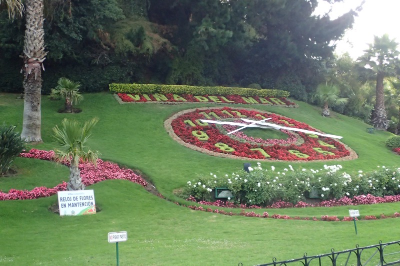
We first went north towards a township that is adjacent to Valparaiso (the city limit/s apparently run straight through the middle of a public school!), called Vina del Mar – a place where once vineyards were common, but now is a city best known as a major tourist attraction, and the town sees travellers all year round.  Dixie informed us that the area was originally populated by the Chango people, who were nomadic and primarily lived on fishing endeavours.  The first Spanish explorers (I didn’t catch the names – Amergo? Amagero? Not sure and can’t google it just now) arrived in 1536.  The Chango people originally called the Vina del Mar area, the ‘Burned Land’ which referenced the frequent bush fires that still plague the region.  Thankfully, nothing looked even remotely of recent bush fire activity, and instead we went to visit what we were told is South America’s first ‘flower clock’.  It is currently planted with red and pink flowery things (big gardener type, me).  The flowers are changed every three months apparently, and there is a tunnel beneath it for maintenance.  Personally, I don’t see the significance of such things, but I’ve stopped and taken photos of many a weirder town monument, so there it is.
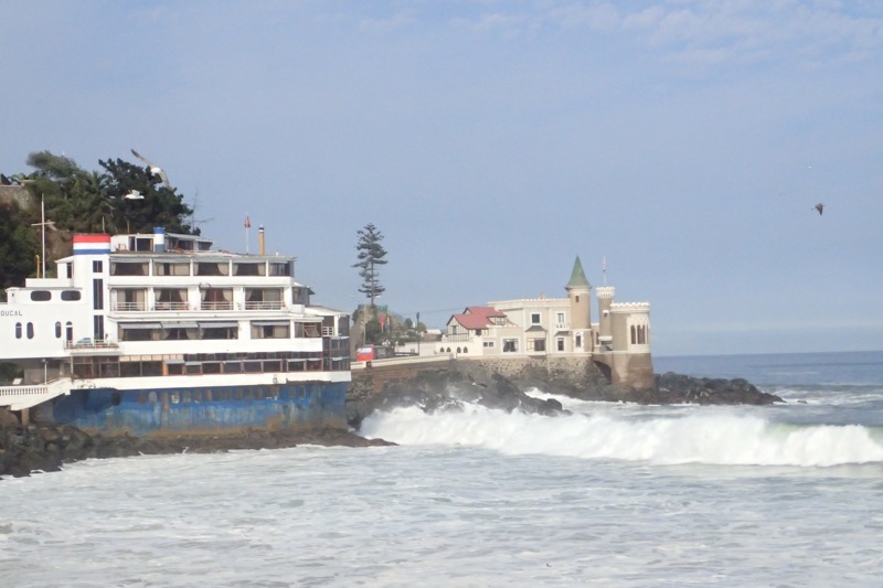
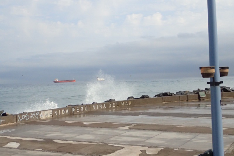
As mentioned earlier, Vina del Mar is a huge tourist town, and it’s wide esplanade is usually bustling with tourists enjoying the seaside restaurants and shops.  However, this week, the ocean has been particularly rough, and the waterfront area was completely closed to pedestrian traffic. No storms or anything, just really huge waves rolling right up to the town’s edge. In recent years Vina del Mar has frequently had to close the waterfront area due to the rough ocean weather crashing onto the breakfront… This is largely due to climate change – historically this sort of weather was very rarely experienced, but it is becoming increasingly common and is causing severe erosion. The town is constantly taking measures to repair buildings and walkways that were getting damaged by these crazy high tides and the brutal onslaught of the constantly crashing waves.  Houses and buildings in lower income areas that are affected by the rough seas are generally either left derelict or repaired slowly over time, but the fancy art deco casino and the lucrative public boardwalk shopping and restaurant areas are always repaired very quickly.  It is becoming a very significant concern for local authorities, and the local constabulary will fine people that go past the barriers that are put in place for people’s safety.
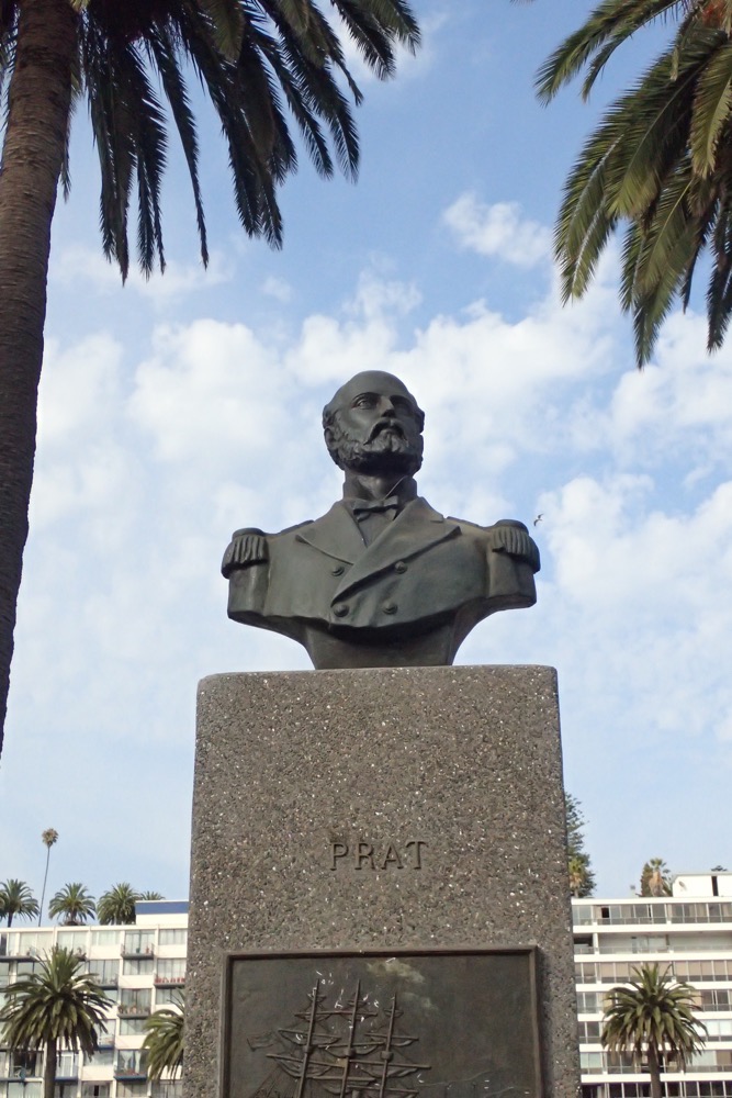
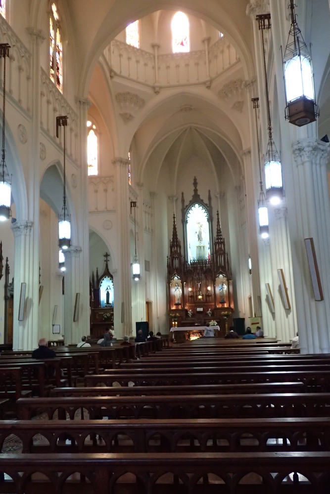
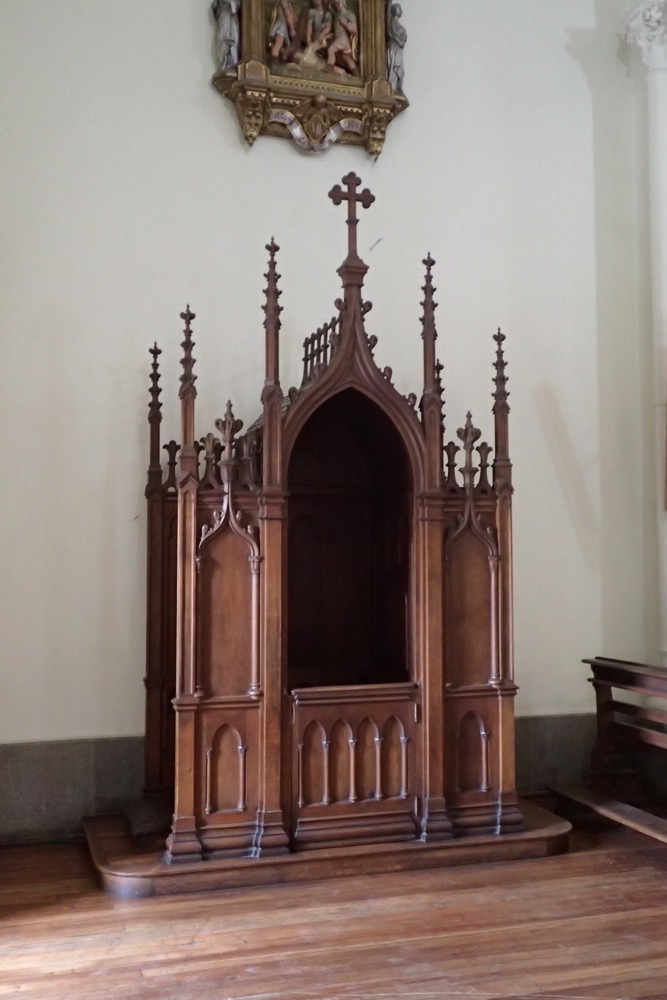
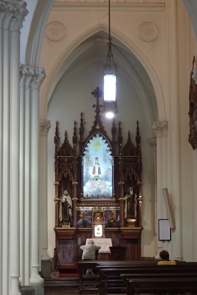
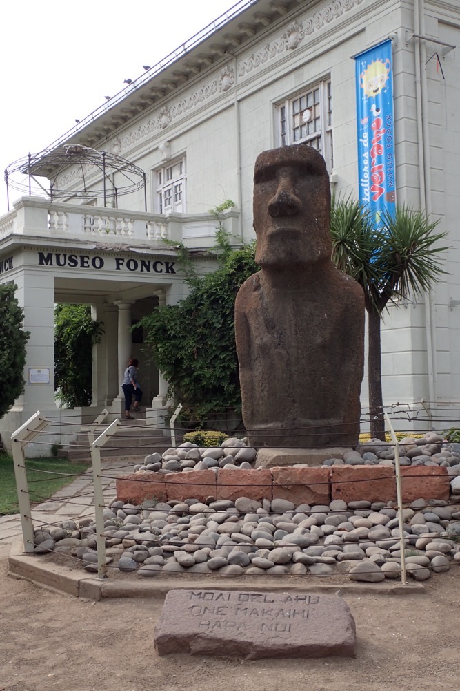
Next we went to see a genuine ‘moai monument from the Easter Island that was relocated to Vina del Mar at great expense, and after much negotiating with the Chilean government and the local tribal councils on Easter Island’. I guess Dixie wasn’t to know that we have all recently just visited the island and seen hundreds of the enormous and impressive monuments in situ a few days before; she was genuinely puzzled that no one seemed particularly interested in the lonely monument that to us seemed sadly out of context, set as it is, outside the Fonck Museum.  Instead, we spied the spire of a nearby church and all wandered around the corner to see what it looked like.  The church was beautiful, with it’s gothic style architecture, select stained glass windows, mosaic tile floor and beautiful timber and gold nave, and quaint confessionals.  Again, our poor guide was puzzled at our interest in the church, and I found myself explaining that in Australia, many churches are unfortunately designed in the same style as a 1960s brick toilet block, so sandstone churches such as these are quite rare for us, whereas Dixie shrugged and said many churches in Valparaiso look similar to this one.
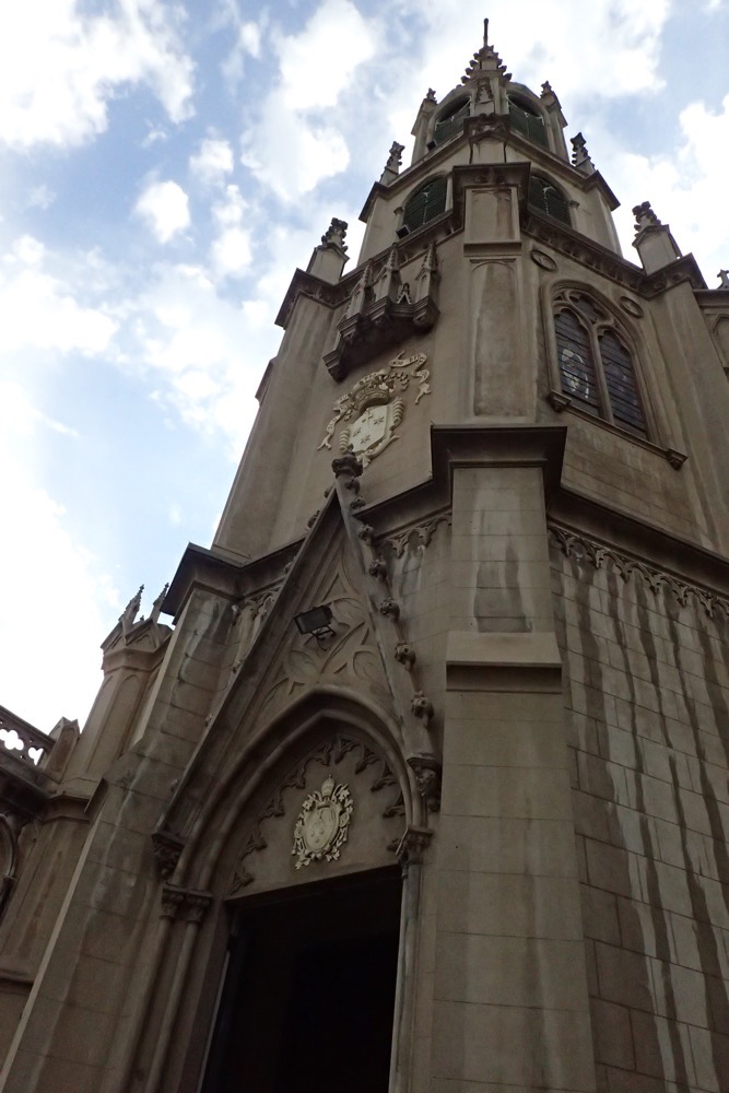
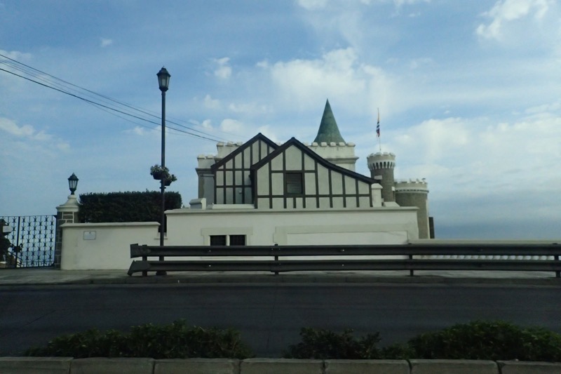
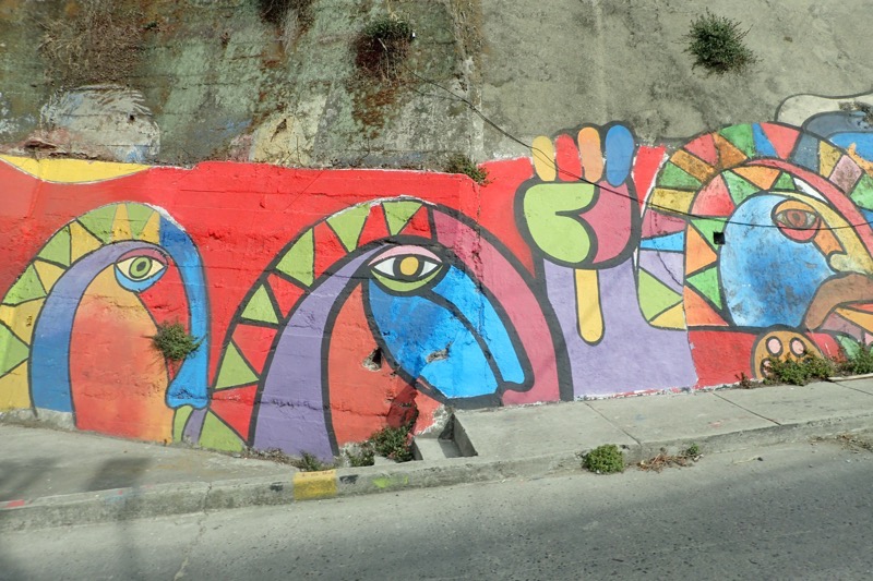
After the church we made a quick stop at a botanical garden that leads to a huge modern amphitheatre that was preparing for the music festival that was starting soon, and then we hit the road back to Valparaiso proper.  Along the way, I caught glimpses of some of the city’s famous street art.

As we drove along the highway that connects Valparaiso and Vina del Mar, we were informed that the port continued to be a significant centre for resupplying and supporting ships during the Californian Gold rush of the late 19thC, as well as being a huge export centre for copper and various produce.  Unfortunately for Valparaiso however,  from the 1950s onwards, there was a fairly significant socio-economic decline after the opening of the Panama Canal, which caused a serious decrease in ship traffic.  Many eminent families moved to Santiago, and the port-based economy suffered for quite a long time.  In more recent years, Valparaiso has started to stage a recovery by becoming the ‘Cultural Capital of Chile’, attracting artists, musicians, chefs, writers and culture vultures, who have reinvigorated the city’s historic districts. The city also has four major universities to attract international attention, and is constantly hosting music festivals and community street art projects.
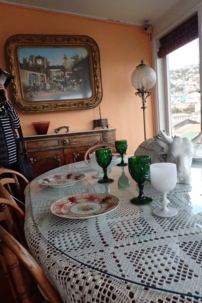
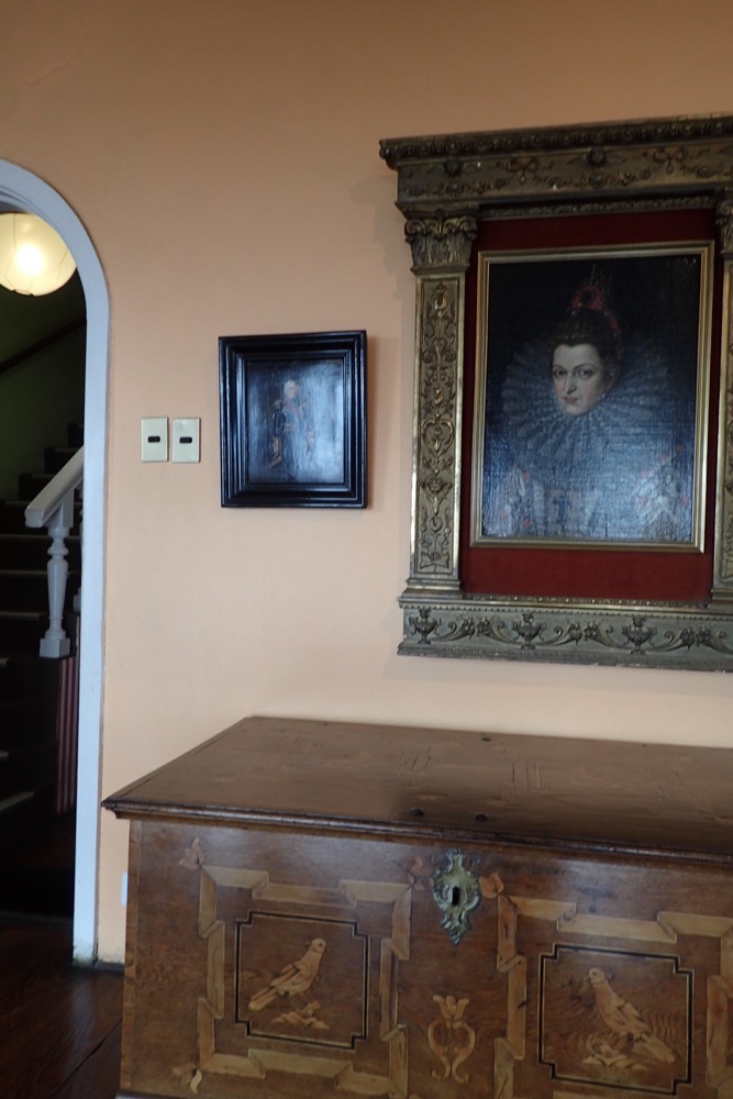
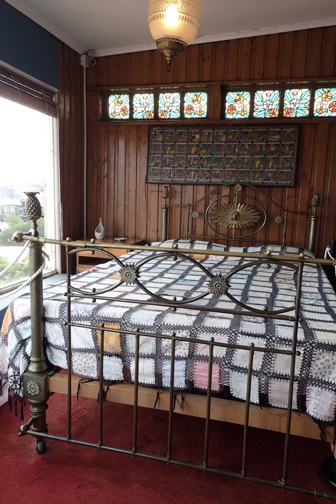
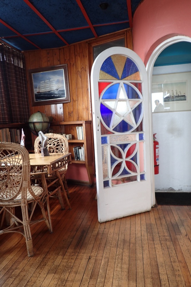
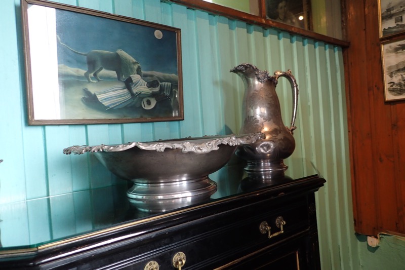
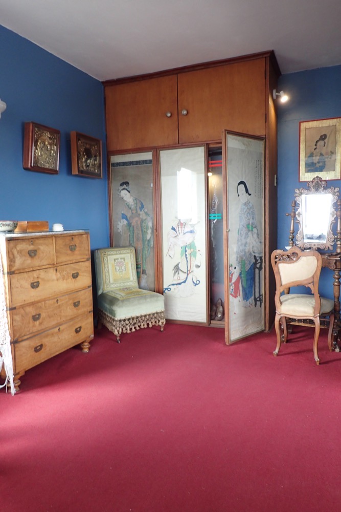
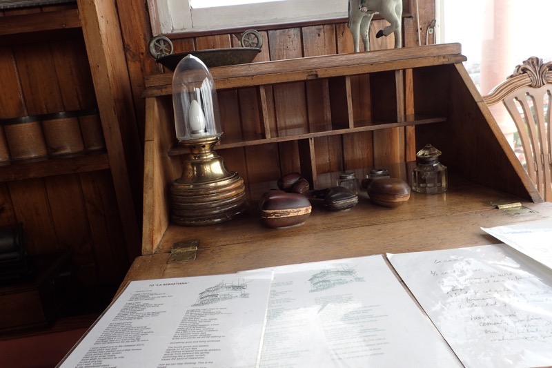
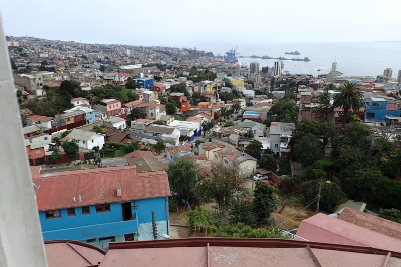
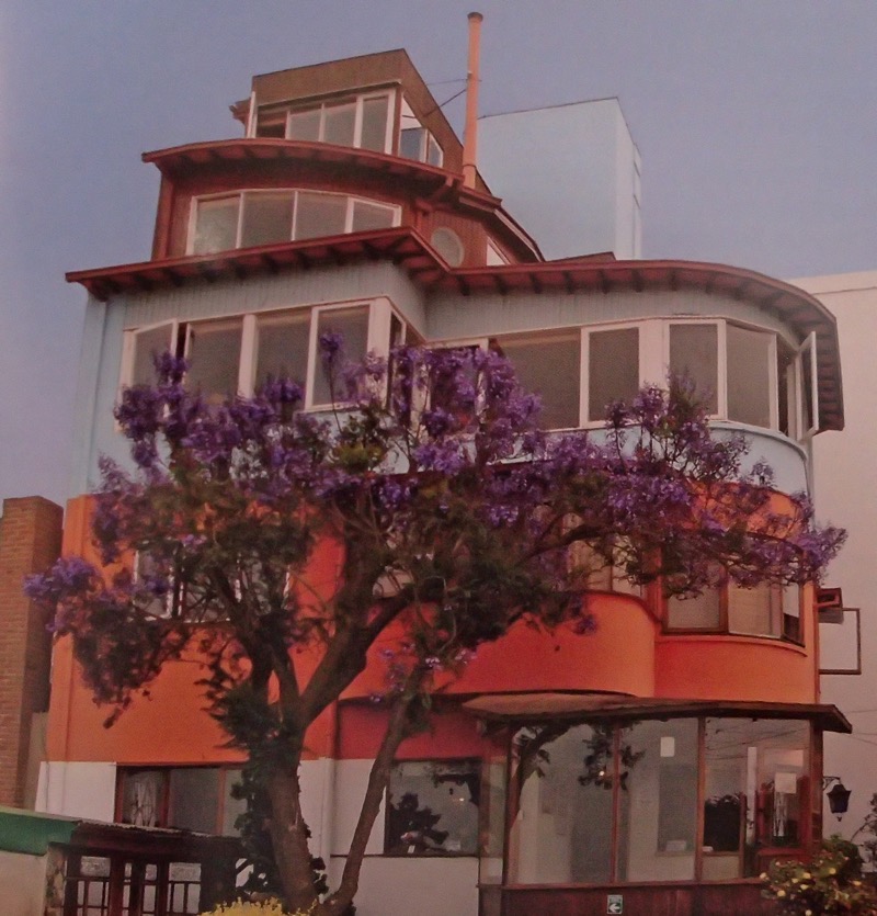
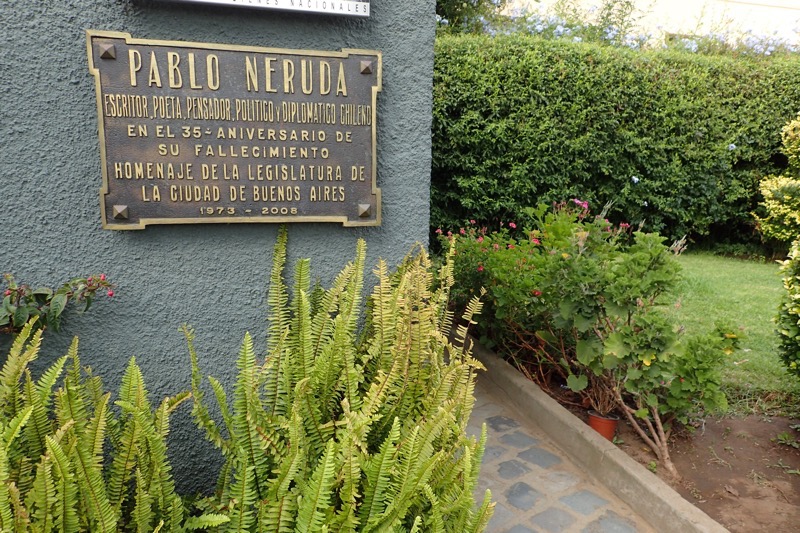
Our first stop on our return to Valparaiso, was to Neruda House, also known as La Sebastiana.  Located high in the hills of Valparaiso, the house once belonged to Pablo Neruda, the famous poet who had taken over the unfinished house started by architect, Sebastian Collado who had died before finishing the home.  It is now a museum dedicated to the poet, and is full of Neruda’s eclectic things from the mid-20thC.  Neruda obviously had a striking sense of interior design, and the house is full of many original pieces of furniture, pictures and objects, but nothing in the house is quite so impressive as the views, visible from every window, over Valparaiso Harbour.  The house was designed to make best advantage of the sweeping panorama below and it is absolutely beautiful.  It was a twisting windy little narrow house built over five floors, and I can’t imagine living there with all those stairs, but the views would make it worth it!
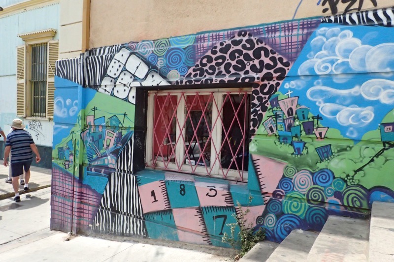
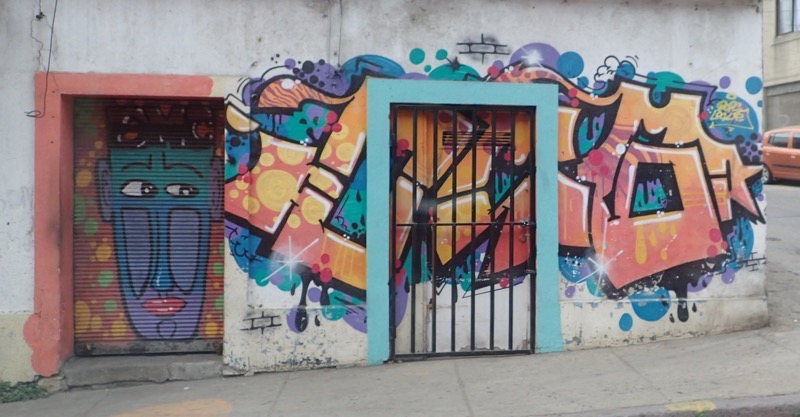
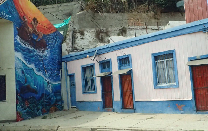
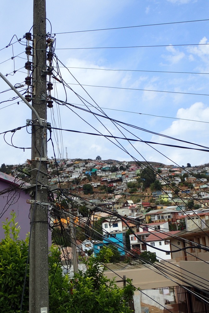
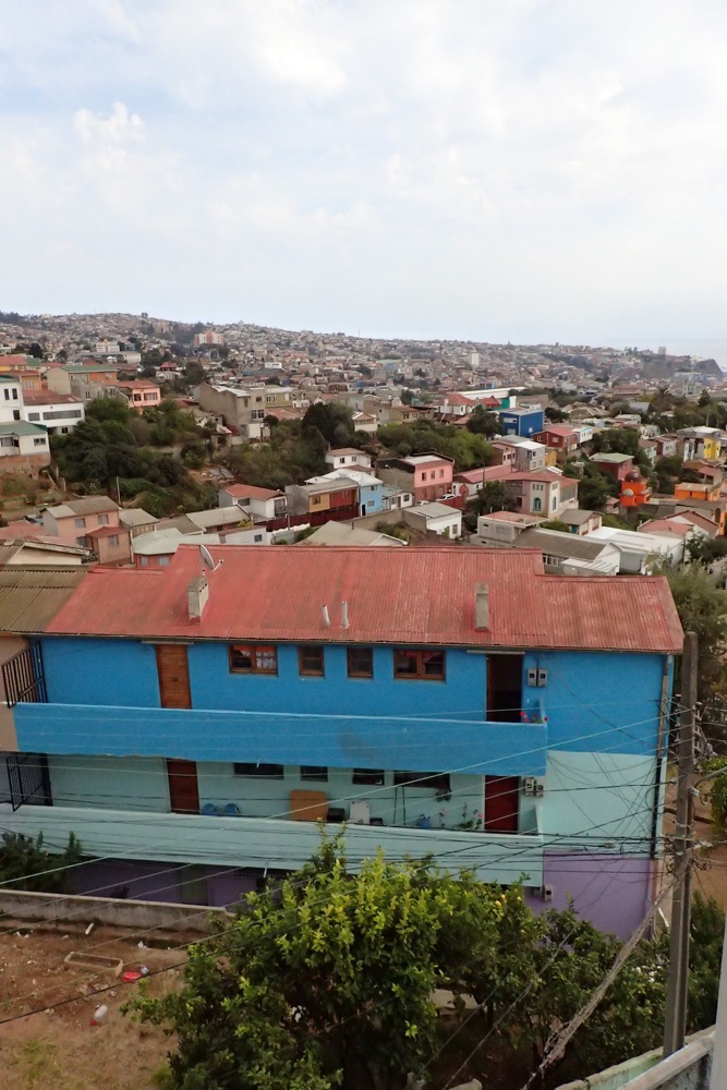
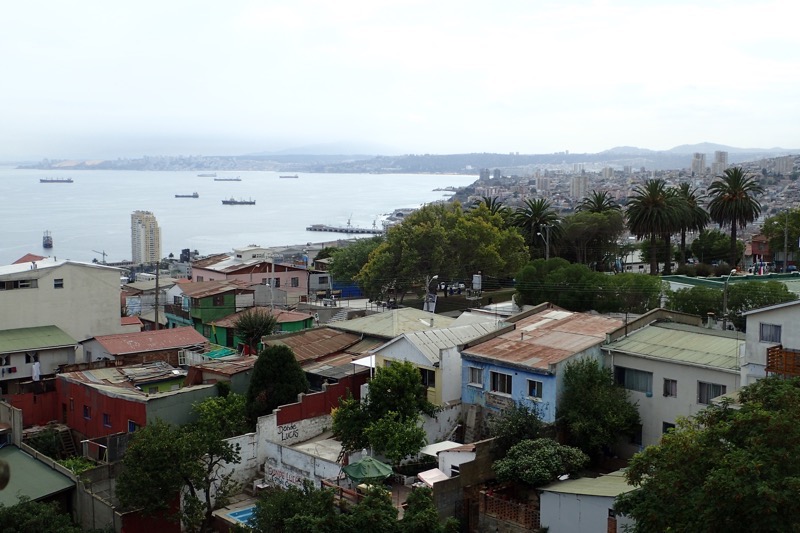
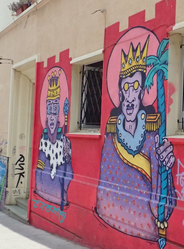
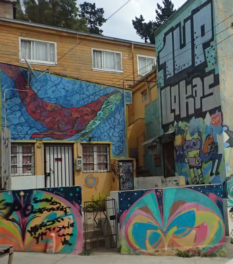
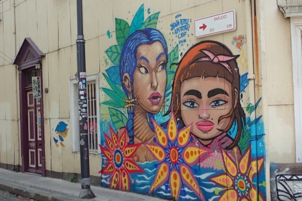
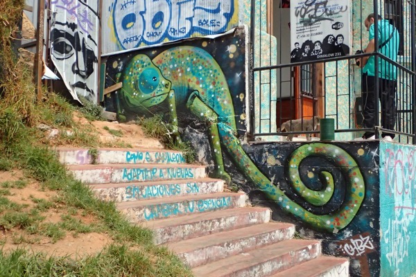
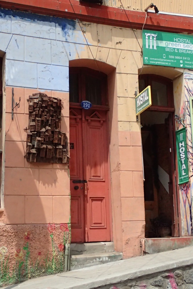
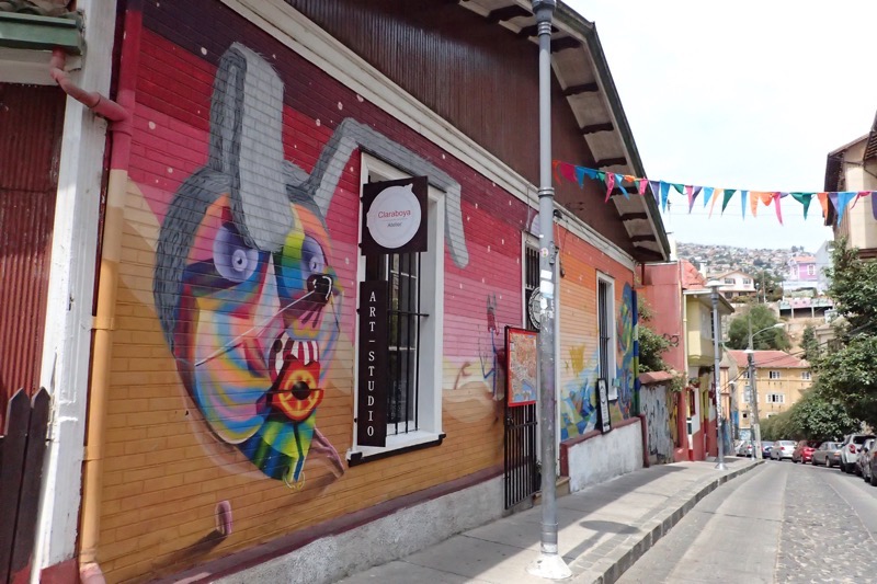
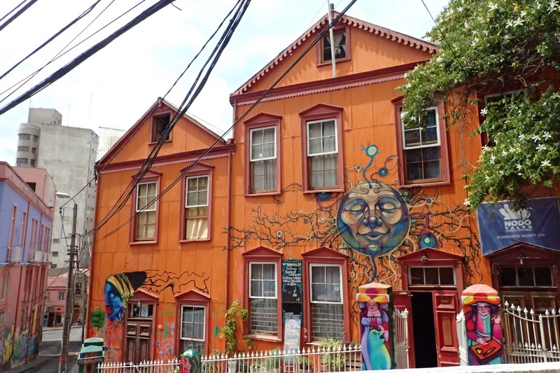
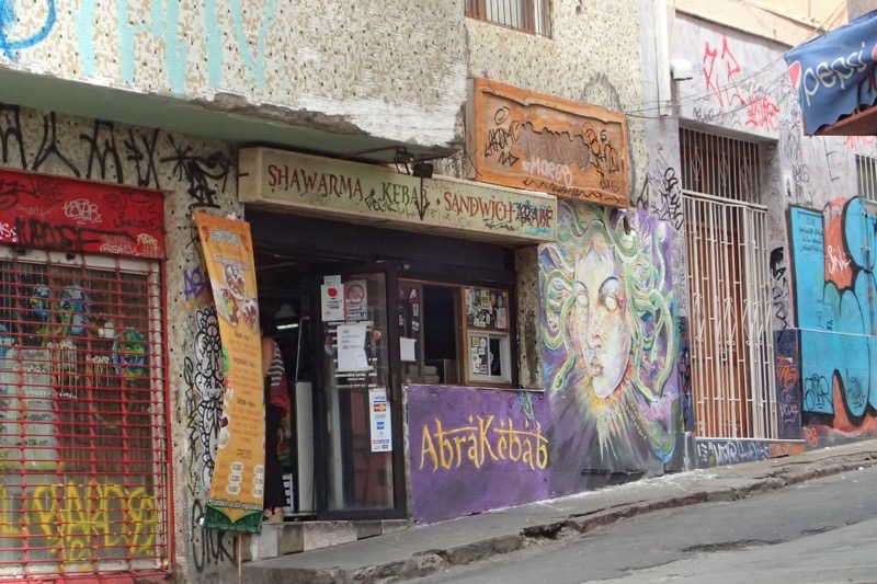
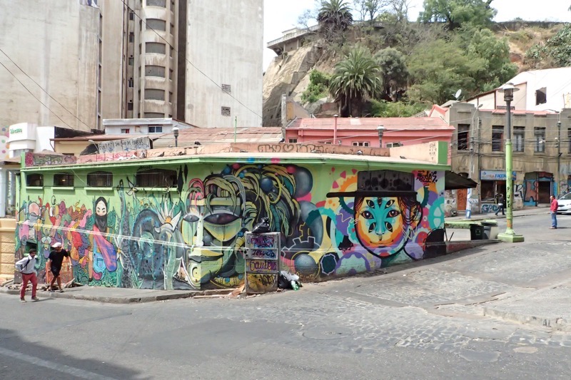
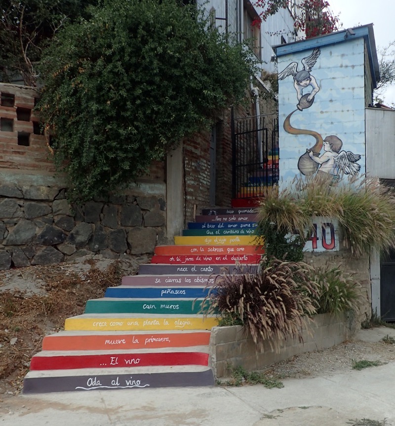
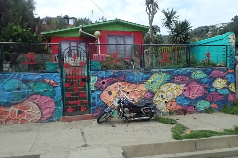
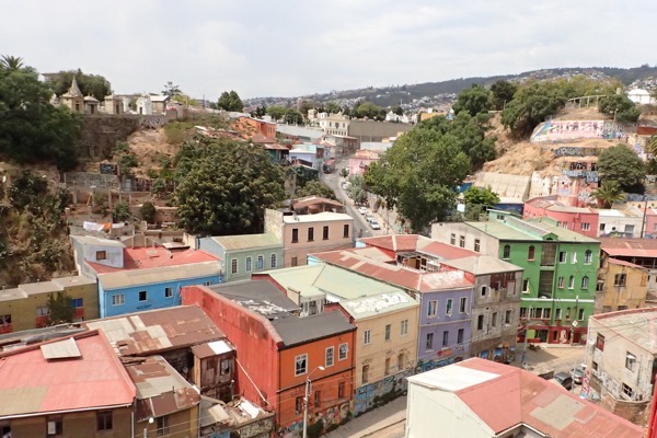
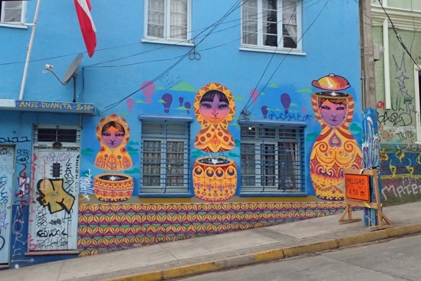
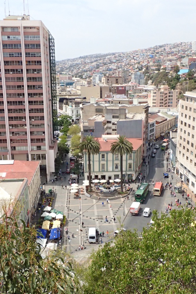
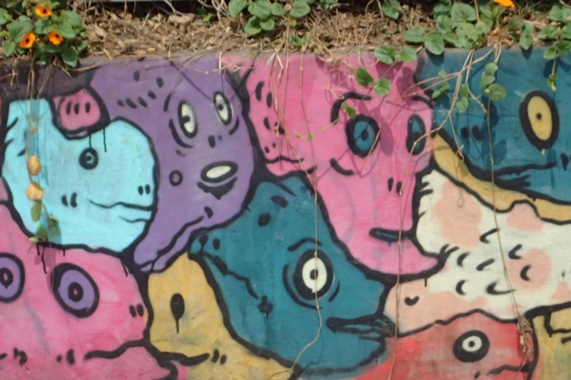
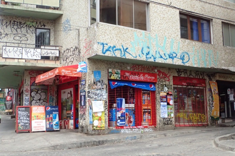
After this we drove further into the historic older district of Valparaiso, with more fabulous street art and more fabulous views of the city.  Tourism now makes up a good portion of Valparaiso’s economy as people come to enjoy the cobbled alleys and maze-like streets, the colourful buildings and the creative murals and almost overwhelming amount of street art.
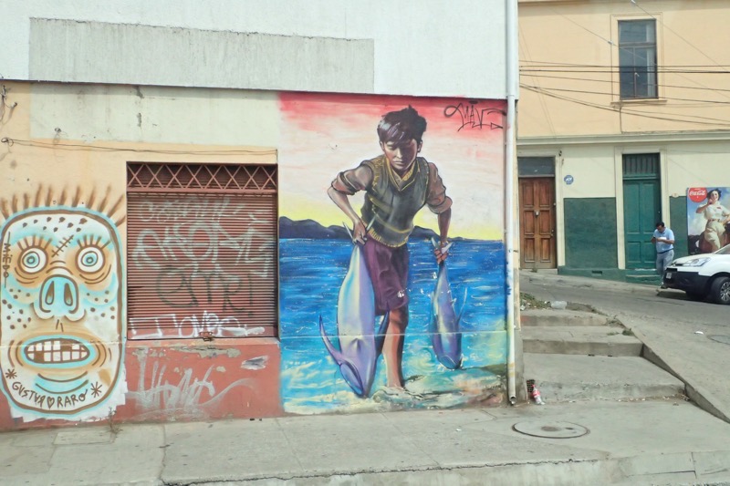
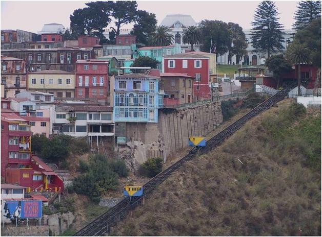
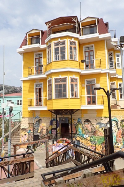
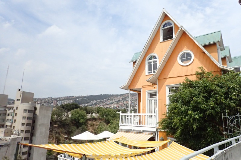
The city is nicknamed ‘The Jewel of the Pacific’ and its historic district was named a UNESCO World Heritage site, in particular its unusual funicular lifts.  Built onto the steep hillsides that overlook the bay, Valparaiso is a winding labyrinth of narrow streets and cobblestone alleyways, between crazy diverse architectural and cultural centres, there is system of ascensore (funicular) lifts that help the locals get around.  For 100 CHL (Chilean pesos), you can take one of these funiculars up a hillside and cut large sections off your steep uphill walks.  This beautifully kept bright yellow house (above) is at the top of one of the ascensores that take people into the historical district. There are 15 of these rickety old ascensores, that are located in different parts of the city.  Dixie also mentioned there was one other that was not for public use, but belongs to a local hospital. These funiculars are also protected by world heritage status and therefore all kept in (at least, barely) working order.  The most popular spot for tourist is to ascent to the Conecpcion and Alegre historical district, or Bellavista hill which is known as an ‘open air museum’ as it contains so much street art.
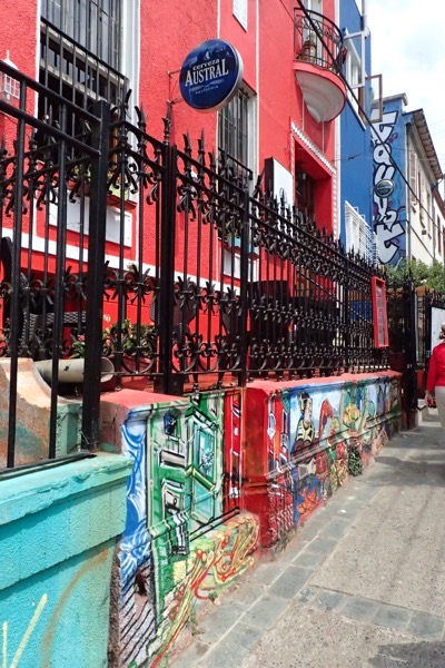
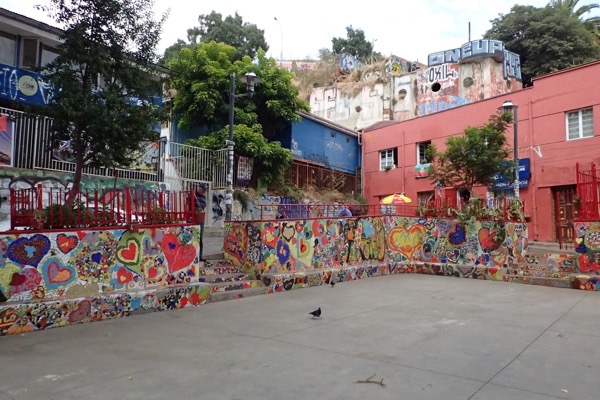
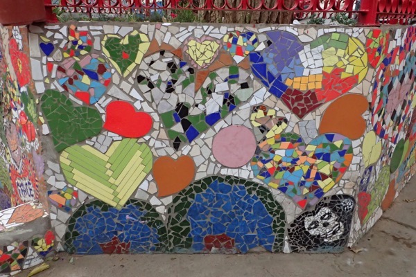
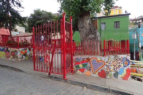
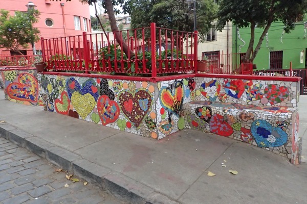
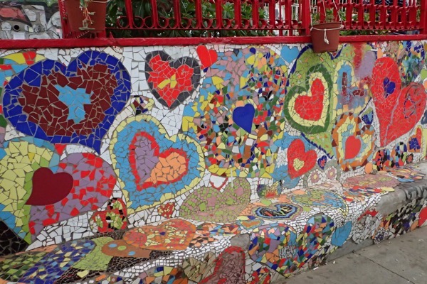
Next stop was this crazy street corner covered with its bright red paint and ceramic tile mosaics, called the Resting Corner or Resting Place, (which is a bit grave, and way less than cheerful in English!).  The Resting Place was a community street project where artists and members of the local community who are interested come together to create a space.  All of the art works are very much encouraged by the city authorities, and Dixie was saying that if you wanted to paint your house a bright colour, all you had to do was tell the council and they would provide the paint and the workers.  If you wanted a mural on your house, you had to apply to do one (presumably for design approval) and they would come paint a mural on your house, but you would be charged a little extra for mural painting.  No wonder the city is so colourful and covered in art work – it is all subsidised by the city.
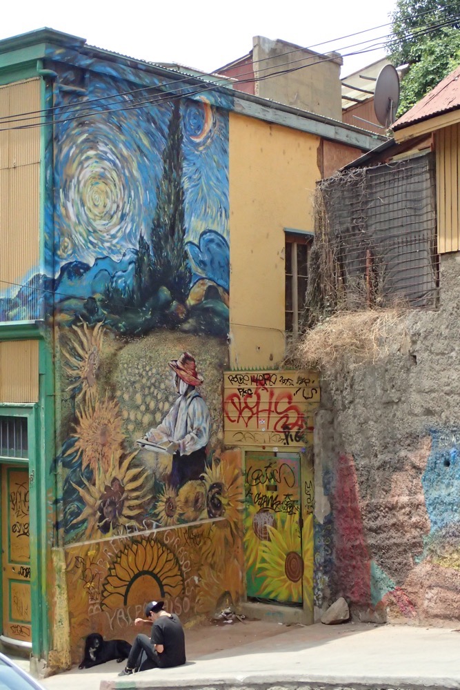
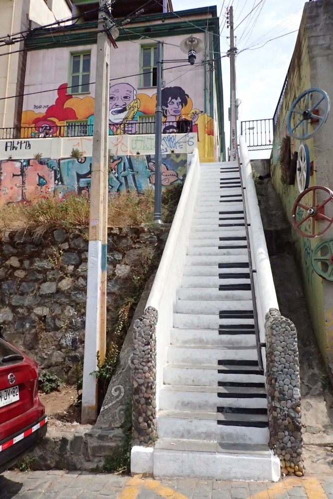
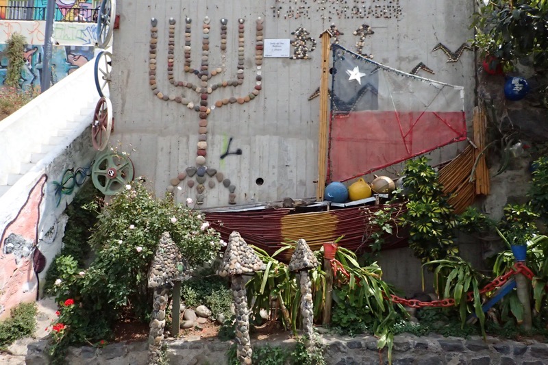
The rest of our afternoon was spent walking back down the hillside, winding through the historic district and marvelling at the brightly painted buildings.  There were painted tributes to Easter Island, to penguins, elements of Chilean culture, backpacker hostels painted with bright red double decker buses, a Van Gogh tribute, stairways painted like piano keys, a rock sculpture wall, and all mixed in with beautiful views down over the city.   This liberal attitude towards painting the town is evident everywhere and while there is a LOT of graffiti covering the town, none of it is over the top of the beautiful murals.
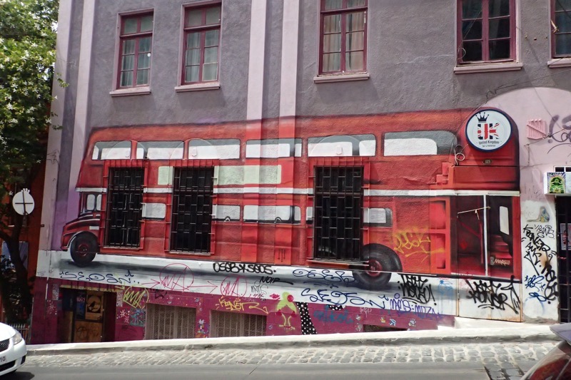
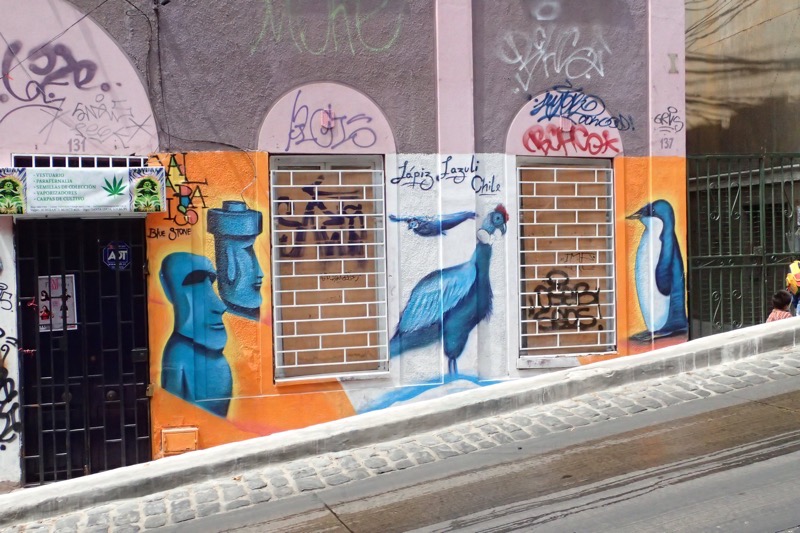
Valparaiso is certainly a beautiful and interesting city with so many interesting pieces of street art, that I have gone totally overboard with images in this post… and these aren’t half of the pics I took!
After this, it was time to head back to the ship – but not before ferreting out a fabric store to try and find some fabric for Aunty Mary’s hand sewn quilt that she has been working on.  We found two fabric stores, but weirdly could not find any material that was 100% cotton in either?!  In the end, we gave up and head for a local department store, where we found, in the men’s department, a 100% cotton shirt with a print that will do quite nicely, so we bought it to take back to the ship to cut up into little hexagons to be added to her quilt.  Everyone needs a decent project for these long sea days, there’s only so much bingo and trivia you can handle!  🙂
Easter Island

Named ‘Easter Island’ by Dutch Explorer, Jacob Roggeveen who allegedly found the place on Easter Sunday, (some contend that because of the International Date Line it was actually Easter Monday… so it shouldn’t be called Easter Island at all *shrug*), the island has also has had a number of previous names; one of which was ‘Te pito o te kainga a Hua Maka’ – ‘the little piece of land of hua maka’, translated literally as ‘the land at the end of the world’. However the word pito can be pronounced to mean ‘end’ or ‘navel’ resulting in the fanciful translation of ‘the Navel of the World’, which I actually kinda like. Further, it was also at one time called, ‘Mata ki te rangi’, which means ‘Eyes looking to the sky’ – and now having seen the volcanic craters on the island, makes total sense. However, for all that, it is now most commonly known as Easter Island (thanks Jacob!), or Rapa Nui, meaning ‘Big Rapa’ – a rapa being a ceremonial paddle??? which makes no sense. Interestingly, the people here are also known as the Rapa Nui, and their native language is also called Rapa Nui. I dare say when it comes to the term, Rapa Nui, context is king.

Easter Island / Rapa Nui is one of those places that is on most every traveller’s ‘Bucket List’ – their ‘one day I’ll get there’, list of dream destinations. And by all accounts, it is one that many people never get to tick off. Understandably, as it is one of the most remote inhabited islands in the world – its nearest neighbours being tiny Pitcairn Island, which is 2,075km away and has barely 50 people living there, half of whom are convicted felons; then there is the island of Mangareva which is equally remote at 2606 kms away, and after that the closest population is mainland Chile which is 3,512kms away. It really is in the middle of nowhere, so I can see why it was once called the end of the world. All this of course, makes it hard – and by ‘hard’, I mean mostly really expensive – to get to for such a small destination.

Cruise ships tend to offer it as a destination on their World Cruise itineraries because of its Bucket List status, and also to break up what would be roughly 15 sea days crossing the South Pacific, but due to it’s small harbour (a narrow channel prevents more than one tender entering or exiting at a time) and the fact that it is surrounded by extremely deep rolling ocean and often experiences a big swell, we have been hearing that barely 1 in 6, or 1 in 5, or 1 in 4 cruise ships actually get to port there (yeah, odd how facts change depending on who you are talking to). Long and the short of it is, that hardly anyone actually gets to go ashore by cruise ship, and we have met a couple of this ship for whom this would be attempt number three – so we didn’t have high hopes of actually making it to port. I’ve been watching the weather forecasts like a hawk for the last week or so, and seeing a suspiciously large low pressure cell, with subsequent storms, move towards the island on Friday and Saturday, and had all fingers crossed that it would have moved on by Sunday when we were scheduled to arrive. So while our tour operator was ‘confident’ the weather would be clement, we were all holding our breath until the Captain actually, said the words: ‘Today, we will be taking passengers ashore using the ships tenders.’ and two thousand people collectively stopped holding their breath.

Sunday morning – bright and clear and just glorious. We were still looking at a 1m – 2m swell which was going to make tendering in a little err, intersting, but thankfully the Captain was willing to brave it. Everyone was up bright and early, and we were all lined up in the Rigoletto Dining Room for our tender tickets around 8am – lucky numbers 322 and 323. Yep, at 8am, already 300 people had picked up tender tickets before us. About 8:15am the Captain announced that local authorities had not yet given clearance to come ashore. By the time around 450 odd tender tickets had been given out, they closed the dining room doors and stating the dining room was full, no more tender tickets would be issued until some of these people were taken ashore – which was seriously bad for the people STANDING in a queue that stretched through the atrium and into the forward stairwell. Once clearance was issued about an hour late at 9am, they started tendering off people who were booked through the ship to go on morning tours (a 3 hour tour through the ship to see only three archeological sites was setting people back $320pp O.o – needless to say many people had made alternative private arrangements). Roughly 25 people from the dining room were being called to fill up each tender with every bus load of Princess Tour people. At 25 people being called every 15 minutes or so, we were siting on our tickets in the 300s and starting to worry we would run afoul of the midday Princess shore tour people who would be given priority! Five calls for only 25 people by 10am and people were getting really restless – and more than a little bit worried*. Eventually, around 10:30am, they called for an entire tender from the dining room, and just shy of 100 people marched out, with big smiles feeling like they had won lotto! We were called just before 11am and we got ashore around 11:30am – which had me a bit worried about what was going to happen to our 9am tour! But there they were waiting for us, Marc Shields from Green Island Tours had assured me that they would wait for everyone who had booked their tour, and thankfully they were good to their word. There were only 14 of us booked on this private tour, and off we went.

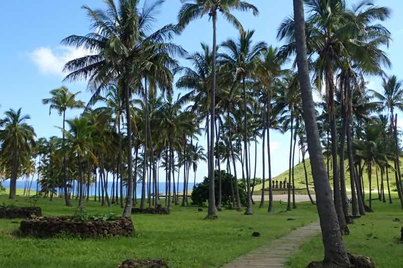
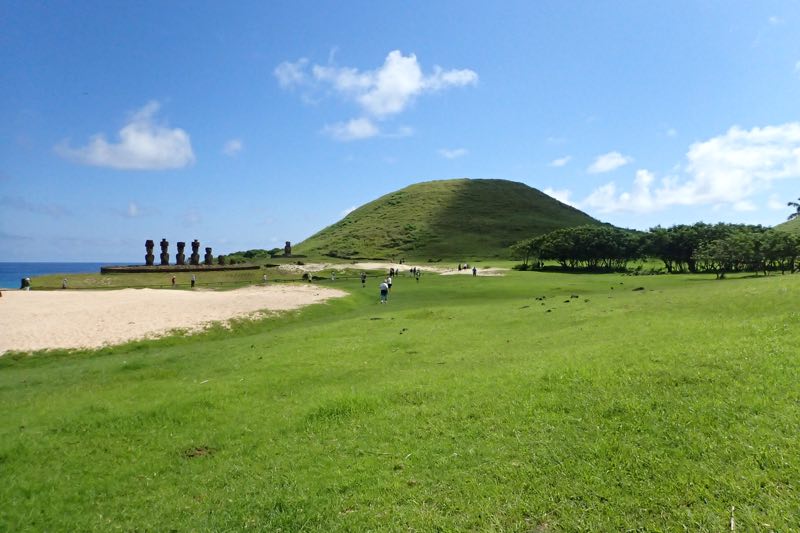
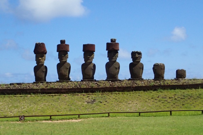
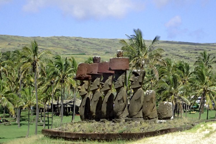
We set off across the island for our first stop was Anakena considered the birthplace of Rapa Nui’s culture. According to the island’s oral tradition, Anakena is the place where the founding Polynesian king of the Rapa Nui people, Hotu Matu’a, first set foot on the island – which makes sense, it is a lovely protected bay with a palm lined white sand beach. Anakena is therefore regarded the cradle of Easter Island’s history and culture, and archaeological studies have confirmed extensive occupation of this area from around 1200AD.

Most scholars believe that the moai were created to honour ancestral chiefs and other important people, but there is no certainty as much of their oral history has been lost and they had no written tradition, so it is impossible to be certain. Our guide, Christina, tells us that the moai were built to harness the mana (strength) of the ancestral people and channel it towards the community, which is why all the moai face inwards towards the island’s centre. It was believed that the living had a tangible relationship with the dead who provided healthy, wealth, fertility of land and animals, good fortune etc, so the people would provide offerings and offer the dead a good place in the spirit world. Most settlements were located on the coastline and as such most moai are erected along the coastline, facing inwards watching over their descendants, with their backs to the spirit world which was believed to be in the sea. This period of founding, settlement and growth is referred to as the Ancestor Cult period.

Interestingly, since Easter Island has been inhabited, they have experienced huge population changes. The island was most likely originally founded and populated by Polynesians, who navigated here in canoes from the Gambier Islands (2600kms away) or the Marquesas Islands (3200kms away) around this 1100-1200AD. This is consistent with James Cook’s visit the island in the 1770s with a Polynesian crew member from Bora Bora, when he was able to communicate quite as the Rapa Nui and Tahitian languages have 80% similarity. However, it is also possible that some settlers came from South America – a theory that is supported by the evidence of sweet potato as a historical food source.

Archeologists estimate that the population rapidly expanded to up to 15,000 people by the 1600s, but that the population dropped dramatically over the following century due to: 1) overfishing and overhunting of local sea birds, 2) deforestation (as larger trees were depleted, the people were unable to build seaworthy vessels which sustained their more distant fishing expeditions), 3) predation by a Polynesian rat (which dramatically effected vegetation and crops), and 4) raiding by slave traders in the 1800s! Peruvian sale traders violently abducted thousands of men and women, and when they were forced to repatriate the kidnapped peoples, they unfortunately sent back carriers of smallpox, which further reduced the population down to under 1,500 people. Today, Easter Island has a population of around 5,000 – 6,000 people.

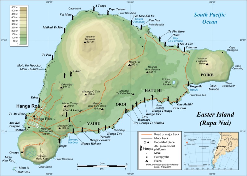
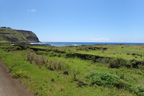
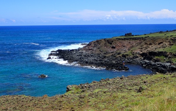
I love listening to the guides and learning about a place, but I tend to digress when I go to writing down what we got up to. So anyway, after Anakena, we took a scenic tour along the northern side of the island, passing some stunning scenery and many small moai sites. The island was once three distinct islands, but approximately three millions years ago, the eruption of the last active volcano joined them together. This has created some truly dramatic scenery and a wild and rocky coastline. The coastline is also dotted with the ruins of platforms that once held moai statutes. At various points during the island’s history, civil unrest saw the huri mo’ai – the desecration, toppling and destruction of moai belonging to rival clans/families. Christina informed us that nearly every ‘pile of rocks’ is an unrestored moai site.

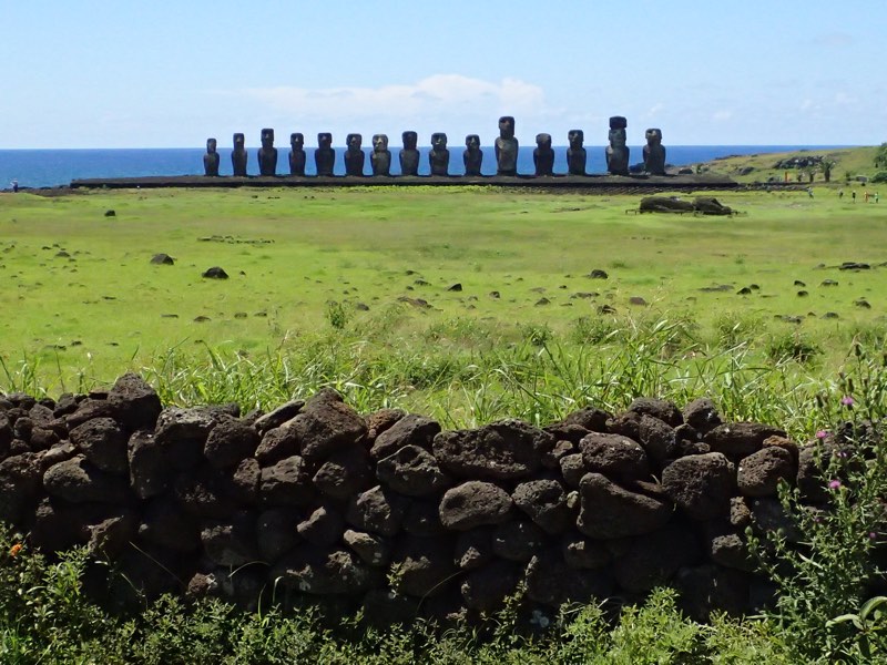
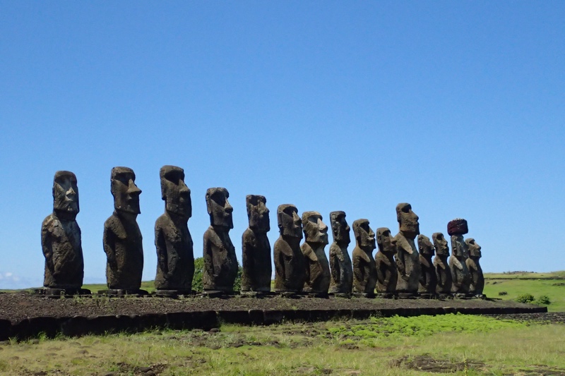
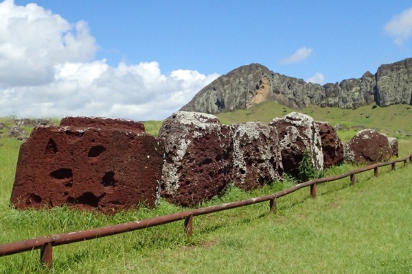
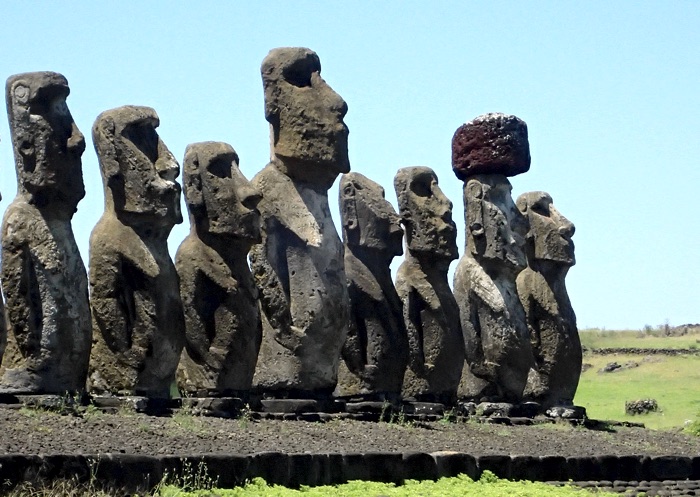
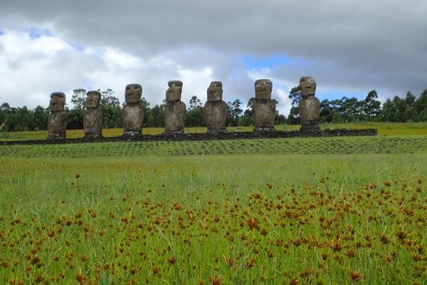
Our next stop was Ahu Tongariki, which has a breathtaking line of fifteen restored moai that stand along the coastline looking over the little remaining ruins of a village. These stone giants weigh over 30 tonnes each, with just their hats weighing between 8 to 10 tonnes. When restoration was started, the platform was shortsightedly started using soil as a base, which of course started to compact and subside fairly quickly, so it had to be redone using a predominantly rock base. As much of the funds for the restoration project came from the UNESCO organisation (the entire island was named a UNESCO World Heritage Site in 1995), a single moai went on tour to museums around the world to raise funds for these restoration efforts. This well travelled moai also resides at Ahu Tongariki standing by itself near the entrance to this section of the National Park.

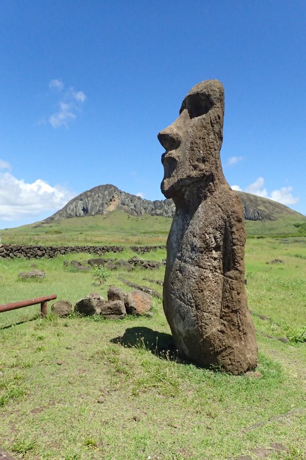
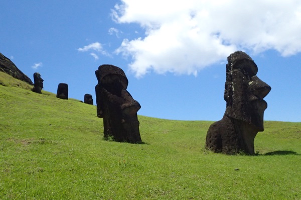
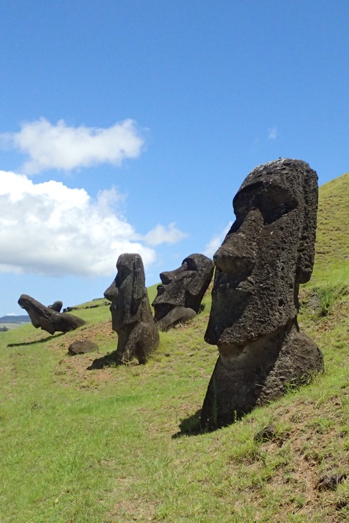
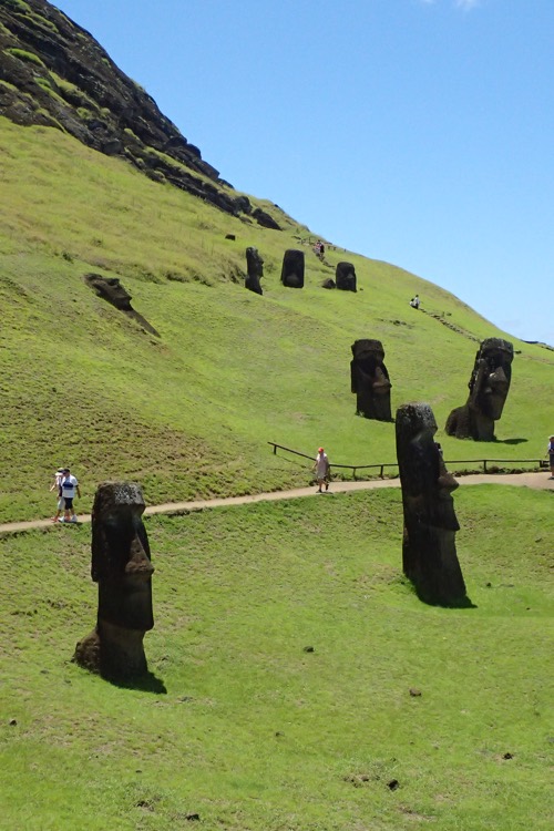
We travelled further around the island across the Peninsula Polke to the Rano Raraku, which is a small crater of an extinct volcano which served as a quarry for the islands moai creation. This unique site shows us how the moai were made. Literally carved out of the rocky mountainside, the moai are in various states of ‘emerging’ out of the sloping sides of the volcano. A head here, a head and torso there, they scatter the landscape of the quarry site. The moai were carved here right out of the slopes, then set upright – by lifting a bit, wedging the gap with rocks, lifting some more, adding more rock wedges, more lifting, more rock wedges etc., until they were upright. Once standing, they would be carved further to add more details to the eye sockets, ears, and tattooed backs (the black and white eyes made of obsidian and coral were not added until they were in situ). From here, the moai were ‘marched’ (much as one might ‘march’ a refrigerator across the kitchen floor) to their final resting place which in many cases were many, many kilometres away! Modern researchers have recreated the ‘marching’ of a moai to prove this is how it was done – it took two teams of thirty men to march a moai and keep it stead. An unbelievable amount of manpower went into creating and moving the moai.

We had a bit of a poke around the handicraft markets here, and tried some local frozen yoghurt which was much appreciated given our ship had given us a forecast of 24C but which turned out to be more like 34C. We had been walking for about an hour around the quarry in the stinging midday sun, up and down about 25 flights (according to my iPhone) of uneven rock steps and gravel paths to see the moai quarry. Definitely not for the mobility impaired!

After this little break, we had a bit of a gorgeous drive to our next stop in Orongo village. We went hurtling past amazing coastline listening to local music on the stereo. It was a bumpy, uncomfortably fast drive over roads with potholes big enough to lose small children in, and by the end of it I was beginning to suspect our driver, (who remained nameless and who, throughout the whole day, never responded to my attempts to say hello or thank you), may not actually have a license. Eek!

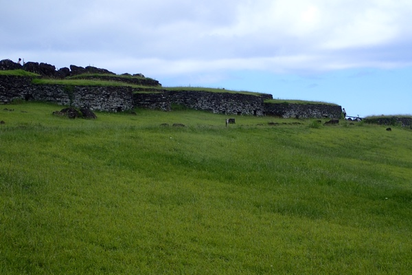
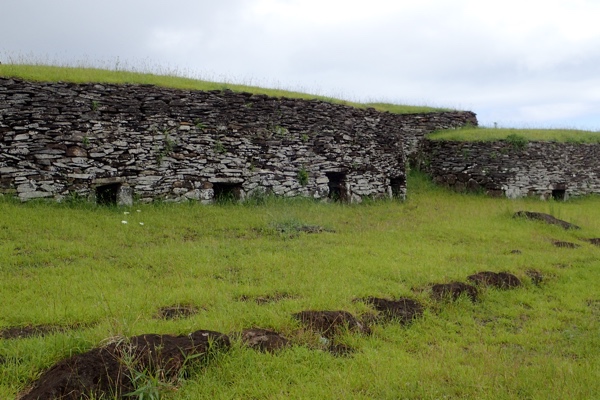
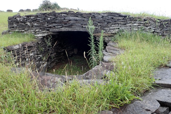
Set on the edge of an extinct volcano, Orongo is a 16th century ceremonial village. The village consists of distinctive circular shaped buildings constructed with flat slate bricks and slabs cut from the volcanic rock found in the area. This area is also covered in petroglyphs carved with mythical bird-man creatures, depictions of Make-Make (god) and with fertility symbols. Orange was also once home to many slabs of slate covered with indigenous paintings – which unfortunately were all pilfered by visitors to the island in the 1800s… some of which are in the British Museum, where all good things seem to end up.

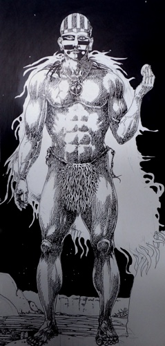
With diminished resources, and the island overpopulated, a warrior culture started to emerge and the era of the Ancestor Cult ended, making way for the Tangata Manu Cult – the Bird Man Cult. These warriors known as matatoa gained considerable power as the shift in the concept of mana, (strength and power), shifted from being invested in hereditary leaders and was reappropriated by the Bird Man leaders. The Bird Man Cult apparently began around 1540AD, coinciding with the last of the moai period. The cult believed that while the ancestors still protected their descendants, they no longer did this through the moai statues but rather, through humans chosen by the Bird Man competition (yeah, even as I write this it sounds… you know).

Anyway, apparently the god responsible for creating people, Makemake (I could be wrong, but is that the same God who fished New Zealand out of the ocean?), played an important role in deciding the Bird Man leaders. The competitions for Tangata Manu started around 1760 and went for over 120 years. The actual concept of the Bird Man was probably brought out with the original settlers, as thee petroglyphs depicting Bird Men on Easter Island are similar to those found on Hawaii.


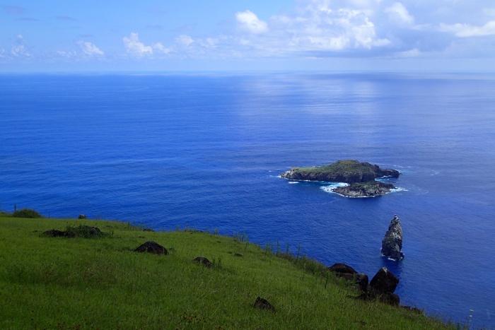
The competition itself? Well, this occurred each year in spring from the village of Orongo, at the Motu Nui islet. The young men of the island would scramble down a ridiculously steep and rocky cliff, swim a mile though shark infested waters, to an island offshore where a particular sea bird called a manutara (aka the Sooty Tern), was known to nest, stealing an egg, tying it into a bandana onto your forehead and swimming the mile back and then scrambling up the same inhospitable cliff, presenting it in one piece to the chief who would then declare that the gods would continue to look over the village.

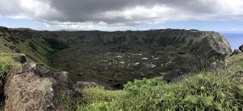
Directly behind the village of Orongo is the incredible Rano Kau volcano crater. It is unbelievably beautiful. Standing on the edge of this crater was not unlike standing in front of an Alaskan glacier or the Grand Canyon – the enormity or the place and the natural grandeur of the site is truly something special and was somewhat unexpected as Easter Island is predominantly known for it’s ancient statues. Just breathtakingly spectacular!


After this it was off to Ahu a Kivi – the site of the only moai that face out to sea. This ahu (altar/platform) has seven 14’ tall moai, which are said to represent seven legendary young explorers who set off to sea to find new lands. They appear to look out to sea, but as was traditional placement for the moai, they once overlooked a, now ruined, village that was between them and the cliff – so they while they appear to be an oddity because they look outward, they were place to overlook and protect the community like the other moai.

Visiting Easter Island has been an amazing experience and I feel very privileged to have had the opportunity to be here. So much of the place was new and exciting but which also felt oddly familiar in a mishmash of similarities and contradictions… the rolling slopes with rich lush green vegetation dotted with domestic livestock felt like driving through New Zealand’s, the long dry stone walls felt like England, the rocky volcanic coastline with the sea crashing not the rocks could (but for the temperature) be Iceland, the evident islander cultural influence was similar to all the Polynesian islands of Fiji or Tonga or PNG, the circular slab construction of Orongo village was reminiscent of the circular slate slab contraction of pre-viking settlements in northernmost Scotland, the moai themselves are somewhat reminiscent of the odd statues found at Nemrut Dagi in far eastern Turkey, and the Rano Kau volcano crater could be a twin to the Wolf Creek meteorite crater in central Australia – so while this place is absolutely unique, I strangely found myself finding comparisons to other places I had been.
I will never forget this place.

Glossary:

  • tangata-manu – bird-man
  • hopu manu – competitor, servant
  • matoto’a – warrior chief
  • ariki – king
  • pora – reed float
  • ao – ceremonial paddle (long)
  • rapa – ceremonial paddle (short)
  • motu – islet
  • ana – cave
  • manutara – Sooty Tern
  • tapu – taboo, forbidden
  • komari – vulva
  • keho – stone slab
  • hare keho – slab house
  • Make-Make – god
  • ahu – stone altar/platform

*For anyone cruising to Easter Island – if you are fortunate enough to actually port here, I think it is wise to remember that the crew have a really difficult job to contend with. The port authority is none too welcoming, historically the Rapa Nui people have not had great experiences with outsiders, from being kidnapped and sold into slavery to having to deal with western diseases wiping out their population – somehow this has translated into being somewhat contemptuous of tourists. They are not as welcoming as other island nations and seem both happy to gobble up the tourist dollars, while not being overly happy to see the tourists at all! They allow only one tender at a time to enter the little port at Hanga Piko and tend to make life difficult for the cruise ships in particular, perhaps because we are not filling the island’s meager accommodation offerings.

We were held up for some hours before getting ashore and while I heard from one of the officers of the security staff how grateful she was that Australians are so laid back about these things, and how appreciative they were that we collectively have a ‘Oh well, what will be, will be’ attitude towards delays that are beyond our control; when they knew they’d have faced near riots on other ships for these sorts of circumstances… there are of course always exceptions to the rule!

This morning the Captain in his usual midday address thanked everyone for their forbearance during yesterday’s trying tender process, but also took what I thought was an unprecedented opportunity to dress down the few upset people who were ‘rude and abusive’ to the staff. It is quite unusual for a Captain to even let us know that people were complaining about anything, let alone publicly address them for poor behaviour, and I believe this is indicative of the frustrations felt by the crew who were doing their absolute utmost, under difficult conditions, to get us all ashore for this potentially once in a lifetime experience. My cap is off to every single one of them… not only do I feel lucky that our ship actually managed to port at Easter Island when most don’t, but I am immensely grateful that the Captain and the crew persevered in dealing with uncooperative shore authorities to try and get us the best experience possible. Kudos to the Sea Princess and her crew.

Tahiti should be nice

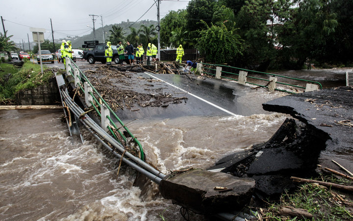
We have sailed two days to get to Tahiti, our next stop and were greeted this morning with heavy skies and rain.  It looked pretty miserable out there.  As we sailed into the harbour, we could see quite a lot of flotsam in the water, and the ocean was looking brown…  yes, brown!  Uh-oh, this isn’t good.

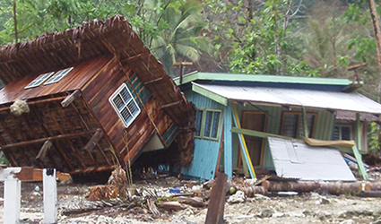
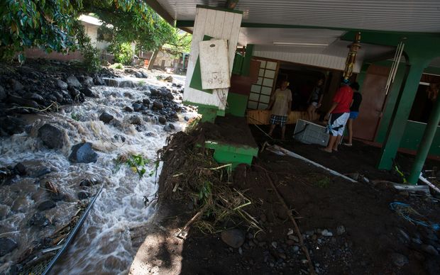
Shortly after this we get a message over the PA system from the Captain telling us that the island and areas surrounding Papeete has just experienced two days of extremely heavy rainfall, that has caused severe flooding, landslides, roads washed out and houses destroyed.  The Captain said they would be docking in Tahiti, but that all the ships’ tours were cancelled as the locals were dealing with the severe flooding.  He would advise us if we could go ashore after discussions with local officials.

People were pretty good about this news – unlike the last time I missed a port, which was in St John’s, Canada due to a severe storm and the (primarily American) passengers grumbled and complained like you would not believe, at being told that it was unsafe to take the ship through the middle of a North Atlantic storm with 24 foot waves.  On this occasion, many people went down to the cruise director asking if they could go ashore and volunteer with flood recovery efforts, which I thought was a wonderful response.

Eventually the Captain came back and told us that the French High Commission had declared a state of emergency and that the port of Papeete was closed – no crew or passengers would be allowed to leave the ship.  We had supplies to load, including fuel, so the ship would be in port all day as planned, though there was one more hiccough to be navigated.  We were scheduled to leave at 11:30pm, but the power station was out and the fuelling system was running on a back up generator, so instead of pumping fuel into the ship at 130 tons per hour (is that a lot? it sounds like a lot) we were taking it onboard at only 80 tons per hour and this was going delay our departure by four hours.

The long and the short of it was – we all had another sea day, in port.  There were some additional hasty activities added to the schedule and many of us spent quite a lot of time up on decks looking into the town feeling pretty useless.  Those of us from Brisbane were particularly sober; it was not so long ago that our own city was underwater and we know all too well how awful and dangerous flooding can be.

We went to sleep that night with the ship not rocking – which felt seriously weird after two weeks of being lulled to sleep by the rocking of the ship.  I have to say, I am really liking this Captain – he kept us all informed and has been daily sharing more and more information about how the ship works and the things that are going on behind the scenes.

The next thing on our agenda is scenic cruising near Pitcairn Island (effectively another sea day with a  bit of a view) and then on to Easter Island.  If we don’t get into Easter Island – and we are told that barely 1 in 5 ships do, due to the weather conditions and the fact that the island has only a floating pontoon to tender to, then we may end up with 15 sea days in a row… right now we are up to our 5th sea day in a row and it already feels like a fortnight!


NEWS LINK

Pago Pago, American Samoa

Woke up to the dulcet, (and somewhat familiar), tones of construction site reversing beepers… huh?  Aren’t we supposed to be at some remote tropical island this morning?  *looks out window*

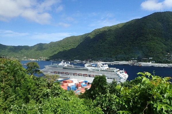
Why yes, yes we are – I see rainforest and palm trees aplenty, however this remote tropical island is in the middle of refurbishing/reconstructing their docks, and there are men in high vis vests, pumps, digging equipment, water pipes, small backhoes and and rollers and things going everywhere.  C’est la vie!

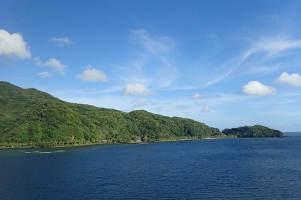
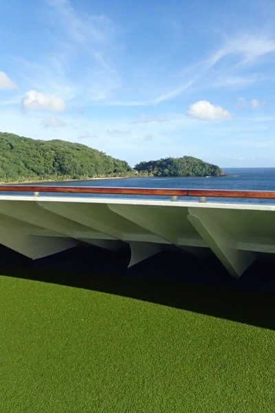
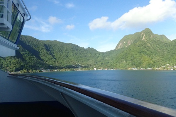
Located in American Samoa, and pronounced, ‘Pahngo Pahngo’, the town of Pago Pago lies on the island of Tutuila, which rises seemingly out of the middle of nowhere from the deep, deep blue waters of the South Pacific.  The town itself is in a magnificent horseshoe shaped harbour with glorious views to be found in every direction – seriously, look in any direction and be greeted with another beautiful vista.  From the upper decks of our home, the Sea Princess, we could see beautiful mountains and the gorgeous blues of the harbour and the sky, in ever direction of the compass.
<insert stunning photos>

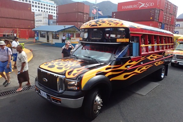
We got off the ship fairly early hoping to find another local-run, dockside tour and we were not disappointed.  Ship tours can often be a bit overpriced and overcrowded for my liking, and thankfully these islands often have plenty of small operators willing to pick up pax and take them on a tour of the island.  We found ourselves with about 20 other ship passengers, on a rickety old bus that looked like it was from the 1960s and was was as comfy as you would expect a 50 year old vehicle to be!  No air conditioning, hard bench seats and limited to non-existent suspension seems to be part of the island experience.  🙂


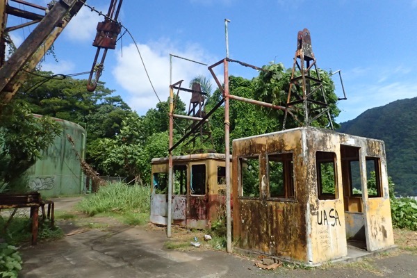
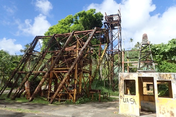
We set off for some scenic lookouts, the first of which was the location of an old cable car that used to go across the harbour to access a tv antennas used by the local station.
  The cable car was in use up until a tragic accident on Flag Day about 20 years ago (Flag Day is April 17th, and commemorates the original raising of the US flag on Samoa), when saw a plane doing a ceremonial fly by, accidentally collected the cable car cables that stretched across the harbour and subsequently crashed, killing over a dozen people.  The noise and the smoke from the explosion could be seen from across the island, and the cable car was never rebuilt for some reason…

After this we head off in our trusty bus, with low gears grinding and engine complaining, driving over the steep mountain to the village on the other side of the American Samoa National Park.  The drive over offered views that leave you feeling like you can see forever, as we wound our way back and forth through such an amazingly thick and lush rainforest – full of many, many palm trees, thick undergrowth and a wide variety of beautiful plants and stunningly bright and attractive flowers. Just beautiful.
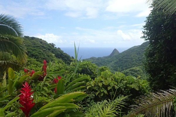
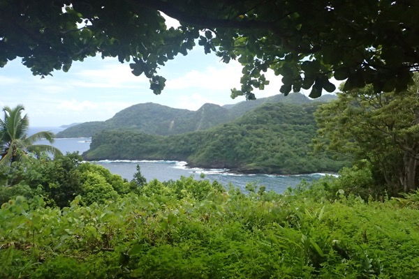
People have lived in Samoa for at least 3,000 years and according to our new friend, Mike the tour guide, the Samoan are the original Polynesian people who then spread to Hawaii, New Zealand, Fiji etc… I think this point is probably debated somewhat by other island nations though. 🙂  The Samoans share that uniquely Polynesian culture – the influences of which, are evident throughout the region despite the hundreds, or even thousands, of kilometres separating the various geographically disparate islands.  The islands have similar oral traditions, wood carving styles, ava (/kava) ceremonies, and weaving and painting techniques that share similarities from Hawaii to Papua New Guinea to New Zealand.
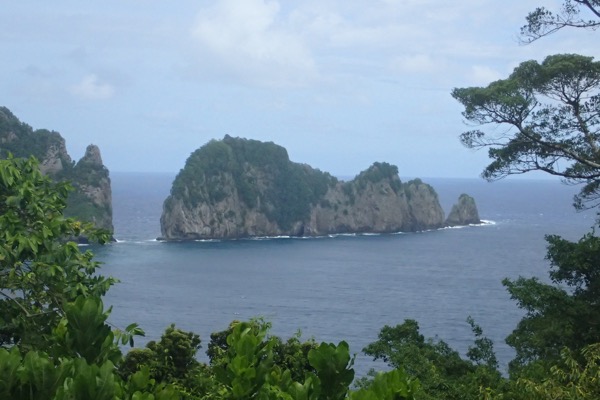
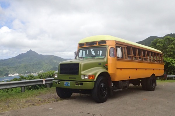
Samoa apparently only came to the attention of the rest of the world, (i.e.: Europe, during the Age of Discovery), around the 1700s by which time, Samoa became a critical stop for European merchants heading west.  Samoa, like many other Pacific island nations, rapidly adapted to Christianity within just a few decades, until now, when many Samoans themselves are missionaries throughout Polynesia.  Their well kept churches stand out proudly in every village we passed through.
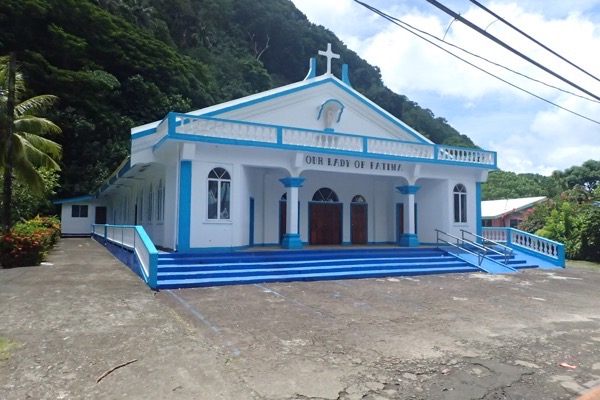
Samoans seems to have struggled to maintain their sovereignty as the British, the Germans and the Americans all competed for dominance in the Pacific in the 1800s.  Various Samoan factions, preferring one European influence over another, rose and fell and even landed the islands in civil war on more than one occasion.
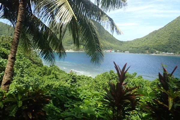
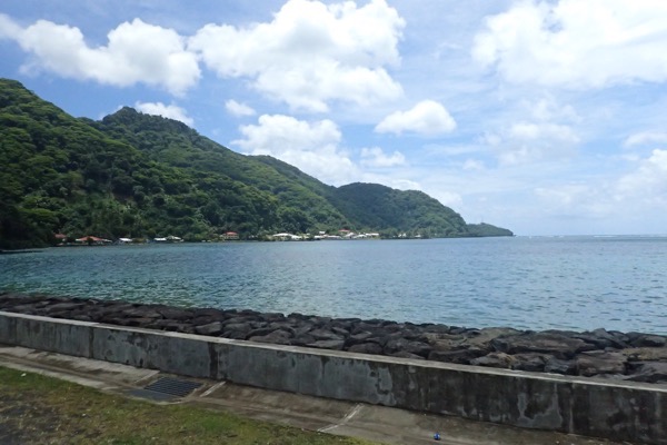
America Samoa’s chiefs then formally ceded the island of Tutuila to the United States in 1900, some of Samoa’s other islands, such as the Manu’a Islands followed suit in 1904.  There are lots of western influences here, but you can still feel the Samoan, islander way of life.  Though the Island’s offical status is somewhat ambiguous at times – they are a Unincorporated Territory of the United States of America (and this Aussie has no idea whatever that legally entails) – their relationship with the US solidified during WWII as the US military made good use of the location as a preparation point for imminent Japanese invasions in the Pacific.
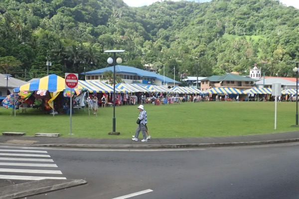
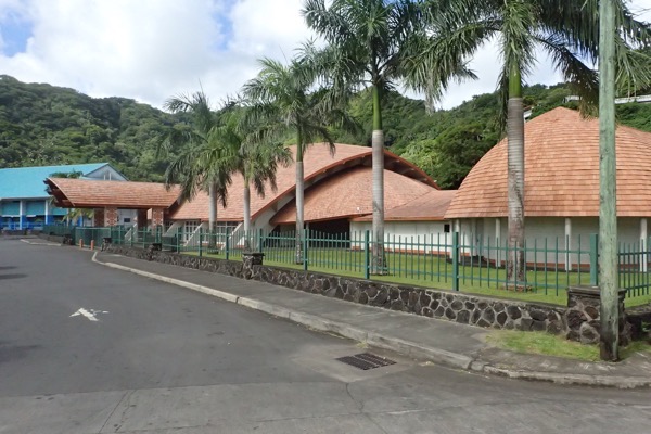
More recent history has seen American Samoa begin moving towards more self government – they have a house of representatives led by the recently re-elected Governor Lolo, and an upper house consisting of traditional village chiefs since the American Samoan Constitution came into effect in 1967.  The relationship with the US is a weird one (imho).  The US continues to fund a lot of American Samoa’s infrastructure, and this is really obvious when compared to other Pacific islands that do not have that financial support, and the people here are US citizens, and are able to move freely in/to the US… but they can’t vote for President?  So they’re citizens but not full ones or something.  I dunno, need to research it a bit.  Doesn’t make a lot of sense to me.

One of Mike’s anecdotes illustrated why American Samoa is constantly striving to become more self regulatory, whilst maintaining their unique status as a part of the US.  Mike tells us that the minimum wage here is USD$5.50 per hour. Which is kinda great – the people are guaranteed to make decent wages, however the more that companies are required to pay their workers, the higher the likelihood that those same companies will move their entire production facilities to somewhere much cheaper, like Indonesia.  For example, the minimum wage is putting an ever increasing pressure on Samoa’s tuna canning factories, which is the biggest industry here… bigger than tourism.  Samoa has the single biggest tuna canning factory in the southern hemisphere in fact, and as such, they employ a large amount of local people. However if (as Mike asserts) the companies are continually pressured to pay their workers the same as someone who lives in a high cost environment, like San Diego or Sacramento, then the likelihood that the tuna companies will eventually relocate to somewhere cheaper increases.  So they want to be able to regulate their own minimum wages, and other government regulated functions, for similar reasons.  American Samoa has been constantly trying to refine and balance their hugely important relationship with the US to try and allow them to make concessions that they feel are necessary for their unique location and requirements.
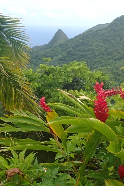
Anyway, all that geopolitical stuff aside, this place is like paradise!  No, I mean it – it looks just like paradise always looks in the movies!  It’s so beautiful; thick luscious rainforest, rugged mountains plunging down to the jagged coastline, with little inlets of white sandy beaches… the people are happy and welcoming and full of that lovely Polynesian cultural charm that makes you warm to them so easily.  I could come back here for a couple of weeks with a small car (not sure they have those though, plenty of big yank tanks getting around!), and just explore the tiny villages, snorkel the coral reefs and adventure out to the smaller islands by boat.  The hot and humid aside, this place could easily become my favourite Pacific island (everyone has one of those, right?)  Though perhaps I shouldn’t speak too soon, we are off to Tahiti next!
Nuku’alofa, Tonga – Malo e lelei!

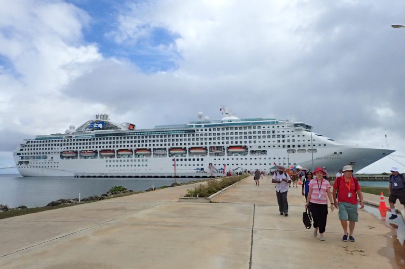
We had no set agenda when we arrived at the port of Nuku’alofa this morning.  I had watched the ship destination expert’s port lecture and he was a bit uninspiring.  Mum was keen to check out the rugged coastline and see the blowholes and I was more interested in the 12thC Ha’amonga Trilithon… so we were considering hiring a cab to take us to these places and then spend the rest of the day pottering around the markets or in town.

Instead we wandered off the ship, wandered through the first section of markets and money changers and straight into a very friendly Tongan woman named Priscilla who worked for a tour company named Tonga Huangdong Tours (there is a strong Chinese presence in Tonga – some of which has created tension and even civil unrest over the last decade when many migrated here from Hong Kong when the Chinese government reclaimed the island).  Priscilla showed us the full day tour she was taking guests on, and it just happened to take in both the highlights we were interested, so we signed up.  $50 per person for a 6-hour tour, compared to $79 per person for a 3-hour ship tour?  Sounds like a plan.

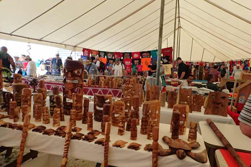
We had half an hour before the tour was departing so we walked into town to have a quick look around.  There are loads of handicrafts and souvenir market spaces near the port that are selling things that are unique and unusual and yet also oddly familiar. Having been to Vanuatu, Fiji, New Caledonia and even Papua New Guinea in the past – the tribal looking artworks are somewhat familiar but all have their own unique artistic slant on them.  Wood carvings, bone carvings, pearls, painted and plaited fibre made into pictures and bags, sarongs, horn, leather work… so many handicrafts, and all of it lovely in its own right – and absolutely none of it even remotely goes with the decor in my house!  So my wallet was safe.

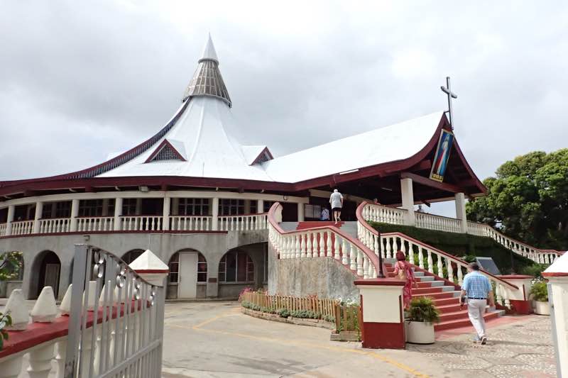
After having a look at the markets, we went down to the Catholic Basilica – a huge round timber building with an enormous traditional style rounded ceiling.  Such a beautiful building.  It becomes rapidly obvious after even just a few hours in Tonga that religion and religious organisations is an integral part of the social structure here.  Many of the schools are attached to churches – there are Catholic, Seven Day Adventist and more Mormon schools than you can poke a stick at.

Missionaries and traders, came here following the first European explorers – Abel Tasman supposedly sailed past Tonga is the 1600s, and Captain Cook landed and named the archipelagos when he visited in 1773 and 1777… he named them The Friendly Islands – though as folklore has it, the local chiefs were debating who was going to get the opportunity to kill and eat his men while he was naming them thus!  Anyway, I digress, somehow Tonga managed to not become a part of the Commonwealth and has held it’s indigenous governing structure since becoming a constitutional monarchy in 1875.   It was a protectorate of sorts under Great Britain from 1900 – 1970 but throughout was still an independent sovereign nation.   Everywhere else in the Pacific ended up colonised and administered by Europeans, so well done there, Tonga!

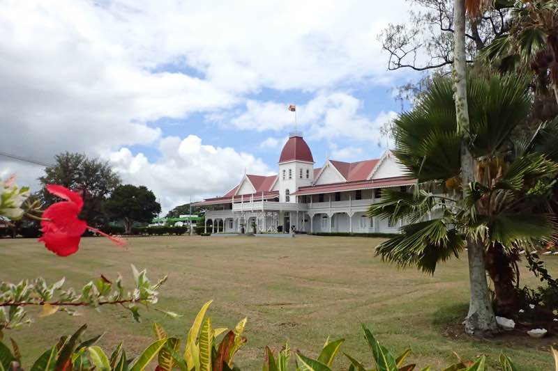
Nuku’alofa, which apparently means ‘the home of love’ is the capital of Tonga and is on the island of Tongatapu.  Even though it is the largest island in the group – it is still barely 32kms across and 15km wide.  Still, for such a small island, there’s plenty to see.  Our first stop on the tour with Priscilla and Sam, my brother the bus driver, was the Royal Palace which dominates the waterfront not far from the port.  The Royal Palace is no longer the primary residence of the King of Tonga – he has a huge mansion just outside of town, and a matching one for the dowager Queen just across the road – the starkly white painted palace is now primarily an official reception centre.

Priscilla turns out to be quite the character, she cackles like a crazy lady hatching a seriously evil plot, and her English is charming – she mixes up her words quite frequently, and she’s hard to understand, but it is lots of fun… “They learn the kids not to throw the rubbish out the car, used to be very dirty dirty here, but now, Tongans eat and take rubbish away not throw out the window.”

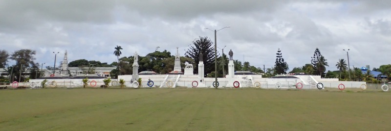
After this, we went to see the Royal Tombs, which are the final resting place of King George Tupou I, founder of modern Tonga, and his descendants.  Weird thing the Tongan royal family – not allowed to marry ‘commoners’.  I was unsure if our guide was aware of the negative associations of being a ‘commoner’ … she used it more in a sense to denote someone who was ‘not royal’, whereas in English, it definitely carries an implication of being underclass.  *shrug*

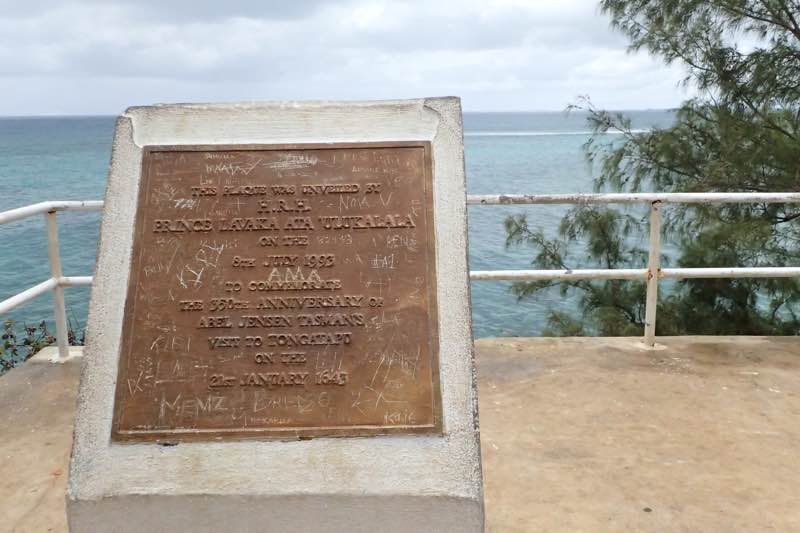
We then went to the eastern most point of the island to see the Abel Tasman marker which oddly commemorates Abel Tasman’s passing near Tonga, because it is completely un-confirmable that Abel Tasman actually visited Tonga.  Very odd.

Following our drive out to the western most point of the island, we were hustled past the one thing that neither Aunty Mary nor I had any interest in at all – of all things they could turn into a questionable ‘tourist attraction’, a flying fox colony is right up there with a colonoscopy clinic.  “Next we got to see the flying fox,” intoned Priscilla, “It is a especial bird of Tonga, very especial bird.  They are protected from the eating and very especial for the royal family… if they find a white flying fox, it means very bad luck for them.  So they sleep here all day and fly around at night time to harvest your fruit.”  Hmmm…  very special birds indeed!  I was expecting some horror guano cave like one would find in North Queensland with hundreds of the noisy flying rats squeaking about the place and the ground six inches deep in bat shit! Instead, we were shown a couple of trees that had only about 40 fruit bats hanging about. There were more fruit bats living in the old turpentine mango tree in the back neighbour’s yard when I was a kid.

What was interesting about this stop was the crazy arse cemetery that lies encircles the protected bat colony!!  The Tongans, for the most part, do not have formal headstones on tombs for departed relatives (Royalty excluded of course), but instead, they decorate the tombs of their departed family members with handmade quilts, crocheted blankets, tinsel, plastic candy canes, and odd solar powered lanterns.  It was a very striking and colourful display, quite unlike anything I’ve ever seen in a cemetery or burial place before.  It was also to my Western eye, extremely tacky… but hey, I don’t want to be all judgey, maybe candy canes on my own grave would be a nice stripey touch.

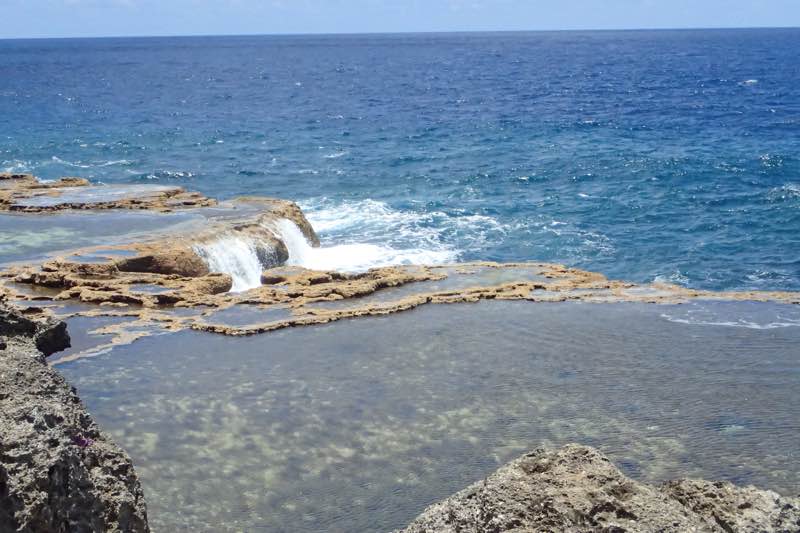
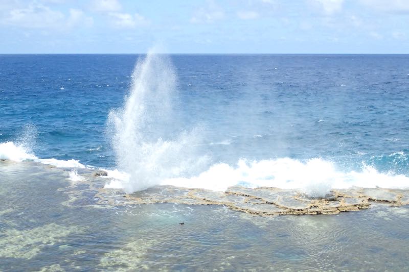
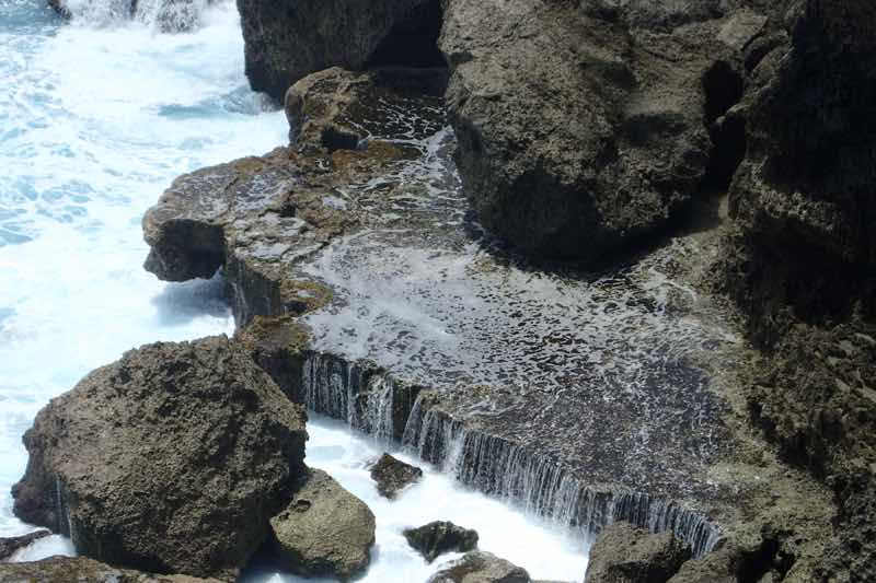
After the bat shit stop, we were off to check out Aunty Mary’s pick, the Chief’s Whistles on the island’s western coast which are known as the most spectacular blow holes in the South Pacific.  It is a stretch of limestone cliffs ranging some 8 km along Mapu ‘A Vaea.  The blow holes were quite spectacular, I could have watched them for hours.  The blow holes needed only a very little pressure from the high tide waves to send half a dozen whistling spouts of water into the air in each direction.  It really was quite an awesome spectacle.

From here, Li took us to… a Chinese Dairy for an opportunity to buy some snacks and chips and things for the rest of the afternoon’s drive. The Tongan people are less than thrilled at how the Chinese are coming to Tonga and taking over retail and tourist opportunities.  Tensions have run so high as to result in civil unrest about ten years ago, resulting in several fatalities.  Unfortunately, it is one of those situations of clashing cultures – the Tongans are laid back, live on ‘island time’, and are very much ‘no worries bro’… in contrast, the Chinese are very industrious, organised and focused in their business endeavours.  So the Chinese are kinda taking over and the locals are none too happy about it, while all the while having a reputation for being too lazy to do anything about it.  :/  Not good.
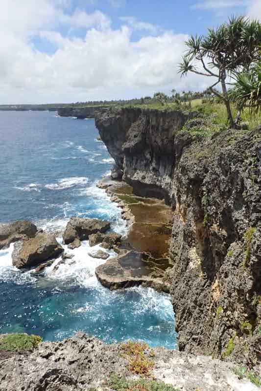
Anyway, the Natural Bridge was our next sight to see, and it was also along the western coast between Hufangalupe Beach and ‘Ahononou Beach… in either direction were stunning limestone cliffs plummeting down to the ocean.  Absolutely stunning landscape, the likes of which I have not seen since the Cliffs of Mor in Ireland.  Weirdest thing was – not a barrier, handrail, walkway, fence, staircase or lookout point in sight!  Holy shit Australian OHS official would have had conniptions at the idea of taking tourists anywhere near the place.  So with our guide in her Havianas and the average age of her pax pushing 70 years of age, we went wandering along the cliff edges checking out the Natural Bridge and admiring the sea crashing into the cliffs forty meters below!  Oi!

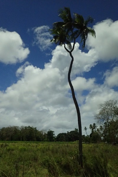
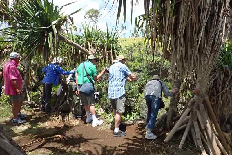
Next, we ventured off to see the “three head, one coconut”.  Yes, I was confused as well.  It turned out to be a freakish coconut tree that had splits in the trunk giving it three fruit-bearing heads.  It seems Tonga, quite literally, has no street addresses – none at all.  No street names and no house numbers.  Mail for the entire island is delivered to a mail centre in the capital and collected by each village’s mail collector – who then delivers it based on the fact that they know everyone personally.  So when giving directions to places, they most frequently do so using local landmarks, and as it turns out, this coconut tree is a particularly well-known local landmark, as it is quite the oddity.  “The coconut are plenty plenty in Tonga.  And we use all of the coconut from the roots to the leaves.  The leaves are used for the roof of the fale (family home) – it doesn’t leak, you know. We also use the coconut to make cream, water, and the husk is used to make a skirt for the Tongan men.  They so smart to make money off everything and is none quite to waste.”

People supplement their income here primarily by farming – bananas, tapioca, kumara, and other primary consumables,   Priscilla informs us that tapioca looks a bit like marijuana, so some islanders hide dope in among their tapioca crops, “Eat tapioca and be big and strong like me and Sam, not like Li, who eat only rice and noodles and he too skinny.”  Li, being the slight Chinese man who is with us and obviously her boss!

The village lifestyle is one that has lots of chickens roaming around uncooked, and pigs, likewise roaming around without fences. We are told later that these resources belong to the village and if a family is hungry, they can help themselves to a pig, with the only consideration being not to eat them out. If you move into the village, you would farm the family plot with your family – Tongans live very much an extended family situation looking after their elderly at home until they pass away, there are no care facilities in Tonga. Each village has a chief, a church, a school and a brightly coloured cemetery plot.

We then head inland towards the large internal lagoon called the Cradle of Polynesia, where we found a marker to well, mark, Captain Cook’s actual documented landing site.  🙂  The mangroves surrounding the area looked just like home, and our driver Sam reports that he comes down to the lagoon to catch enormous mud crabs and do some spear fishing.  Each week he goes spear fishing to catch some food for the old folks in his village who can no longer fish anymore.  What a gem!  Wish he was bringing me fresh fish each week!

The next stop was the most remarkable in my humble opinion.  It is called the Ha’amonga Trilithon.  It’s an ancient monument as inexplicable as Stonehenge.  Believed to have been constructed circa 1200AD, the Trilithon is a dolmen style arch and lintel that may have served as an astrological calendar, aligning with the summer and winter solstices.  Incredibly the stones themselves are faced to the island of Wallis (in Wallis and Fortuna) and must have been transported by boat!  Eight hundred years ago!  How did they do it?!

Anyway, after this we had a lovely drive through all the villages and farmland back to the ship.  Tonga is a beautiful and surprising place, I’d love a chance to come back and go visit some of the more remote islands which I am guessing are an unspoilt paradise.