
We set off today from Egilsstaðir with the cunning plan of heading towards northern Iceland across the mountains. On the way, we were going to stop at Dettifoss waterfalls, the geo-thermal craters of Kraftla and some other bits and bobs on the way to the volcanic lake, Mývatn and the Mývatn Nature Baths. (Hot springs! Huzzah!) However, today turned out to be a story about how the best-laid plans of mice and men are aft gang aglae… We managed to do most of what we wanted today, but it felt like a shit fight every step of the way to do anything at all.
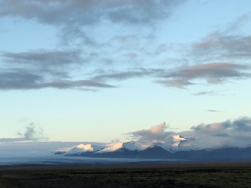
Look how gorgeous it was when we were barely 15 minutes out of Egilsstaðir… yeah, that shit didn’t last very long.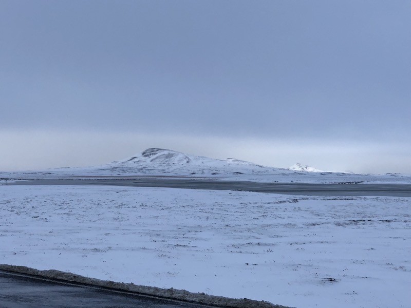
 Beautiful! Snowy pristine vistas with visibility for miles in any direction – what more could you ask for?
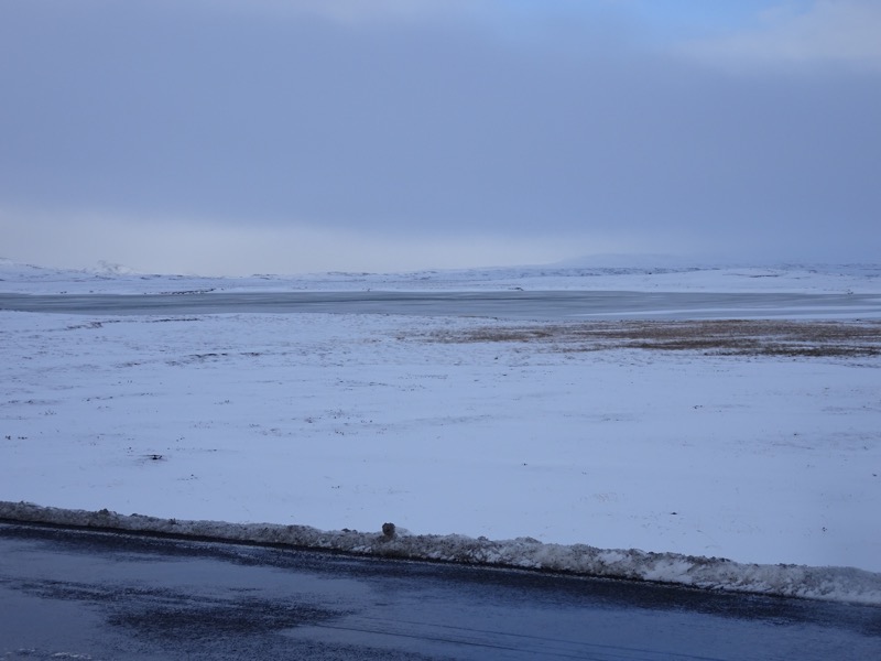
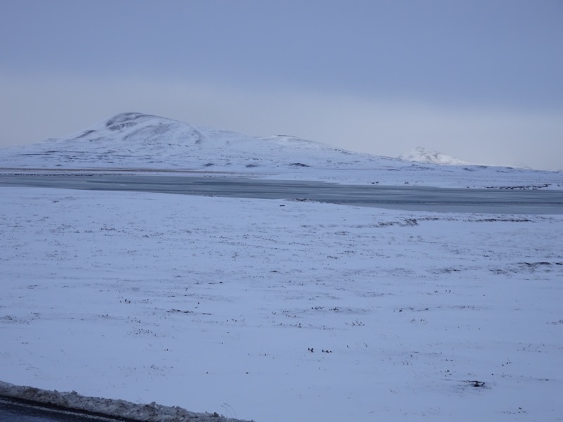 Another half an hour down the Route 1 though, and the weather had rolled in, or it was already here we driven into it, or the gods were bored and decided to fuck with those two hapless tourists getting about in the little Jeep Renegade, because we went from blissfully beautiful snowy peaks to, ‘Wtf, why can’t we see more than 40m ahead of us?’, and, ‘OMG, that snow literally fucking horizontal!?’
 So we jumped onto safeiceland.is to see if there was anything about road conditions in the area and found this:
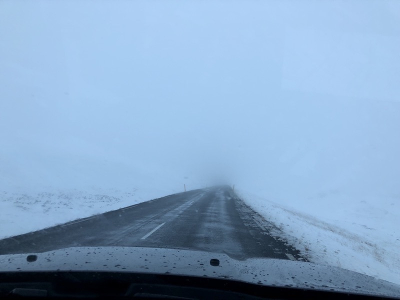
 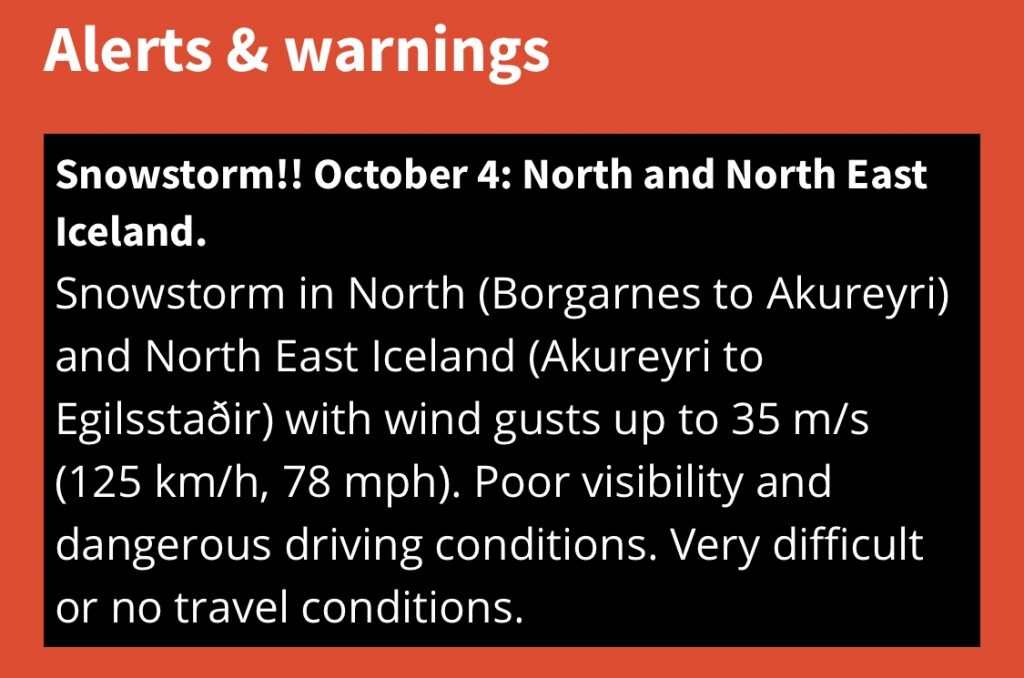 A snowstorm with cyclonic winds! Argh! So that’s what happened to my snowy pristine vistas with visibility for miles in any direction. They disappeared in a maelstrom of furious winds and ice pelting the car as we slowed to a crawl for the next hour or so while we suddenly became hyper-vigilant about black ice, and paid heed to the somewhat redundant hazard warnings on the dashboard about ‘icy roads’ and ‘snowy conditions’. My imagined plans of a beautiful clear day exploring waterfalls and lava fields likewise vanished. :'(
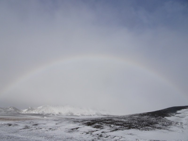
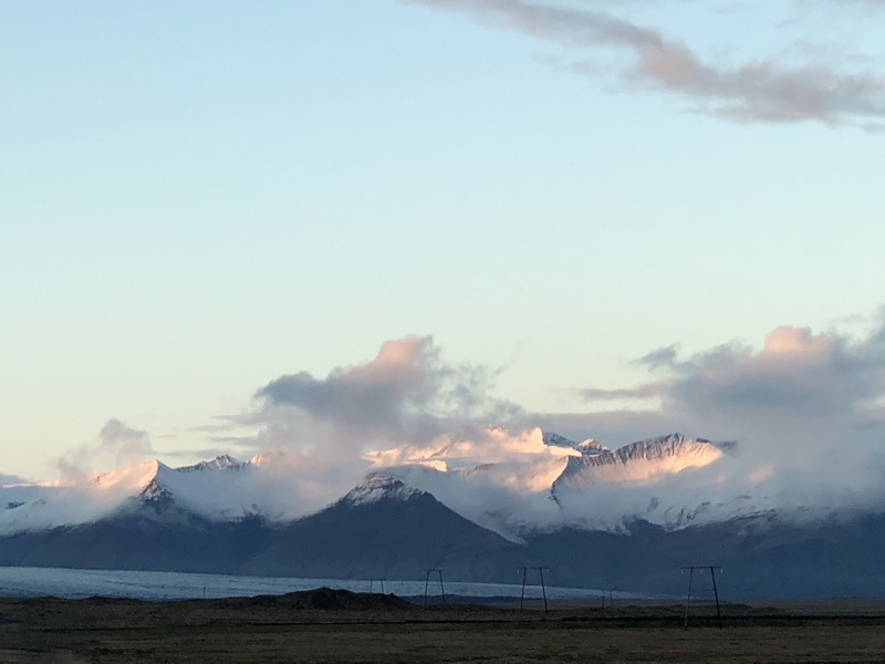
And then suddenly we rounded a ridge and it was just gone. Clear skies, visibity returned and rainbows. Seriously? I was looking sideways for unicorns. What good fortune that we passed through it unscathed and relatively quickly.
 Look at that… I mean, just look at that!
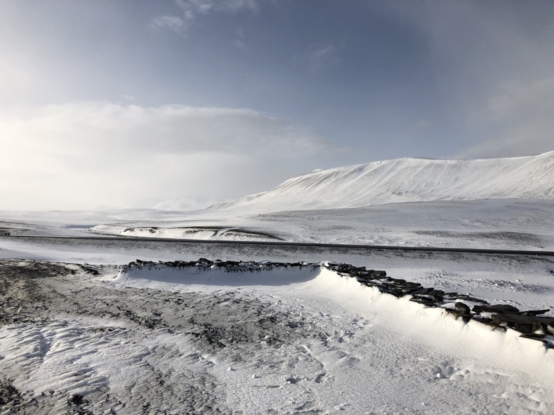
 Georgeous, georgeous. Just fabulous.
  Alas, no matter how remote, we are always reminded… people are selfish useless creatures.
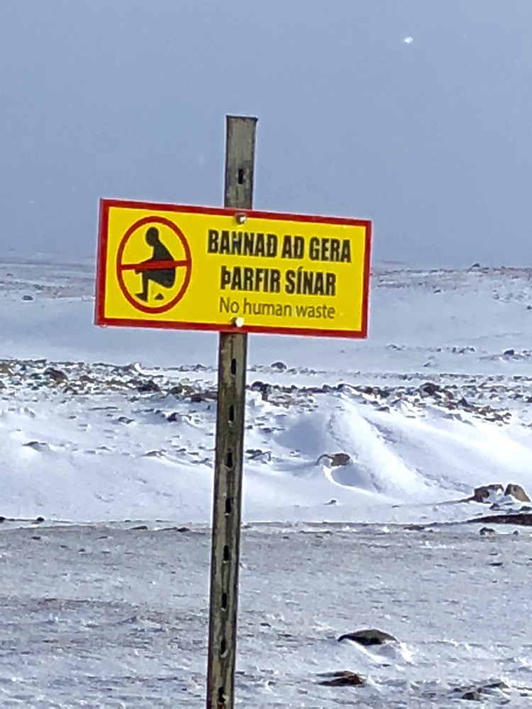
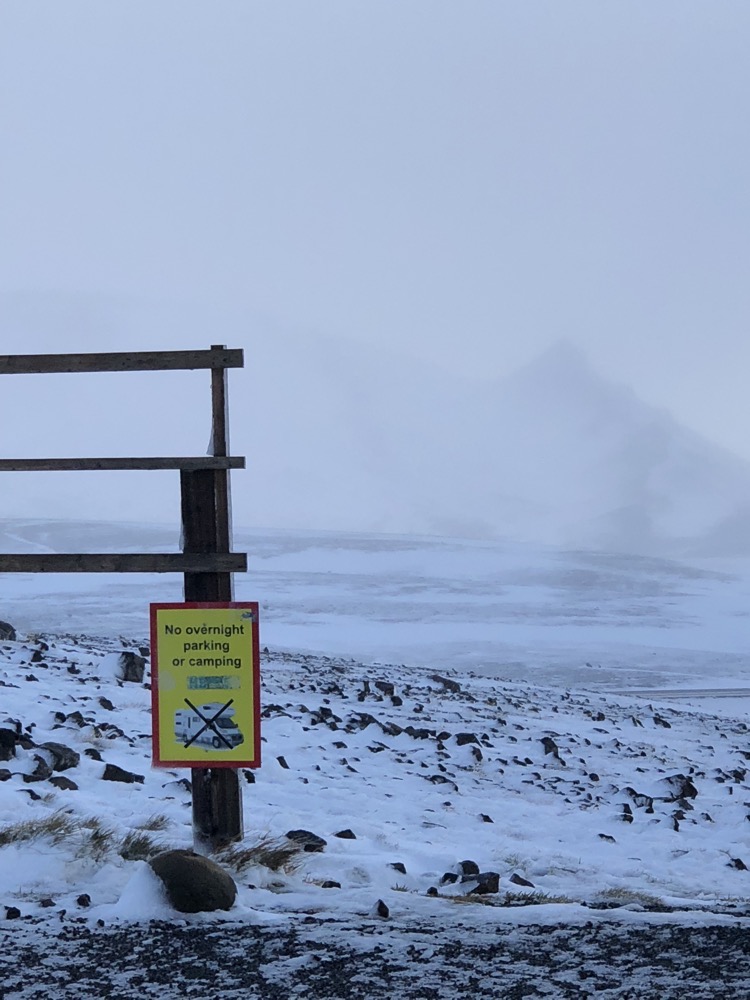
Anyway, we are tootling along happily enjoying the blue skies and fabulous conditions when we came to a sign saying that the 864 east access Dettifoss waterfall road was closed. It felt a bit like one of those Brisbane flood days when all the rain has stopped, but we are sitting around on a brilliant summer day waiting for the flood waters to rise as they come down the valleys… it was clear and lovely and they are telling us we can’t go in? Huh? Well, we thought we had better do as we are told – having run into people who were doing their lap of the country clockwise that had seen cars upside down and rolled off roads in these areas and basically their opinion was: when the Icelanders close a road, they aren’t mucking about. Disappointed again.

A little further down the road though and we found the 862 west access road to Dettifoss was still open. Hurrah! It turns out the east 864 is usually passable in summer only, but we were going to be able to go check it out which was the important bit.
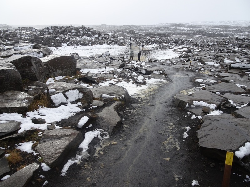
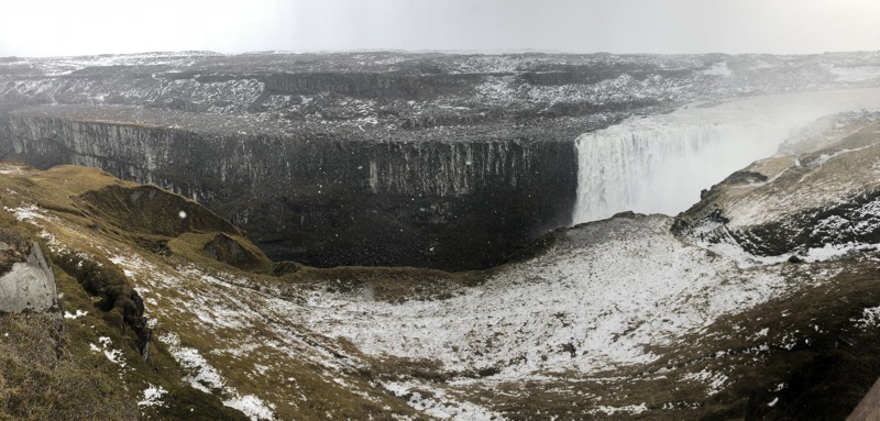
As we neared the Dettifoss parking lot though, the weather seemed to be catching up with us a bit. A little bit of snow, a little bit of wind. We double checked the walk to the falls – about 700m each way and not particularly onerous and thought we’d hazard it.
FUCKING STUPID MOVE THAT WAS!
What we thought was light flurries of some soft and happy bits of snow floating about turned rapidly into the aforementioned maelstrom of furious winds and ice pelting our bodies as we mountain goated our way through the boggiest wet path I’ve seen since hiking Hartz Mountain in Tasmania in 1985. Mud and slush and scouting ahead on where its safe to put your feet and not land ankle deep in freezing cold muddy waters. The path was trashed from visitors going off the path looking for better purchase – I have not seen a place so desperately in need of a boardwalk in an age.
 By the time we got to the falls, I was seriously lamenting the fact that I did not bring my Antartic gear – I have the fabulous Quark Artic expedition jacket, I have waterproof pants, I have a good merino buff, I have the Black Diamond snow gloves… and all of them are back home in Brisbane! You see the weather for this time of year is supposed to be cold. Extremely cold but usually clear and dry and cold in October. Seems Iceland has had a long summer this year and the wet period they experience in September has extended well into October. So I had packed for the cold, but not to be waterproof… which meant I arrived at the falls with my thermals and my jeans sopping wet, my jacket was likewise actually dripping wet (it’s good for snow or a shower, but not for the sideways sludgy shit) and my gloves were so saturated I could wring them out. Goddammit.
 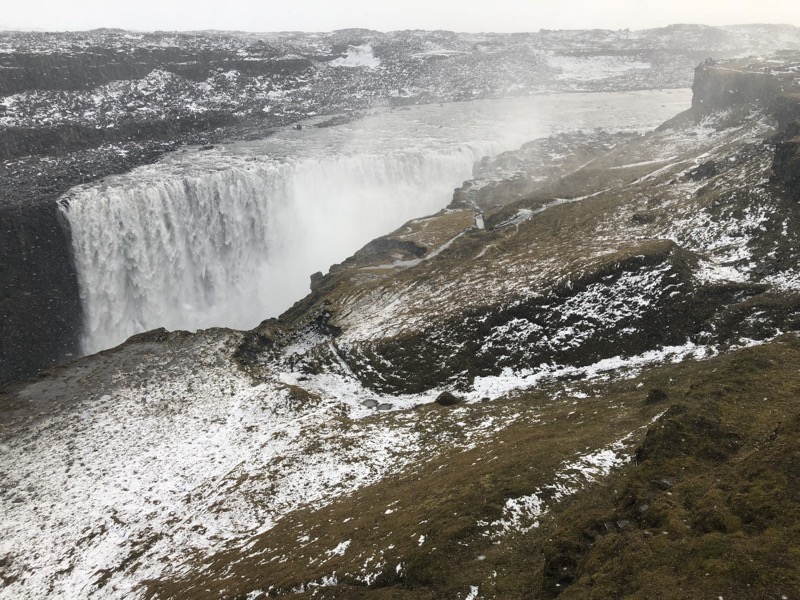 The falls were beautiful – though it’s hard to think it was worth it.
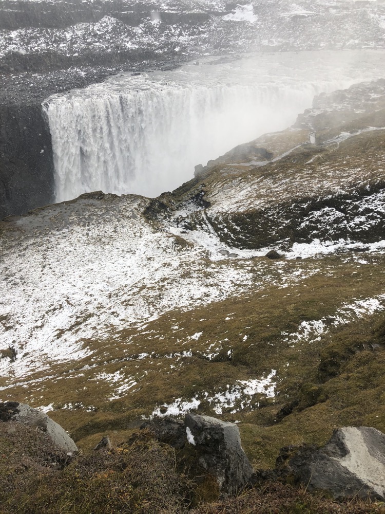
Dettifoss is known as ‘the most powerful waterfall in Europe’. It’s on the Jökulsá á Fjöllum river, which originates at the Vatnajökull glacier, and the falls are 100m wide and have a 44m drop into the Jökulsárgljúfur canyon. It is the largest waterfall in Iceland with an average water flow of 193 cubic meters per second. There is a waterfall in Norway that has a slightly greater water volume going over it – but it is only half the height, so Icelanders tend to hang onto the ‘the most powerful waterfall in Europe’ thing because Norway’s is so small. 🙂
 Beautiful… but there we are soaked to the bone and wondering, ‘Whose stupid idea was this?’
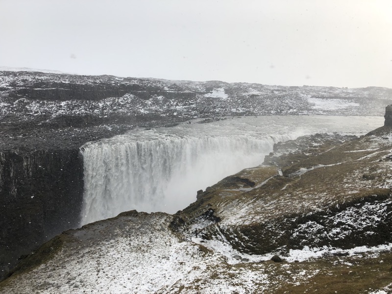
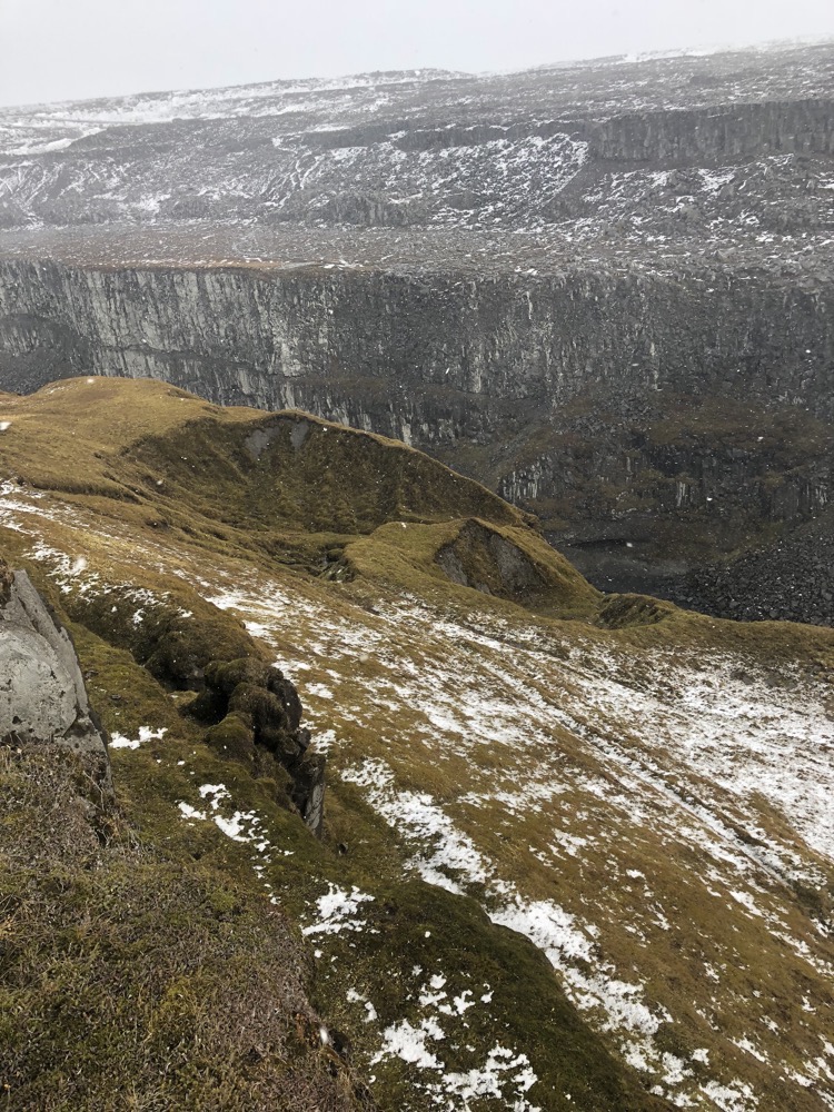
We made our way back to the car, rock hopping and sidestepping the not insignificant puddles, the whole 750m track. Got back to the car and yale (wisely or not… jury is still out) cranks up the heater and strips down to his shirt and underwear to get the cold things off his body. I take the other approach – wipe as much water off my jacket as I can and lay it out on the back seat, put my gloves and beanie over the heater vents on the dash and cover my legs to see if I can get my thermals and jeans to dry out a bit from body heat.
We had a bit of a drive to the west and hopefully back into the clearer weather again, to get to the Krafla volcanic craters, so I was hoping we would dry out a bit before needing to get back out of the car. Though it seems I was destined to be wrong again.
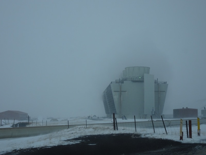
The drive to the Kraftla lava fields was getting darker and more ‘snowstormy’ the closer we got to the area. We got as far as the Krafta geothermal power station before realising the road should be closed – serious incline, easily 4 inches deep in snow and it hadn’t been graded. We made the sensible decision to turn back and head for a different geo-thermal field instead.
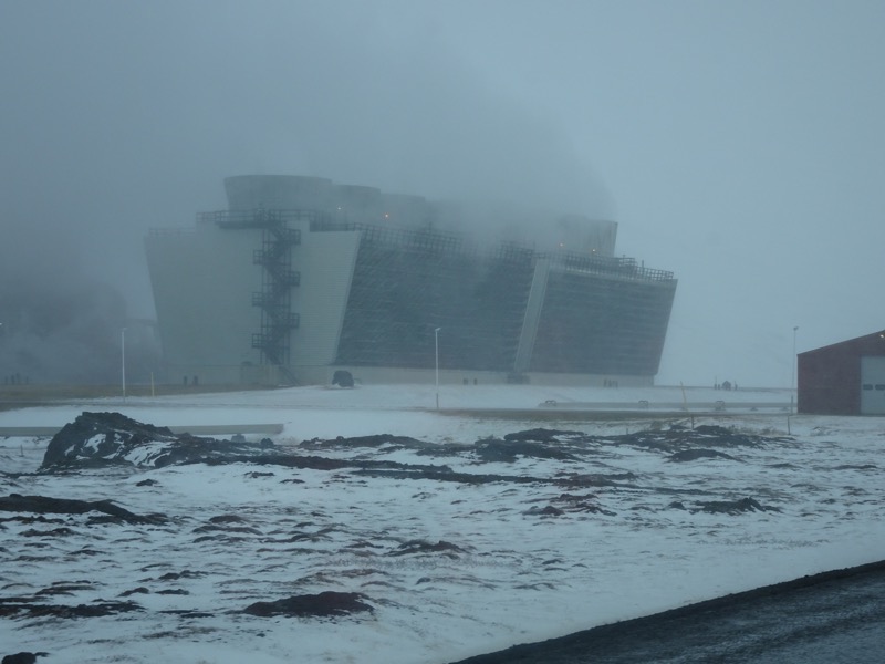 Looking right out of something in the middle of communist Siberia, the Krafla geothermal power plant is Iceland’s largest power station with 33 boreholes, and its ability to produce 500 GWh of electricity per annum… is that a lot? It sounds like a lot, but I have zero knowledge of such things.
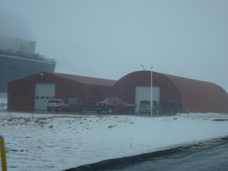
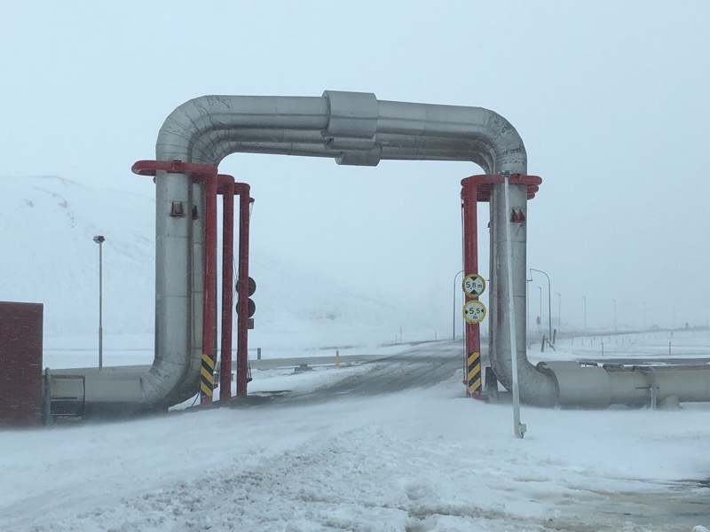 I think it was right about here somewhere that I warned yale ‘I’m going to wind down the window and take a photo’… a courtesy seeing that it meant it was going to let freezing cyclonic winds temporarily whip through the car and bring with it plenty of snow and rain… little did I realise though, that the car A/C had been on recycle that whole time and outside at the biggest geothermal power plant in Iceland was the most godawful rotten egg stench of pure vomit-inducing sulphurous gas which now filled our car in 5 seconds or less, leaving us reeling and gagging from the shock of it. Well, one of us was… I was laughing like a maniac. It was that or you know, cry. So fucking ridiculous. Of course, it was going to be positively foul outside a geothermal power plant!
We drove off as quickly as was safe, to try and get away so we could flush the stench out of the car and ended up stopping near this odd carpark near the plant which had a weird shower coming straight out of the ground, and a handbasin nearby too. I dared yale to go jump under and have a shower (he still hadn’t found dry clothes, but it was seriously still blowing 100kmph and the snow was hitting the car like little ice bullets.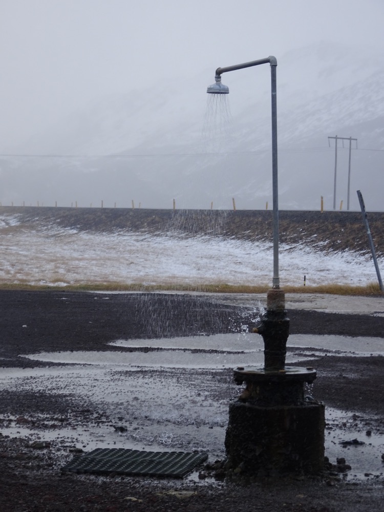
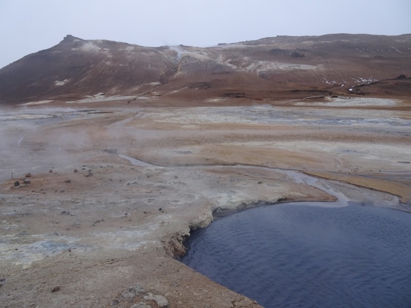
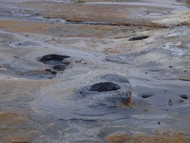
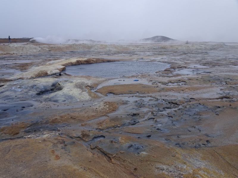
So we didn’t actually get to see the famous Krafla crater, which is aptly named ‘Víti’ meaning ‘hell’. Instead, we head a bit south to the foot of the Námafjall volcano to see Hverir, another geothermal area not far from Lake Mývatn known for it’s boiling mud pools and steaming fumaroles.
Here, we actually thought twice about getting out of the car – I mean, I was still sitting in my cold wet jeans and thermals and not looking forward to getting out into the wind. It wasn’t snowing too bad – when we arrived :/ – and the track through the mud and fumaroles started less than 20m walk from the car park. We had already decided that sight seeing in this weather is just plain stupid, but we figured we wouldn’t be out too long and what the hell, it is right there.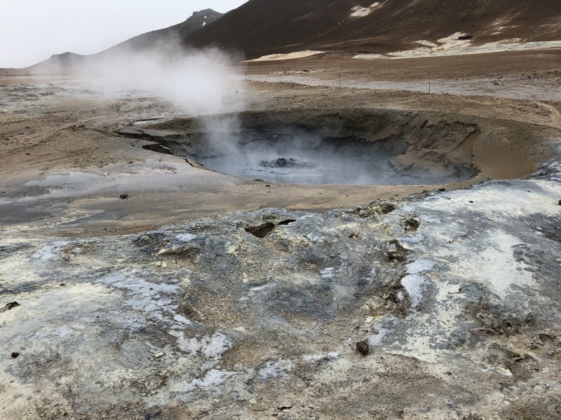
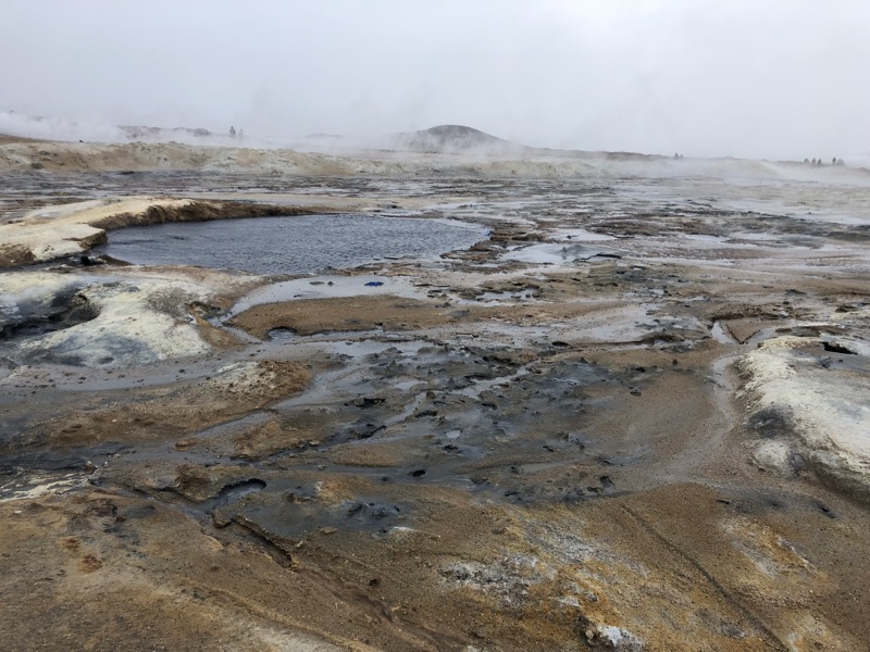 We stepped out of the car and the biting wind reminded me just how cold and wet my jeans were. Thankfully the inside of my jacket was still totally dry and it was only my bum and my legs which were going numb with cold. We walked through Hverir, assaulted yet again by the overwhelming stench of sulphur – though this time a little more prepared for it!
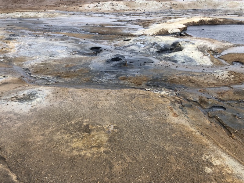 The colours on the ground were incredible. Lava fields and environments like these often get described as ‘moonscapes’, perhaps simply because they are treeless – but I don’t think the description is very fitting at all. It’s more like you expect ‘hell’ to be (should it exist).
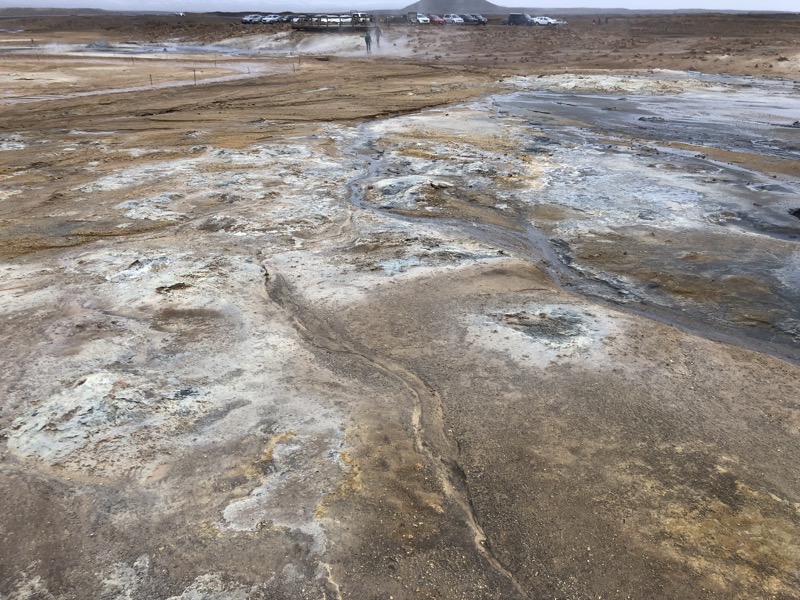
 New Zealand has nothing on this place for boiling mud… it’s not just lazily bubbling to the surface, it’s full on bubble and plopping all over the place.
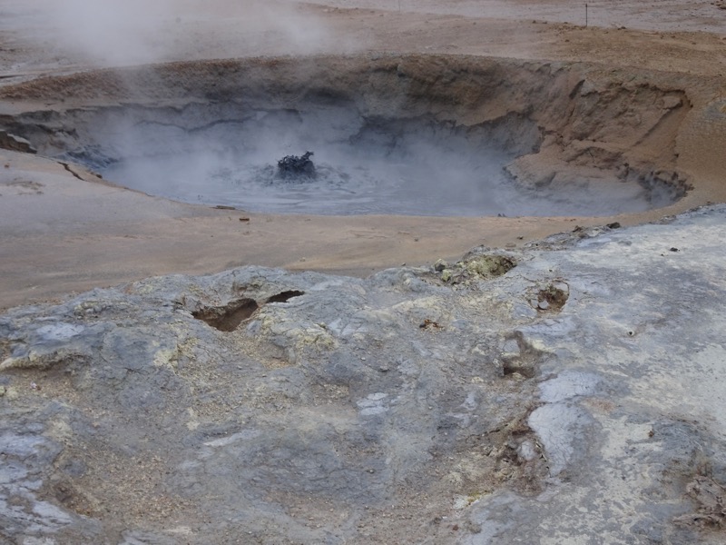
 By the time we had had a say, 20 minute look around, the wind had picked up even more to the point where it was hard to walk against (OMG – how is that was even possible?!) and was just cutting through my wet clothing, and the snow was stinging into my hands and face like sand at the beach on a windy day. I was trying to walk back to the car park but couldn’t open my eyes properly – I had to squint against being hit in the eyeballs by tiny sharp flying pieces of ice. I copped a few in my eyes, and god that fucking hurts.
 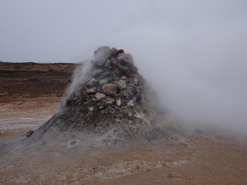 Thankfully yale had his glasses on and while he couldn’t see great because of the water and fog, he saw well enough to stop me from wandering off the safe paths twice! In this area, it’s ‘Please stay on the roped paths because if you do not, your boots may melt.’ I ended up hiding behind him to slipstream my way back to the car. When I got to the car, my jeans were even more drenched, my skin was freezing cold, my fingertips were so sore I couldn’t touch them and my face was red and burning from the cold wind with its deadly ice projectiles. This was rapidly turning into Not My Idea Of Fun… but you can’t come all this way and let the weather stop you. Can you?
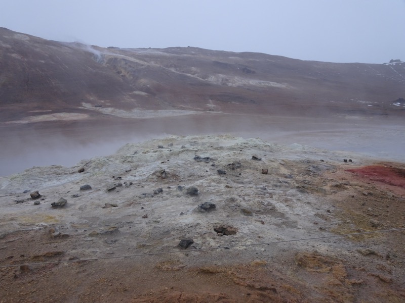
From the Hverir geothermal field we thought we’d go past the Grjótagjá cave. The cave is a small lava cave with a thermal spring inside. People used to bathe here quite regularly, until the 1970s when nearby eruptions caused the water temperature to rise to well over 50°C. Since then the water temps have slowly been coming back down to around 39°C so it’s becoming popular again… no doubt helped along by the Game of Thrones episode that was filmed in here. You know the one, where Jon Snow hooks up with the wildling girl. Yep, that was filmed in this cave.
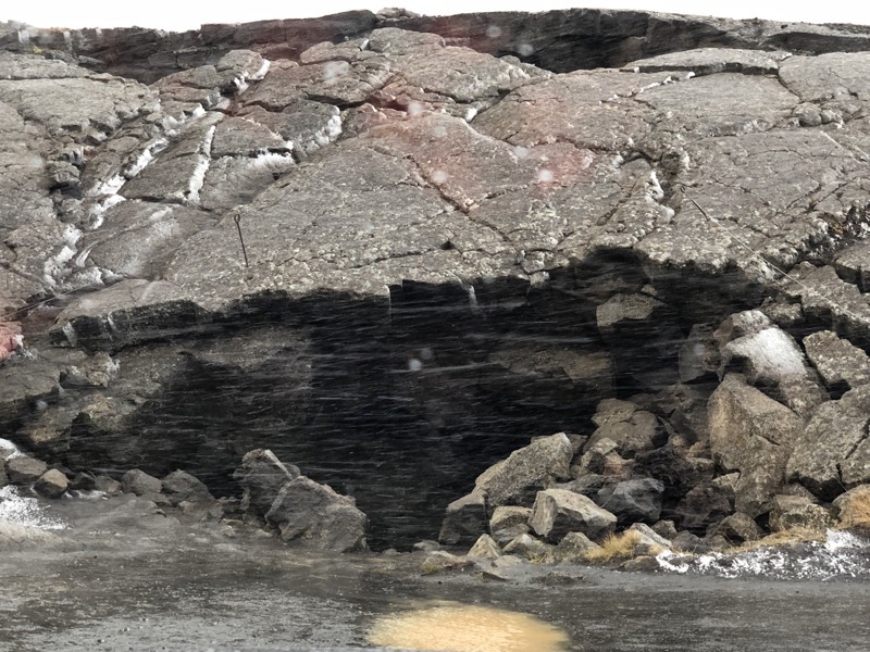 After out traumatic experiences ‘outside the vehicle’ already today, we had planned to pull up and see how far the walk was to get to the cave. The pic above was taken from the car windscreen while we braved ourselves to get our wet things on – again – and go back outside. It was only 10m away, we said. We will only be out a few minutes, we said. It will be warmer underground, we said. ..
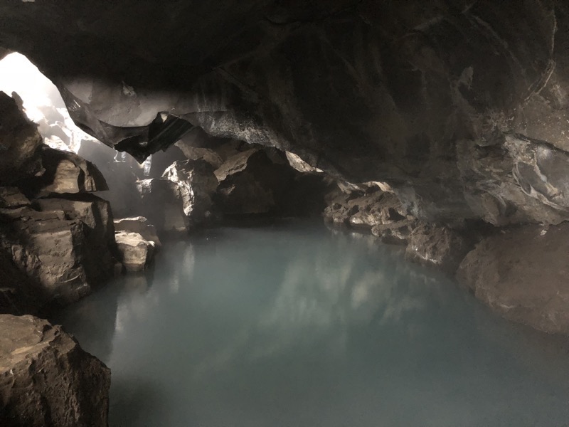 The cave was really quite pretty and probably the only thing we did today that was kinda worth leaving the car for in a payoff vs pain equation!
 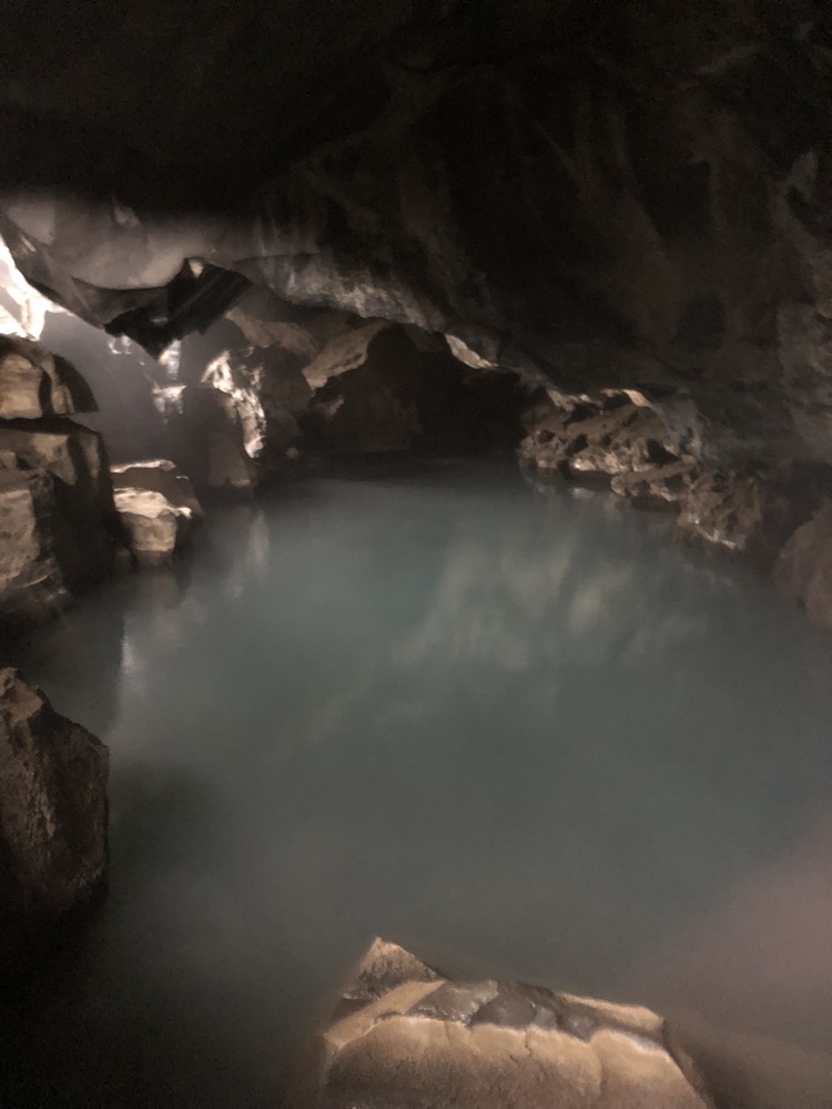 We were so cold and it was so inviting, it would have been lovely to jump right in. But with no way to get dry and an uncertain distance left to cover this evening, and with heaps of other tourists popping their head in for a sticky beak – perhaps not.
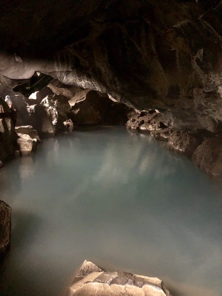 This was the side of the car after being parked for less than about 15 mintues… seriously that horizontal snow is a killer. I’m over it already and it’s been one day. We saw one guy out here in high vis waterproof overalls, helping some tourists change a tyre on their rental car – when I saw him, I said, ‘That guy deserves a fucking medal, out here changing tyres for tourists!’ by the time we were ready to leave the area, I was thinking, ‘That guy desrves a medal, some champagne, diamonds and a trip to bloody Tahiti!’ What a shit job in the worst weather conditions imaginable.
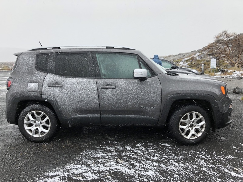 After this we quite sensibly and perhaps some would say, belatedly decided to give up on touristing for the day. We were heading for a local supermarket to buy some dodgy ravioli and pasta sauce or something to cook for dinner when we happened to see a “Pizza Open” sign that attracted our attention. Now, bearing in mind, I am still wearing soaked pants (but feeling very lucky really that my upper body was warm and dry) we decided to go in and have an early dinner.
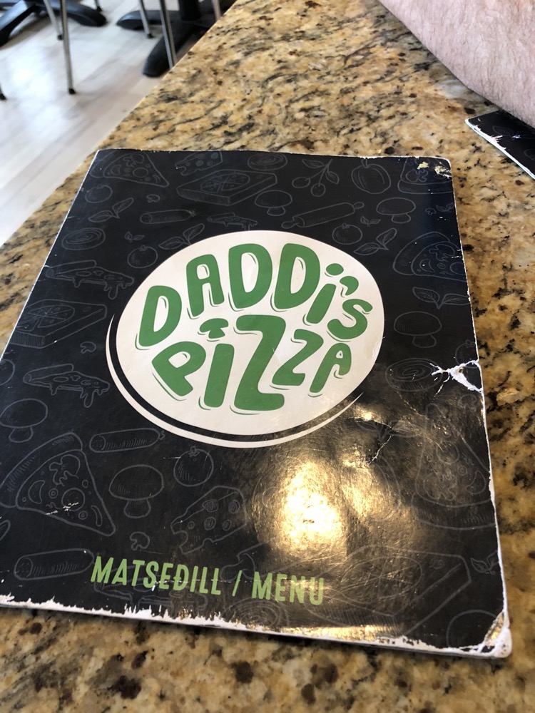
The sign was directing us off the highway to Daddi’s Pizza to what appeared to be a dodgy shack in the misty snowy shadows down an ungraded road going to goodness knows where. ‘Daddi’s Rape Dungeon Pizza more like it,’ was yale’s comment (yes, it was turning into *that* sort of unfiltered day. Still, it was so cold and we were quite hungry we googled up some reviews before getting out of the car and it all looked good so in we went.
 The place was clean and tidy and even though I have been careful not to photograph any other customers – there were about ten other diners in there at 4:30pm in the off season.
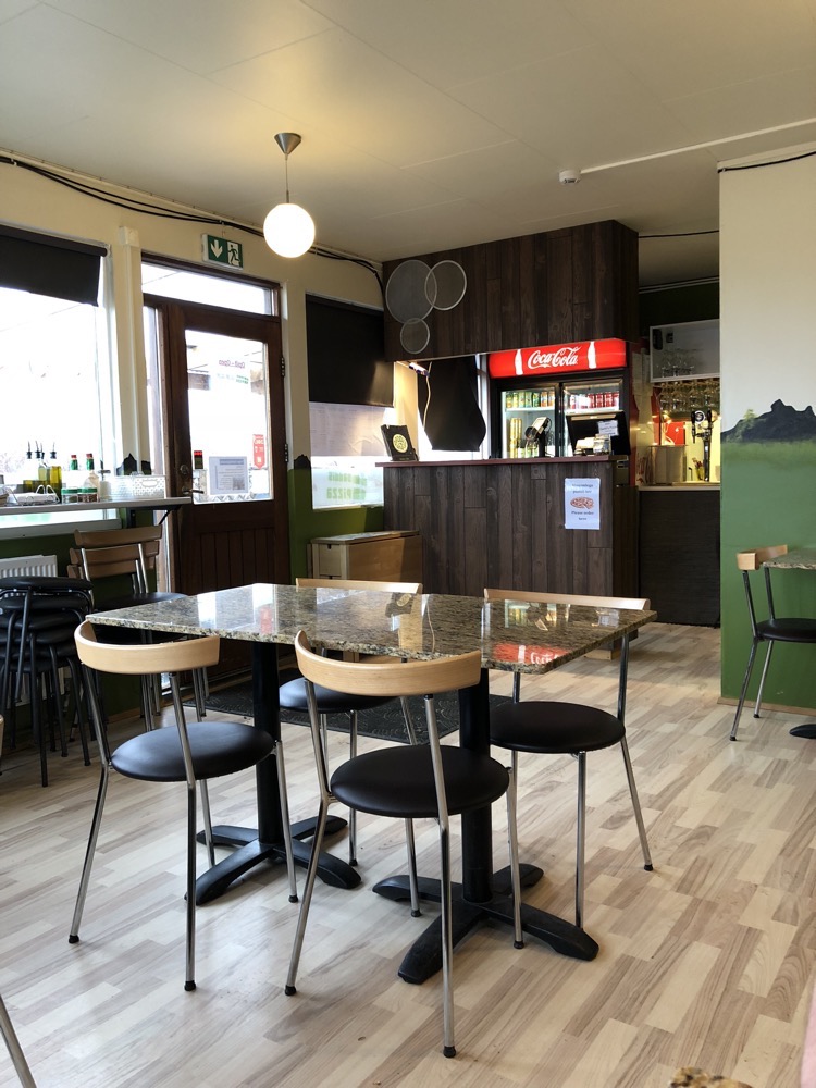 Menu was extensive and it all looked good. We ordered a large (ambitious if you asked me) Lúdent pizza, which came topped with a tomato base, local lamb, garlic butter mushrooms, Bernaise sauce, black pepper and we added blue cheese for good measure.
 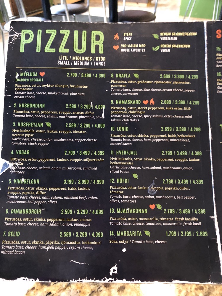 Check out the prices on xe.com if you want a heart attack…
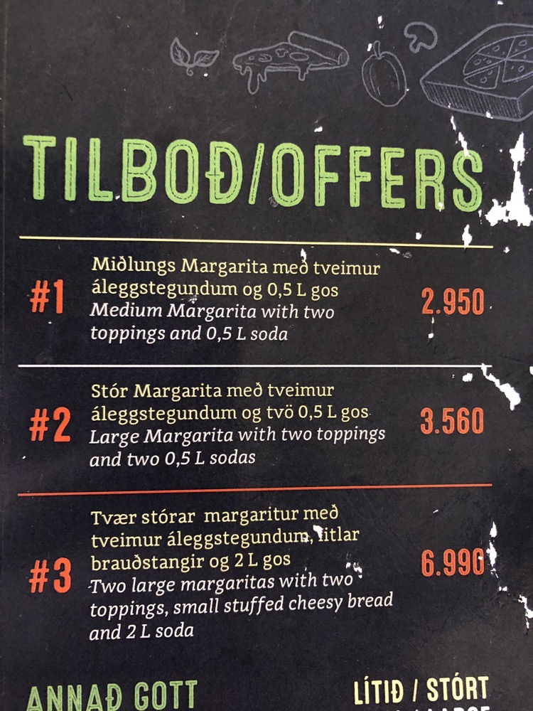 But then the pizza arrived and all seemed well with the world.
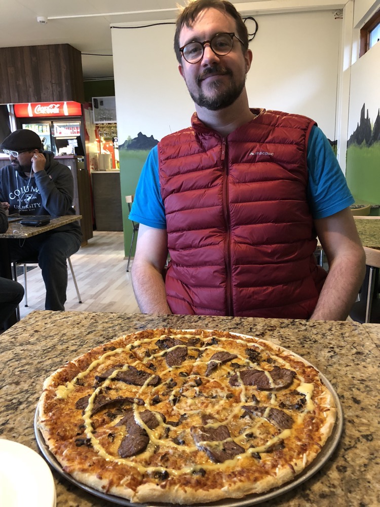
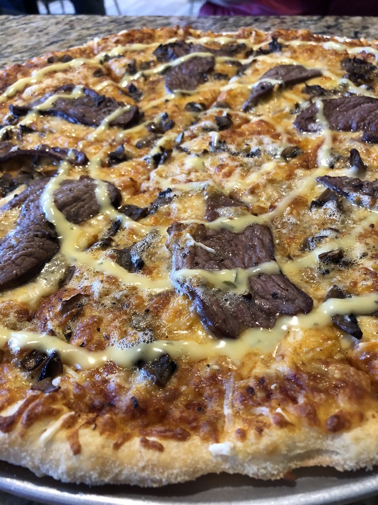 The pizza was amazing – even if it was AUD$63.00. We ate the whole thing (and by that I had three sizes and yale finished it off) before making another sensible decision to high tail it to our accommodation for the night so I cou,d FINALLY get out of my wet clothes!
We got here, checked in and I swear it has take me nearly three full hours to warm up. I’m exhausted. Bed time soon me thinks.
 Dotted around the promontory were also monuments to each planet, this one was for the Sun:
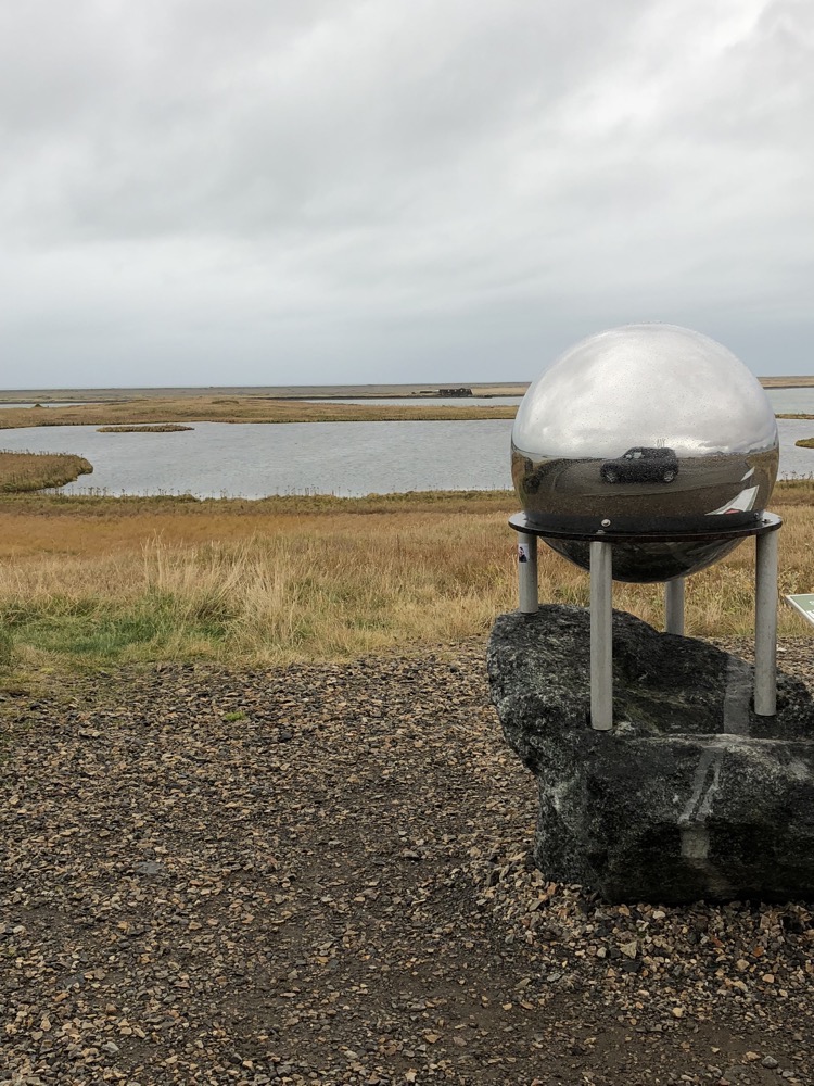 In another nod to Höfn’s seafaring history, this gorgeous wooden narwhal tusk statue graces the seafront.
 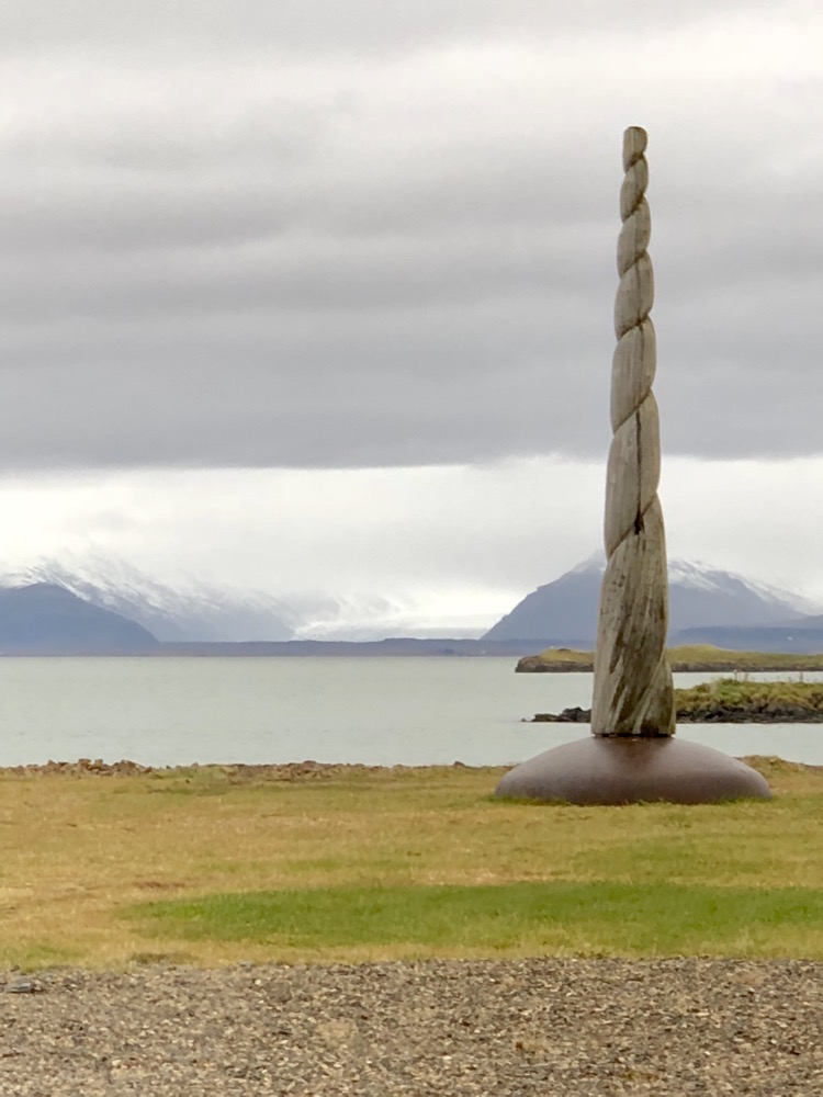 Interesting fenceline in someone’s front yard…
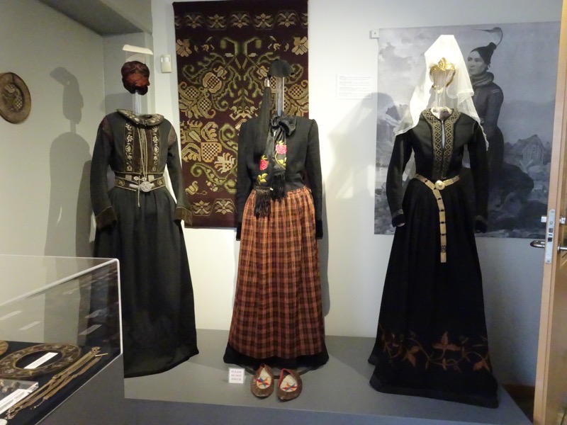
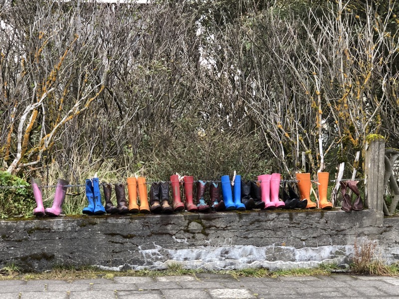 We had a quick stop at a local handicrafts store; there are lots of lovely woollen textiles everywhere we go, and I’d be tempted to find something in colours I like, but I’m very conscious of two things – 1) EVERYTHING in Iceland is crazy expensive (these knitted sweaters start at around AUD$250), and 2) they’re so thick and warm, you’d never ever be able to wear one in Brisbane, not even on the coldest night of the year.
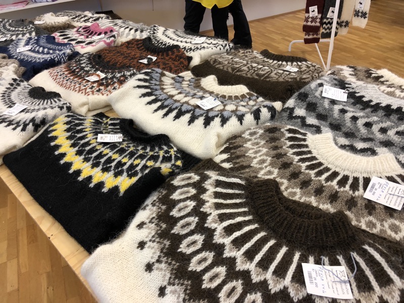 Languostine pattern: ‘langoustine’ is another term for a
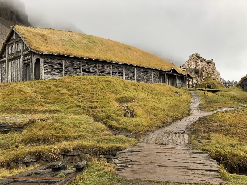
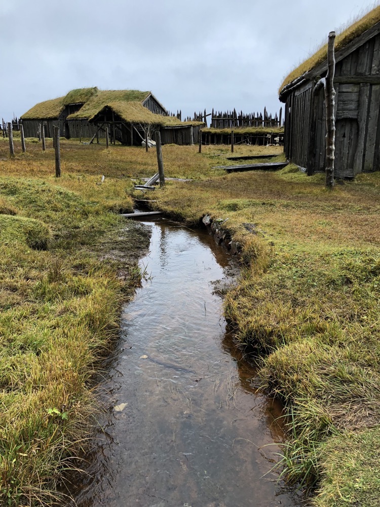
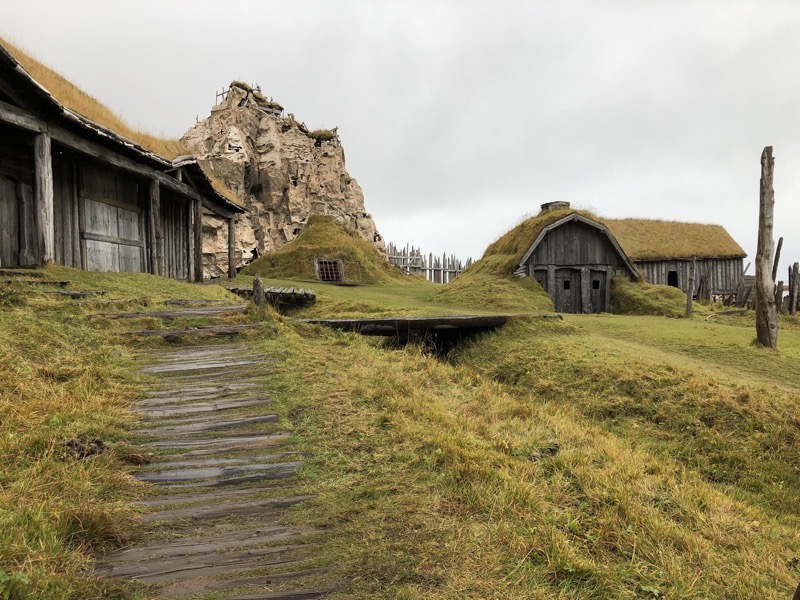
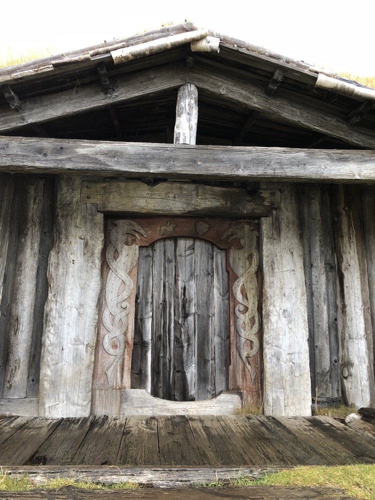
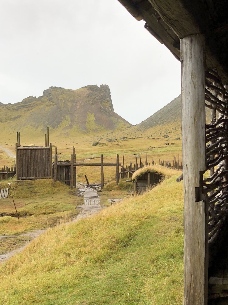
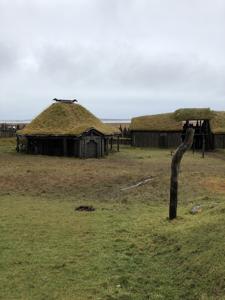
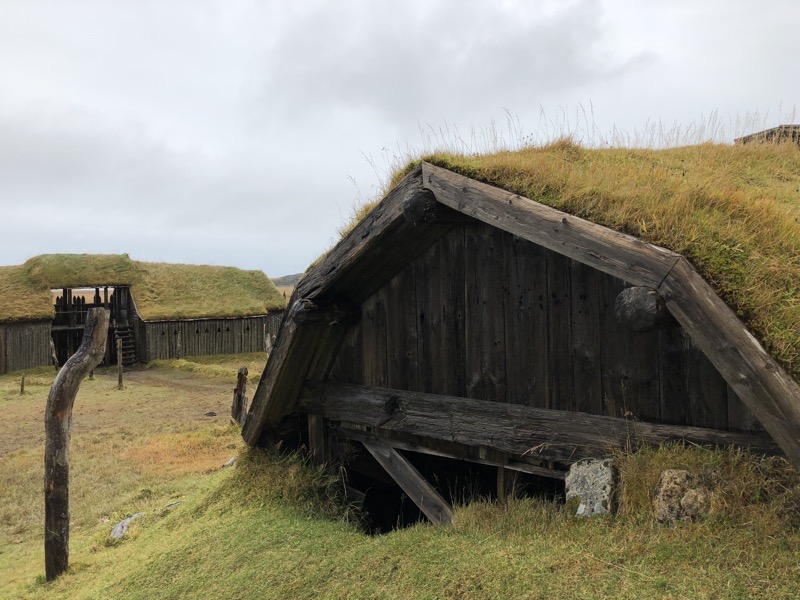
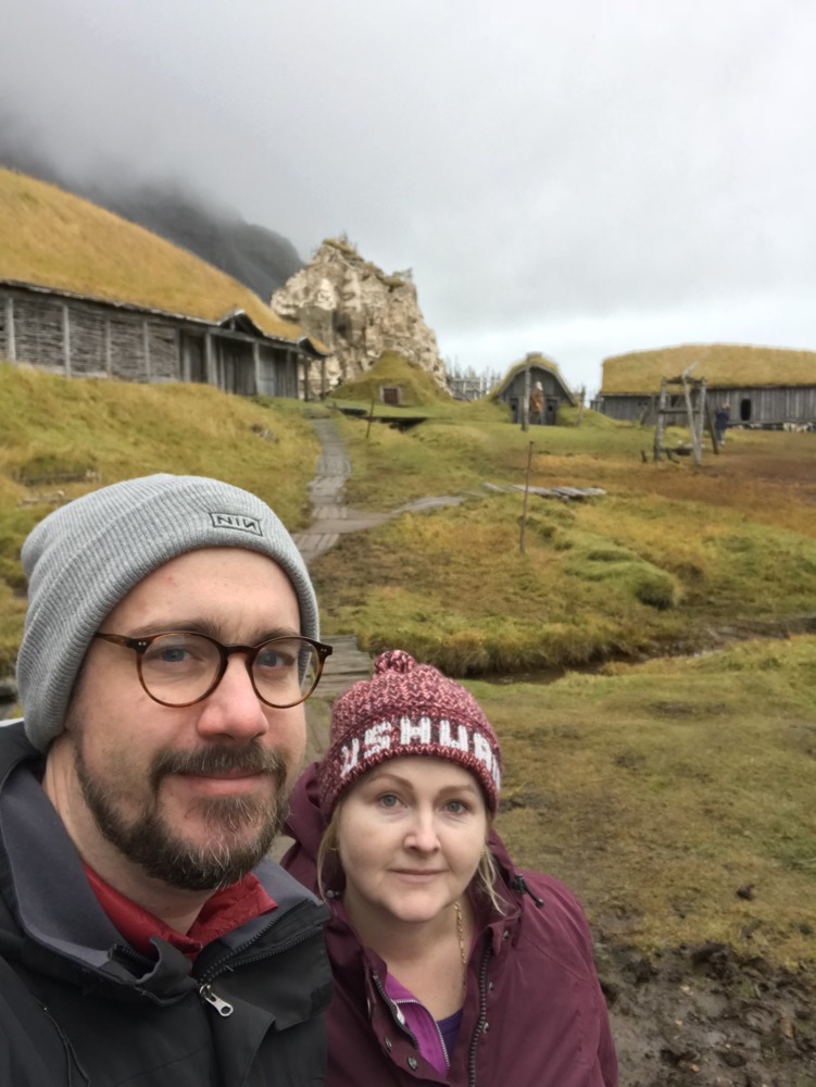
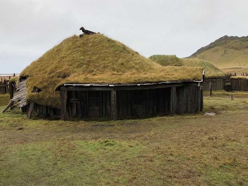
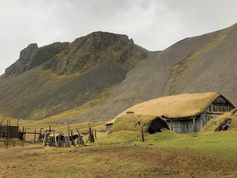
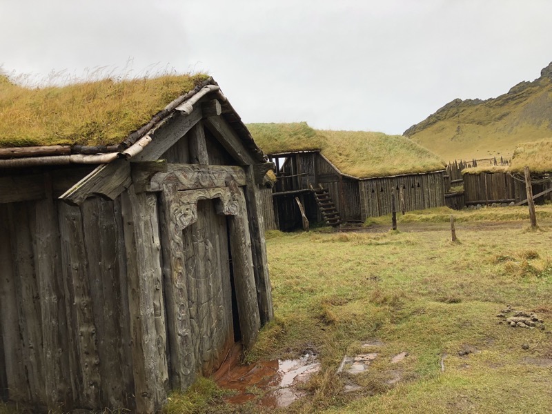
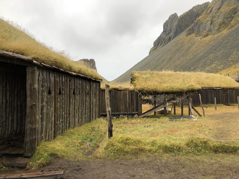
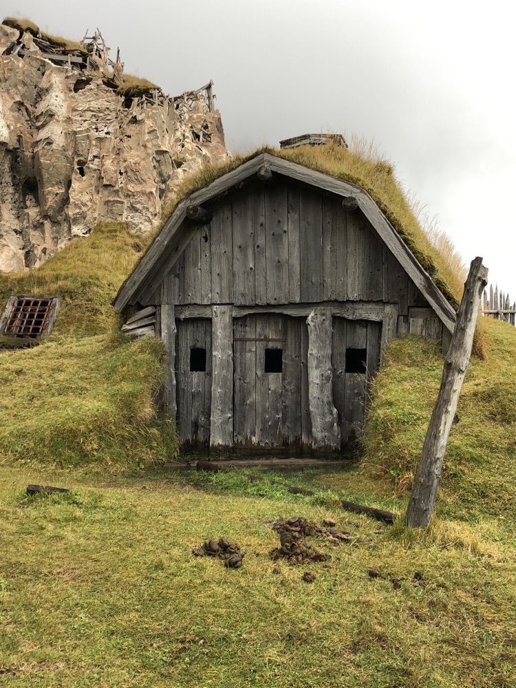
 On our way out of town, we decided to stop at the Vestrahorn Viking Village. It’s a recreated viking village that was purpose built to be a movie set which was slated to be filmed in 2010. It seems the movie was never made but the set is on the property of a local farmer, and he has wisely plonked a cafe on the property and turned it into a bit of a tourist attraction.
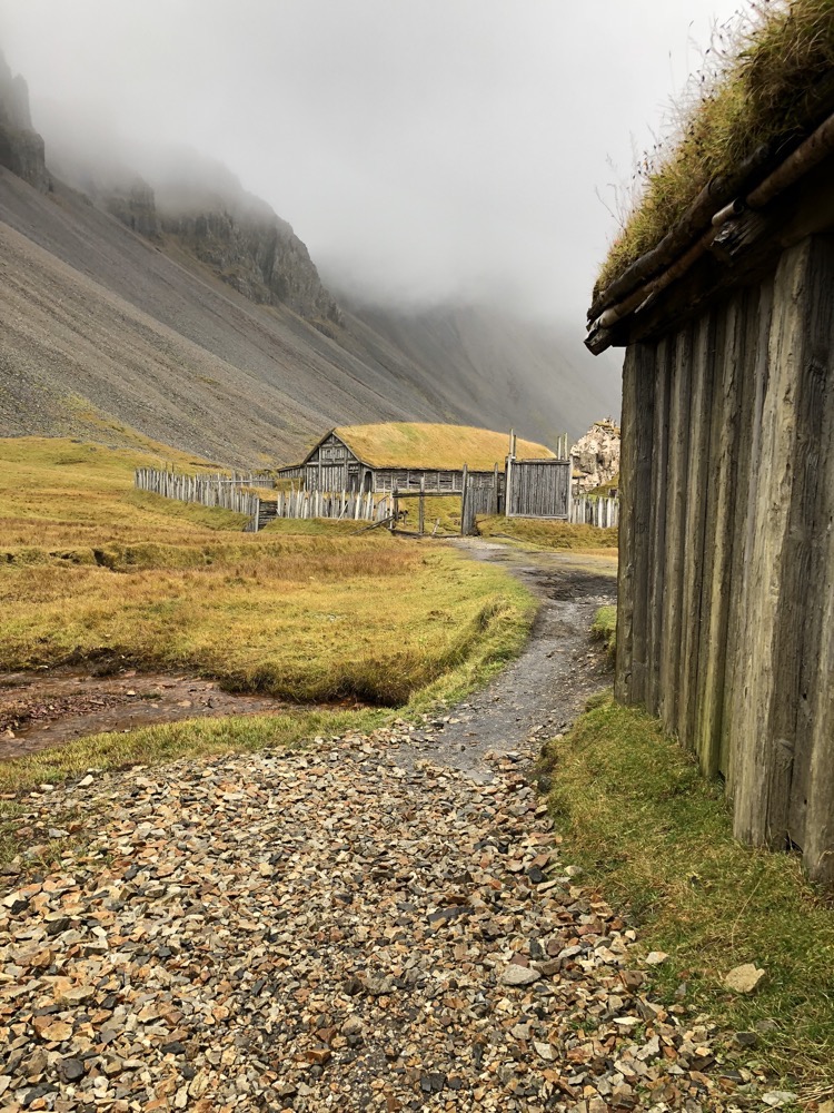
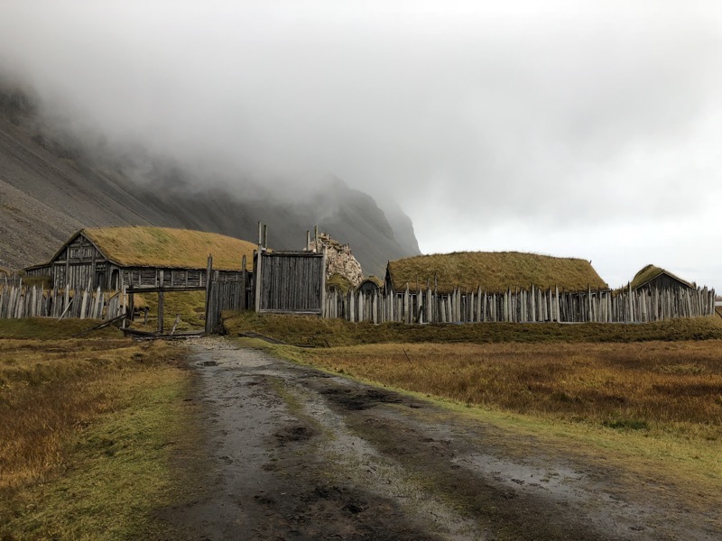 Given it was created for a movie, it is perhaps as not historically accurate as if it were built by archeologists (who knows?) but we walked around and found the place really interesting.
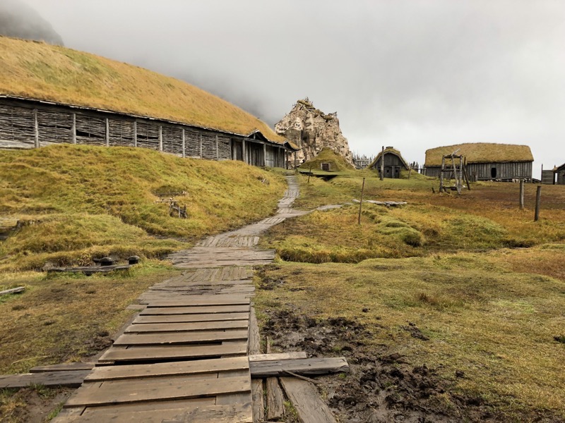
 As we were getting ready to leave, two people wearing viking garb walked in, and I thought initially they must work there. On striking up a conversation, we found ourselves chatting with Cian and Tatiana, the recently stepped down Baron and Baroness of Coeur D’Ennui in Calontir, who happen to be friends with Sir Siridean, once King of Lochac. Small world.
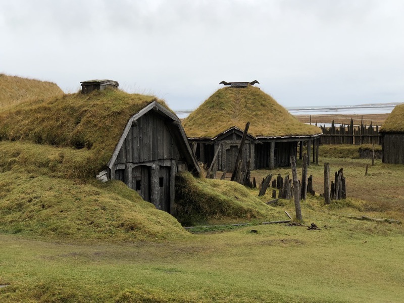
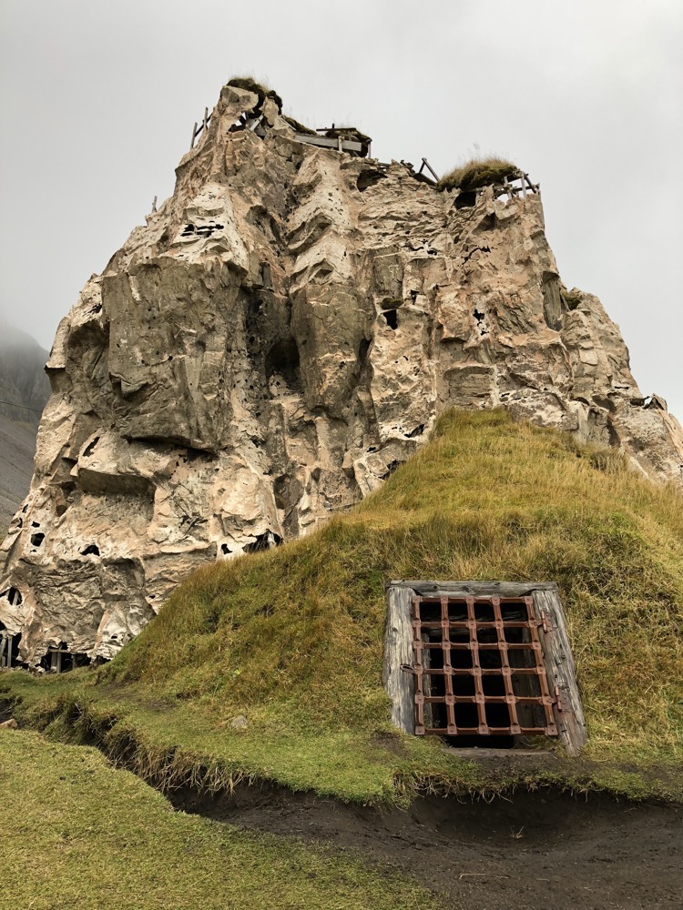 If you are going to build yourself a viking village for a movie, this is definietely the place to do it.
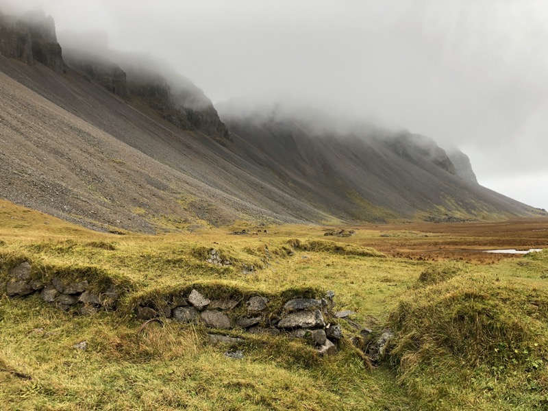
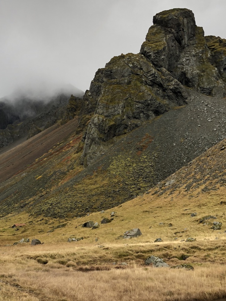
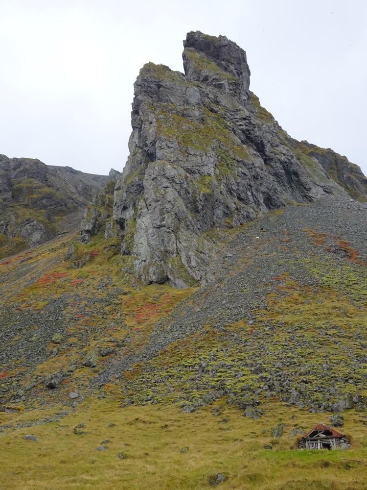
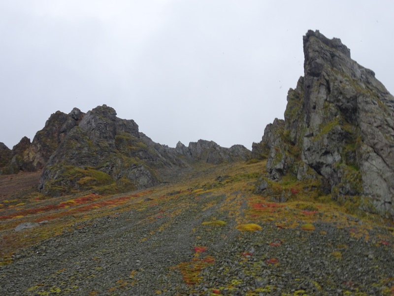
 We then went for a bit of a drive out to a NATO radar base to get a good view of the mountain… so much for that! Today Vestrahorn looked like this… slightly interesting at the base and then, nothing.
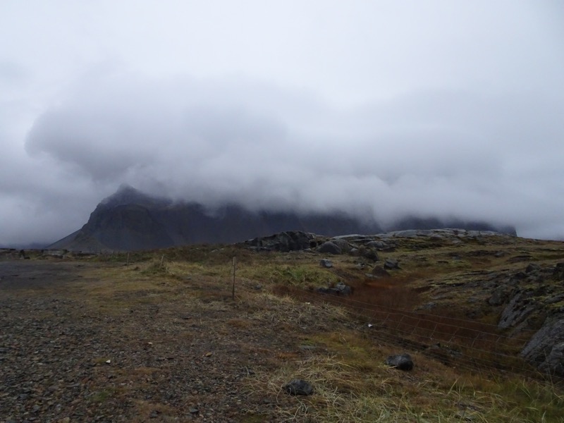 Vestrahorn has more commonly been captured looking like this:
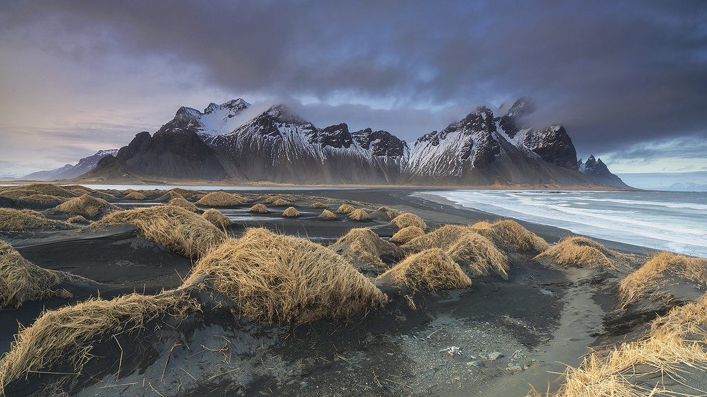 So you’ll just have to imagine that is what is under the clouds. 🙂 Our trusty Jeep Renegade that is getting filthier by the minute.
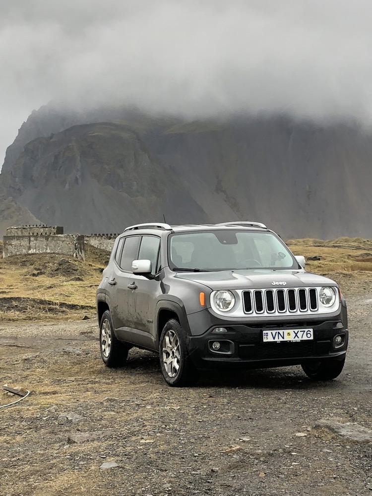
 T
T
 Even though we couldn’t see the top of the mountains, the scenery is still so dramatic.
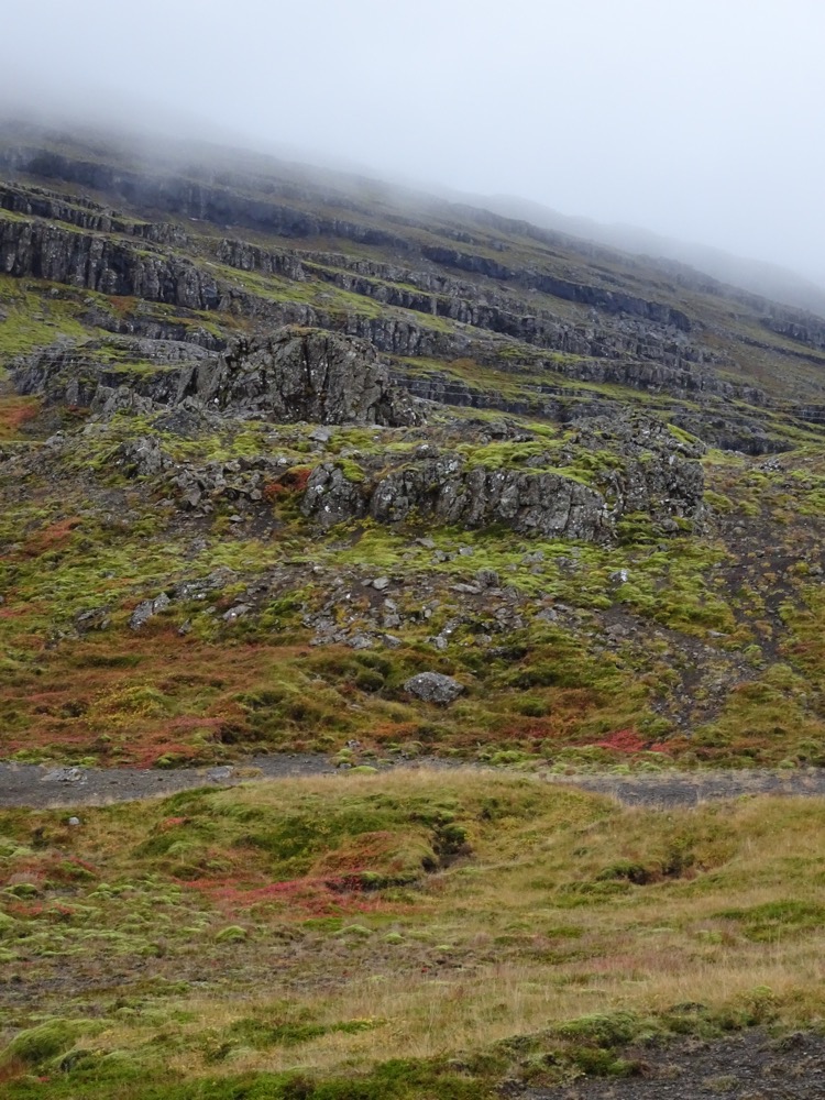 Lunch stop for soup and snacks overlooking a craggy black beach.
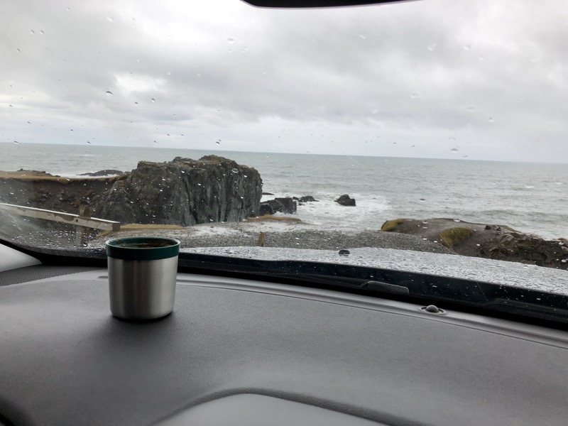 This part of the coastal ring road that takes us from Hofn to Egilsstaðir is really bloody crazy. Uphill and down dale, plenty of blind corners and blind crests, loads of one-way bridges where who has the right of way is totally ambiguous, and so many people speeding even though there is literally no shoulder on which to pull over if you have a problem or any sort of incident.
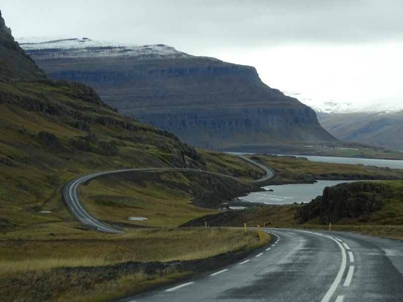 There is nowhere to pull over and visibility sucks, yet people seem to want to travel 100kmph on these roads.
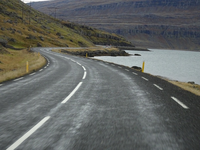 It also cuts through some seriously long tunnels – including Fáskrúðsfjarðargöng tunnel, which is about 6kms long.
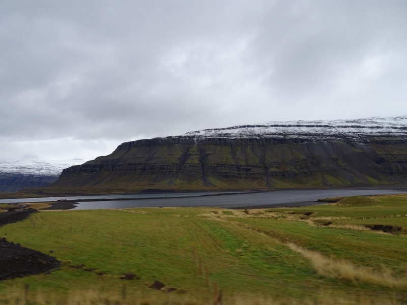
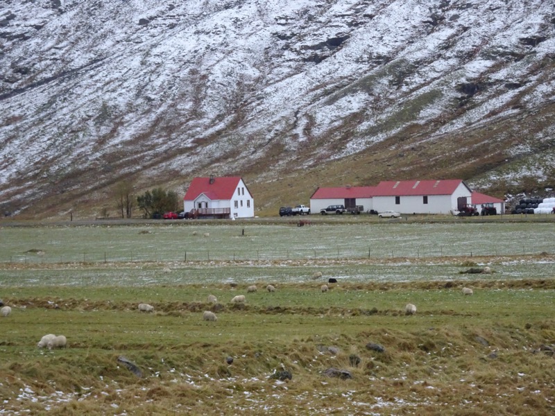
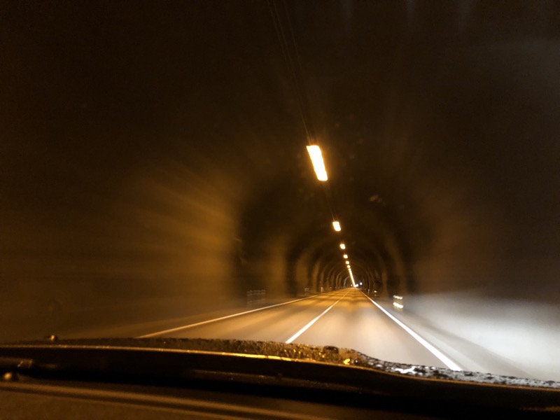 Farm houses near Reyðarfjörður.
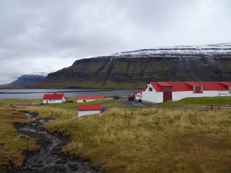
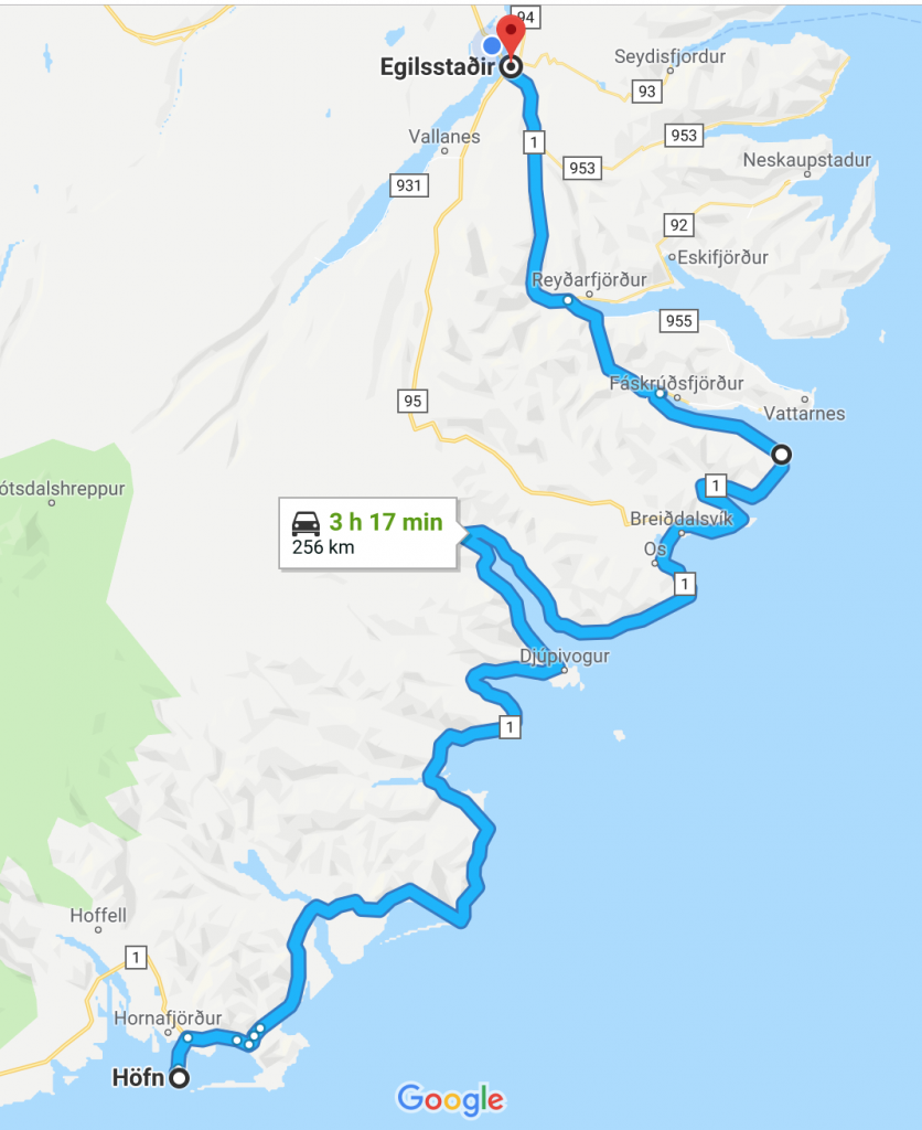 We finally arrived at Egilsstaðir and decided to pop by the visitor’s centre to ask about somewhere to go for dinner to try some local food. Apparently, the entire area was once just one farm, which is now a guesthouse called, Gistihúsið with a restaurant, Eldhúsið, and a spa. The restaurant at the farmhouse is famous for creating their menu from all locally grown produce, which they also sell locally. It looked pretty flash and I was quietly confident that dinner there was probably going to cost more than our accommodation for the night – but the advertisements won us over.
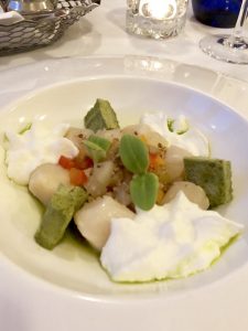
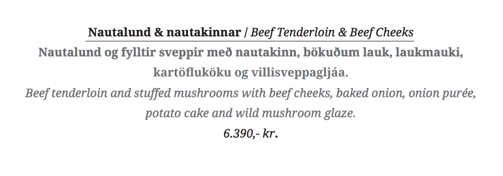
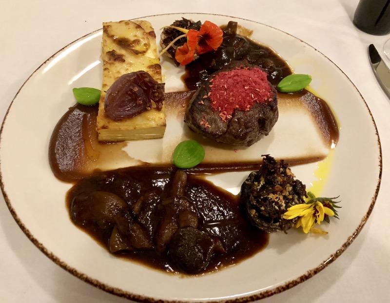
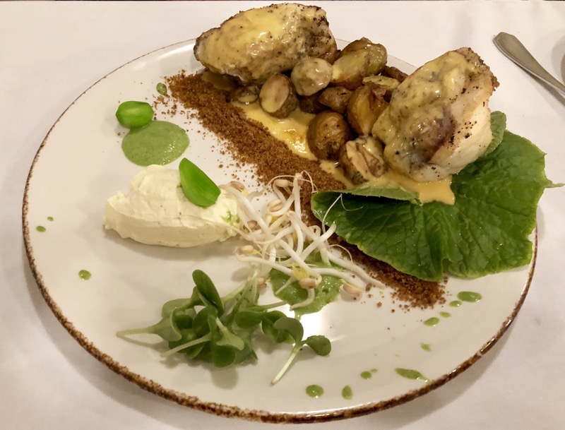
 The menu was extensive with plenty to choose from. For starters I ordered the scallops and yale ordered the smoked beets, for a main, I order the beef tenderloin and yale ordered the monkfish. All of it was absolutely delicious and beautifully presented. I took a grab off their menu so you could see the descriptions (and the prices.. oh my giddy aunt!)
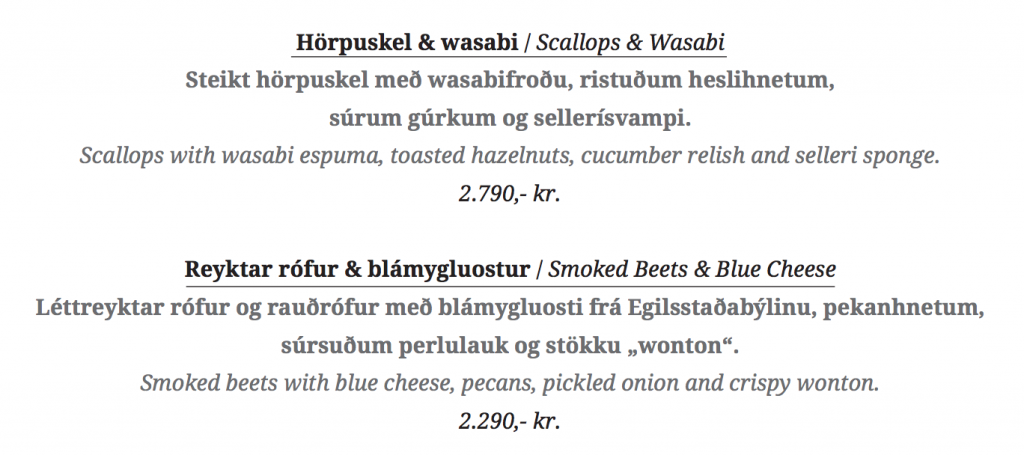
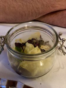
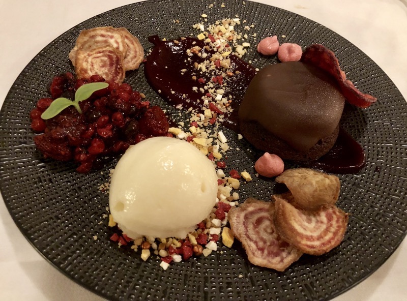
 yale ventured to try the beetroot cake for dessert, I tasted a bit, but it was far too chocolatey sweet for me.
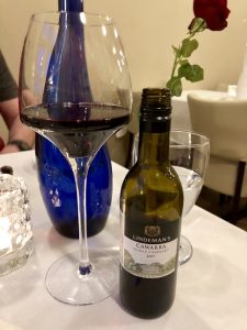 The food was really good, but the hardest thing about this meal was choosing wine. They had wines from all over the world; Iceland not being known for it’s boutique wineries or anything… and with that comes the ‘Everything Is Imported Dickhead Tax’. I mean prices were just prohibitive. Check this one out – Lindemans Cawarra Shiraz/Cabernet, 187ml piccolo bottle for 1,590 ISK (approximately $19.55 AUD. $20 a glass!?! for a wine that I could (but wouldn’t, because I don’t drink cheap crap like this at home), pick up for $5.50 a 750ml bottle at Dan Murphy’s back home! And the Chilean, American and European wines were just as bad.
 When the check came I was not at all surprised, but this probably explains why we are pretty much living on ham and salad wraps, cup-a-soups and fresh pasta. yale said he has figured out how Icelanders stay fit – they spend all their time hiking up to see waterfalls or down into ice caves and, they can’t afford to eat!
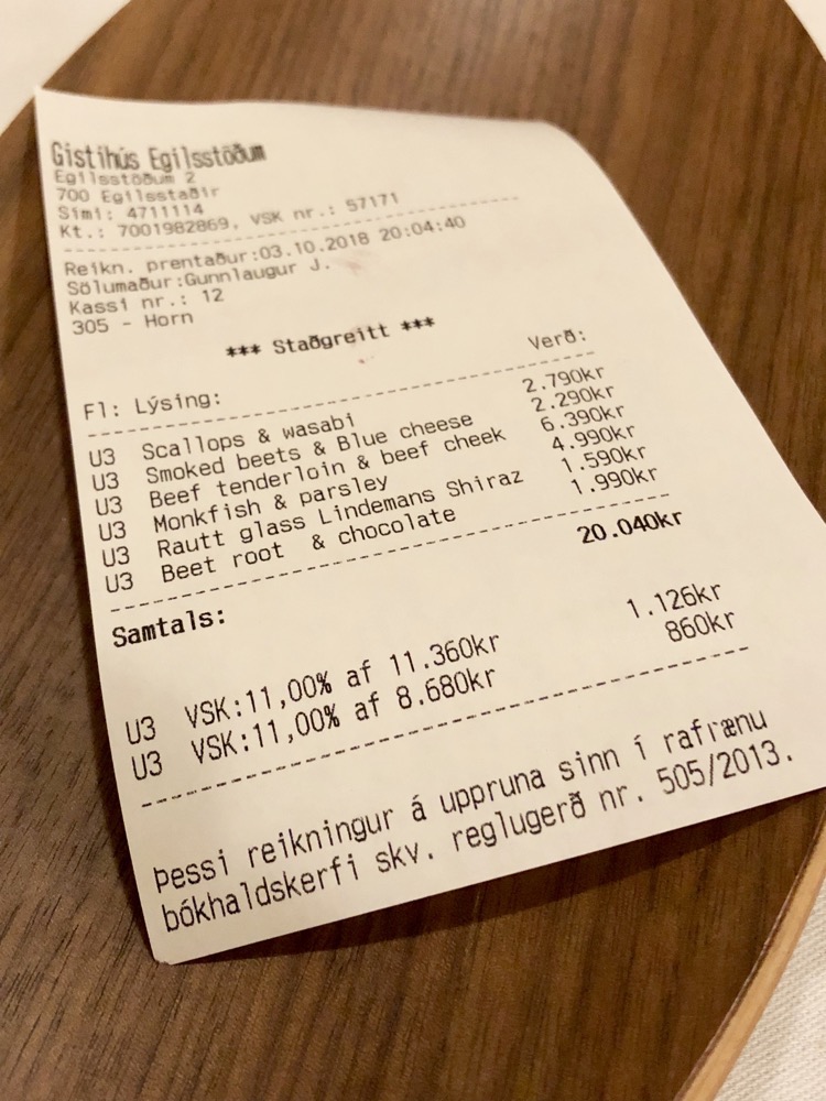 Dinner was undoubtably good, but nothing to write home about (she says, while writing home about it 😉 ). This probably just means I am either altogether too hard to please or my disappointment over the selections lingered a little too long. With an entree and a main each, one glass of very ordinary wine and yale’s dessert… you can do the conversion on our dinner for two in xe.com if you want – the Sticker Shock for shits and giggles is probably worth it.

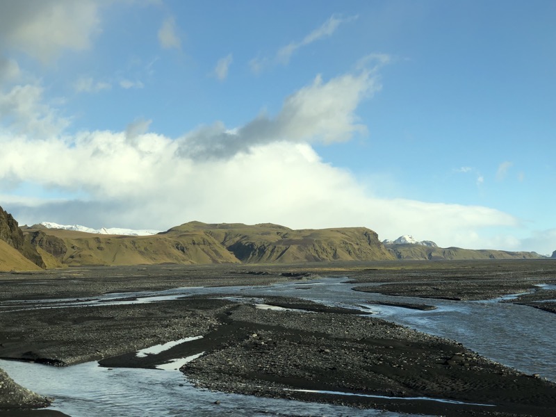
 First stop was a quick photo opp at Fjaðrárgljúfur Canyon. The canyon is about 100m deep and 2kms long having been cut in the last Ice Age by the Fjaðrá River that flows through it.
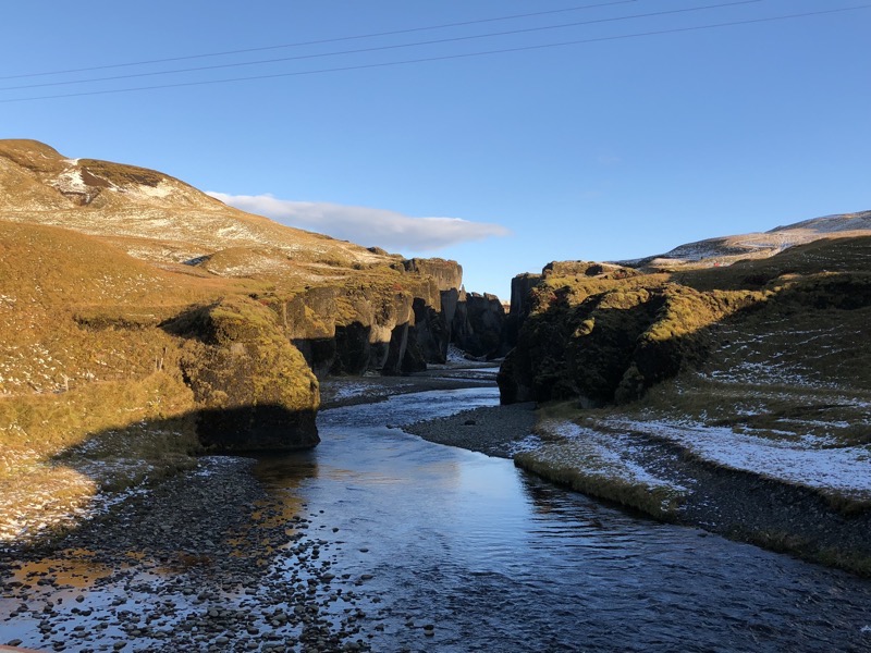 It would be amazing to go walk through the canyon but alas, we have only so much time and so many things to do today.
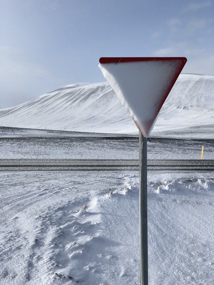
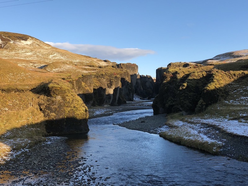 Unrelated, but directly adjacent to the canyon, we found the first of a bunch of ‘No Pooping’ signs on the side of the road… Why the fuck do people need to be told not to take a dump at a car park on the side of the road at the beginning of a nature hike? People suck.
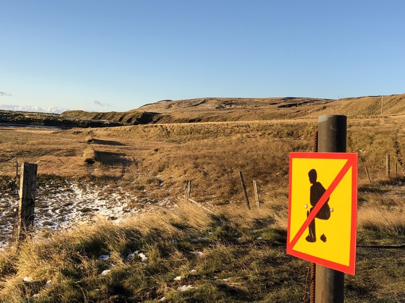 We were heading back a bit to Vik this morning and with the sun out, everything looked completely different to last night in the dark and rain.
 The gorgeous views just go on for miles – and around every corner some other truly beautiful vista greets you.
 Snow over the lava fields.
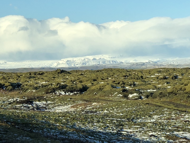
 A small selling point for some – the walls of the glacier are ‘The Wall’ in the Game of Thrones tv show. Film crews came out here in the winter to film sections of the glacier wall to use as a model/basis. Stefan informed us that ‘They film these wall, and then the rest is they make in the computer.
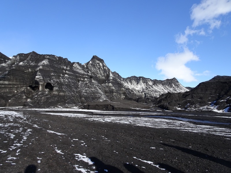
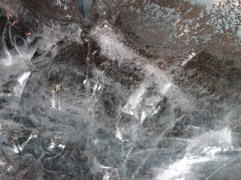
 So not sorry that there are so many pictures being added to this post – everywhere we looked was beautiful vistas, stunning ice formations and interesting light.
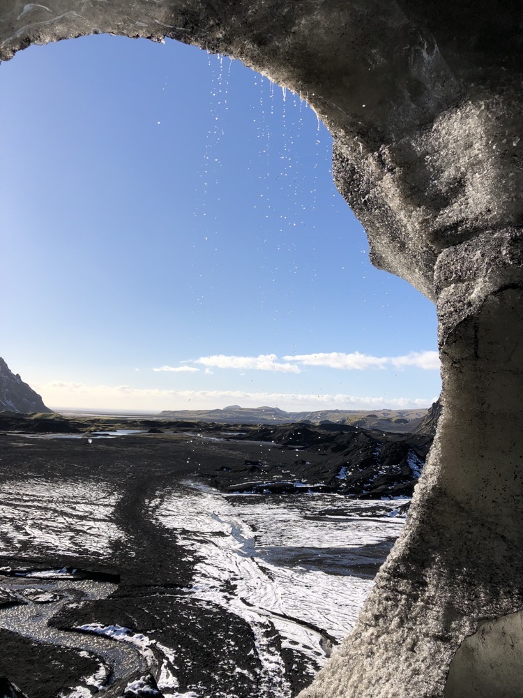
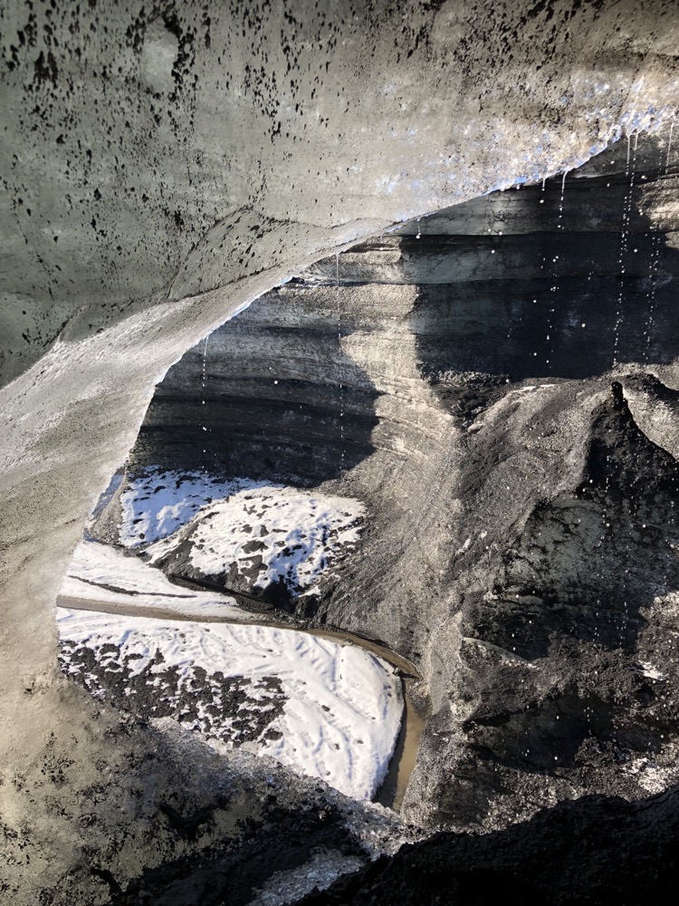
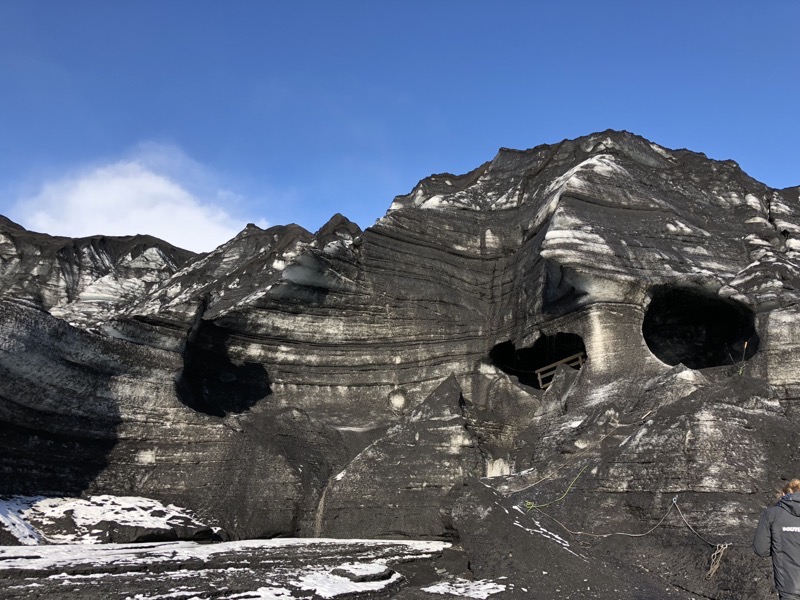
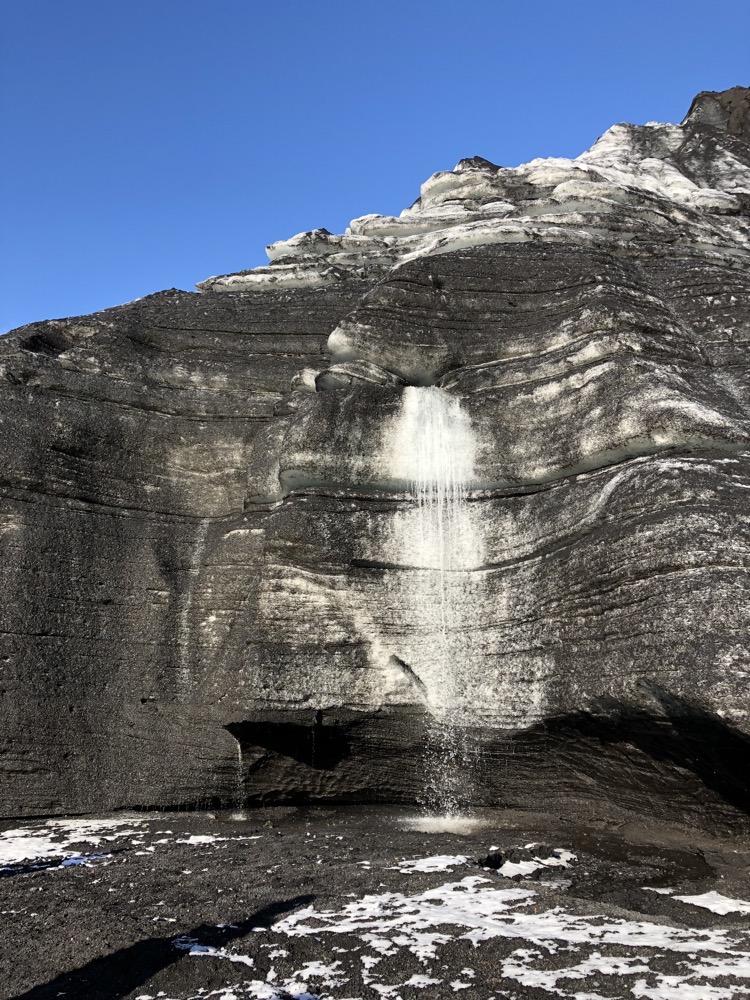
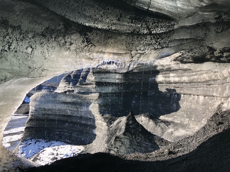
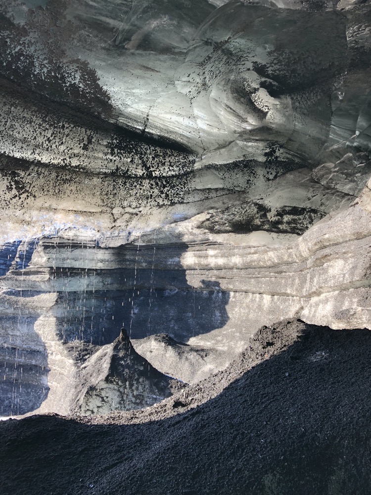
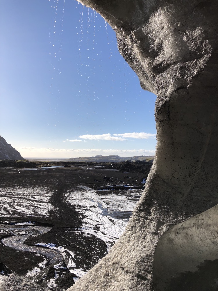 The ice caves change every year as the warmth of summer brings rapid erosion, and the frosts of winter stabilize newly formed caverns and tunnels. So every season the spaces that people can safely access are altered.
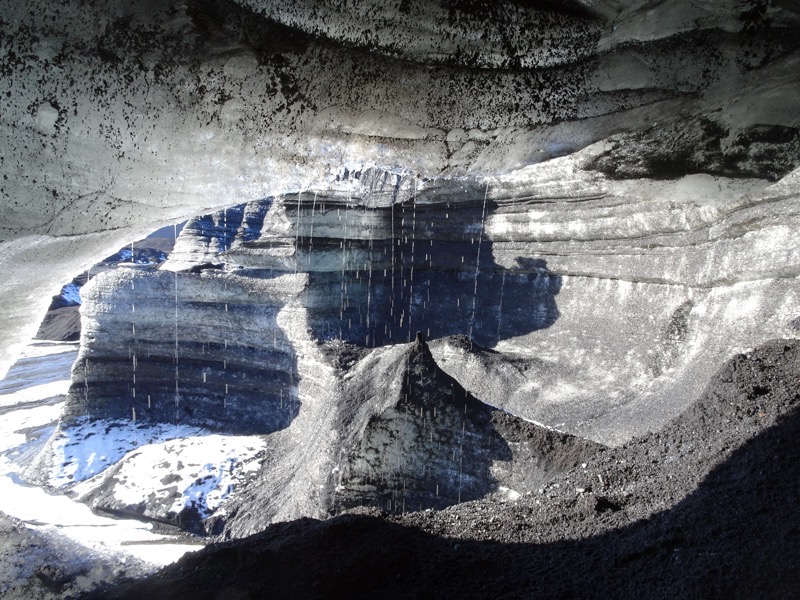
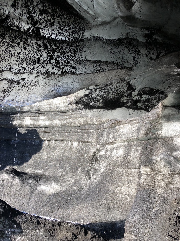
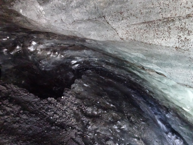
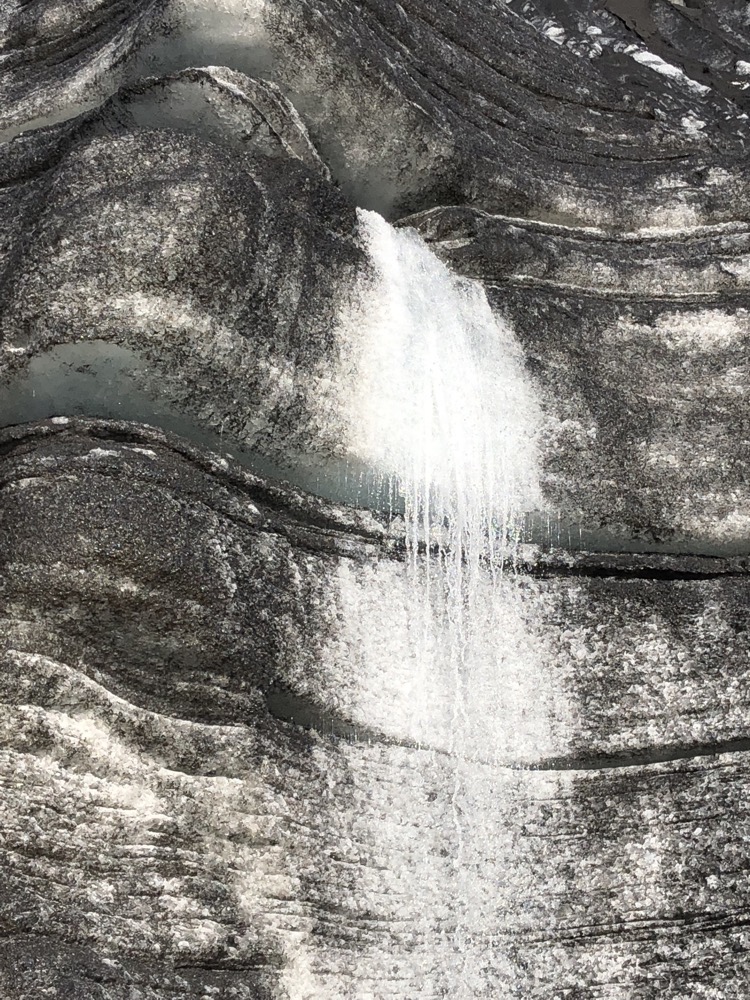
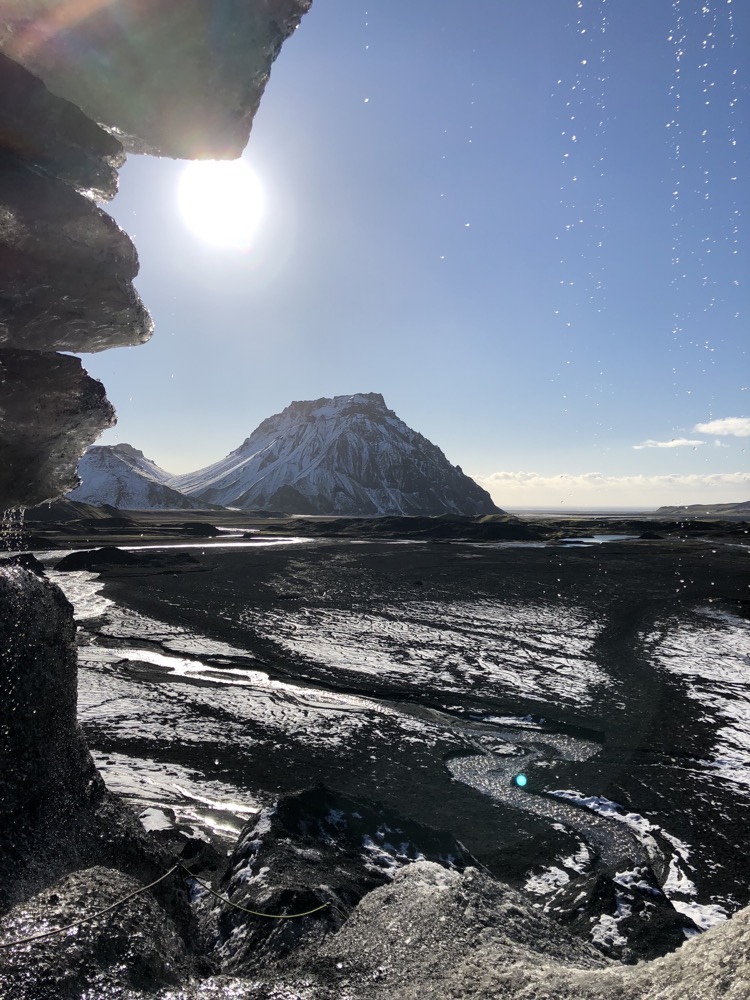
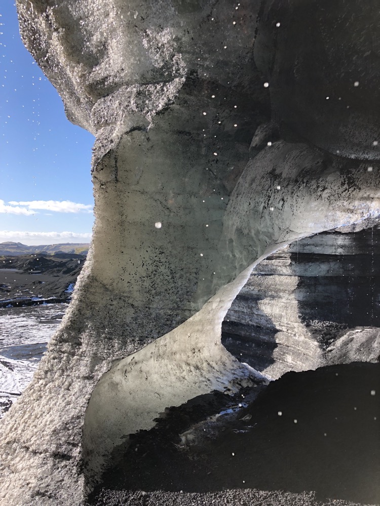
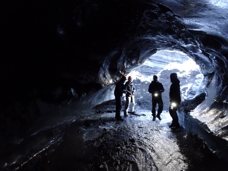 These ice caves are among the most extraordinary and mesmerizing wonders of nature. They are some of the most breath-taking sights I have ever experienced and this is just a little taste of what the ice caves offer – some of the most impressive ice caves you can visit in Iceland are not open until the full winter season due to their unpredictability. Just a few weeks ago, the ice cave known as the Crystal Cathedral (a large underground ice cavern) collapsed under the weight of the moving ice.
 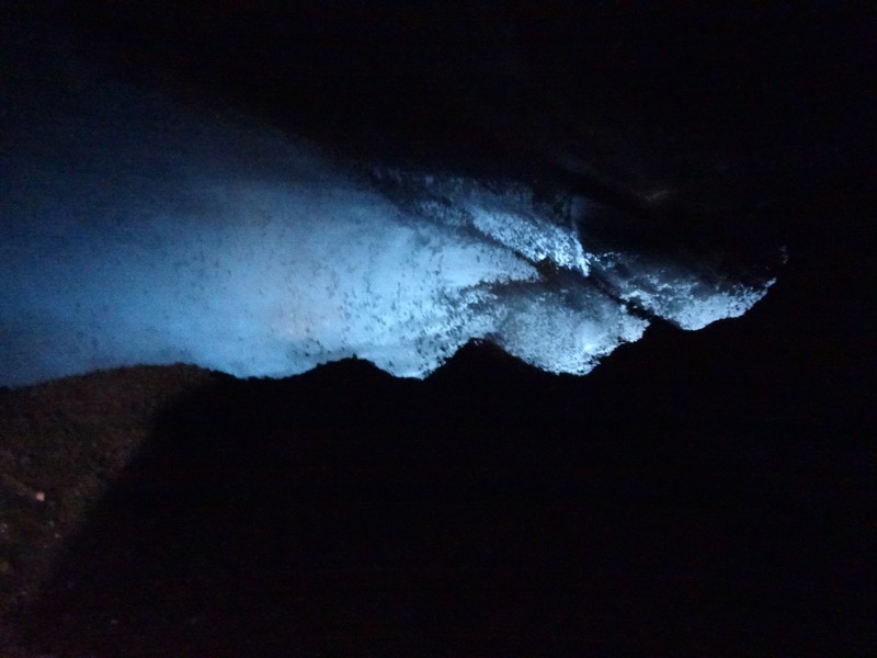 We are literally standing inside a glacier, it’s all around us. It feels really solid and safe, but in the back of your mind is the fact that glaciers are moving natural phenomena, all around us the ice is slowly moving and creaking its way down the mountainside.. which in this case is an enormous live volcano.
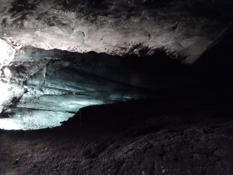
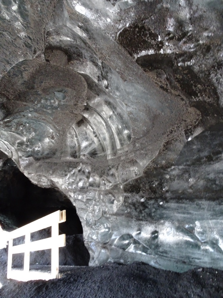
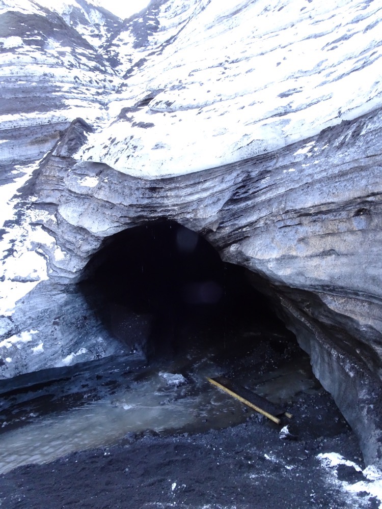
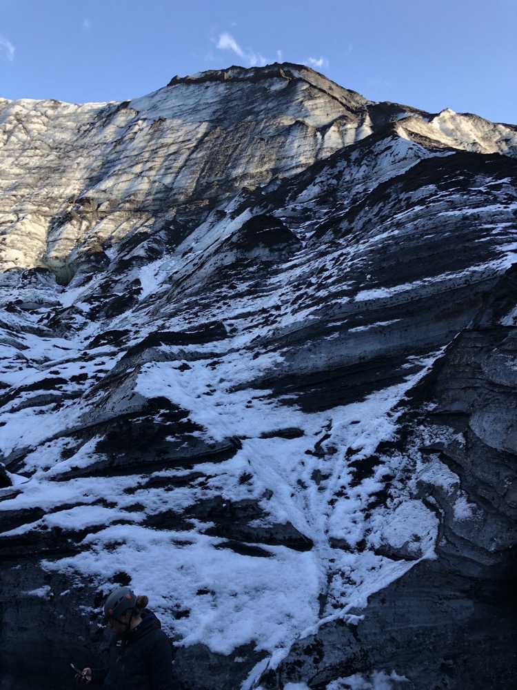
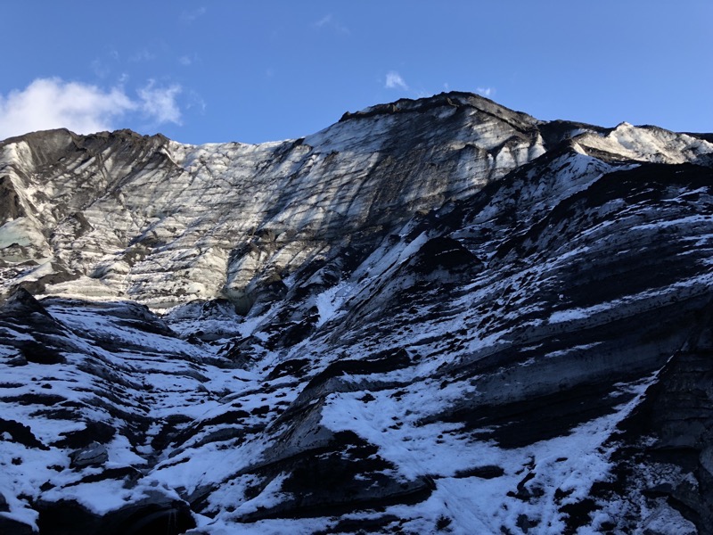
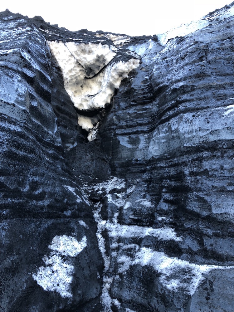
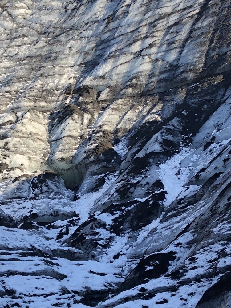 The ice walls covered in volcanic ash make for a very dramatic backdrop.
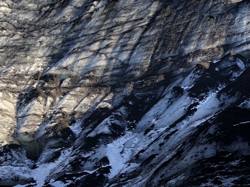 Stefan, our guide who repeatedly claimed it was his first day with a drivers license and then continued to drive that monster truck like a maniac for our (and possibly his) amusement, explains to some American tourists that Katla is overdue to erupt and when this happens, ‘All Iceland is probably fucked.’
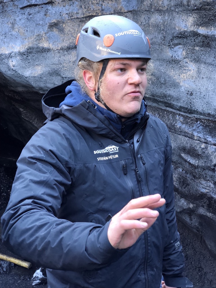
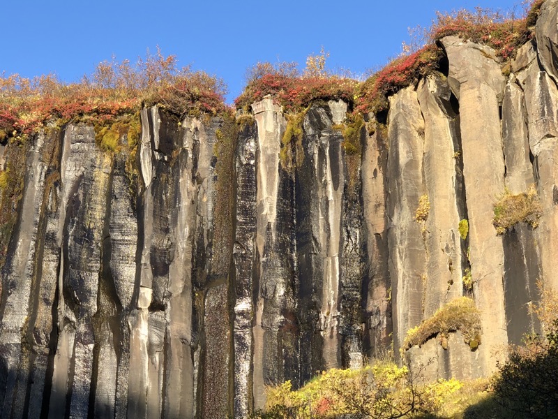
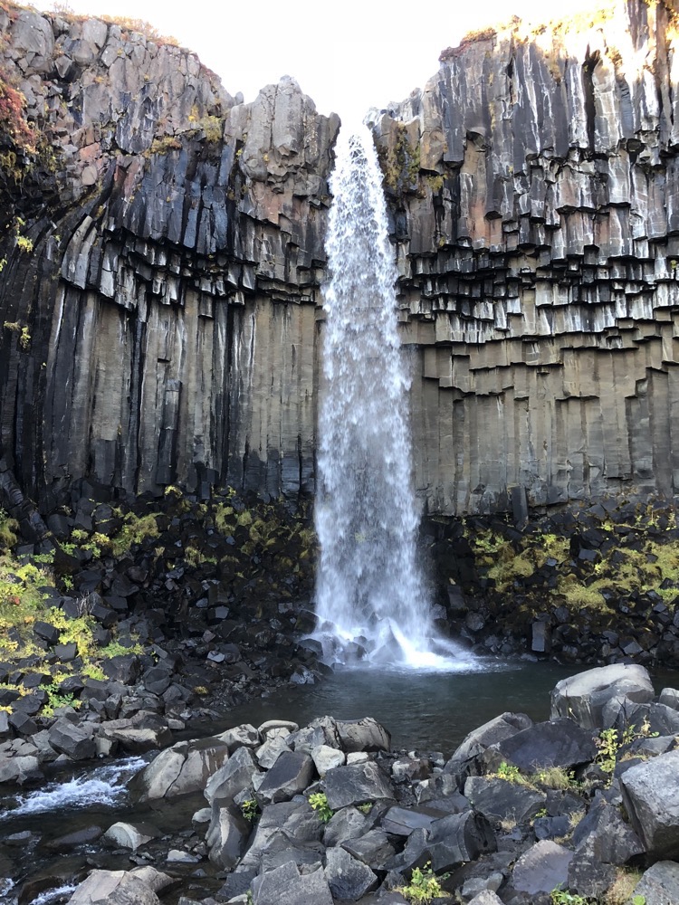
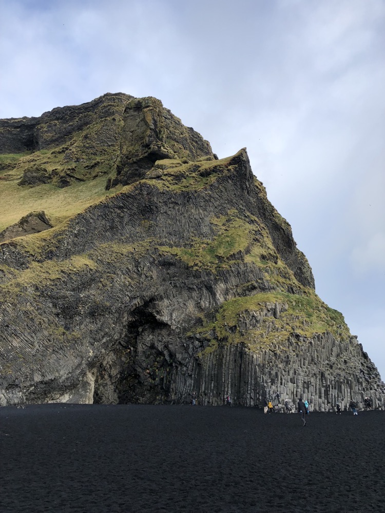
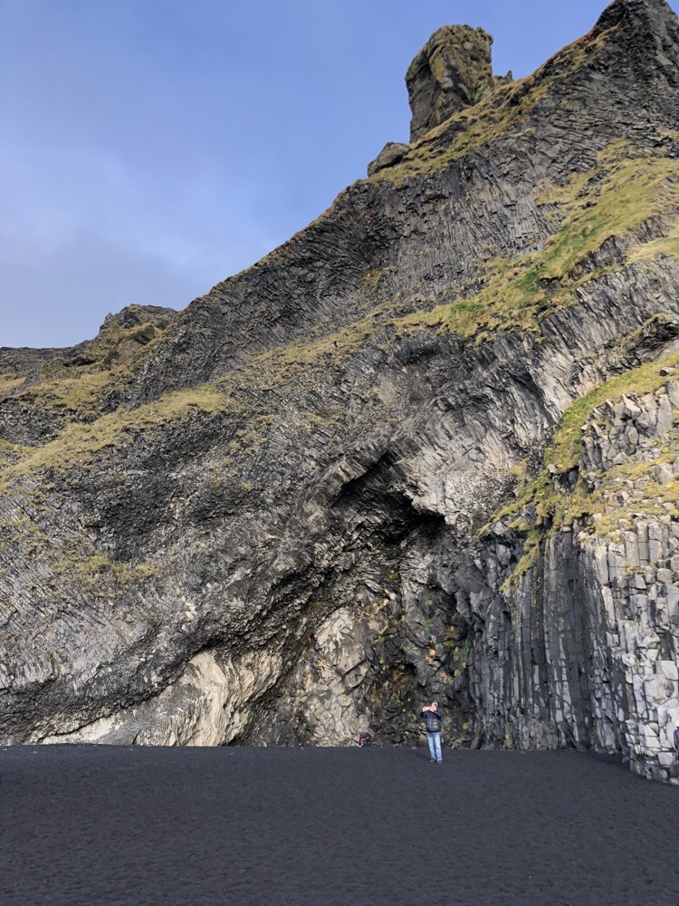
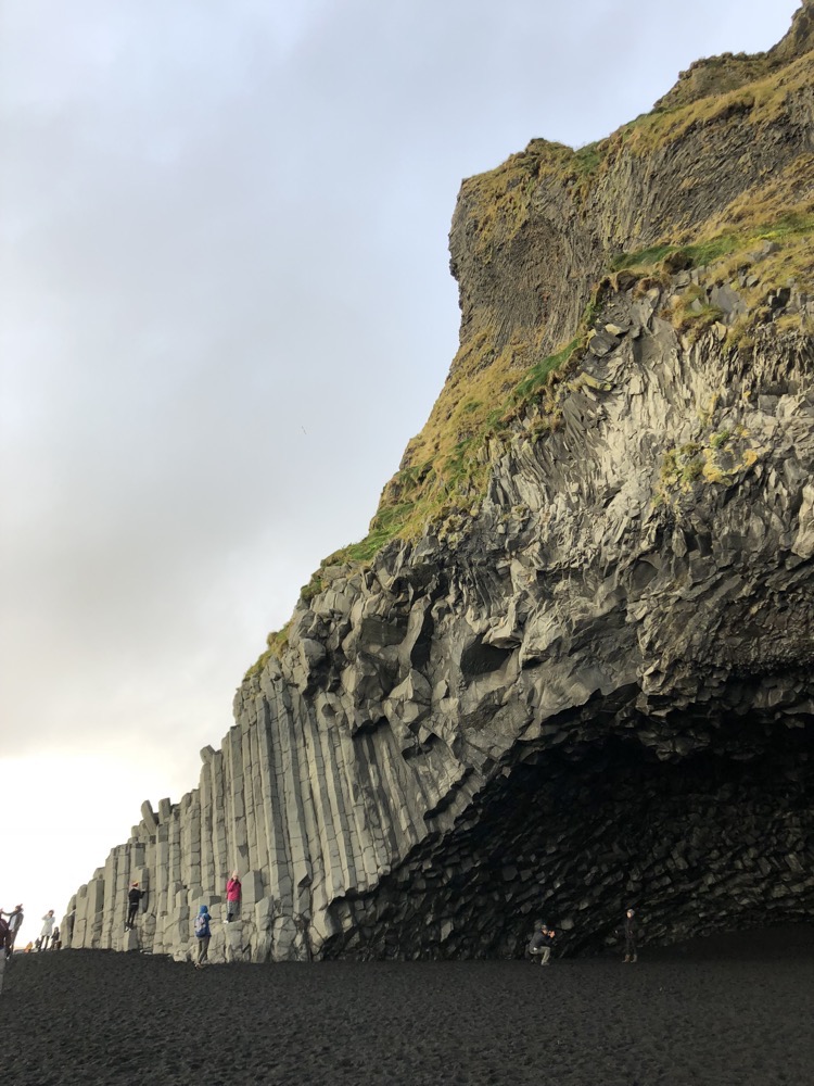
 The next part of today’s adventure was taking us to Vatnajökull National Park to see the famous Svartifoss waterfall. Svartifoss (literally, black waterfall) is part of the Skaftafell wilderness area in Vatnajökull. It is surrounded by dark lava columns made of basalt similar to those that are seen at places like Giant’s Causeway in Northern Ireland, the Devil’s Tower in Wyoming and the Island of Staffa and Fingal Caves in Scotland. There are also similar basalt column formations on Reynisdrangar beach which we visited yesterday.
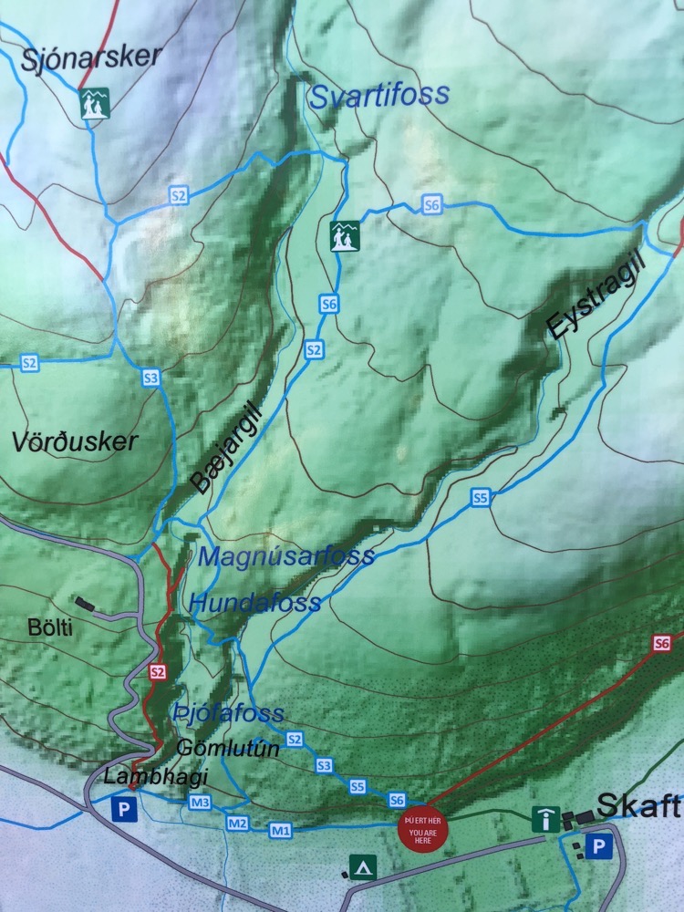 I took these photos on the way back – on the way there I was using all my energy to focus on keeping my head down (it reduces the clicking and grinding feelings that I get in my neck when going up inclines and steps) and reminding myself not to hold my breath.
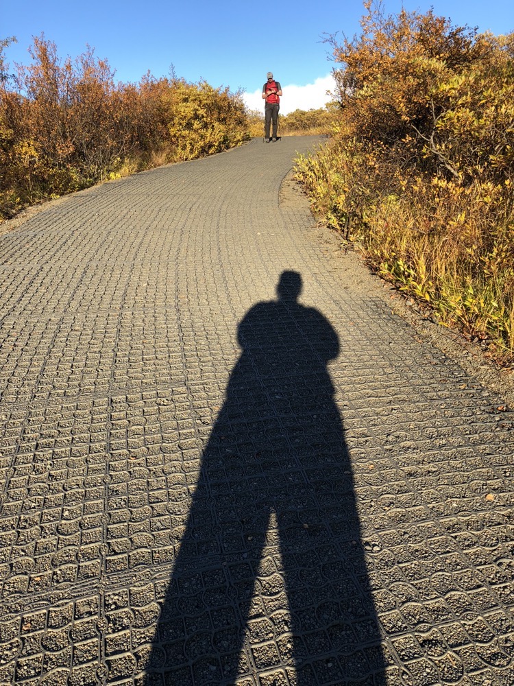
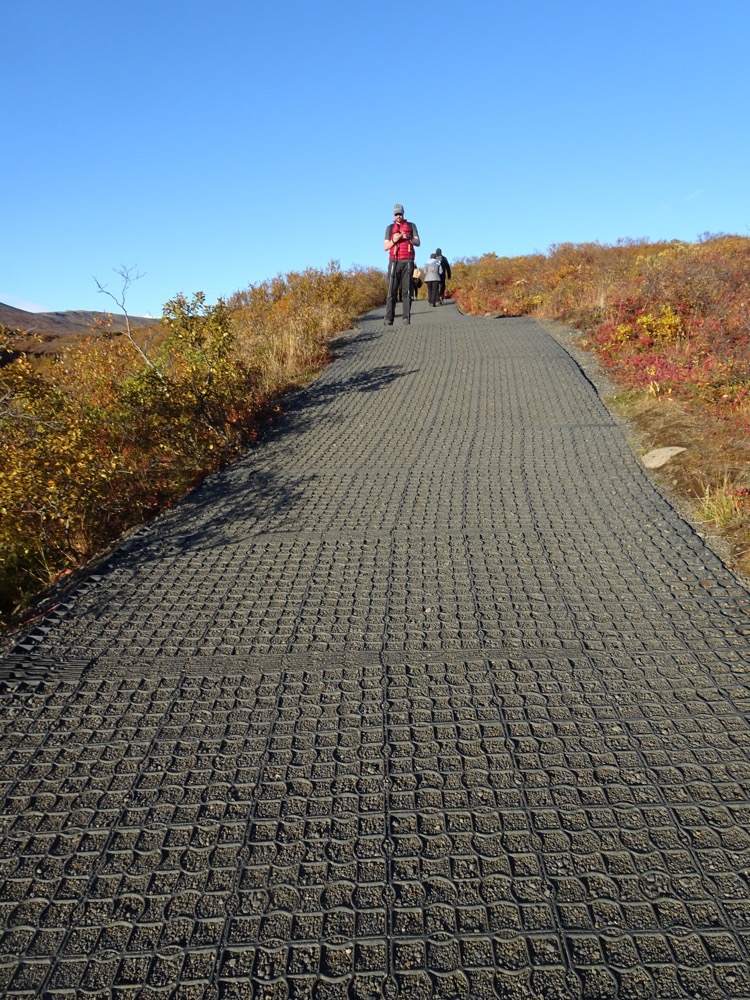 Many of you probably already know that I am a chronic pain sufferer and I kinda anticipated the energy required to do the ice-caving walk and planned to walk around a glacier lake this afternoon, but this ‘hike’, I had not anticipated. Which meant from about 200m in, it was a struggle. I was ramping up my neck/back pain, my Kyoto knee was not happy with me (I stepped oddly off a bus in Kyoto in 2015 and did something weird to my knee and its never forgiven me), I literally stopped about six times because I was going to throw up – not because I am unfit, though I am, but because the clicking and grinding in my neck drags against my oesophagus causing a gag reflex to induce feelings of impending vomiting. Yes, me and steep slopes/steps simply do not mix and have not since 2007. The other big problem with pain is fighting the urge to hold your breath – you know that thing you do when you kick your toe hard into a piece of furniture and you go ‘Shit!’ and then hop around holding your breath until the pain subsides to stop yourself from exclaiming more? Yeah that. When my pain levels are amped right up to 11, I have a tendency to hold my breath, which is not ideal when hiking unless passing out is your goal.
 I looked at these paths on the way back and simply could not believe I walked up them. They were very steep and about 1.2km of the 1.8km walk was all like this. Eventually, we got to a viewing platform where we could see the falls in the distance and I could also see the track in front of me – straight down for about 300m. I looked at it and thought I can not go down there because I have to come back up. But after a few minutes rest and some water to get the peristalsis moving back in a downwards direction, I got to the ‘Fuck it, I’ve come this far, I’m not missing out on seeing this damn waterfall.’
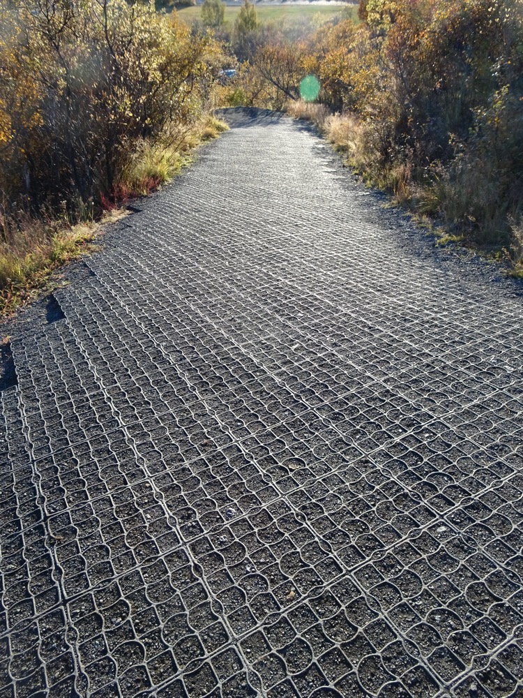 So, after basically getting there on pure pigheadedness, I managed to see the Svartifoss waterfall.
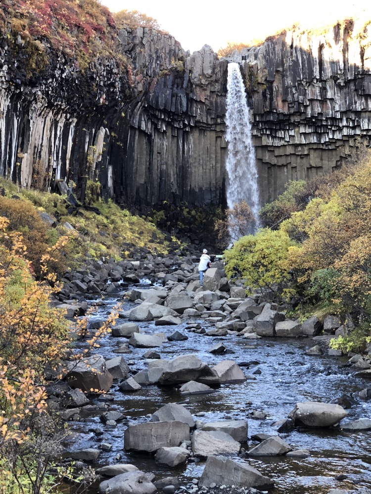
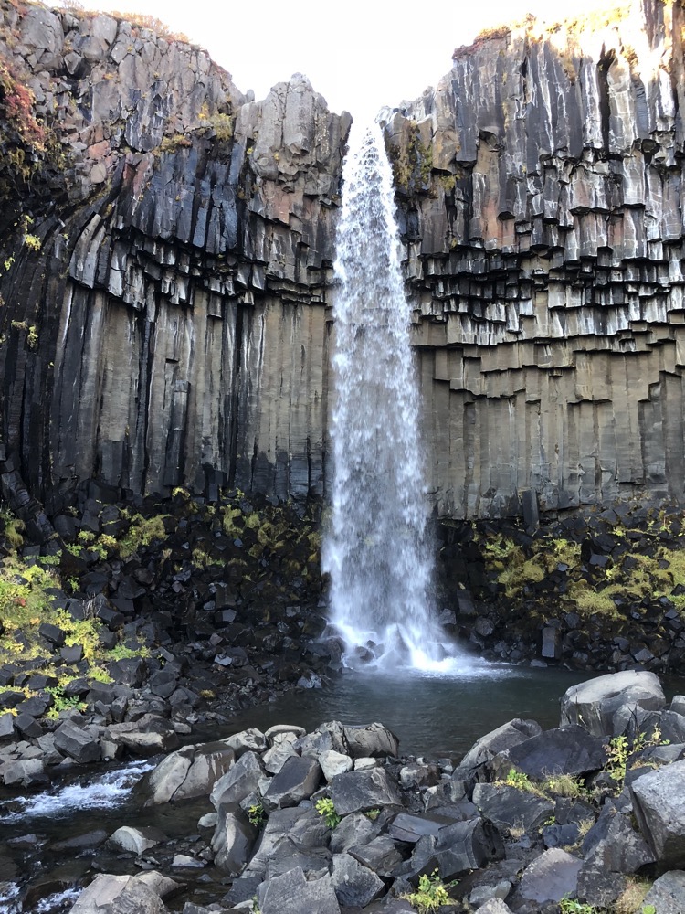 It really is a unique natural formation with the tall black basalt columns and the broken pieces of columns all scattered around below the falls. It was late afternoon, so the light could have been better but still, just beautiful.
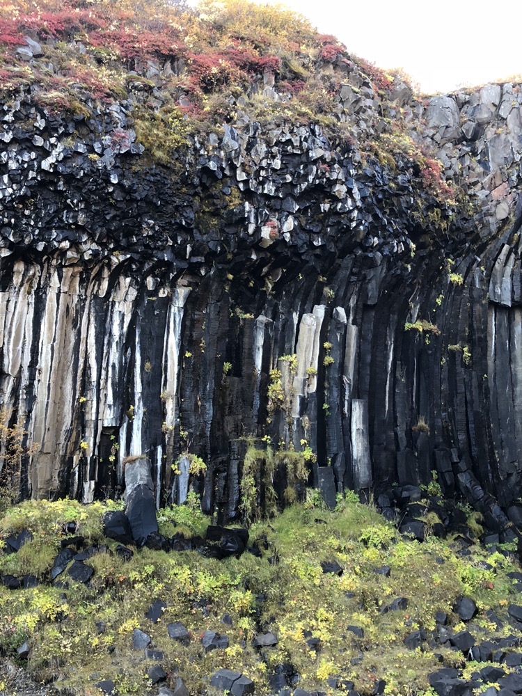
 After I hobbled back to the car (and yes, hobbling was seen as my back was just screaming at me and all the drugs were in the car), we then continued our journey towards Höfn and at every turn, we were marvelling at the scenery. You literally drive another five minutes and are greeted with completely different landscapes. It’s incredible. The impulse to keep taking photographs is overwhelming and the ever-changing landscape boggles the mind wiith its diversity.
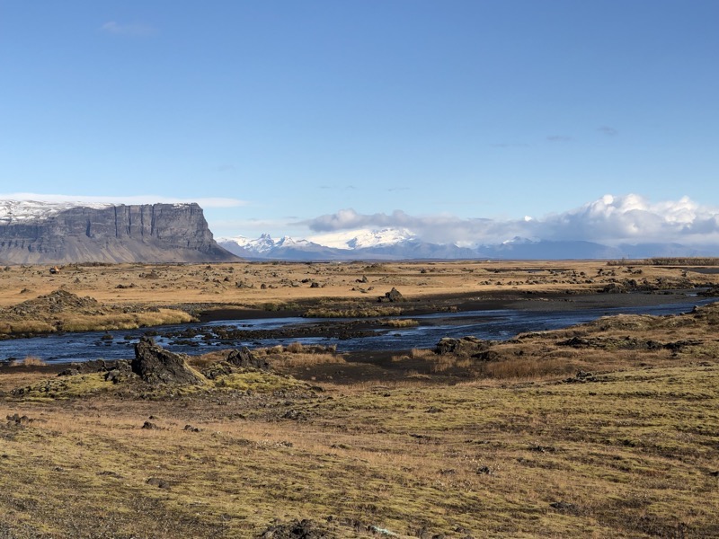
 I’m in the car as we drive along, queuing up some 80s tunes to try and take my mind off the ill-advised hike to the waterfall. We were heading toHöfn for the evening and on the way is the Jökulsárlón glacier lake (Jökulsárlón literally means, ‘glacial river lagoon’) which is on the edge of Vatnajökull National Park. The lagoon has formed at the base of the Breiðamerkurjökull glacier which used to just spill into the Atlantic, but developed into a lake as the glacier has receded from the sea, as glaciers are wont to do. This is the stunning result of this incredibly unusual naturally formed glacial lagoon:
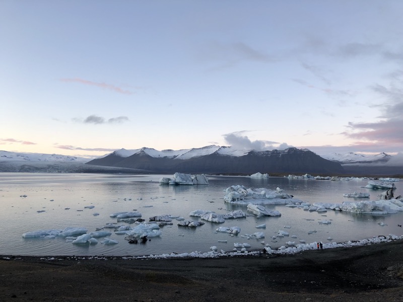
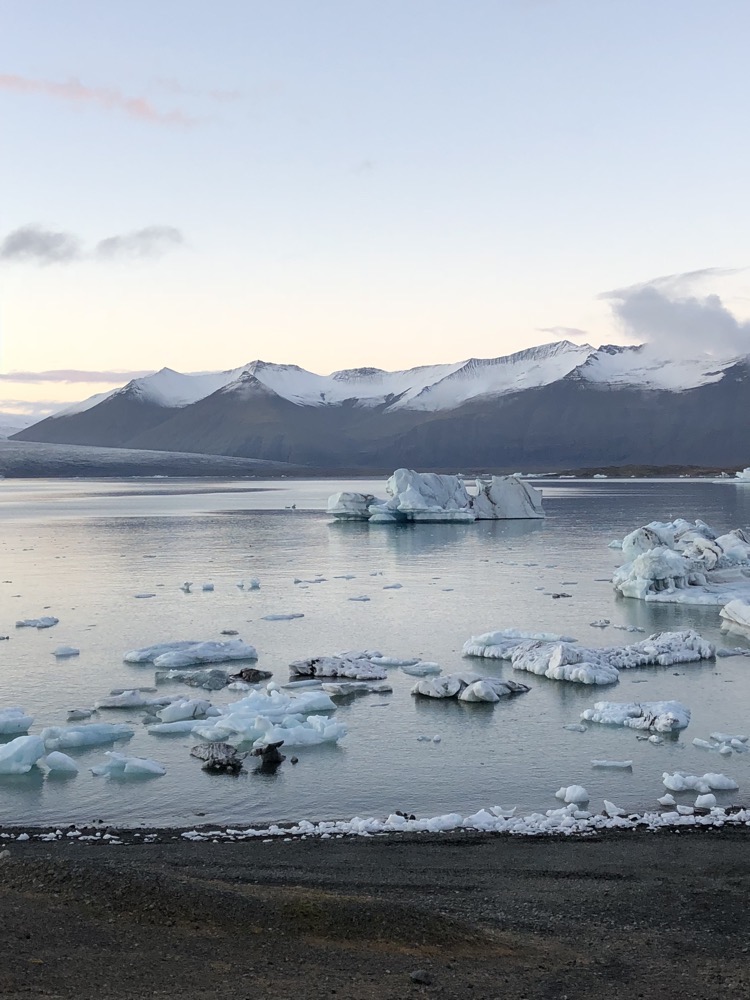 The lake is constantly changing size and shape depending on the varying melting rate of the glacier. Currently, the lake is about 1.5 km from the ocean and is about 18 km2 in size. In 2009 it was surveyed and is reportedly the deepest lake in Iceland, at over 248m deep! As the glacier continues to retreat the size of the lake continues to increase and has quadrupled in size since the 1970s.
 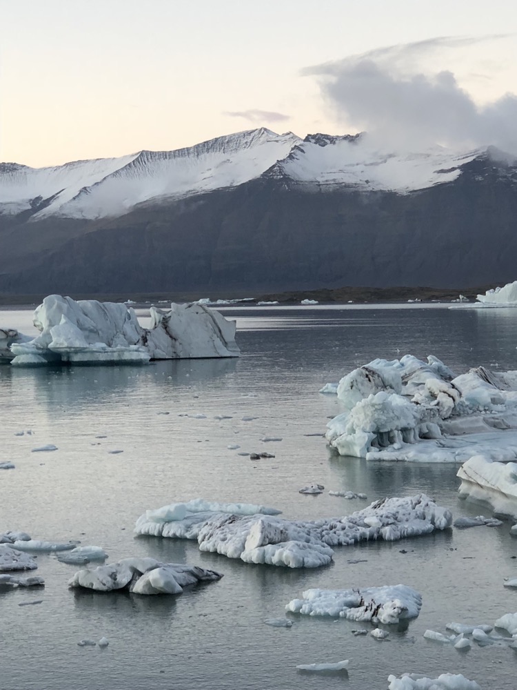 I haven’t included it in any of these photos, but on the other side of the lake, there are small buildings that house the many tour operators that you can book through to go out in a zodiac and explore the lake, its icebergs and wildlife (mostly birds and seals). I discovered fairly quickly that the buildings immediately gave you a frame of reference for the size of everything – from the size of the glacier face to the distances across the lake, to the estimated size of the icebergs.
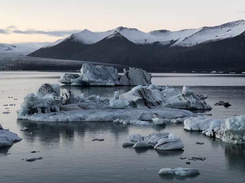
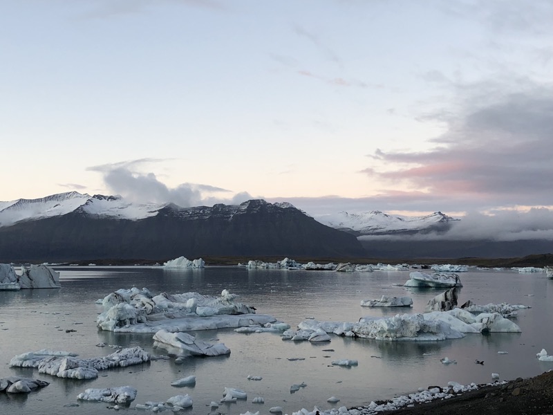
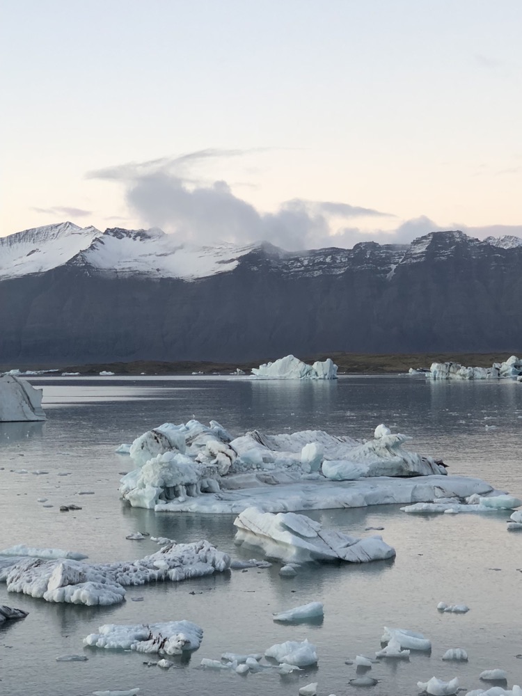 I am pleasantly surprised to see that I can still be amazed at the size and beauty of the icebergs – in spite of having seen many of them in both Alaska and Antarctica. Maybe I am not as travel weary and jaded as I think I am – mind you, it probably really helped that there were no hordes of other tourists here while I was admiring their beauty and enjoying the serenity…
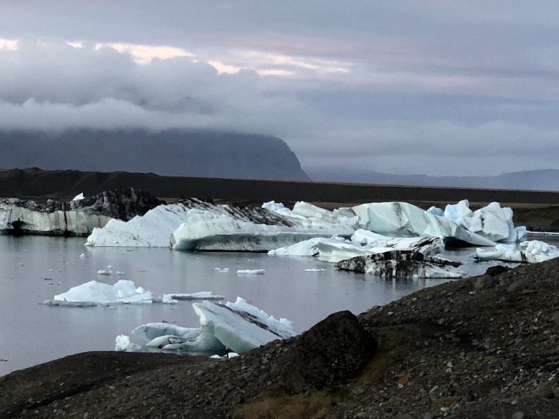 Iceland Tourism considers Lake Jökulsárlón to be one natural wonders of Iceland – gotta say, they won’t get any argument from us!
 It was early evening by the time we left the glacier lake, and totally dark by the time we arrived in Höfn. As we checked into the House On The Hill Guesthouse, I was elated by the beautiful places I had seen today but also completely regretful of my ridiculous stubborn streak that saw me march into Svartifoss like a healthy person. I am in so much pain I can’t describe it. Tomorrow is going to be a real struggle… I hope I get some decent sleep tonight.
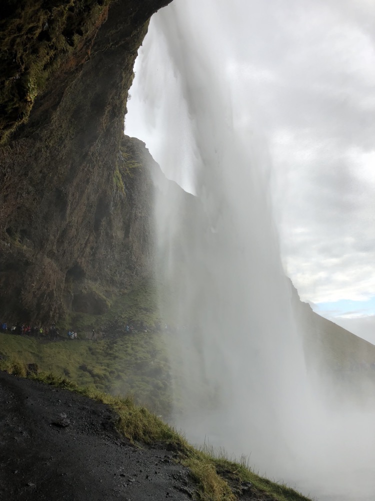
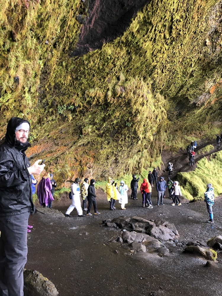
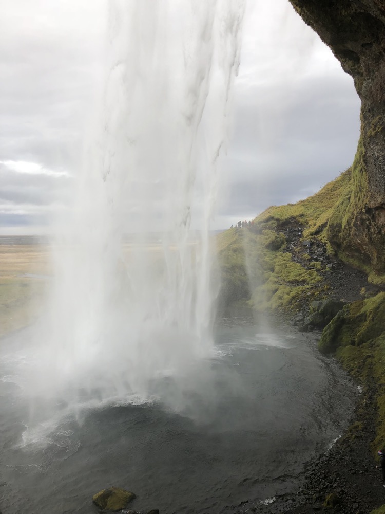
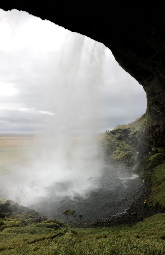
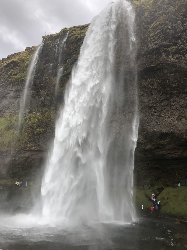
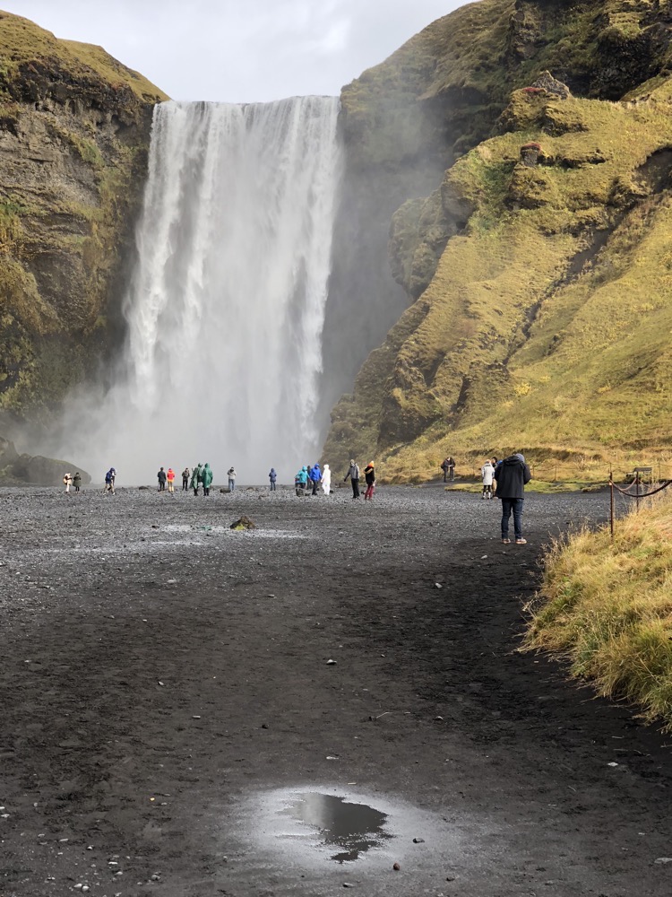
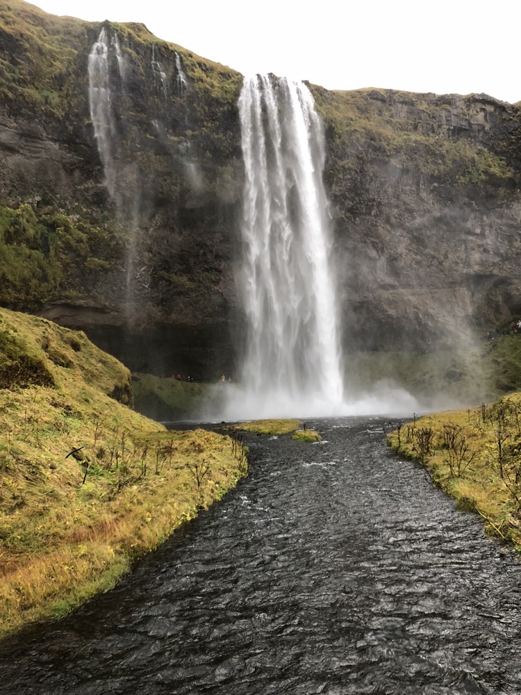 Seljalandfoss is one of the most famous waterfalls in Iceland – I say ‘one of the most famous’ because there are several… well, shite tonnes of them actually and every single one of them stunningly beautiful. The only other place I can ever remember being with this many waterfalls was Wells Grey Provincial Park in British Columbia – that place was simply spectacular too.
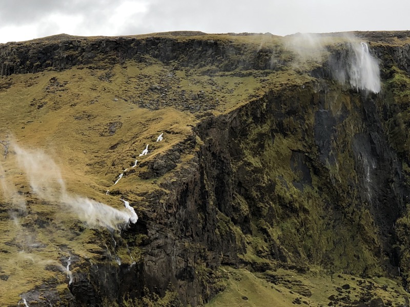
 It was so windy a little further down Route 1 and we observed two smaller waterfalls that were literally flowing up..!
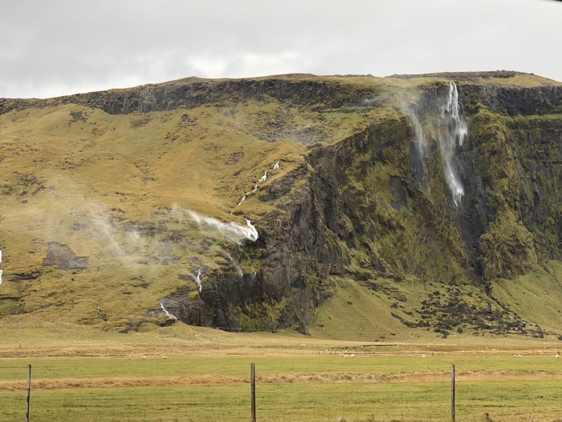
 A little further down the road, we stopped to see Drangurinn, which is a unique ‘tuff’ rock formation that stands alone at the Drangshlíd farm in the foothills of Eyjafjöll. Old folktales tell us that there was a strongman named Grettir Ásmundsson who was showing off and ripped the giant tuff rock right out of the Hrútafell cliff, leaving a chasm which is now above Skarðshlíð… as you do.
 Skógafoss waterfall is on the river of the same name, the Skógá River, and belongs on the same cliff line that the Seljalandfoss falls are on. The long cliff line was once the former coastline and was formed by sea erosion where it used to meet the sea. However, the coastline has receded seaward and is now about 5kms away, leaving the former sea cliffs running parallel to the current coastline for hundreds of kilometres. This creates the flat, flat, flat coastal lowlands, flat flat, flat then omg fuck off steep cliffs that are called the Highlands of Iceland.
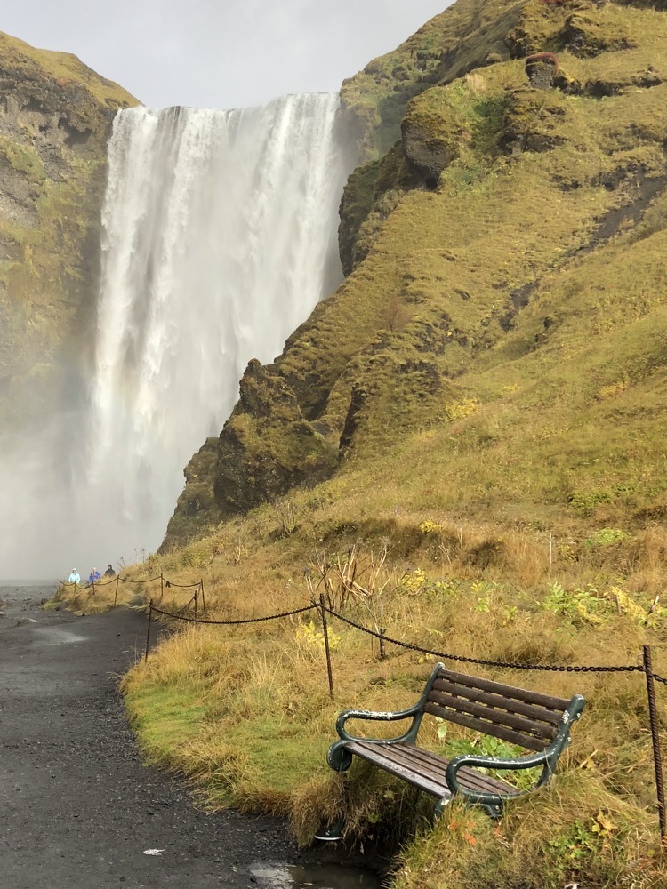
 This ring is reputed to date back to the days of Þrasi Þorolfsson the first settler of Skogar around 900AD. Folklore claims that before his death, Þrasi hid a chest full of gold under the Skofafoss waterfall. Many attempts were made to drag the chest from under the fall, and on one occasion a rope was fixed to a ring in the end of the chest. But before the chest could be lifted, the ring came away and the chest plunged back to the depts. The ring then became the door-ring of Skogar Church until 1890.
 Puffin… he’s a bit stuffed.
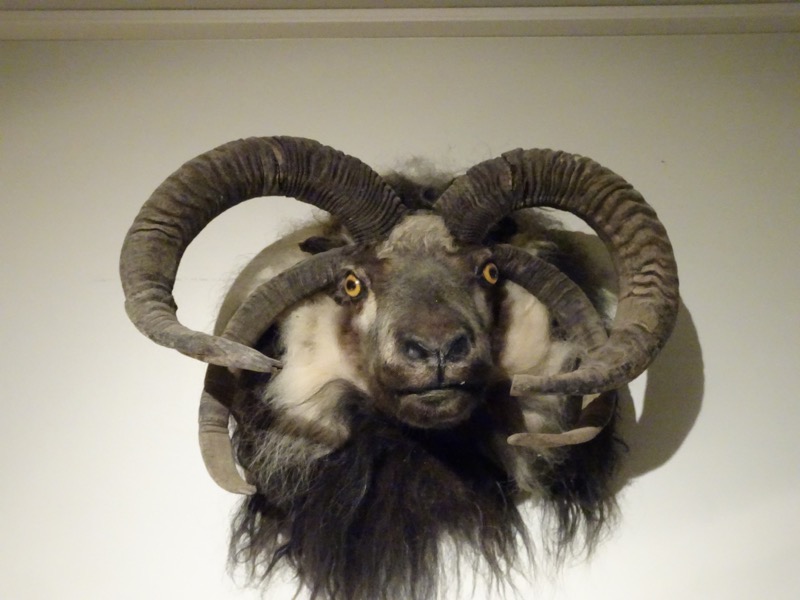
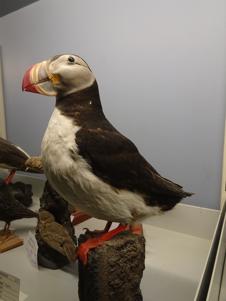
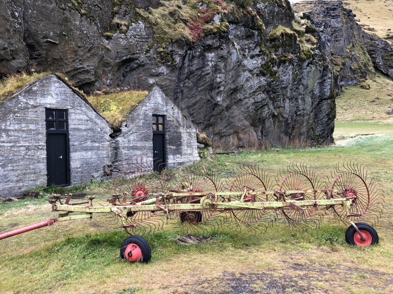
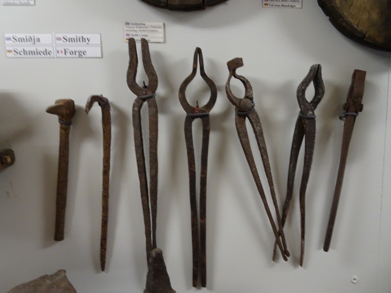
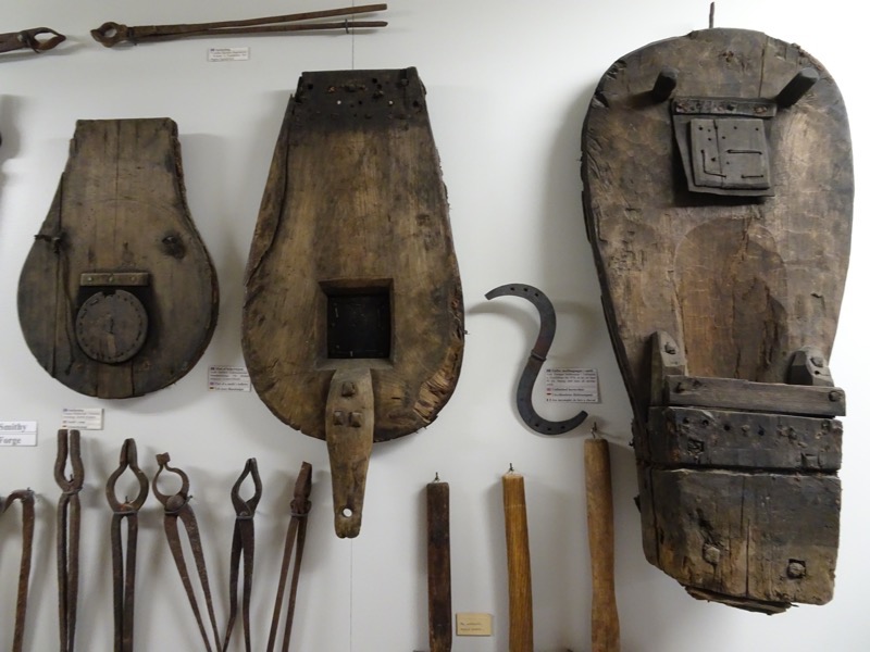
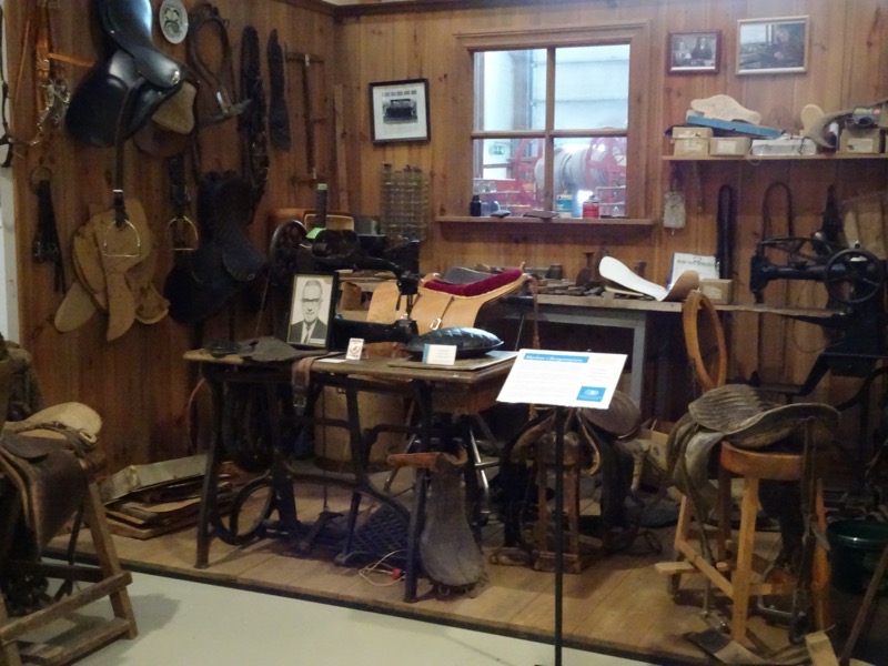
 Smithy
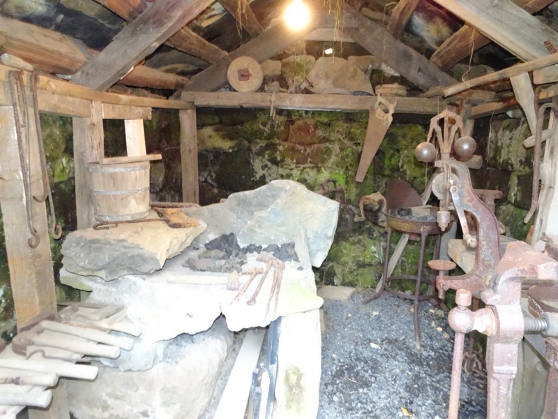 Barn/stable
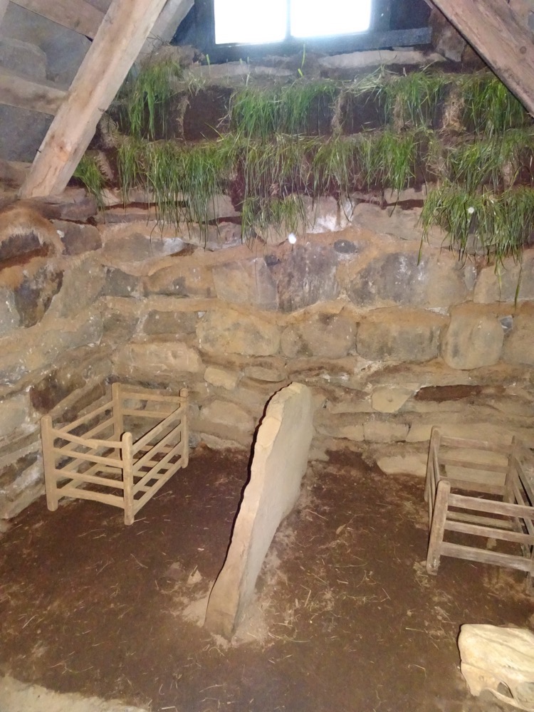
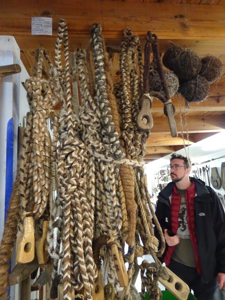
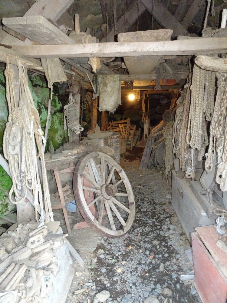
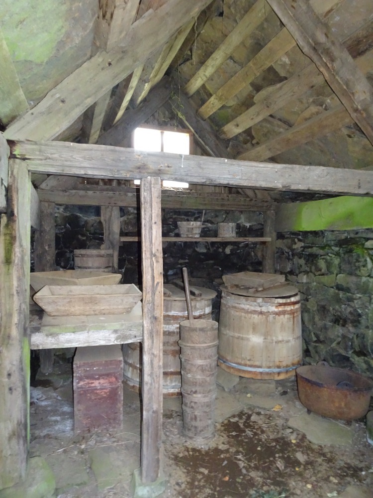
 Workshop for rope making
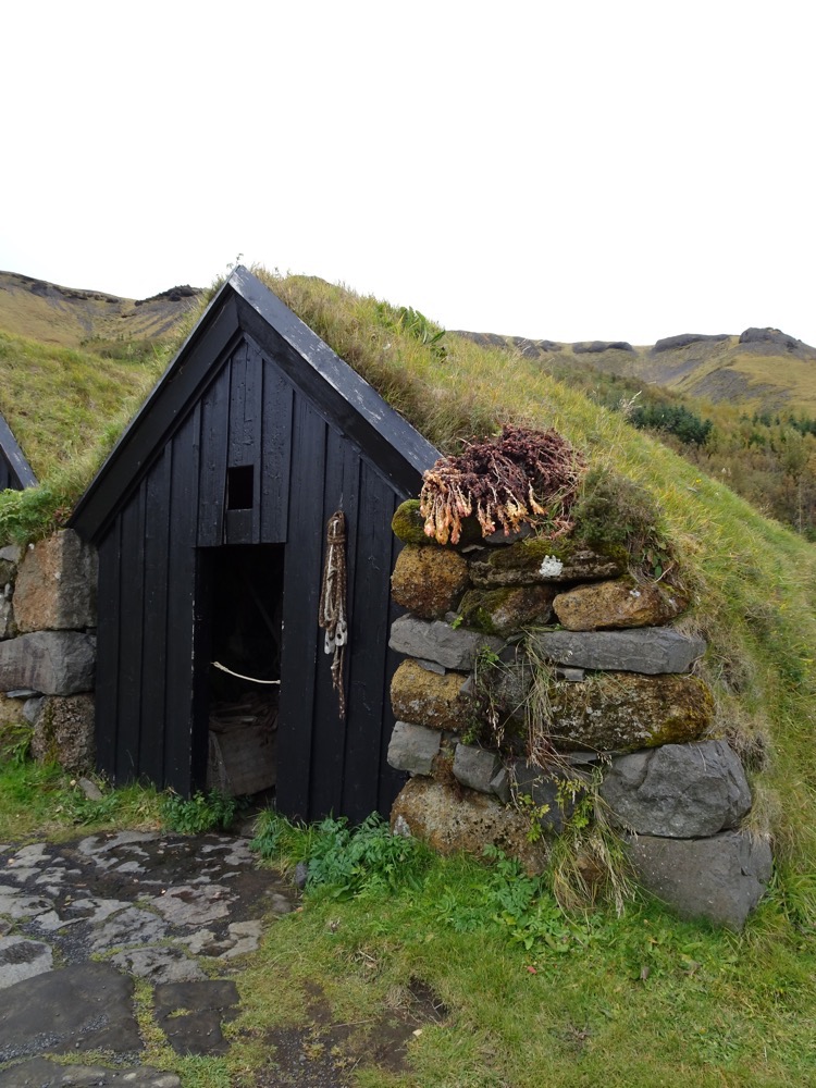
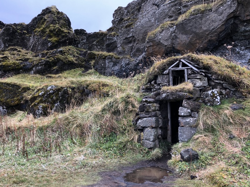
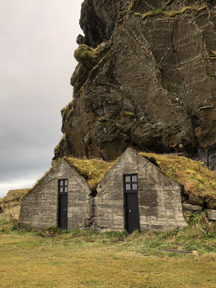
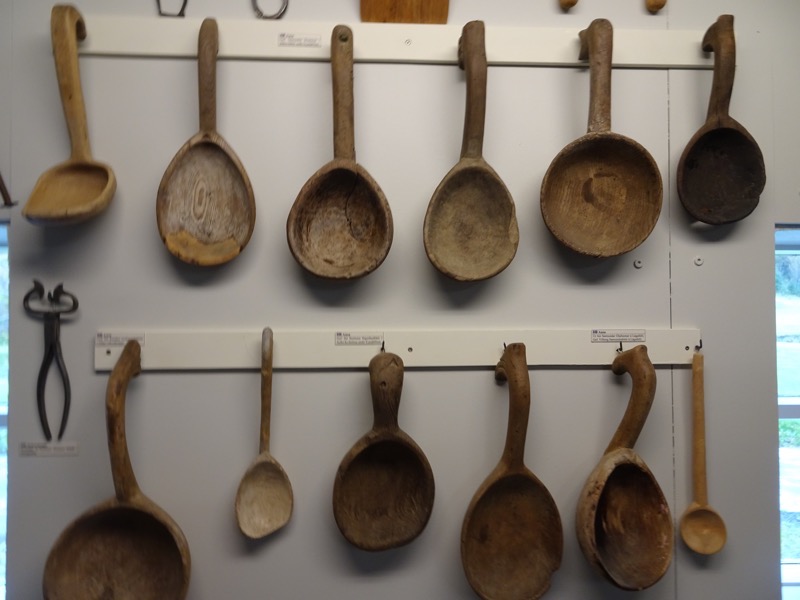
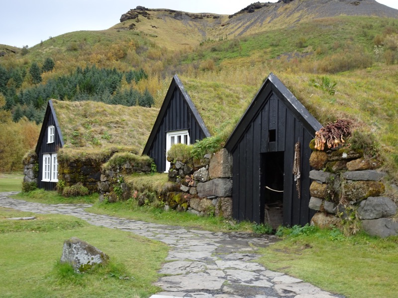
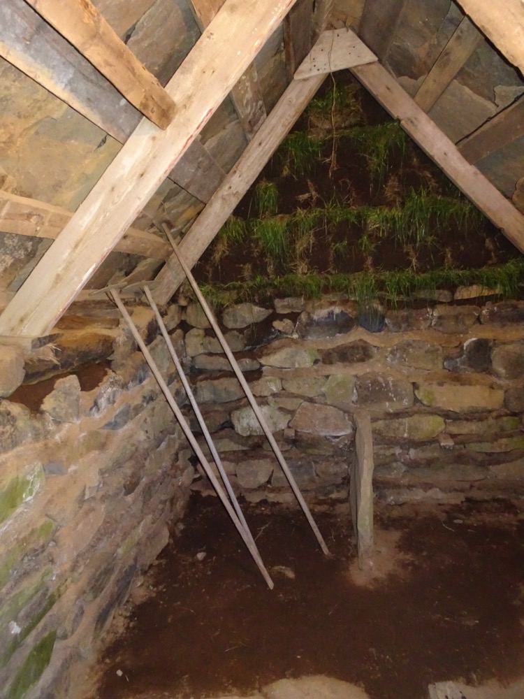
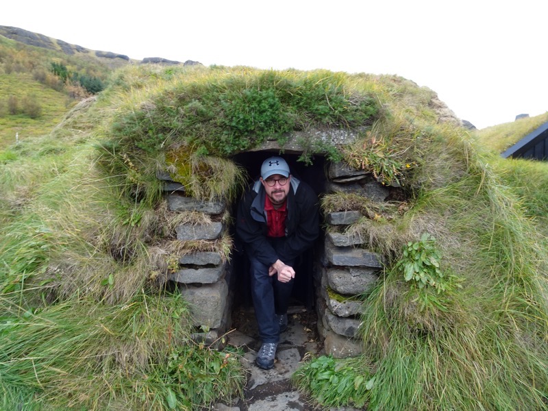
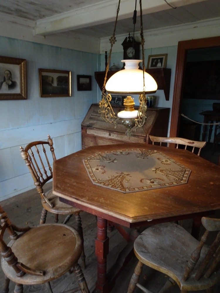
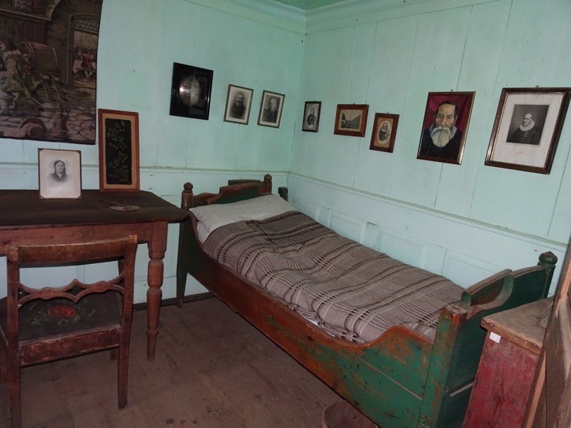
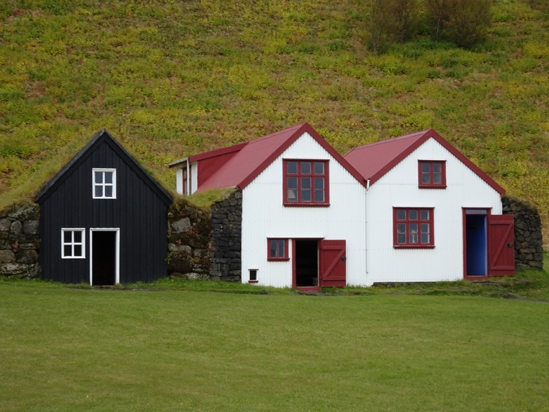
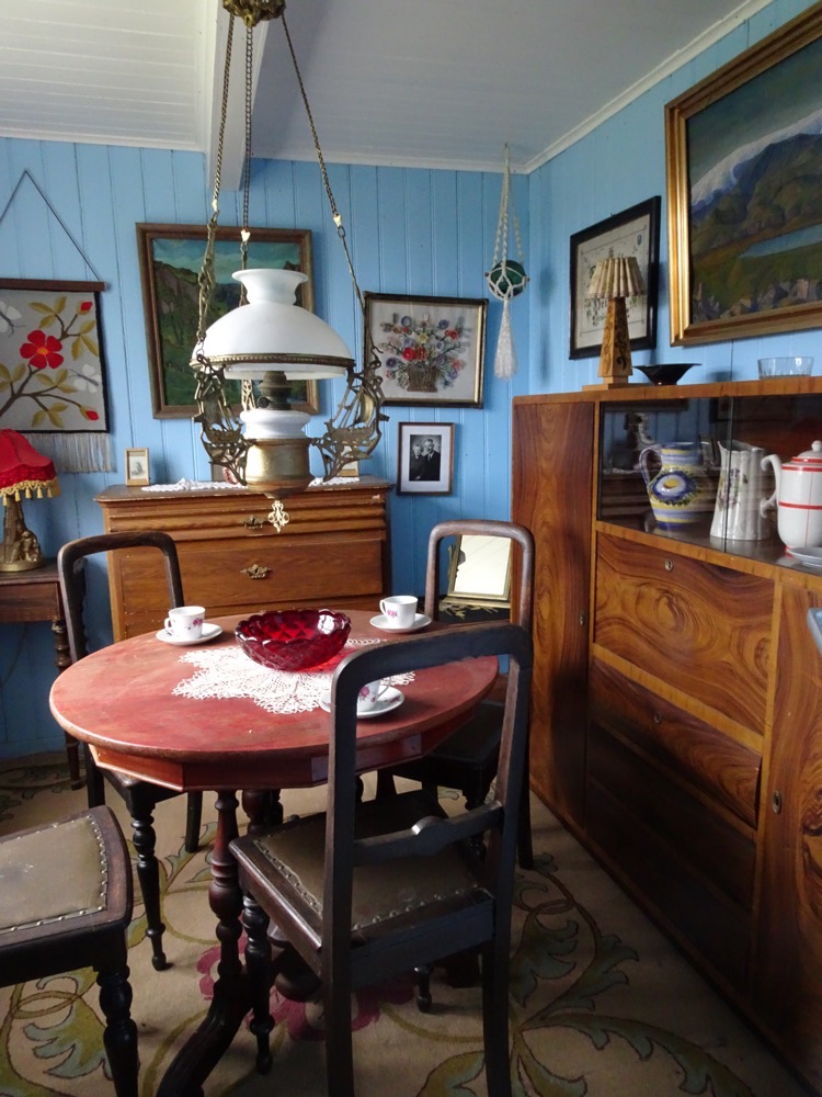
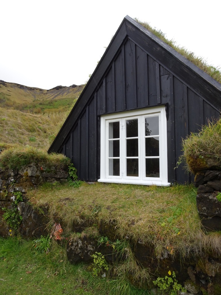 19thC farmhouse comprising of a number of small turfhouses that each have different purposes – living space, bedrooms, kitchen, stables etc.
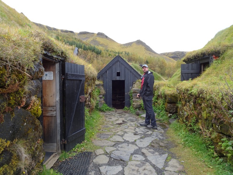
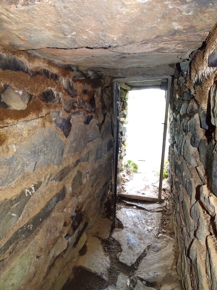
 Headroom mustn’t have been a priority…
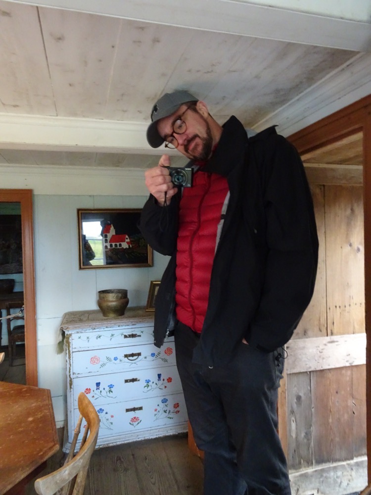
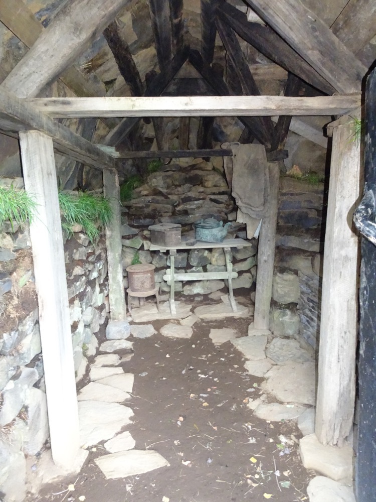
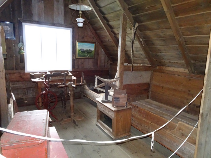
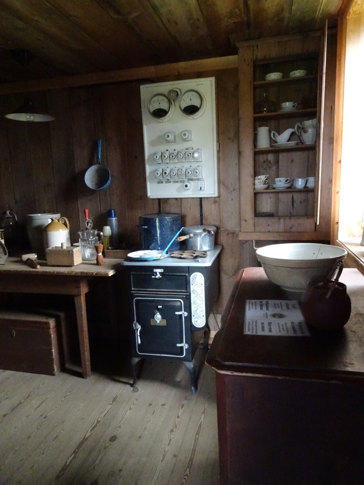 Stables directly under the living areas and accessed through a tiny door way from the kitchen.
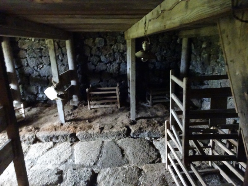
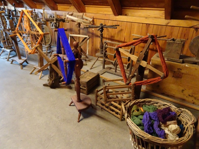
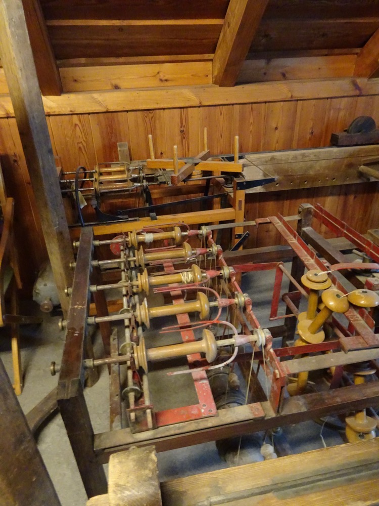
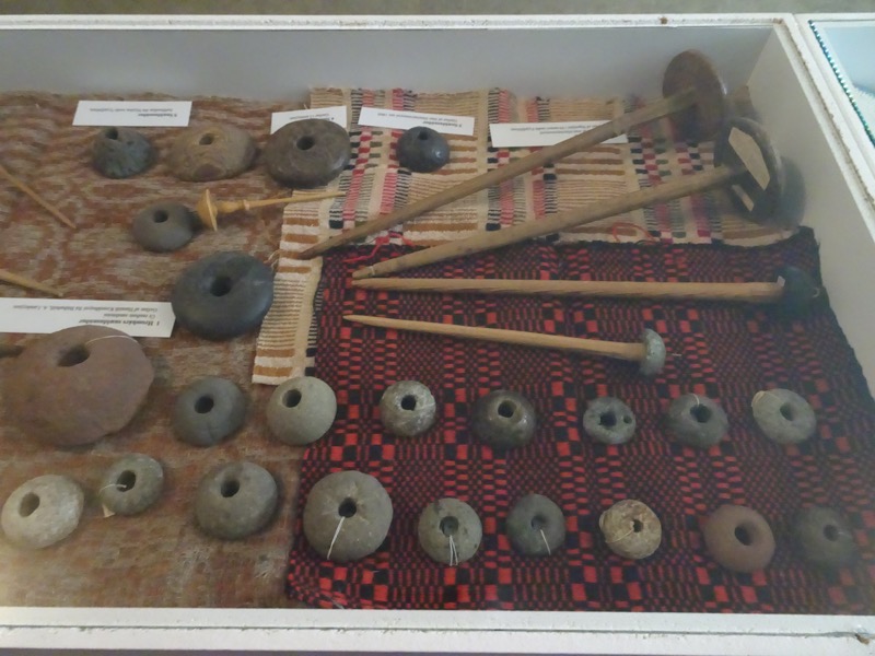
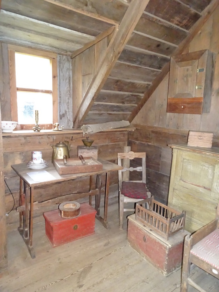
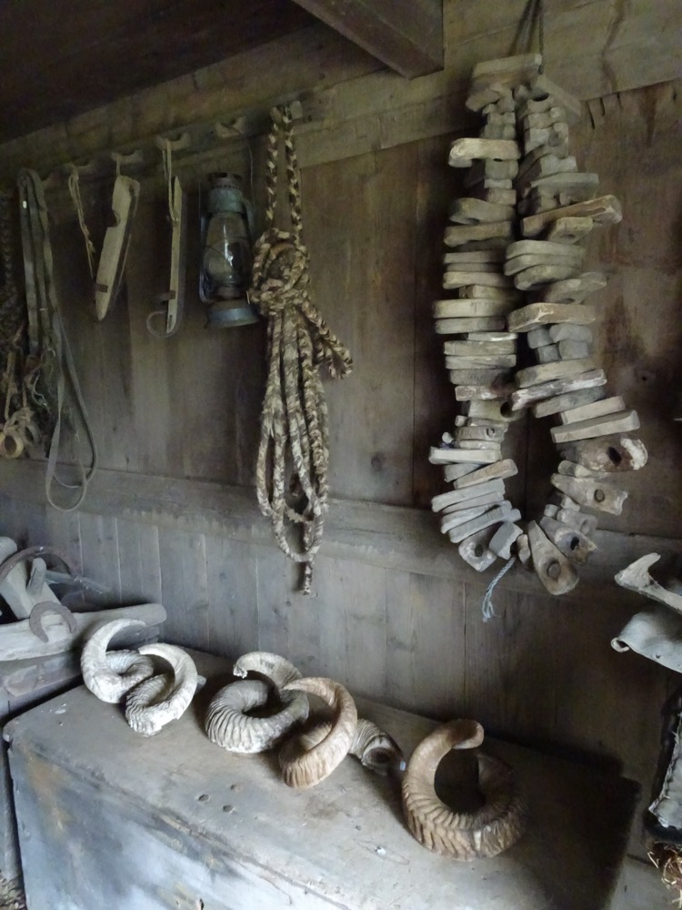 I have no idea what this is – and with many of the descriptions in the musuem in every language, but English, am unlikely to find out.
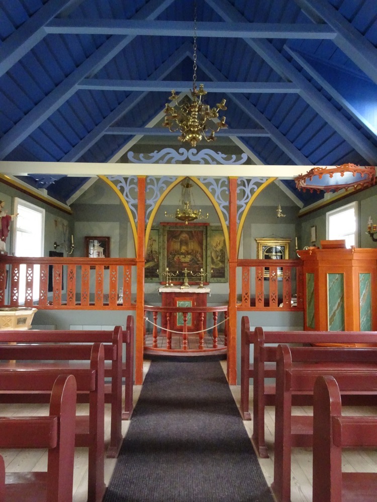
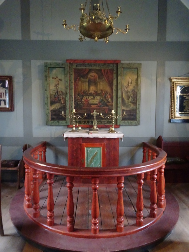
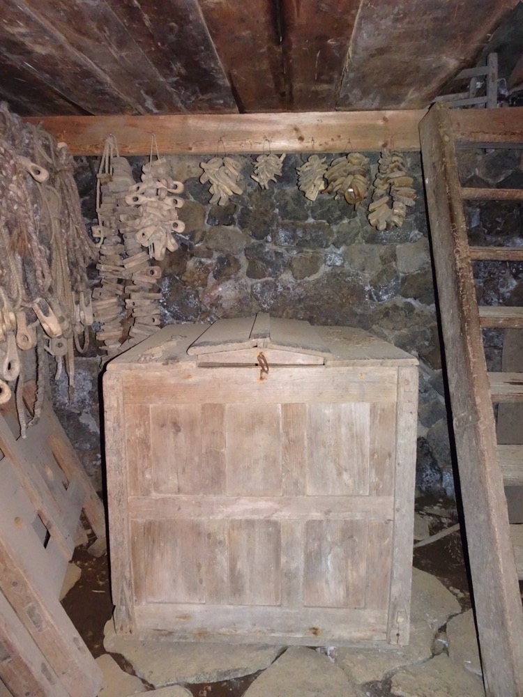 Replica of a 19thC church.
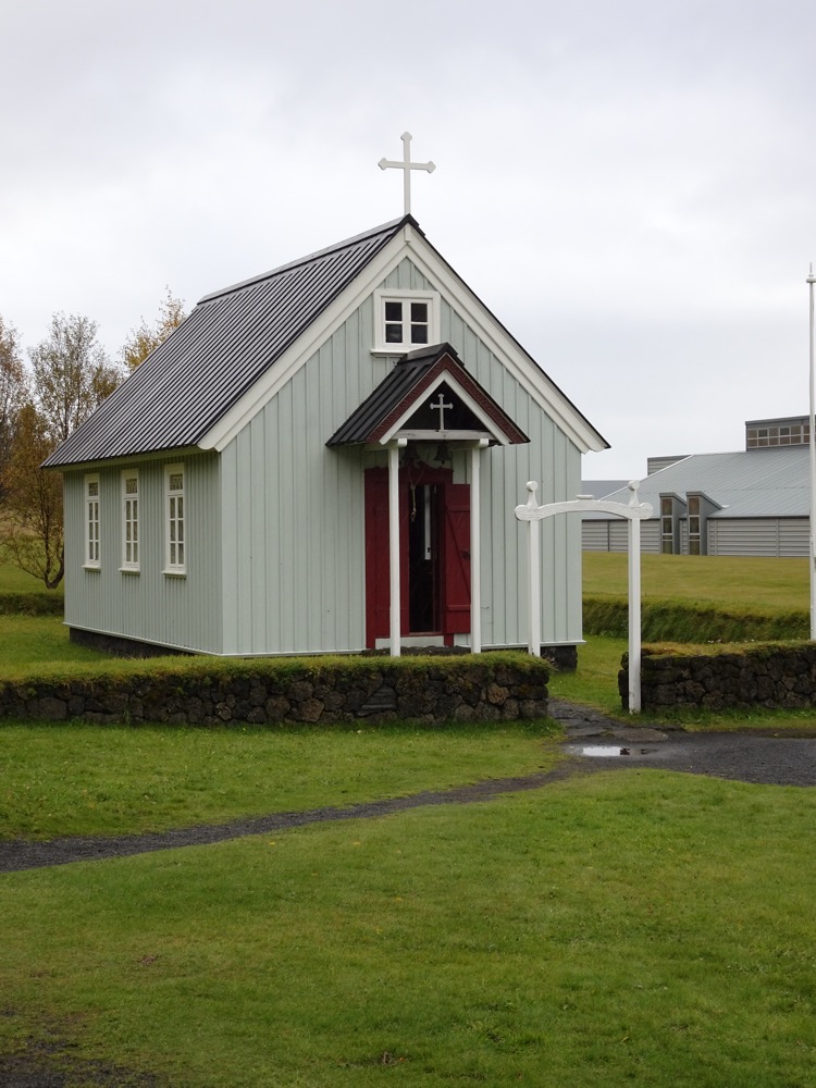
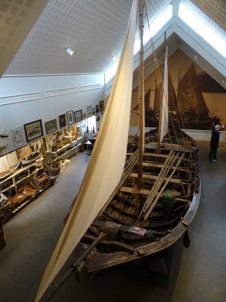
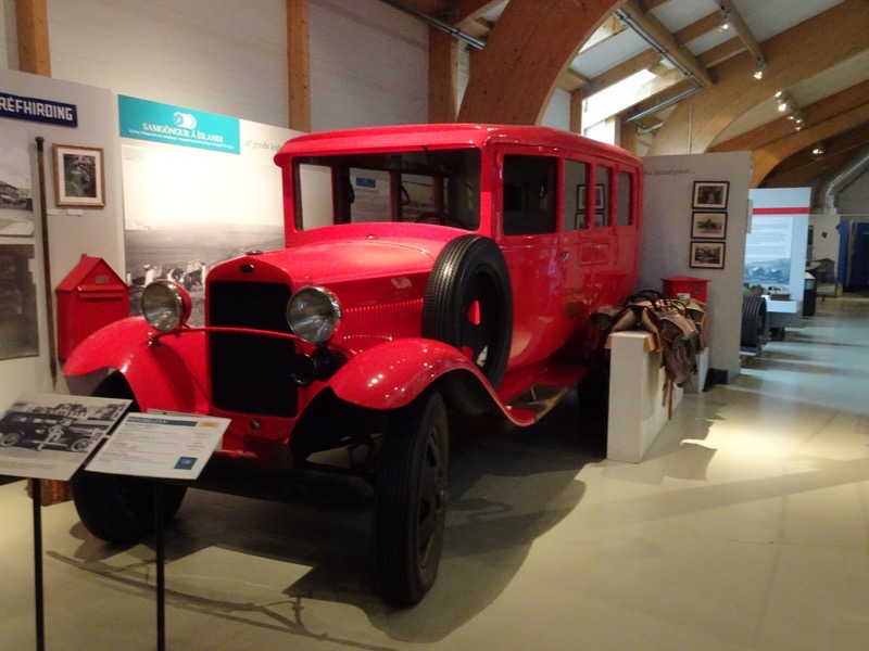
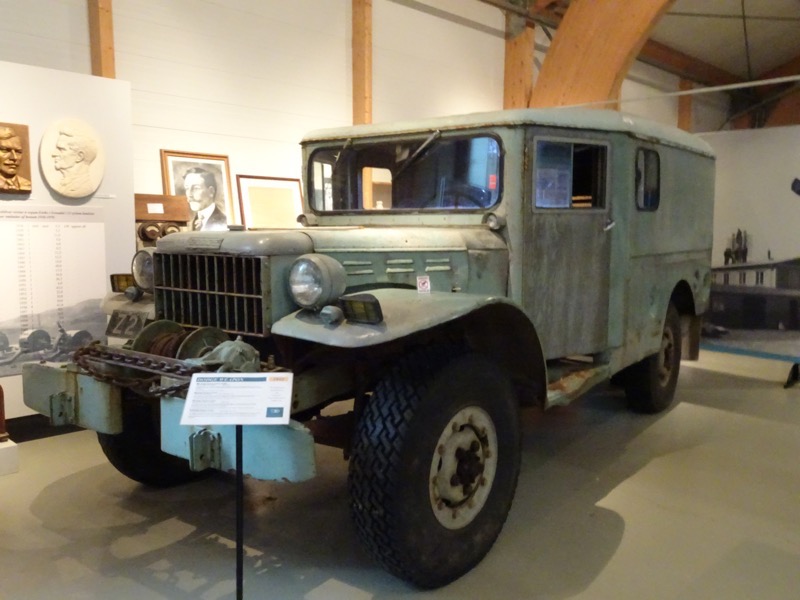
 Transport Museum.
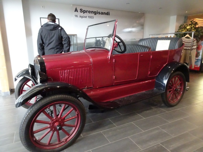
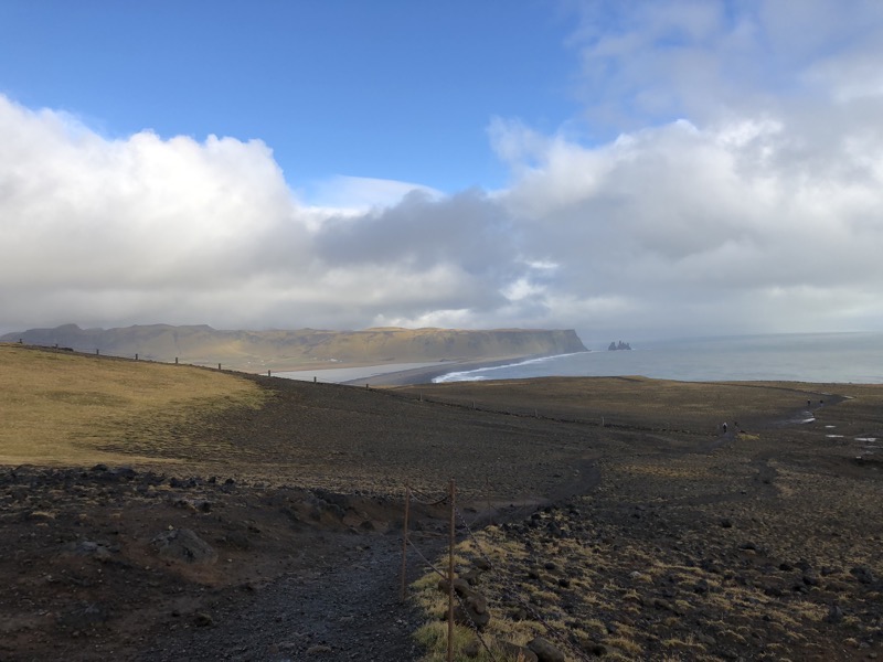
 In the summertime, the areas is closed off to vehicular access as the entire cliffside and peninsular becomes a rookery area for many seabirds including, you guessed it, puffins! So normally, ‘Here Be Puffins’ but as per usual they heard I was coming and probably left about four weeks ago.
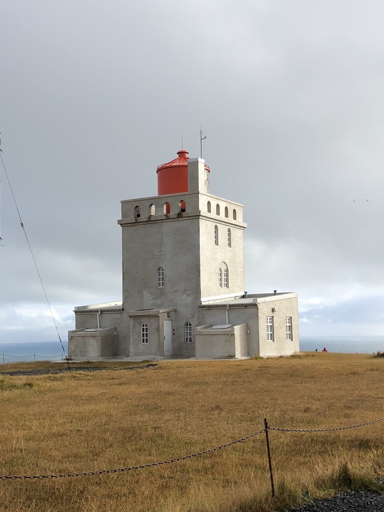 Dyrhólaey literally means “the hill island with the door hole”. It’s 120 m high and you are able to walk the arch or the bridge if you are not afraid of heights and well if you’re stupid enough today to think that you can’t be blown away by what were still extremely strong winds.
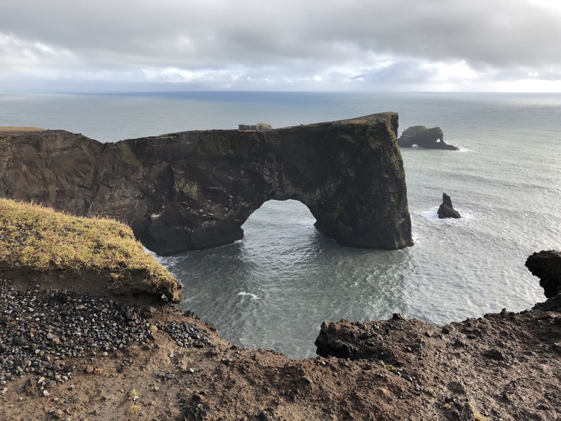 And yet, there were plenty of Chinese tourists jumping under the chains to have their photos taken in front of the rock formations, and to actually go close enough to the edge to stick their cameras over and take downwards photos… even with the prevailing 60kmph winds gusting semi-regularly into ‘shit my beanie is going to blow off!’.
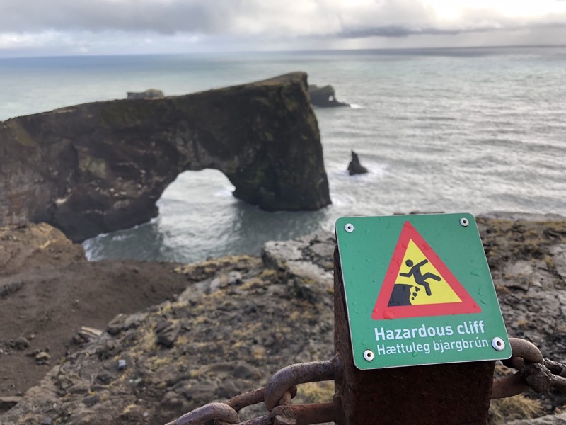
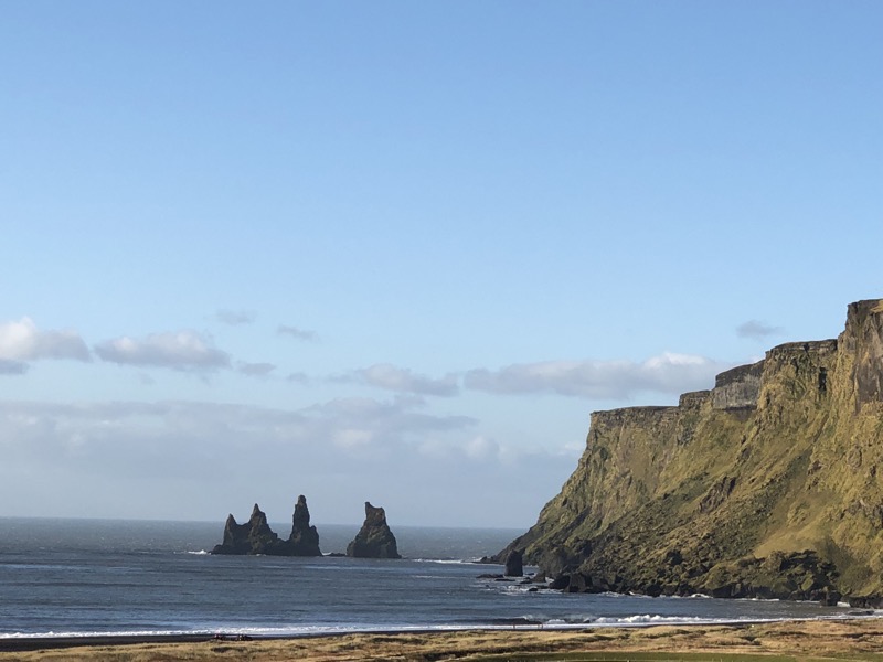
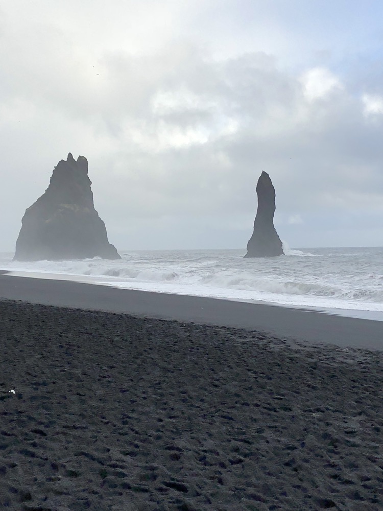
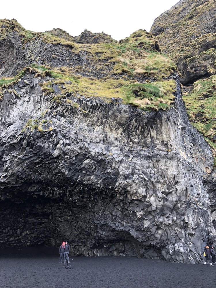
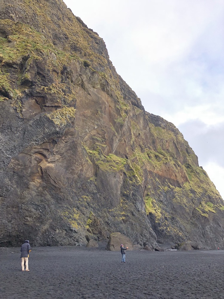
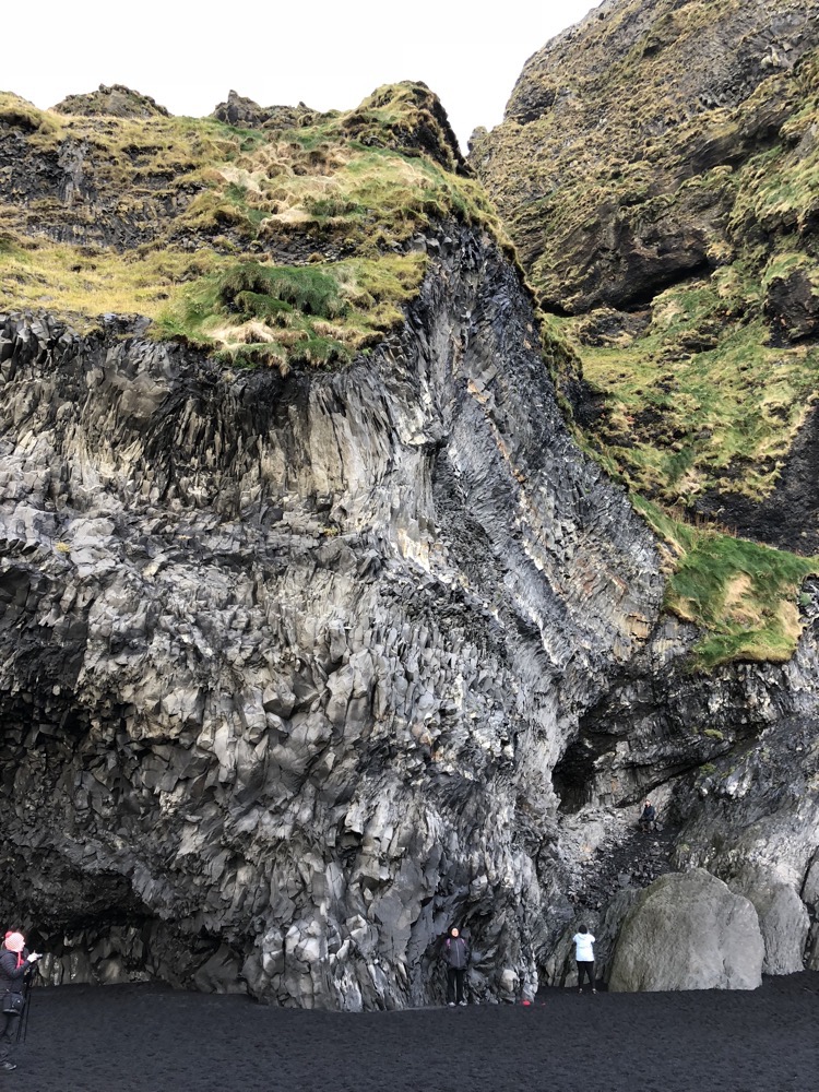
 There are several legends surroundingReynisdrangar, one of which states that the stacks of basalt originated from when two trolls dragged a three-masted ship to land somewhat unsuccessfully, but then when daylight broke they (the trolls) became needles of rock.
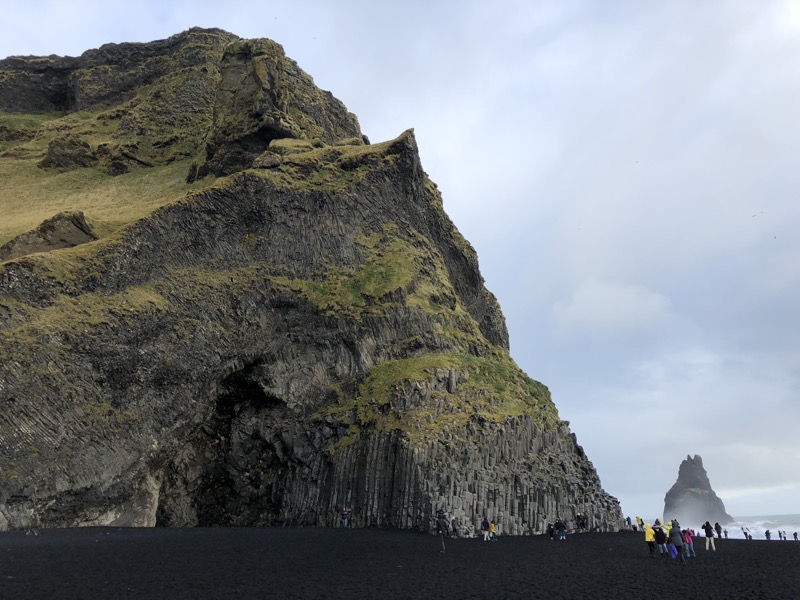 The other, more contemporary legend, notes the story of a husband who found his wife taken by the two trolls, frozen at night. The husband made the two trolls swear to never kill anyone ever again. His wife was the love of his life, whose free spirit he was unable to provide a home for; she found her fate out among the trolls, rocks, and sea at Reynisfjara. Which sounds a bit of a likely story, you know: ‘Two trolls did it, Officer.’ *shuffles and kicks in the dirt*
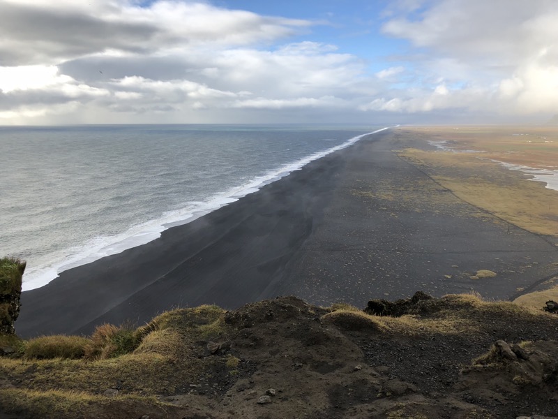
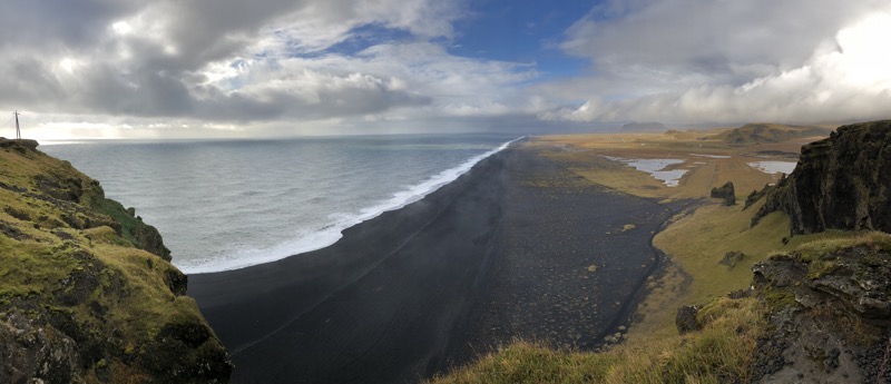
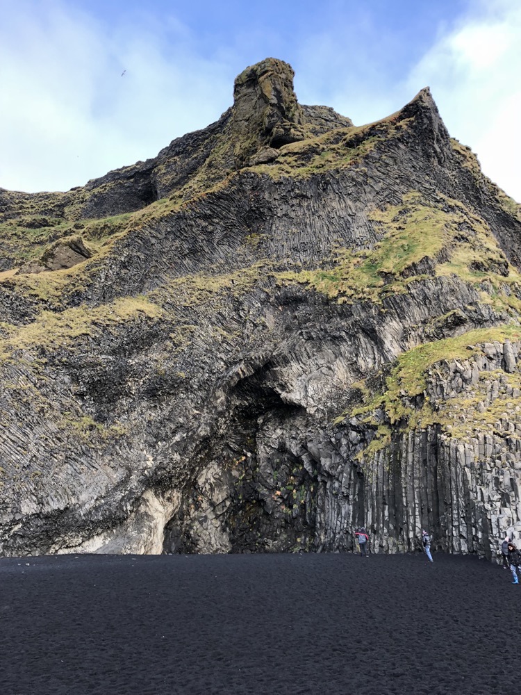 For the life of me, I couldn’t photograph the sand and make it look as black as it was… the camera (and my phone) kept adjusting for the lack of contrast.
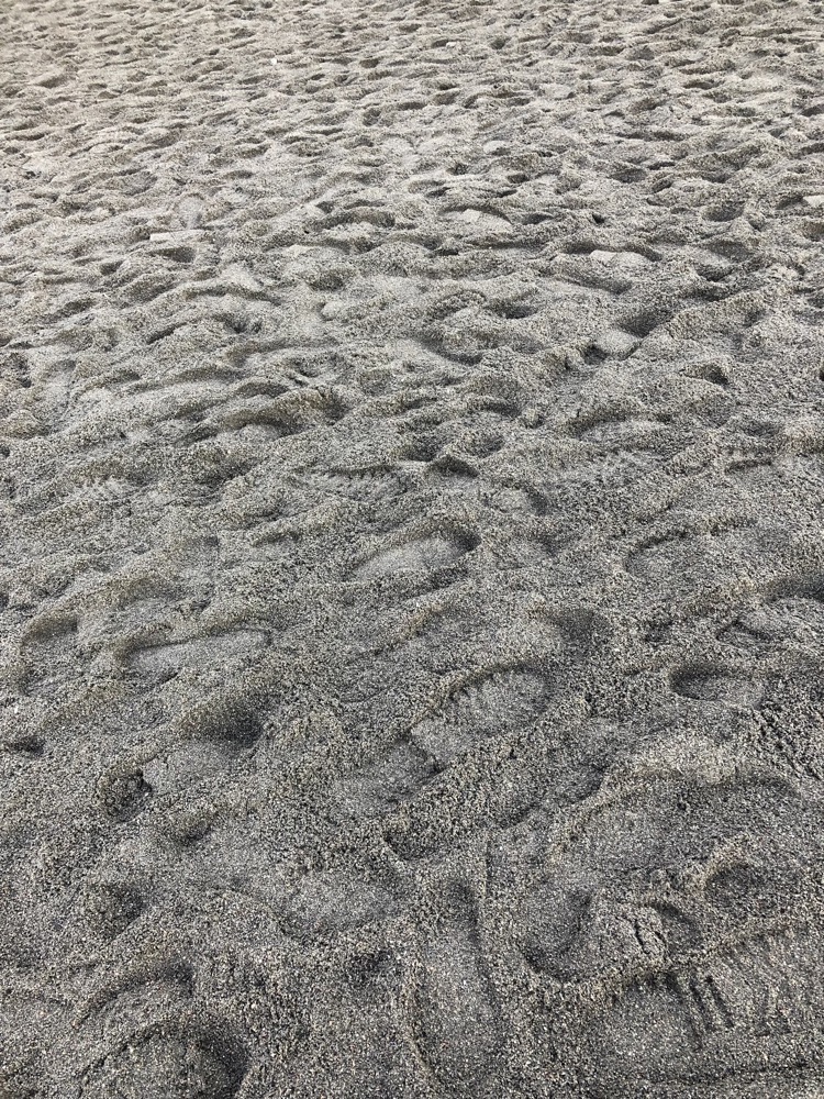
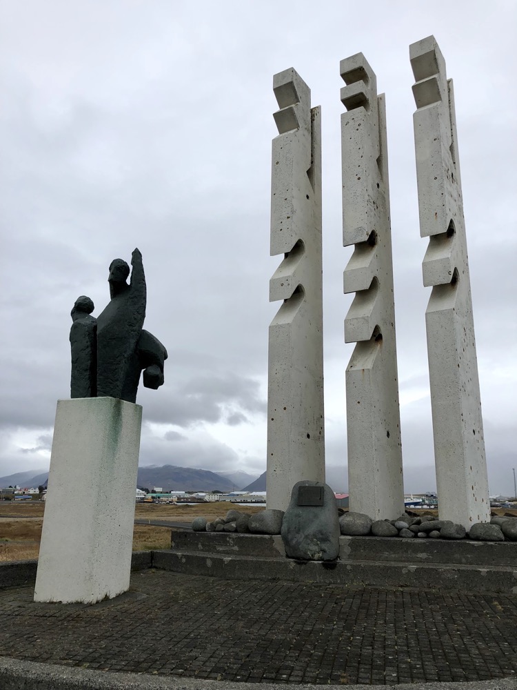
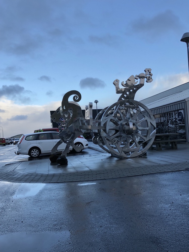 Civic art in Vik.
 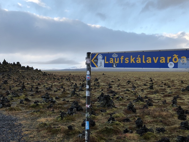 When you come to Iceland, one of the things that you will see splattered about on tourist guides and in tourist info is a request to not go around making stone cairns everywhere. The disturbance to the natural landscape is quite visually jarring and obviously, Iceland Tourism wants to keep the environments as natural and pristine as possible. Laufskálavarða is an exception. It is a lava ridge, between the Hólmsá and Skálmá Rivers, that is surrounded by stone cairns. Travellers crossing the lava fields of Mýrdalssandur for the first time would pile stones up to make a cairn, which was supposed to bring them good fortune on the journey but it stemmed from a tradition to bring good luck for someone else first.
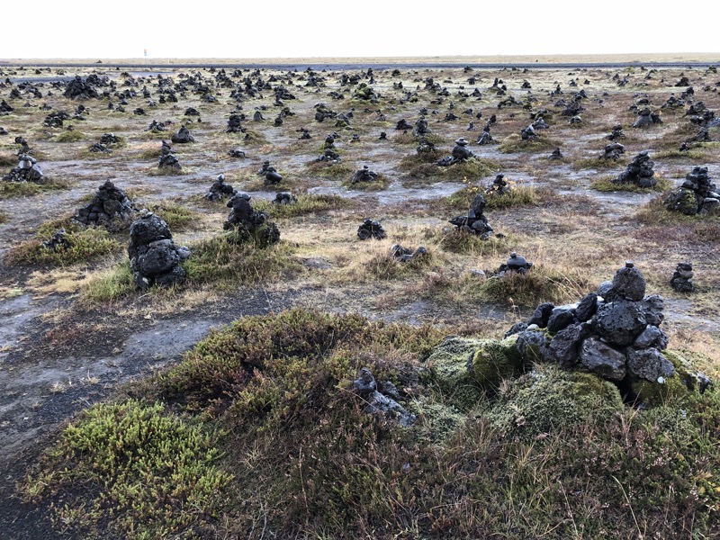
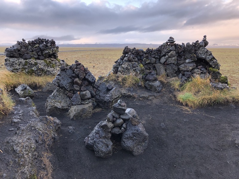
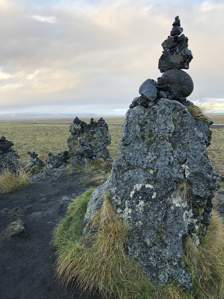 According to the tradition, there was a large farm here but it was destroyed in the year 1894 during the first recorded eruption of Katla. The farm neighbouring Katla was Kynskofar, home of a settler named Hrafn Hafnarlykill, for whom the rocks were being left… everyone travelling the Mýrdalssandur for the first time is supposed to leave him a stone to bring *him* good luck on his journey. which has translated into modern travellers leaving stones to bring good luck to their journeys – the tradition continues thanks to the Public Roads Administration’s efforts in making sure there is a good supply of rocks nearby.
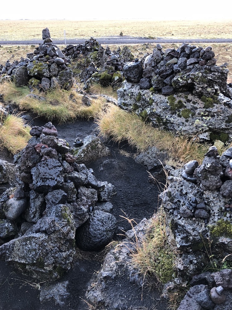 We went barely another 10kms north and started to see snow laying around the lava fields. It is quite the contrast, the mossy green low lying lava fields – which you know are created by enormous upheaval of fire and earth, covered in scattered snow.
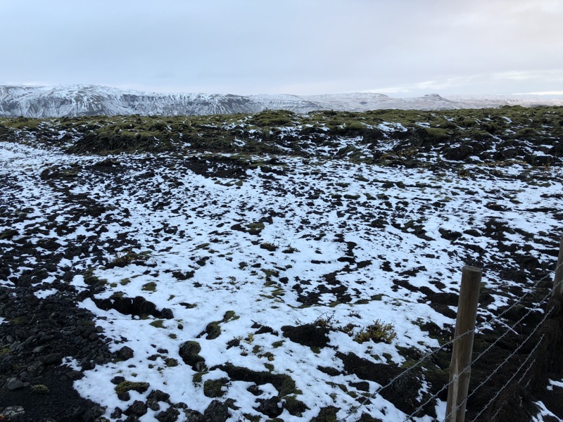
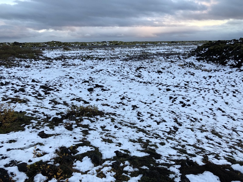 The early dusk light makes it hard to capture, but I may get another opportunity in the morning.
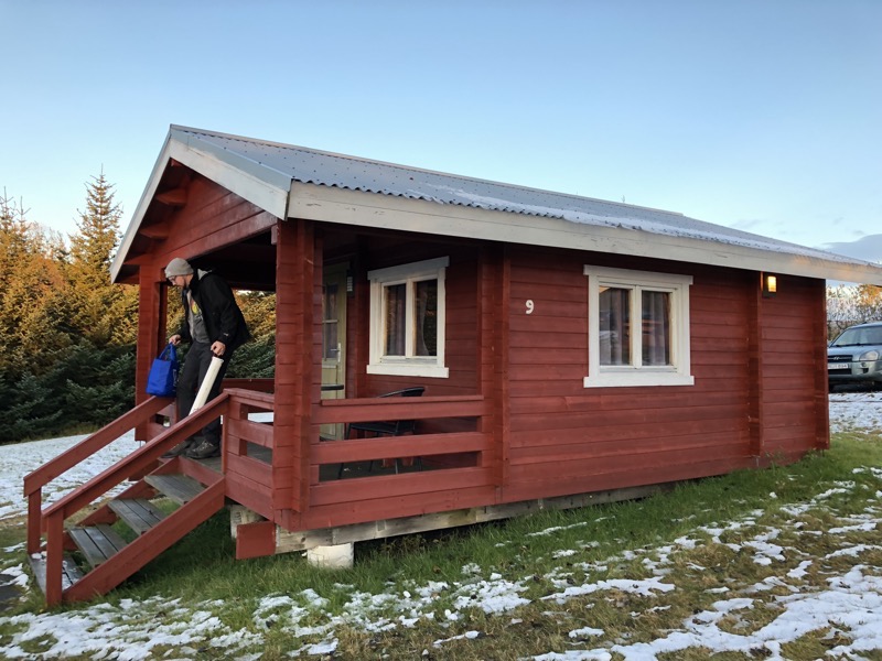
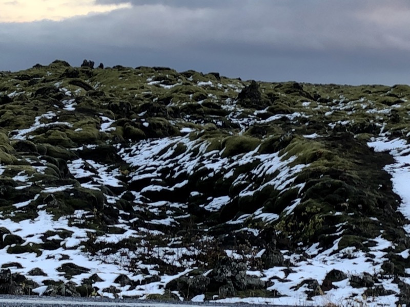 We eventually arrived at our home for the evening, the Hunkubakkar Guesthouse. We have a quaint but Scandinavian simple log cabin for the evening and the facility here has a restaurant attached instead of a big communal kitchen so we ended up having dinner in the restaurant. With the prices here (and by here, I mean Iceland) being anywhere between exorbitant to ‘a bit of lube first, please’, I opted for the plokkfiskur for dinner which is an Icelandic fish stew dish literally described as:
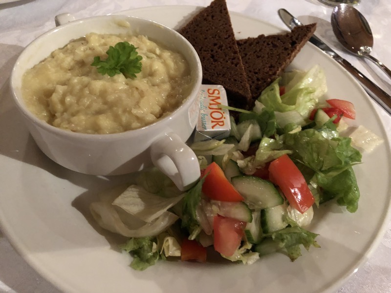 I was kinda expecting some sort of white sauce fishy stew… but instead, it was more like white stodgy fishy clag. You could literally put it on your spoon and turn the spoon upside down and the stuff wouldn’t fall off – talk about stick to your ribs, comfort food! It tasted more of potatoes and salt than of fish, and while I found I couldn’t handle the pasty texture of it (it was like eating salty powdery peanut butter), yale seemed to enjoy it enough to finish off both bowls.
 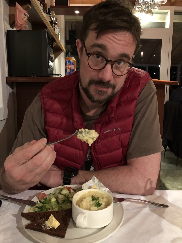 After dinner, I started writing this all down – as is my usual travel habit – only to discover the world’s worst internet. Which as you all know is really saying something given that I come from Australia, land where destroying the National Broadband Network is a favourite hobby for politicians from both sides of the aisle. I couldn’t upload anything, not even a single 200kb photograph. yale, having experienced the same slow rubbish, mentioned he had already checked out the situation and we had a good wifi signal to what was effectively a shitty 3G wireless connection that was probably being shared between 20-30 other guests. He also happened to mention that the router for the guesthouse had the login: ‘admin’, password: ‘admin’… no shit. Unfortunately, no amount of pressure on my part seemed to convince him that changing the password so we could kick everyone off and I could hog all the bandwidth was a reasonable plan to deal with the situation. 😀
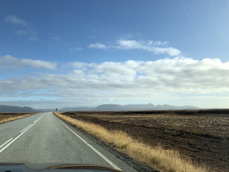 Þingvellir is one of Iceland’s most important historic sites/national parks known primarily as the place of the Alþing (Althing) – which was the name of the Iceland parliament from the 10thC all the way through until the 18thC. There are ruins of the Þingvellir Church and some old stone buildings, but the site is very well known due to its location – it sits in a rift valley between two separated tectonic plates, which create cliffs and fissures like the huge Almannagjá fault that runs through it.
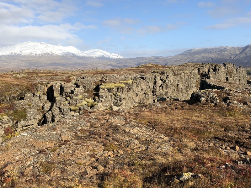 It’s hard to make our the rocky chasm in these pictures as the light was so stunningly bright today.
 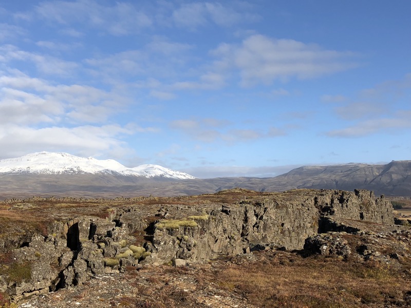 Apparently as late as 1967 you could drive through this rocky chasm created by the fault lines, but at that time they created a pedestrian-only gravel roadway through the space.
 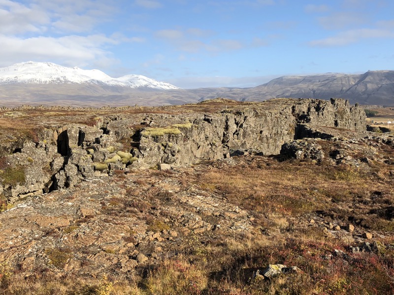 In the early 2000’s that pedestrian walkway collapsed in one section revealing that the fissure was something like 30 metres deeper than thought. Due to the subsidence (possibly from tectonic shifting), they decided not to fix the entire gravel walkway but to instead create an elevated boardwalk for visitors to use that would meet up with the gravel walkway in the lower areas.
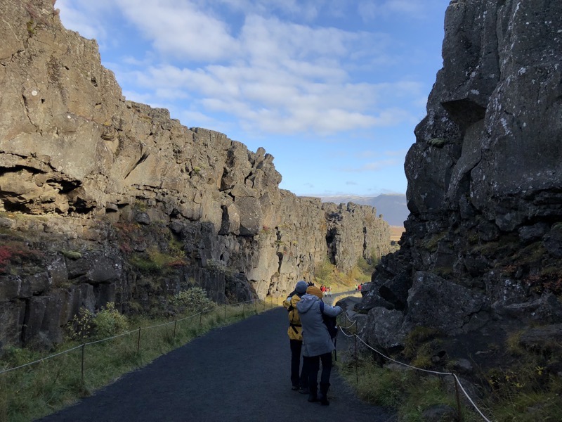
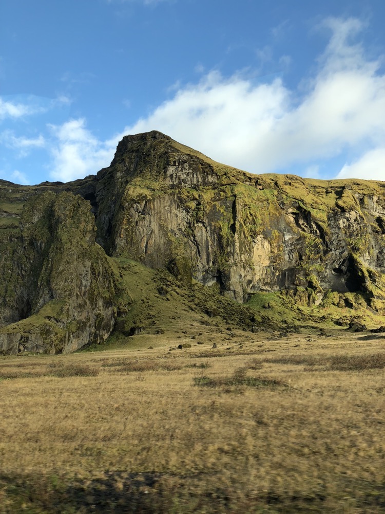
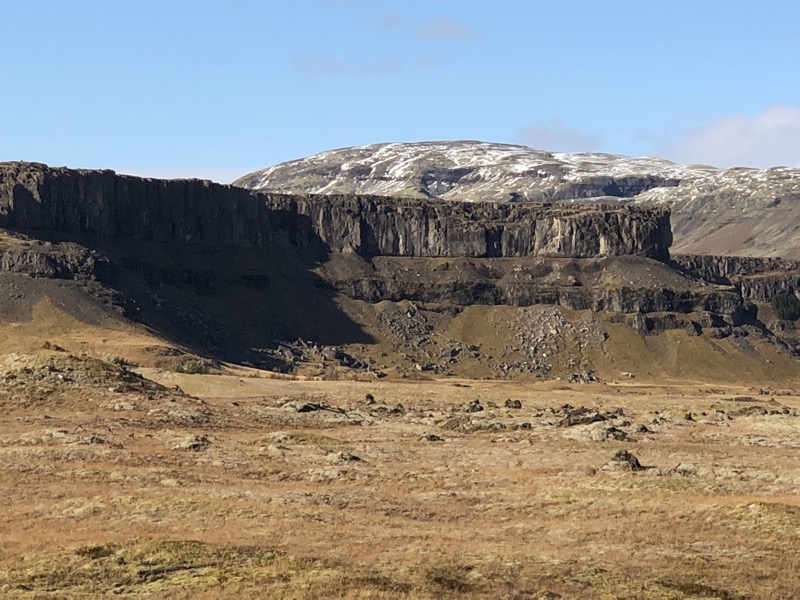
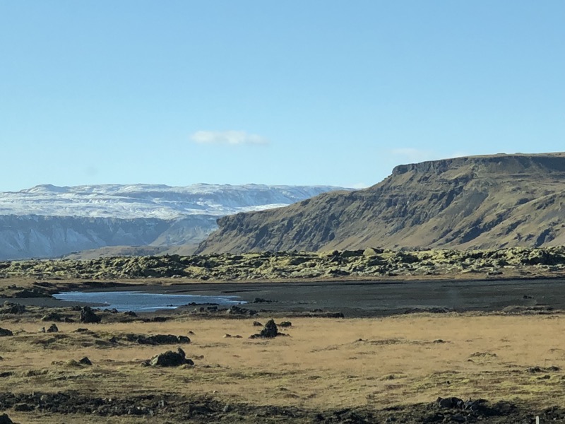
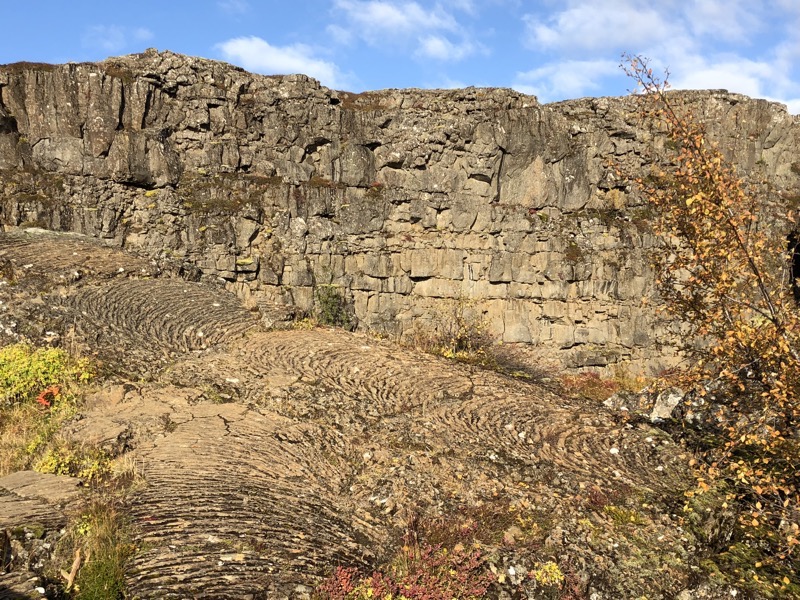 The entire lava fields have rock formations like this – though a great deal of it is under moss and peat in large areas.
 Such a gorgeous day! Was about 6-8°C with a light breeze and beautiful blue skies.
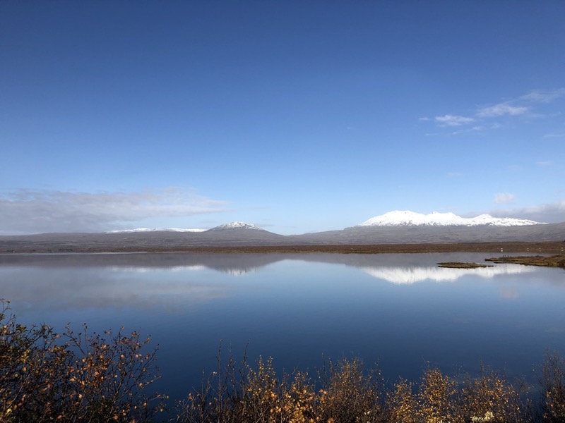
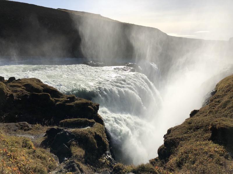
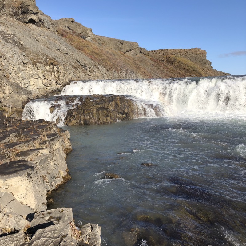
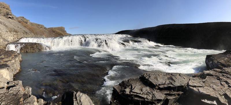
 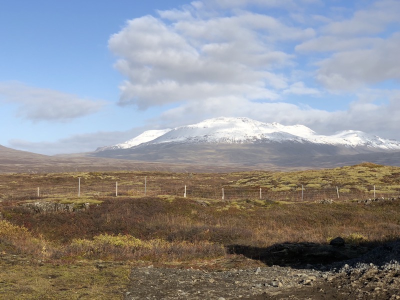 After seeing the Alþing area, we made our way towards Gullfoss falls via the back roads around Þingvellir Lake, The lake was calm and still with mirror-like reflections visible on its surface.
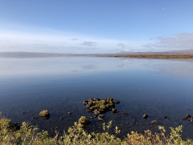
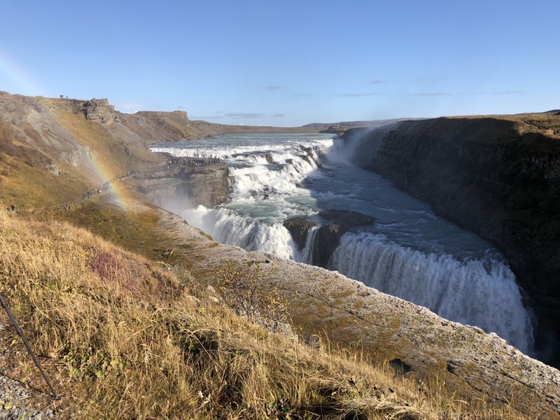
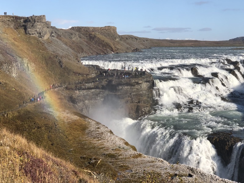 We were drenched walking through the mist to get to the cascading part at the top of the falls.
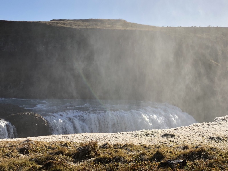
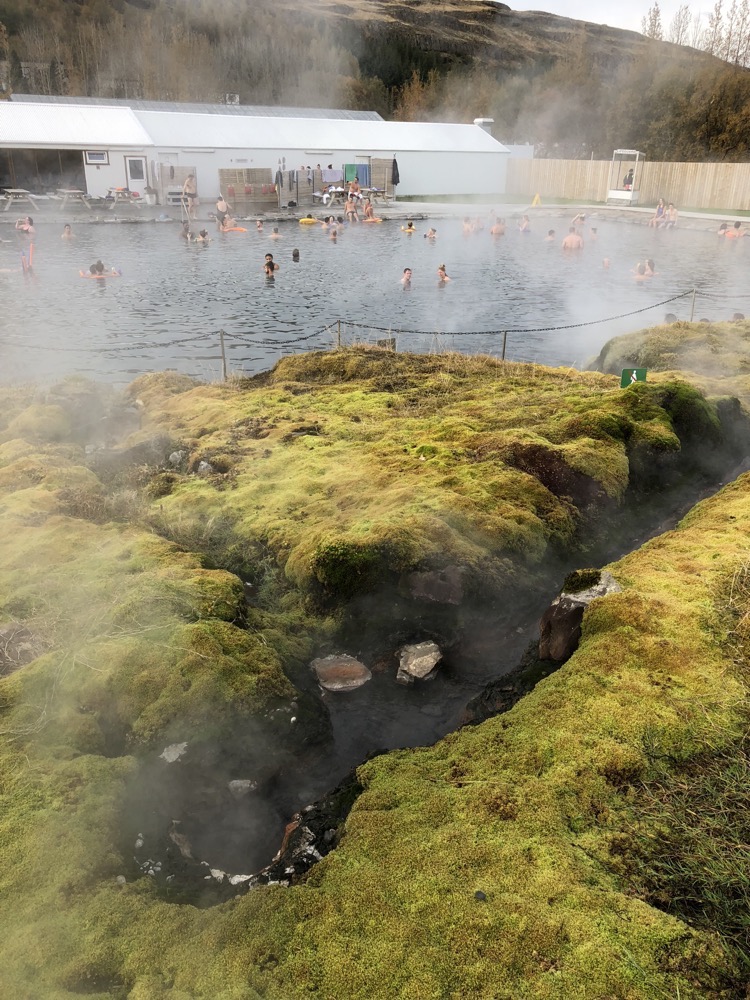
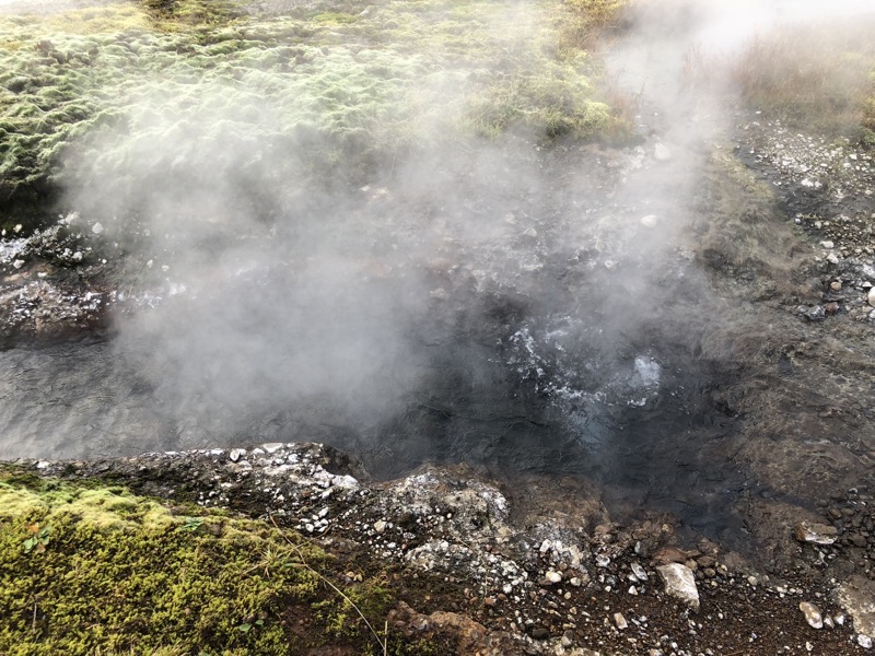
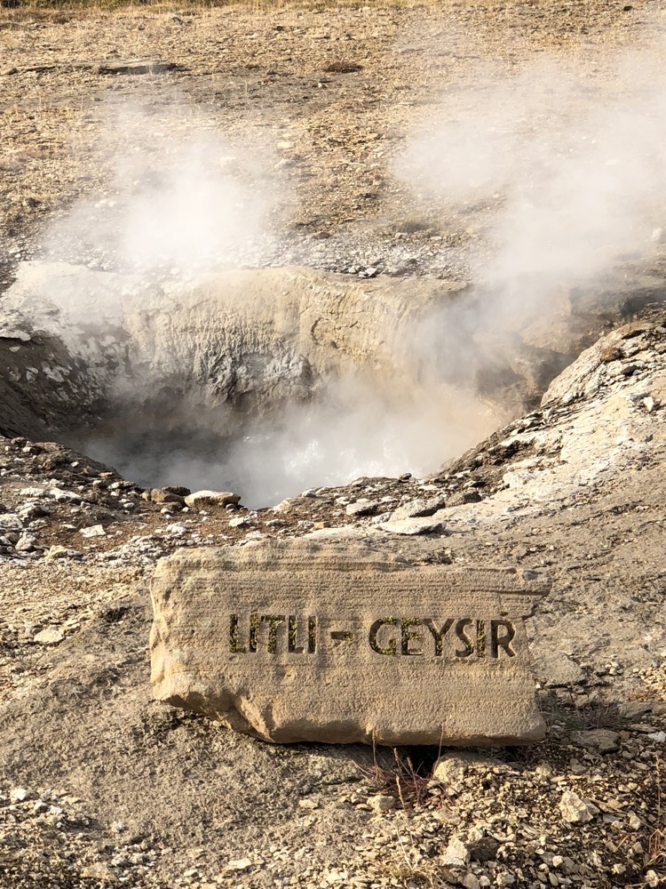 The entire area is a thermal wonderland with misty pools and creeks full boiling and steaming sulphurous water winding it’s way through the moss covered lava fields.
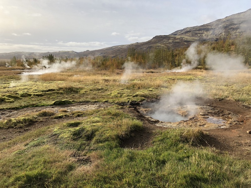 Watching the pools bubble away always reminds me of Macbeth Act 1, Scene 1…
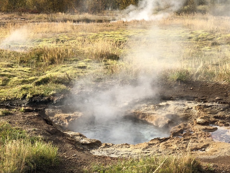 After we pottered around the Geysir area for a while we retreated indoors for a wander around the gift shop for a bit. Wondering what the Land Of The $25.00 Souvenir Tea Towel has in store for us by way of souvenirs this time…
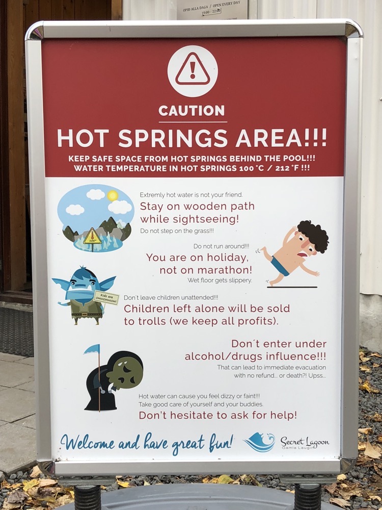 Selling children to trolls is a proper threat in Iceland – according to polls, more than
 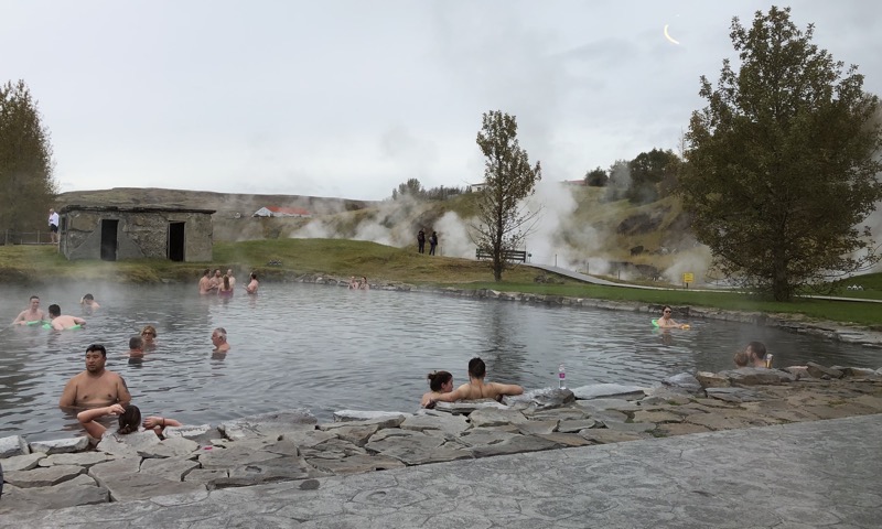 The water comes straight from an underground source at boiling hot temperatures. You can see it bubbling away – no doubt you could cook your eggs or anything else in it quick smart.
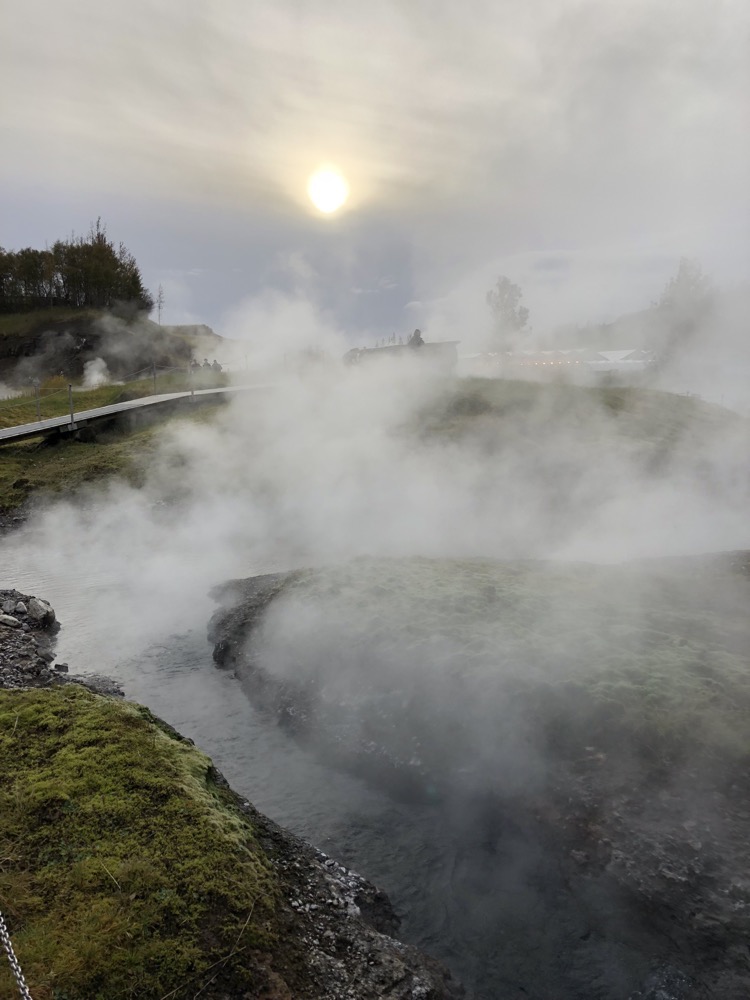
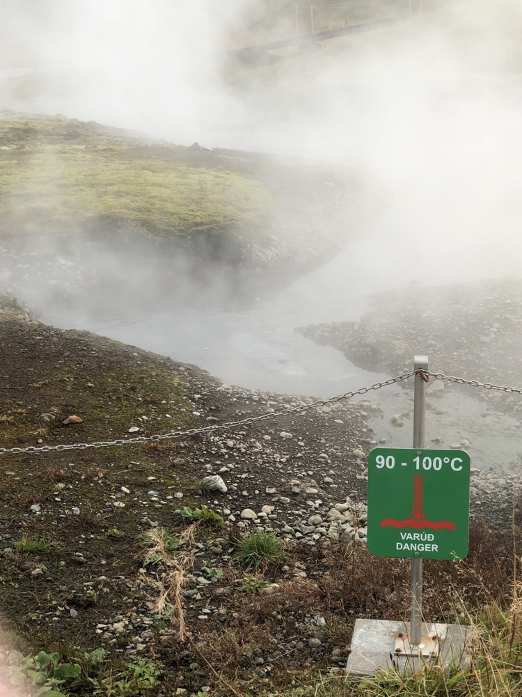 The pool’s moss covered surroundings and wispy steam rising into the air from the water gives the place an almost mystical feeling. The warm water stays at 38-40 Celsius all year in large part due to a local geysir that bubbles away all day and has a minor eruption every few minutes, which constantly floods the lagoon with fresh hot water.
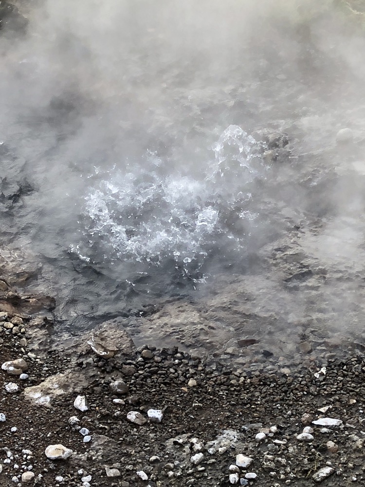
 The afternoon sun over a nearby greenhouse.
 The water was glorious after our few days of transits and flights and whatnot. It was lovely to float around in the heat after being in the cold and wind all day. The Secret Lagoon also happily sells alcohol so I was able to float around in the hot water while enjoying an ice cold cider. Oddly, even though there was about 80 people in the rather large pool, the place is rather quiet. People are enjoying the relaxation of the hot springs and keeping their conversations quietly between themselves (mostly… I mean, there’s always *those* Americans in the room).
 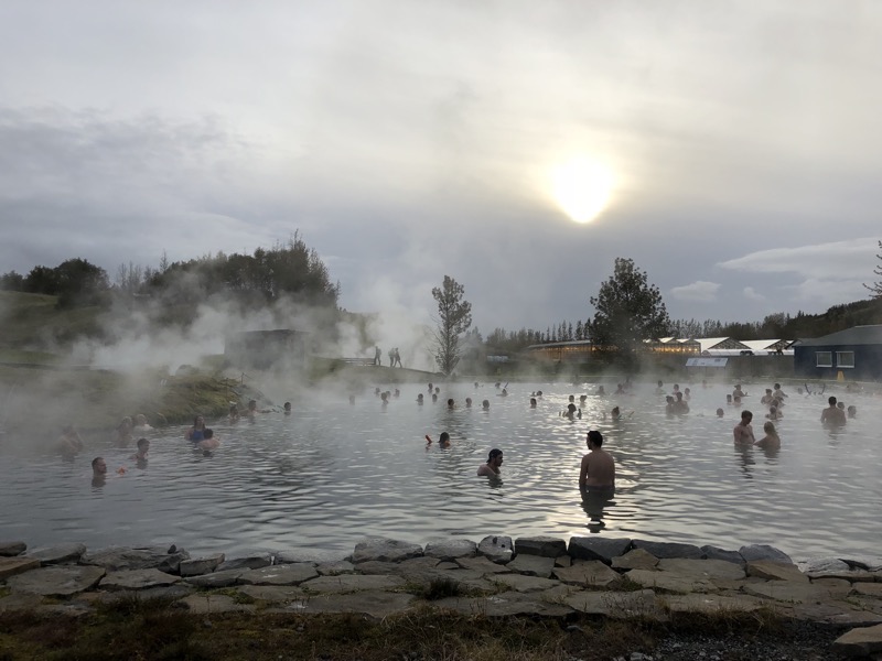 My experience hitting the showers on the way out could not have been more different had I directed it. Massive cultural differences evident between the young American women on the way in, and a bunch of young Scandinavian women on the way out. I was in the shower, naked, washing my hair and about eight young ladies who obviously knew each other entered the long shower area – they all stripped off and into the showers without a second thought for saggy bums, pieced nipples or unshaved armpits. Unsurprisingly they were dried off and changed in half the time of some others in the space who were desperately trying to keep covered while drying themselves and dressing under falling towels and doing that special dance you do when trying to put a bra on under a shirt when your skin is still damp. All up our visit to the hot spring was lovely (the rant in the middle not really occurring to me until I went to write this all down!) and I am looking forward to the next one in Myvatn which is in the more remote north of the island.
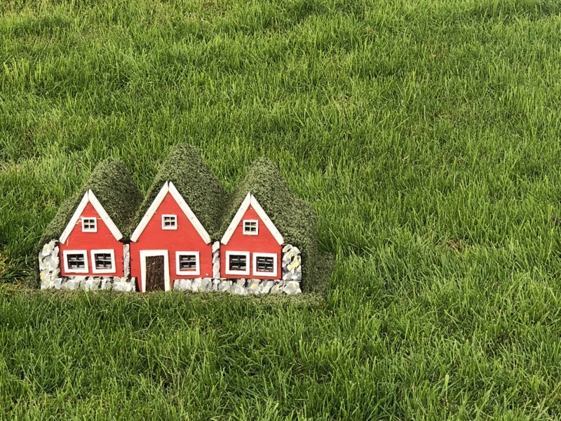 I have no idea what these little houses are for, they’re not even knee high but they are dotted around the property. Possibly for the elves…?