
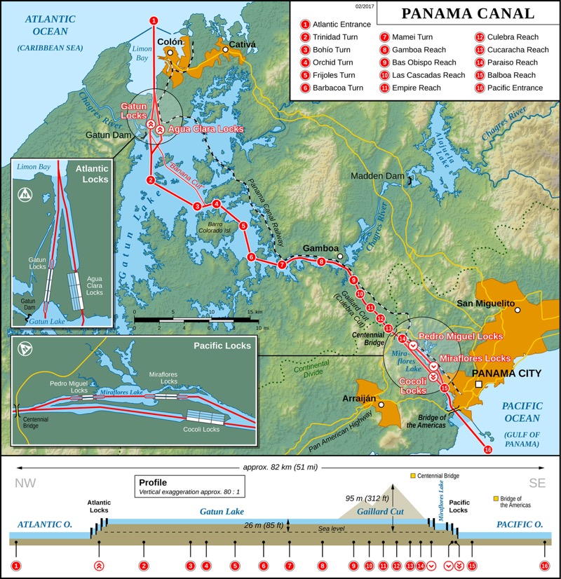
 The Panama Canal is a 77 km, manmade, waterway that cuts through the country of Panama connecting the Atlantic Ocean to the Pacific Ocean. The canal is a major international maritime trade route… and on every cruisers check list. We were up early to get a good look at the entry area near the town of Christobel.
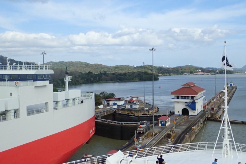
 At either end of the canal are major port operations allowing for the offloading of containers to be moved by rail instead of through the lock system. The locks assist ships in being elevated 26 metres above sea level to a large manmade lake, Gatun Lake, and again a second set of locks allow the ships to be moved back down to sea level on the Panama City side. The entire system was devised to allow ships to avoid the hazardous and time consuming Cape Horn route in the southernmost tip of South America via the Straits of Magellan or the Drake Passage – where we were just a few short weeks ago.
The original locks were only 33.5m wide, which is quite spectacular when you consider our ship is literally 33m across the beam, leaving barely 1 foot of clearance on either side! Our ship has actually been built to a Panamax standard, which is the maximum allowable width before it is no longer able to traverse the Panama Canal. The Grand class ships in the Princess fleet are unable to do this transit and instead have to access other areas of the globe by TransAtlantic crossings instead – eg: the Grand, the Ruby, the Caribbean and Royal and Regal Princesses.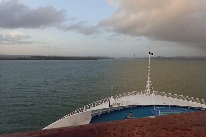 A larger, wider canal was finished in 2016 and it allows for Post-Panamax ships to move through which are capable of carrying more cargo.
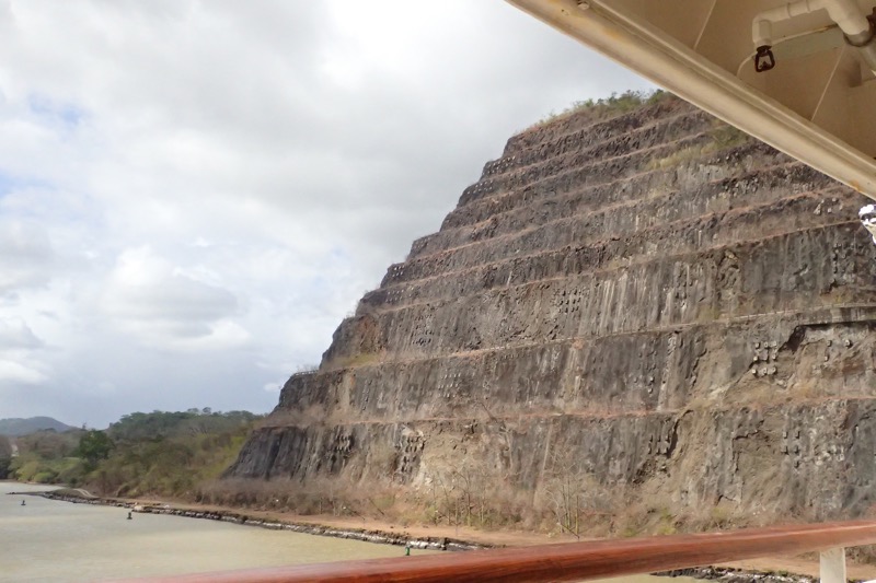
France was the first country to begin work on the canal in 1881, but they had to call it quits due to an extraordinary number of workers dying on the site, and a multitude of engineering problems – and I mean extraordinary numbers of worker fatalities, some 26,000 men, many of whom died due to yellow fever and malaria in a time where the role of mosquitos in disease transference was not yet understood. Much politicking and international treatises and whatnot later, the canal we see today was eventually built under American rule and ownership, with semi-military engineering supervision and involvement.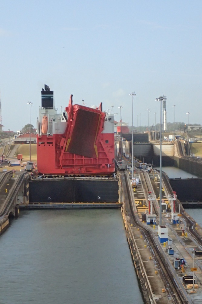 When looking at all these photos of the canal – it is most interesting to note the differing water levels of each lock, that allow the ships to move north and south through the system. The canal was officially opened in 1914 and initially saw about 1,000 ships per year utilising the canal. Most recent numbers see approximately 15,000 ships pass through the canal each year, and a total of 815,000 vessels had used it by 2012.
It takes 6 to 8 hours to make a full transit through the canal, and our transit was actually held up somewhat by a huge natural gas freighter moving through the new canal, and the regulations surrounding how close passenger ships are able to be to this type of ship during a transit… I guess if something goes wrong and the whole thing goes to shit in a ball of flames, they don’t really need 2000 tourists and 1000 cruise ship crew caught in the middle of a huge industrial accident like that.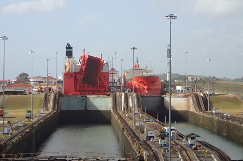 We were spoon fed a lot of history about the canal across the Panama Isthmus today by our destination expert, Hutch, and while I find this stuff quite interesting – feel free to zone out about now. The first proposals of a canal across Panama date back to 1534 when Charles V of Spain conducted a survey looking for a route that would make the voyage for ships travelling Spain to Peru, shorter and easier thereby giving Spain a significant military advantage over the Portuguese.
In the mid 1600s, an English philosopher also proposed a short cut through Panama to the East Indies and China. IN 1788, Thomas Jefferson was encouraging the Spanish to create the same short cut so they could avoid the treacherous southern transit around the Horn. And in the late 1700s, Alassandro Malaspina (sp?) finally came up with some plans for construction of a sea level canal. Additionally, the Scots also planned, in 1698, what eventually became the failed Darien scheme, which was ditched due to ‘inhospitable’ conditions in 1700.
Another effort came about in 1843, this time by some British in conjunction with the Republic of Granada. It was a primarily British endeavour and was set to be built in 5 years, however that all proved fruitless too.
In 1846, the US got involved in negotiating transit rights with Columbia (then owner of Panama) as their interest in being able to move gold from the California goldfields to the east coast increased. The Panama Railway was built by the US to cross the isthmus in about 1855)… Around the same time, a UK born engineer working for the US rolled out yet another proposal for a water canal, and the French were engage in starting building on this after their success with the Suez Canal. Alas the French screwed the pooch (overcome by climate, disease, heavy tropical rain and forest conditions), and the original sea-level canal was ditched in favour of a lock system and man made lake approach, because they were totally unprepared for the 10m rise in water that occurs every rainy season.
By this time, more was known about the spread of yellow fever and malaria and by the late 1800s, the death rate among workers fell to at ‘tolerable’ 200 per month?! (wtf?) The French effort eventually went totally bankrupt in 1889 after spending more than USD$280,000,000, which wiped out the savings of over 800,000 investors. The Panama Affair saw some prosecuted and imprisoned, though not for long.
Not long later, another French company picked up the project and tried to resurrect it using the old available assets, but eventually they sold out to the US for a song (all things being relative), and the US got involved in 1902. Long political campaign and legisilative wrangling omitted here, but the US eventually finished the canal and it was opened in 1914 on President Theodore Roosevelt’s watch.
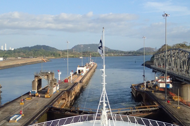
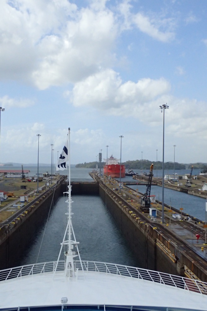 Going through the locks now – you can see what an enormous undertaking it was. It is easily as impressive as seeing the Hoover Dam or the Great Wall of China. The Gatun locks:
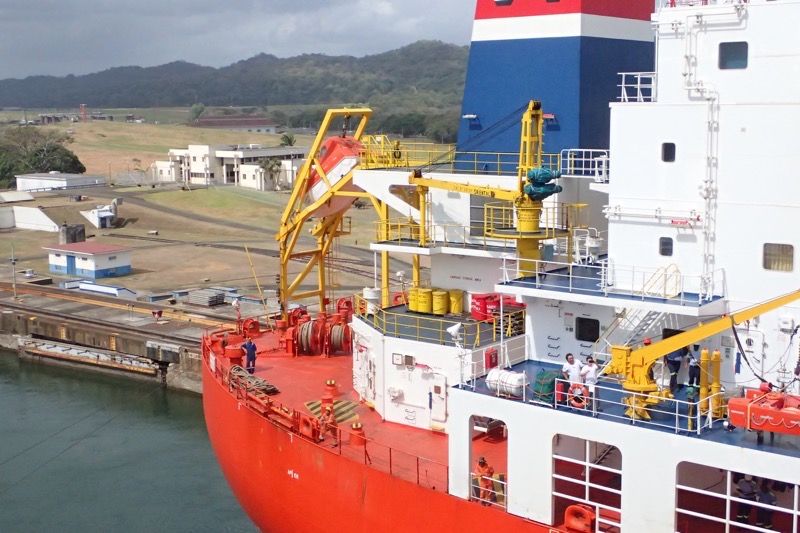
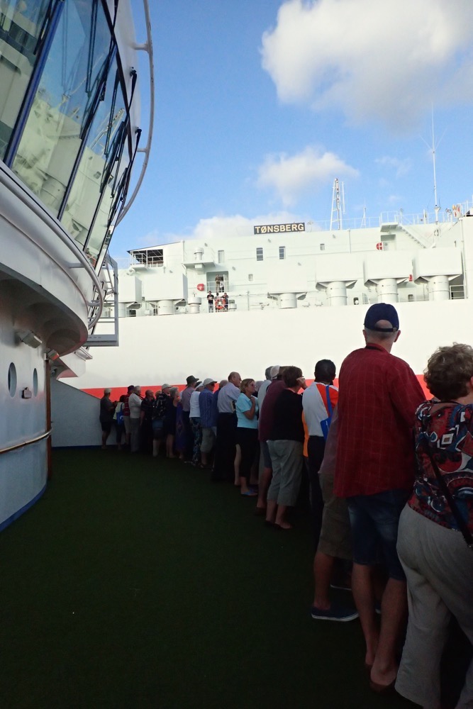
After making our way through the first set of locks, we were put into a holding pattern, waiting for the aforementioned naturals gas Post-Panamax ship to traverse the new canal. Friends of ours who have a suite on the back of the ship were having a bit of a party, and after running all around the open decks checking out the canal for most of the morning, we decided to go down and join the party tarts… aka ‘The Nookies’! We got down to D750 and found a very happy crew enjoying the view, a quick rain shower and a lot of laughs… 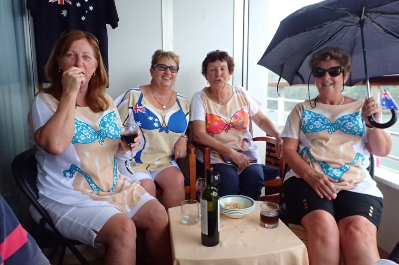 Marie, Sandra, Kathleen, and Sandy all dressed up for ‘flashing’ onlookers and the local tug boat captains! 🙂
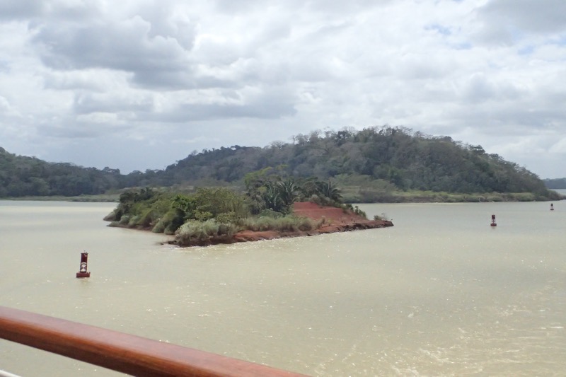
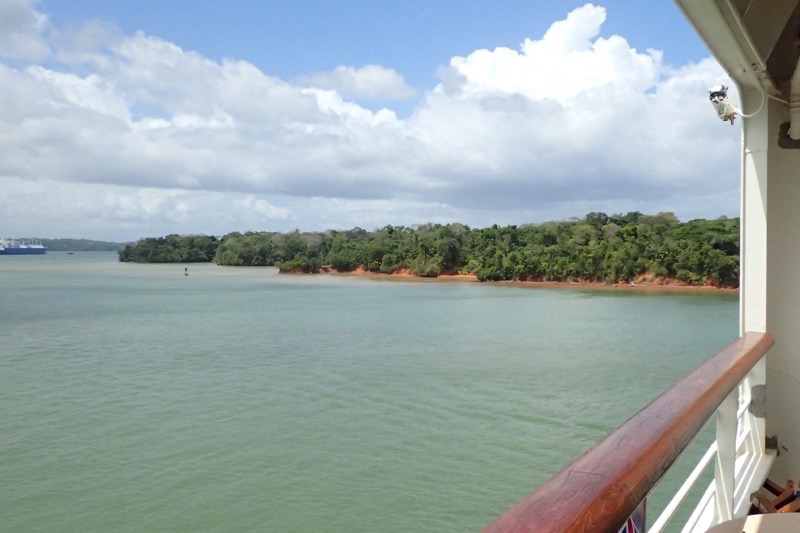
 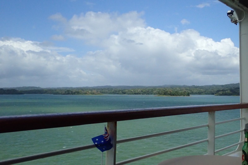 Views of the Gatun Lake…
 Lunchtime with the Nookies; Terry, Barry, John and Mick (aka Mick The Official, and Original, Bad Influence!)
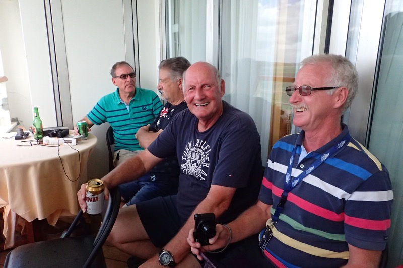 The Girls taunting the local tug boat captains with their ‘girls’. 😉
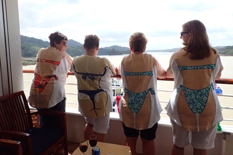
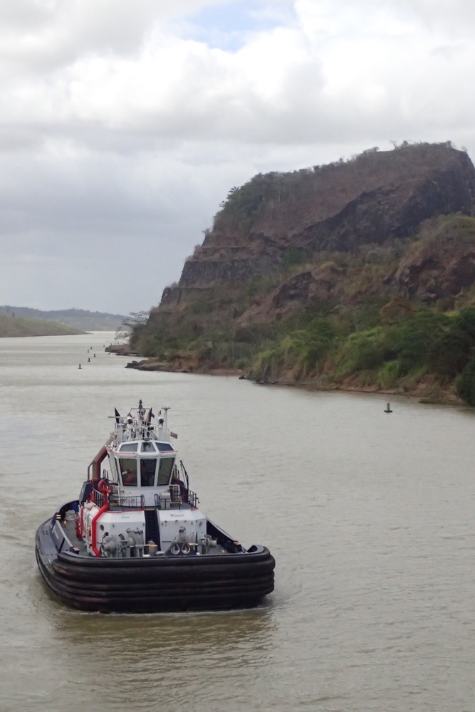
 One of the tugboats who was following us for quite some time was doing donuts in the water for our amusement and talking to us over their PA system… when we held out beers for them, they said “We wish.” and “Now, you’re just being mean!” as we were partying on the deck and they were stuck working… poor fellas. I think they followed us for an hour hoping someone was going to flash their bits! 🙂
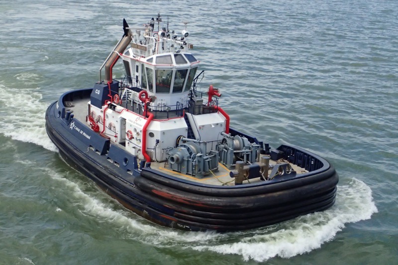
 The Centennial Bridge
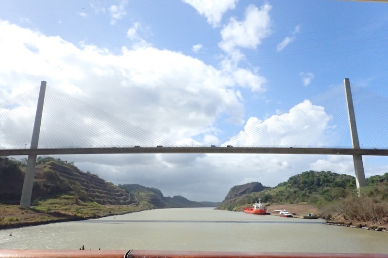
 Out the other side of Gamboa we found ourselves going through the Pedro Miguel Locks and then the Mira Flores Locks. I was back on the front of the ship on the deck 11 view deck to see this – you can really see the water levels moving up and down to move these enormous ships – our cruise ship and the car carrier that we had been moving neck and neck with all day.
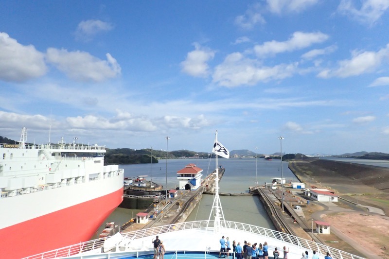
 The other interesting thing we learned today was the cost of using the Canal. The tolls are set by the Panama Canal Authority and are based on the type of ship and what type of cargo it may be carrying. For examples, container cargo ships are assessed on a unit of measurement called a ‘twenty-foot equivalent unit’ TEU, which is roughly the size of a regular shipping container. From last year, the toll was about USD$90 per TEU… which doesn’t sound too much until you consider the average Panamax container ship can take over 4000 TEU. Passenger cruise ships are calculated differently – a cruise ship of over 30,000 tonnes is charged based on the number of berths on the ship/the number of passengers that can fit on the ship, not necessarily the number of passengers that are on the ship. The cost per berth as of 2016 is $111 for unoccupied berths (why?) and $138 for occupied berths. Other ships are calculated based on the amount of cubic meters of water they displace which is sounding too much by math for me.
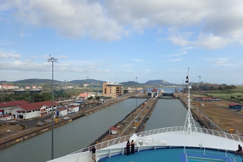 The most expensive toll ever paid was by a cruise ship called the Norwegian Pearl which paid over USD$375,000 for an expedited passage – the average cost is about $54,000 for a ship of that size, but they basically paid to jump the queue. There was another ship when work was being carried out on the Gatun Locks, an tanker I think, that once paid about $250,000 to avoid waiting in a 90 ship queue (7 days wait) on what should have been a $13,500 toll.
And the other bit of silliness we were told about was an eccentric American named Richard Halliburton who was charged USD$0.36 to transit the channel by swimming, and his fee was calculated based on his tonnage displacement.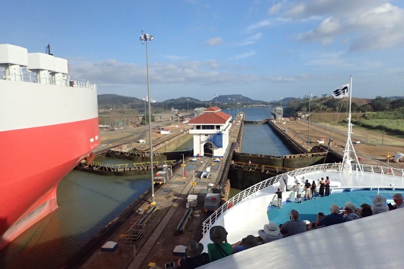 In the image below, you can see the water racing through a culvert… this is how the lock system works – by using gravity to move metric shit tonnes of water to allow each ship to raise and lower as required.
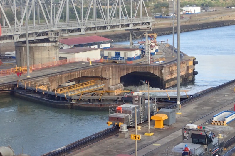
 Currently, the canal is handling far more traffic than had ever been projected by the original engineers – it was estimated that it would move about 80 million tonnes of cargo each year, but in 2015, over 340 million tonnes was moved through the canal… I gotta ask myself, how much of the stuff on these container ships is full of shit made in China destined for $2 stores the world over? Are we overdoing this moving crap around the world thing? Something to think about…
Anyway to overcome the capacity issues, they are implementing better lighting so the canal can work more efficiently at night. They are widening some sections, improving the tugboat fleets, deepening the draft (which is currently only 10.5m) and generally updating the entire system, along with the parallel Post Panamax sized canal.
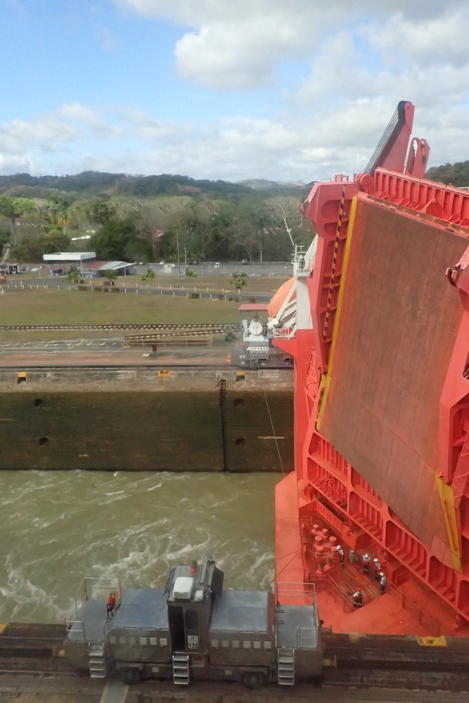
 The rolling bumpers that allow the ship to move through the canal without damage – with barely a 1 foot clearance these rollers keep the ship from rubbing along the canal’s concrete edges.
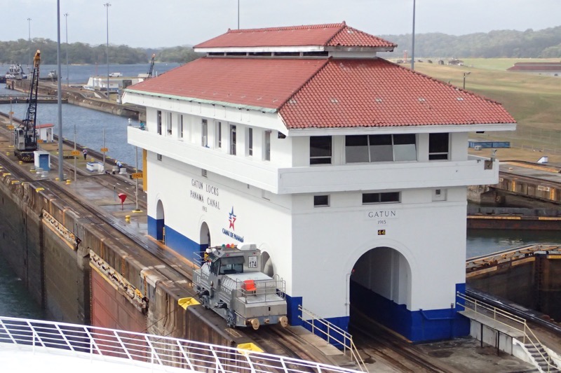
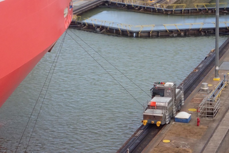
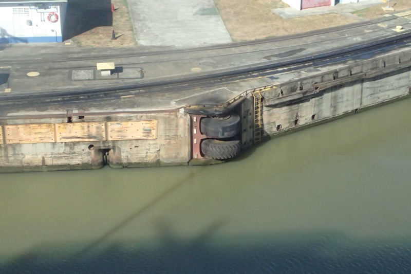 In the old days, mules were used to pull ships through the canal – today ‘mules’ are still used to pull the ships through and help keep their sideways movement controlled. Only now they are 50 tonne machines made by (originally General Electric) and Mitsubishi now. Six of these are attached to the ship for the transit, and believe it or not the cables are sent out to the ship at the beginning of any transit by two little guys in a row boat who then pass them to a crew member on the ship who has gone out a watertight door and down a rope ladder to ‘catch’ it! Many different methods of throwing and/or shooting the cables to the ship have been tried in the past, but the little guys in the row boats have proved most effective over time.
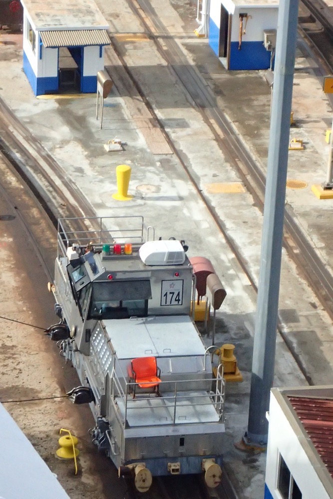 Mules…
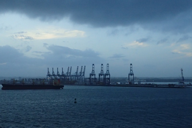
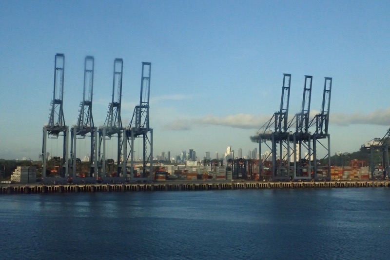
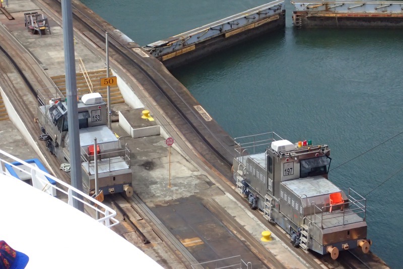 Heading out the other side you can see the large port infrastructure at the other end of the Panama Railway… large cranes dot the skyline to unload/reload ships that are not traversing through the canal.
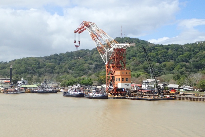
 Elaine and Anyse enjoying the view from the Deck 10 forward viewing deck.
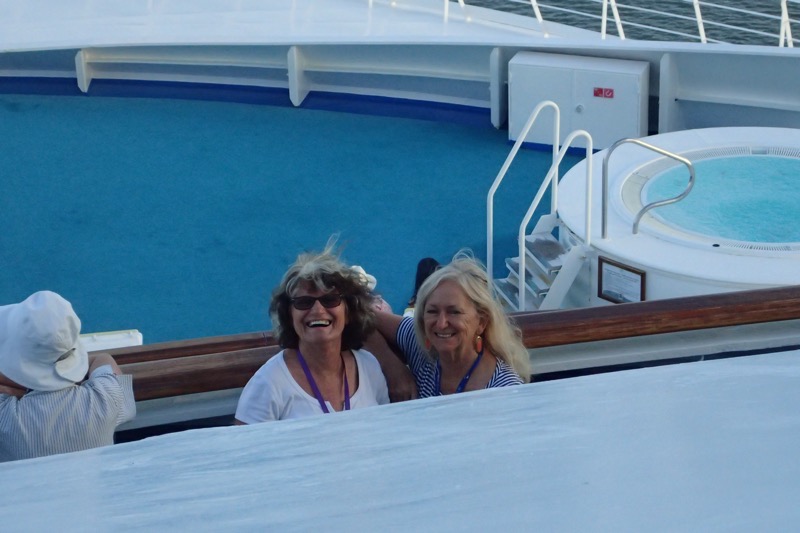 And then, before you know it… ta-da! We are back in the Pacific Ocean, and well, you know – we could swim home from here, right? 😉
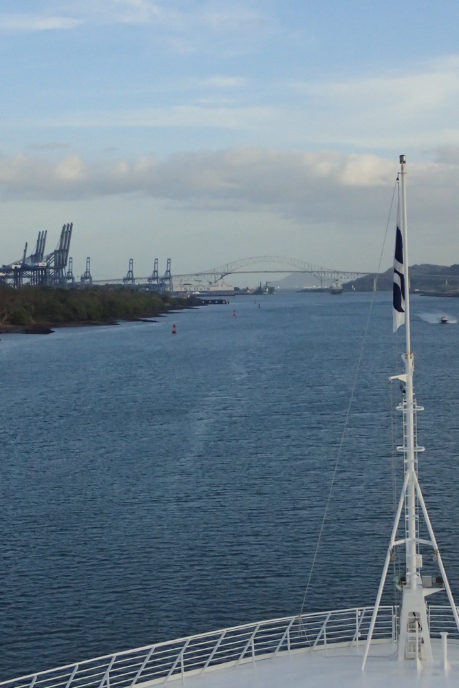
Really enjoyed so far was on the world cruise last year the same ship, Panama i really enjoyed a great transit.