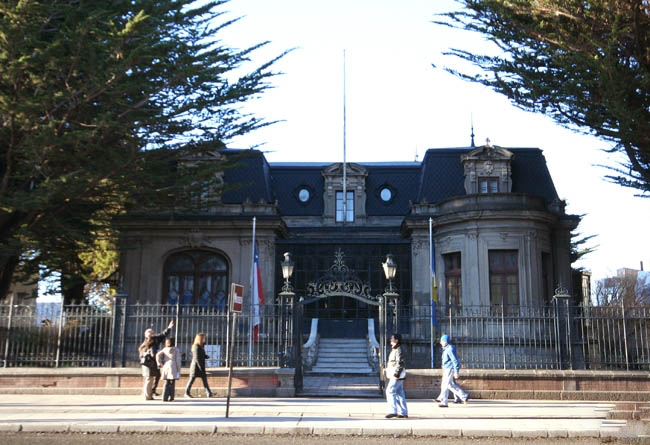
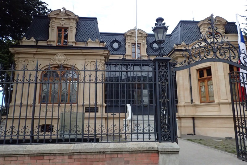
Ushuaia is the capital of Tierra del Fuego, Antartica e Islas de Atlantic Sur Province in Argentina. But it is more commonly known as Ushuaia – the End of the World! Generally considered the southernmost city in the entire world, Ushuaia is located in a wide bay on the southern cost of the island called, Isla Grande de Tierra del Fuego – which is bounded by the Martial Mountain ranges and the Beagle Channel.
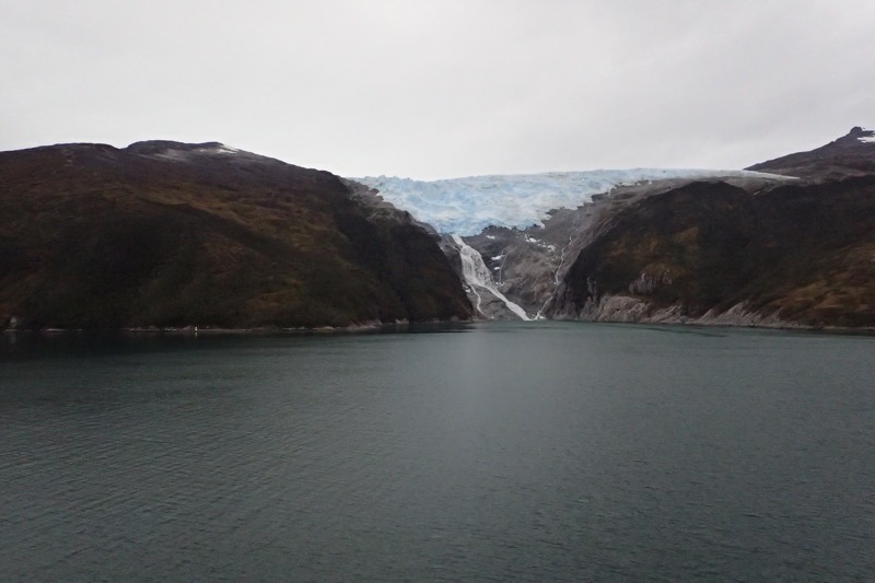
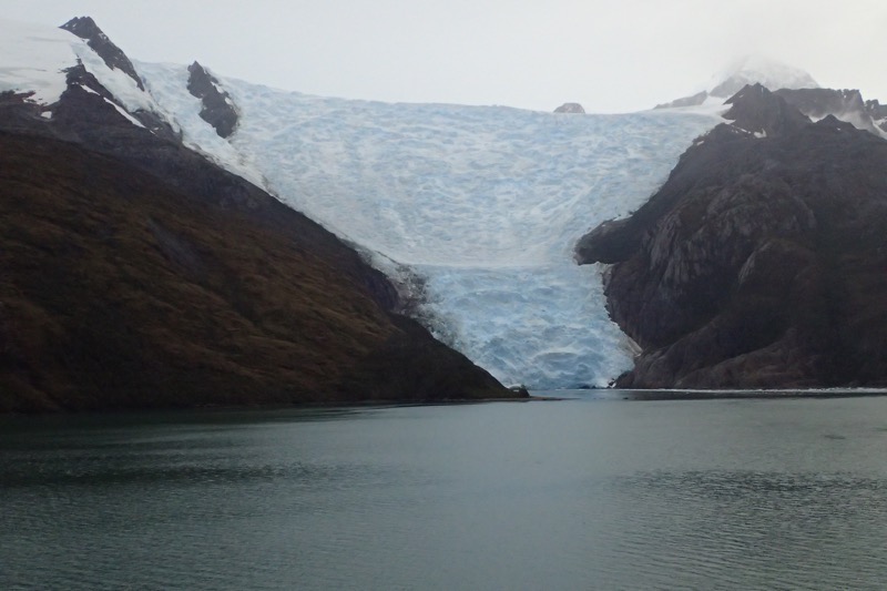
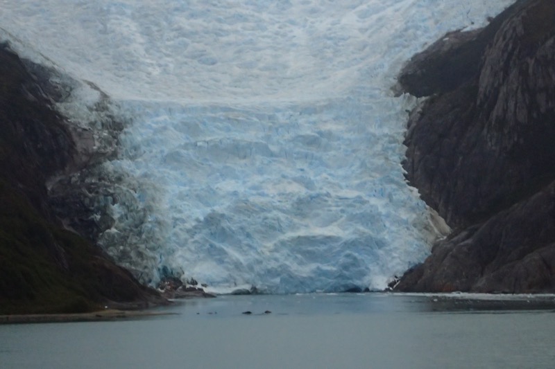
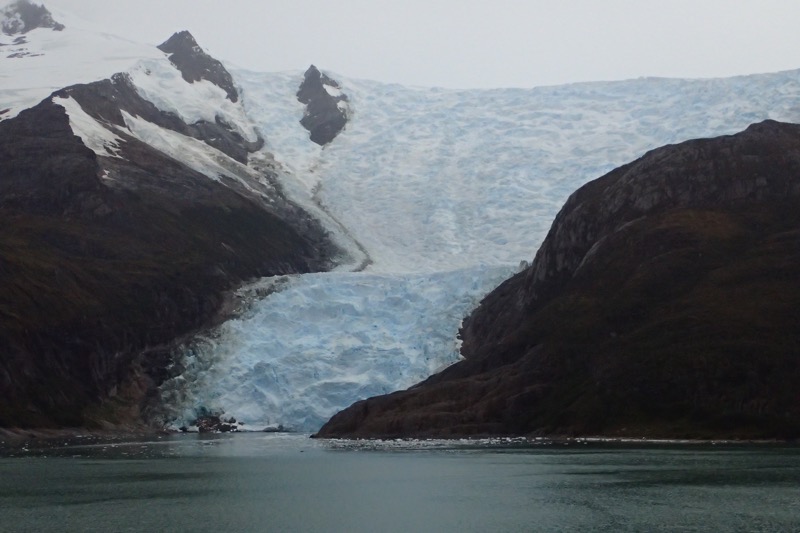
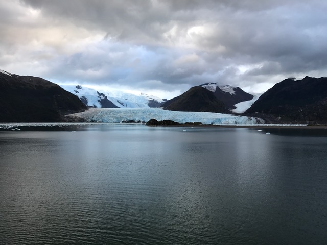
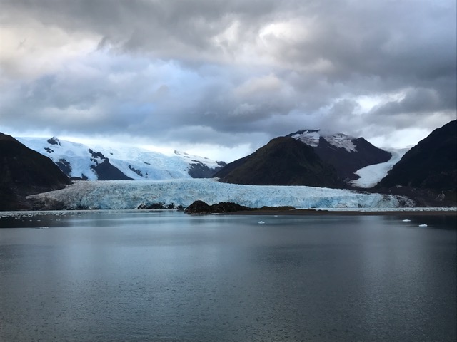
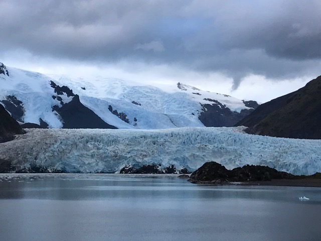
We sailed in through the beautiful Beagle Channel glacier field, just watching amazingly beautiful glacier after glacier appear as we sailed through the channel.
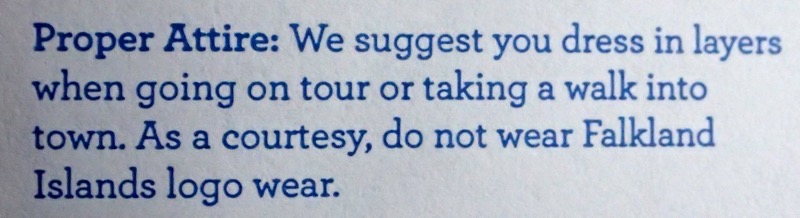
Getting ready to go ashore, I saw this little notice in the Port Guide… never seen that before. I was just a kids when the Falklands war was going on, it never would have occurred to me that tensions might still run high.
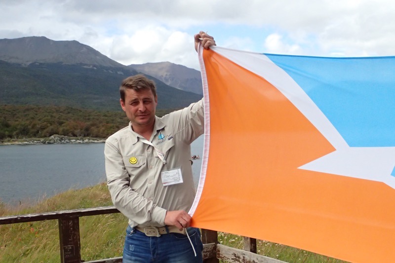
 Once at the port, we met our guide, Andres, and our trusty drivers, plural, for the day Coco, and Juan Emannuel (don’t ask, long story), and we head off towards the famous Train at the End of the World to take us into the Tierra del Fuego National Park.
On the way, Andres gave us plenty of information (much of which he had to repeat later, poor fellow – the bus PA system wasn’t working). The term Ushuaia (pronounced u-sua-ia / u’swa ja), comes from the yagan language ush and waia, which means ‘deep bay’ or ‘bay to background’. I asked Andres how the region got the name Tierra del Fuego, ‘Land of Fire’, which seemed a name more likely for an active lava field than an alpine tundra spotted with peat bogs, and he told us that the original peoples of the area, the Selk’nam Indians (also called the Ona people) first arrived in the region about 10,000 years ago, and they would have enormous bonfires that were visible from the straits – the same fires that Magellan spied from his ship; hence the ‘Land of Fire’.
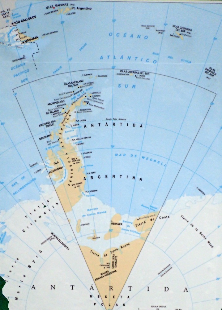
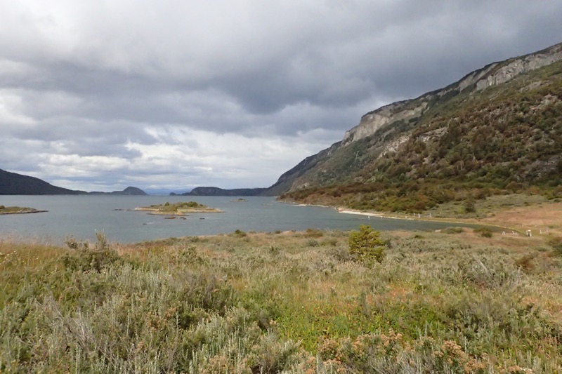
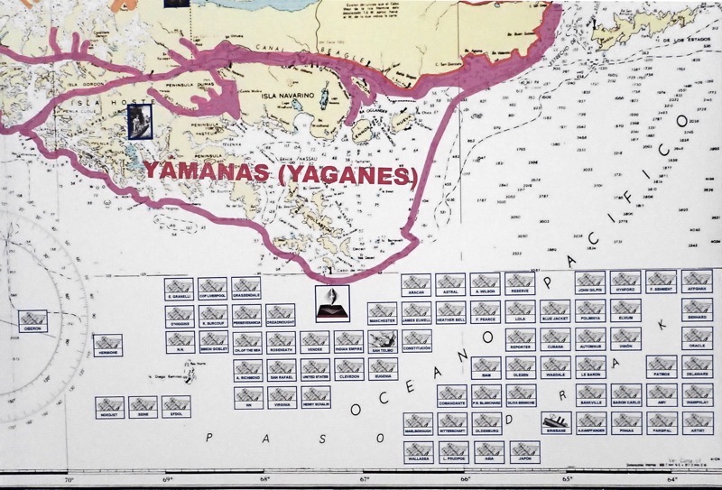
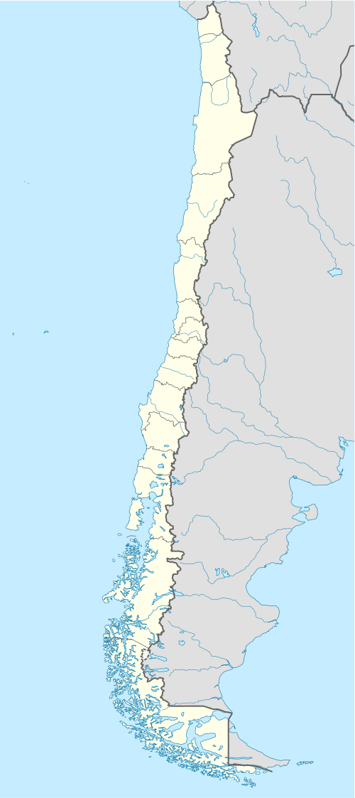
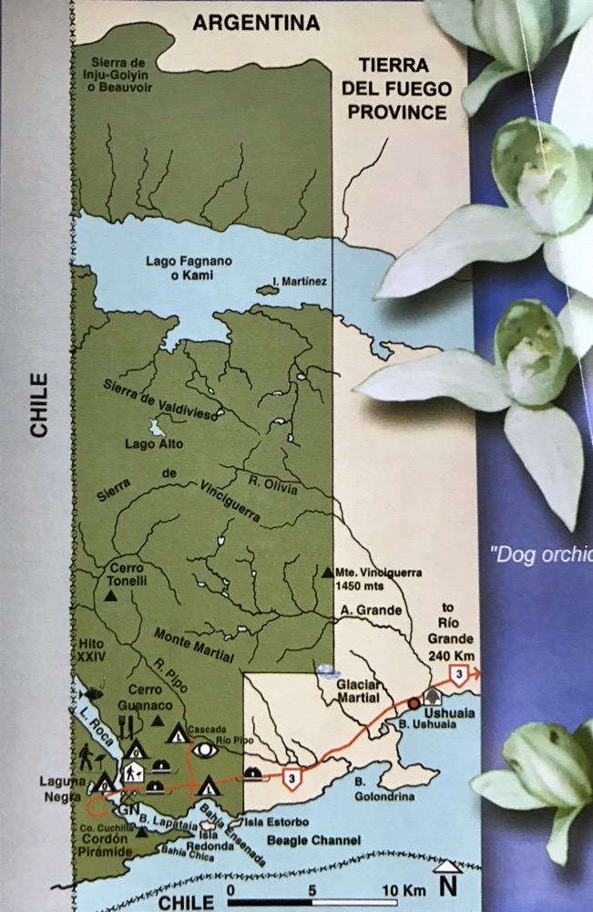 You can see by this map, that very little care was taken when drawing the boundaries between Chile and Argentina on this particular island – they have quite literally taken a ruler and sliced through the countryside, with one side of the mountain in one Chile, and the other half in Argentina. As we traversed the park, it was a bit, ‘Oh 3kms that way is Chile’… and ‘half of this lake is Chile, and that half of the lake is Argentina’. Seriously? That’s gotta make conservation efforts a little tricky!
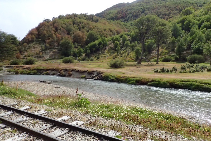
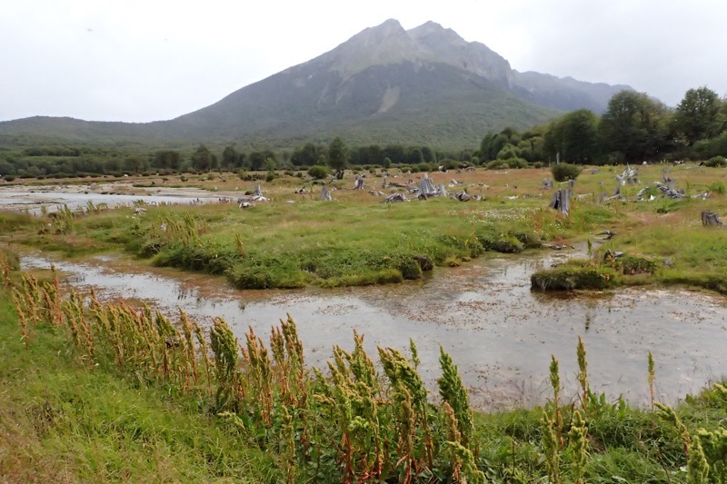
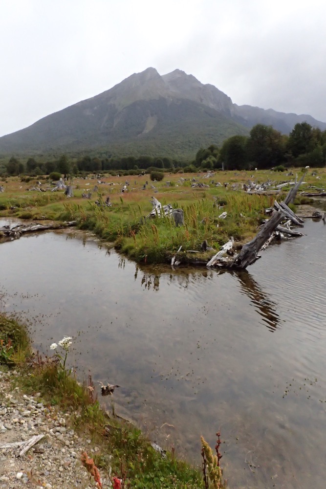
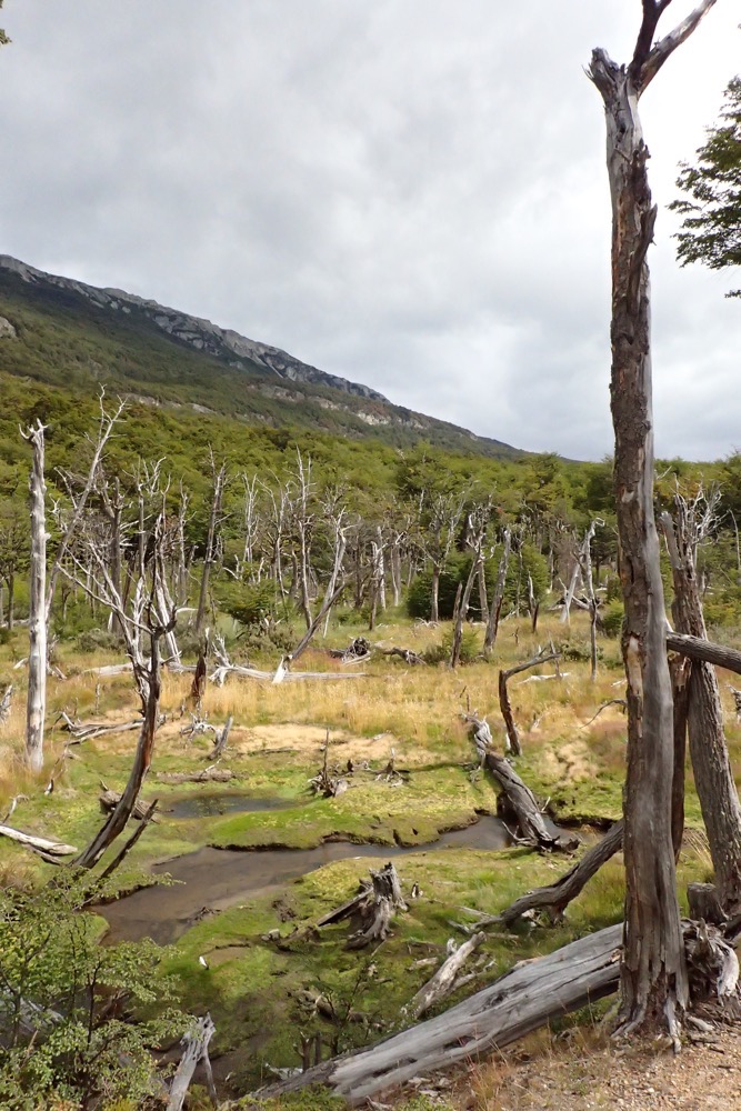
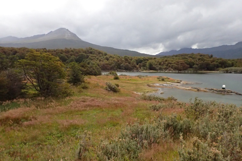
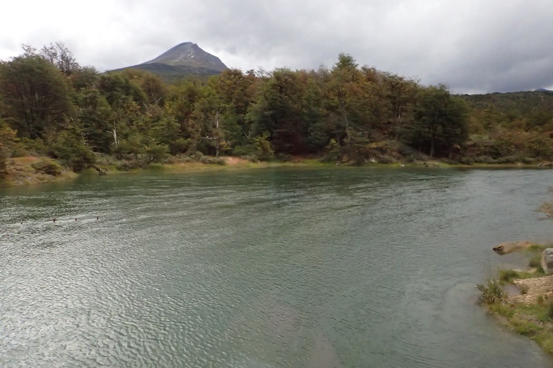
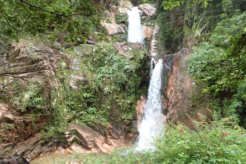
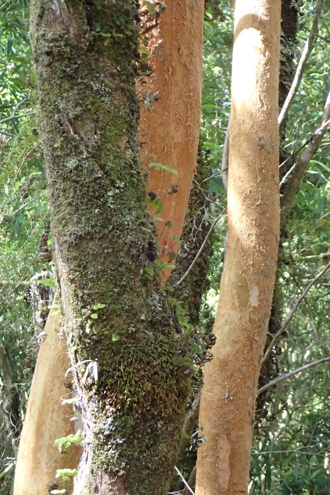
Tierra del Fuego is the southernmost national park in Argentina, and it is full of dramatic scenery – waterfalls, dense forests, mountains, glaciers, lakes, peat bogs, and rivers. It is a simply stunning place, and I think you could easily explore here for months without seeing the same spot twice. The forests here are of Antarctic beech and Lenga beech, which looks very similar to Tasmania’s alpine forests which are also heavy in Lenga beech trees. There are many species of fox, rabbit, muskrats, mink and beaver here… most of these species have been introduced, and several are now actively culled – the meat used for crab bait, and the furs sent for tanning and sale. Interestingly, and this makes total sense but I probably wouldn’t have considered it at all, had Andres not mentioned it; there are no reptiles in this entire region. It is too cold for them here, so there are no frogs, no snakes and no lizards at all.
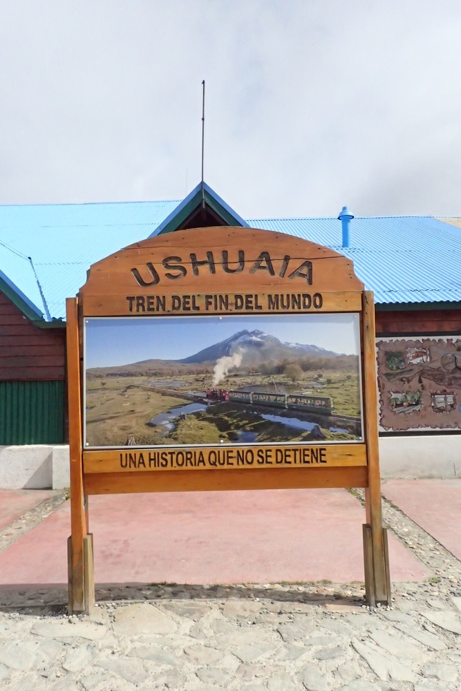
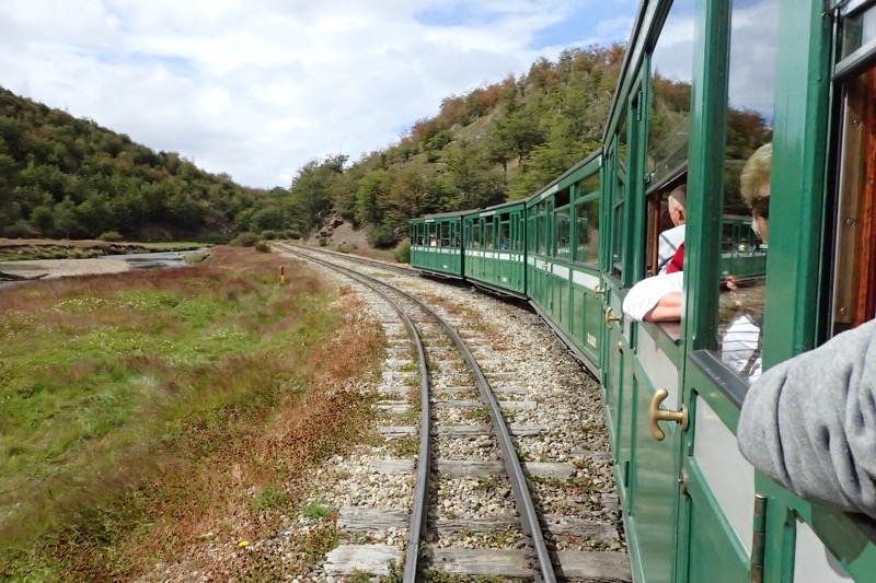
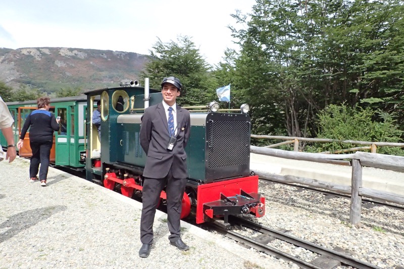
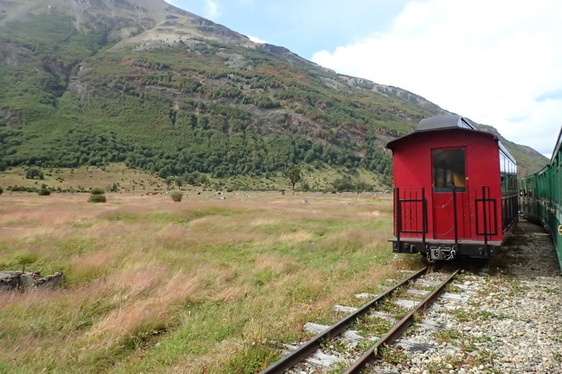
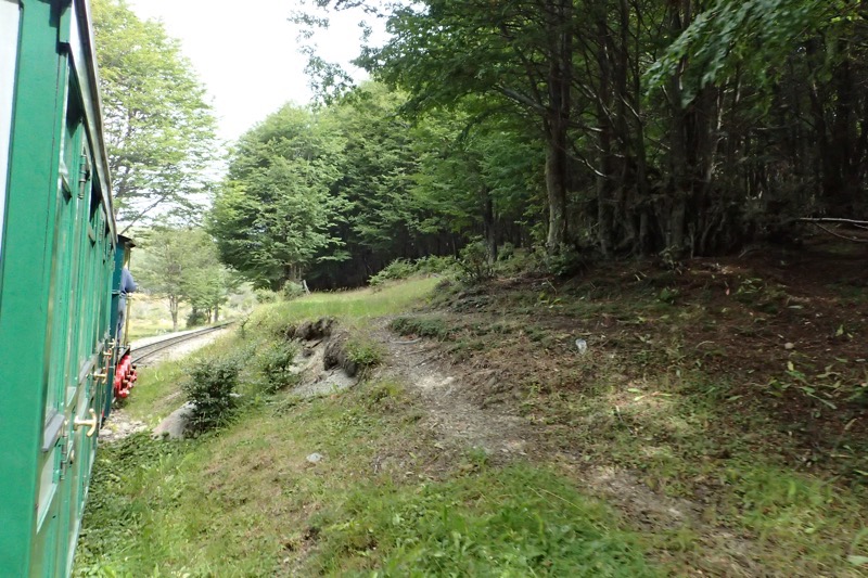
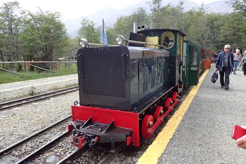
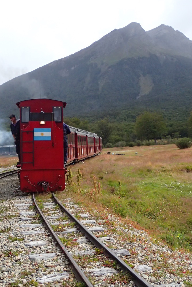
The park stretches 60km from the Beagle Channel on the Chilean border and is quite frequently accessed by the very quaint, heritage listed, ‘End of the World Train’. The End of the World Train, which was more properly named, the Southern Fuegian Railway was established as a narrow gauge steam railway, which replaced an old wood track rail system that was drawn by bullocks – the primary purpose of which was to supply Ushuaia’s prison. The steam engine trains were built over a 25km length on the Ushuaia waterfront, past Mount Susana and then through the Pipo River Valley into the Tierra del Fuego National Park. The railway, which is a cute 500mm (20”) gauge, was designed to connect the prison camp with a forestry camp for timber supplies.
The prison train was used to transport prisoners to the camp, and transport out logged timber from the forest. The conditions under which the prisoners worked and were accommodated sounded appalling – they worked long hours in deep snow; lived in dank tiny cells, and suffered cruel conditions with guards who make Alcatraz guards sound like candy stripers. Men were stood in sopping wet clothing for hours in the freezing cold for minor infringements, locked in small cells in the dark, indefinitely, these and many other cruel punishments were devised for transgressors. Being allowed outside to go work cutting timber, under armed guard, was a privilege – even if that mean standing in deep snow, working with tools with freezing fingers for hours on end.
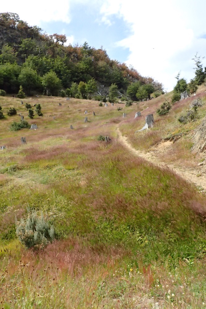
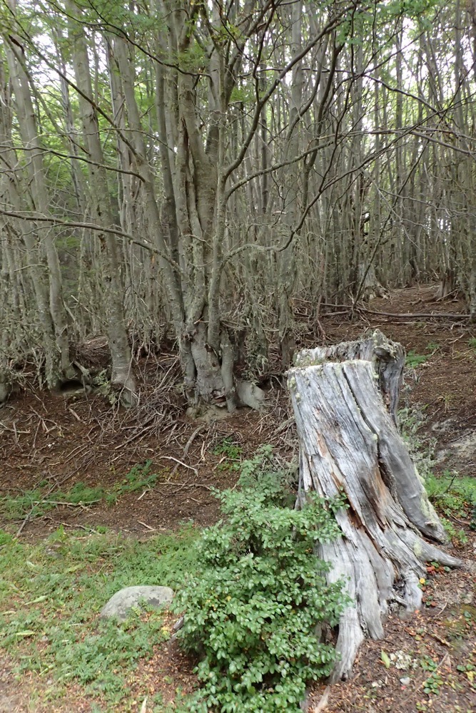
The landscape is scattered with tree stumps everywhere – nothing grows quickly down here, and likewise, nothing rots away quickly here either due to the low temperatures. At the time the trees were cut, they were taken at ground level, but you can see umpteen stumps left behind by the prisoners all appear to be at different heights… this apparently is indicative of how deep the snow was when each particular tree was cut down, as ‘ground level’ constantly changed with the snow depth.
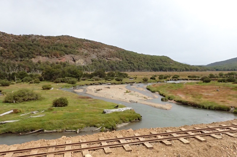
The prison was eventually shut down in 1947 and the railway was closed in 1952 following the reduction in forest resources (that will happen when you cut down really old, slow growth forrest), and the train tracks suffered some damage during an earthquake. It was some 40 years later that the train was revived and repurposed as a heritage tourist attraction. The 7km route takes about an hour to traverse into the park and every view from every window is just stunning.
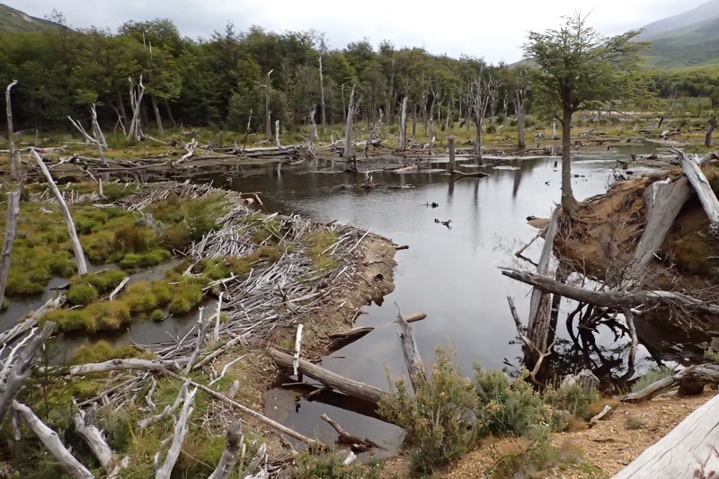
 After our train journey, Andres and Juan-Emmanuel picked us up and took us to a few different areas of the National Park. First we went to have a look at a beaver dam… which if you’re North American may not seem such a big deal, but when you’re Australian and you’ve never seen a beaver, was really quite curious. The island has several introduced species that have all wreaked havoc on the sensitive ecosystem here to the detriment of the local flora and fauna. The Tierra del Fuego National Park is studded with mountains, lakes and rivers carved out by glaciers which form deep valleys and beautiful water courses – and we went to checked out a dam across one of these rivers, that was built by two beavers in barely two months and I could not believe the size of the endeavour! It brought a whole new relevance to the saying ‘busy beavers’. I couldn’t’ believe that it took just two industrious rodents to create such a huge dam across a whole river in such a short period of time – meanwhile, back home, I can’t seem to get my back fence finished in two years… not even with ready money! Incredible work, pesty beavers.
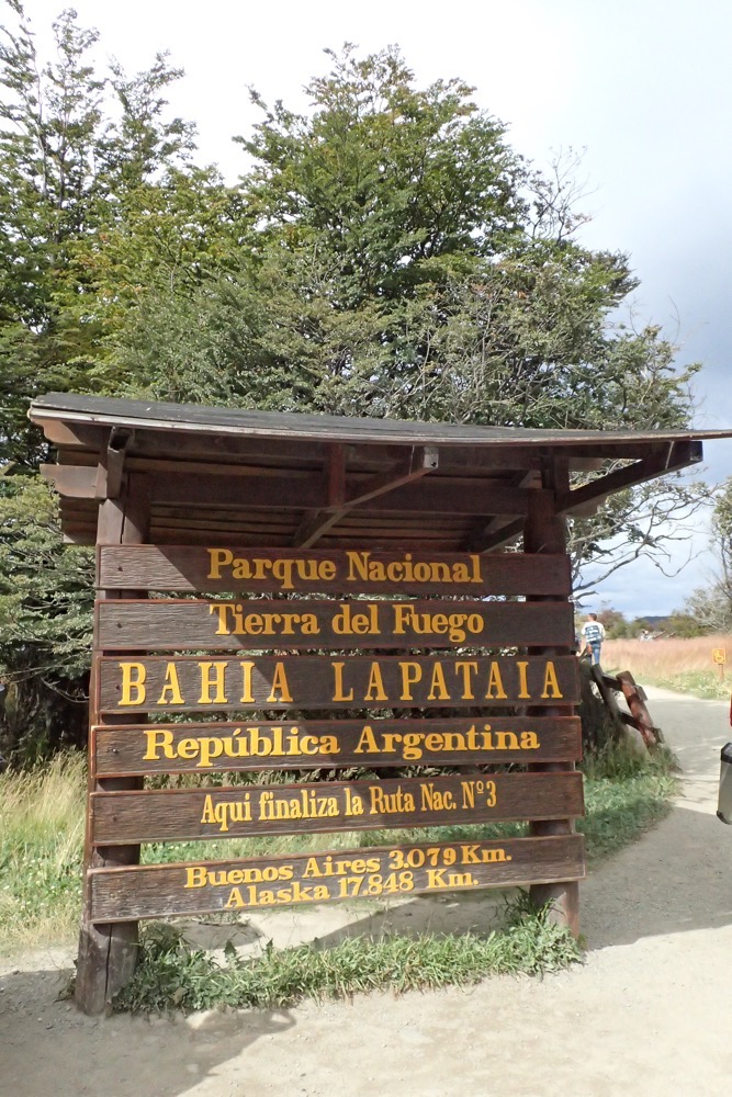
 After this we went to the actual (literal or metaphorical, I am not entirely sure?!) ‘End of the World’ site within the park. We are approximately 17,818kms from Alaska. And yes, apparently you can walk it! Andres told us he met a man who had walked from Alaska to Ushuaia and it had taken him almost three years to do the entire trip on foot… absolutely remarkable. Apparently he has set some kind of record in completing the epic adventure and has written a book about it, though my notes have deserted me and I can not remember his name or the title of his book!
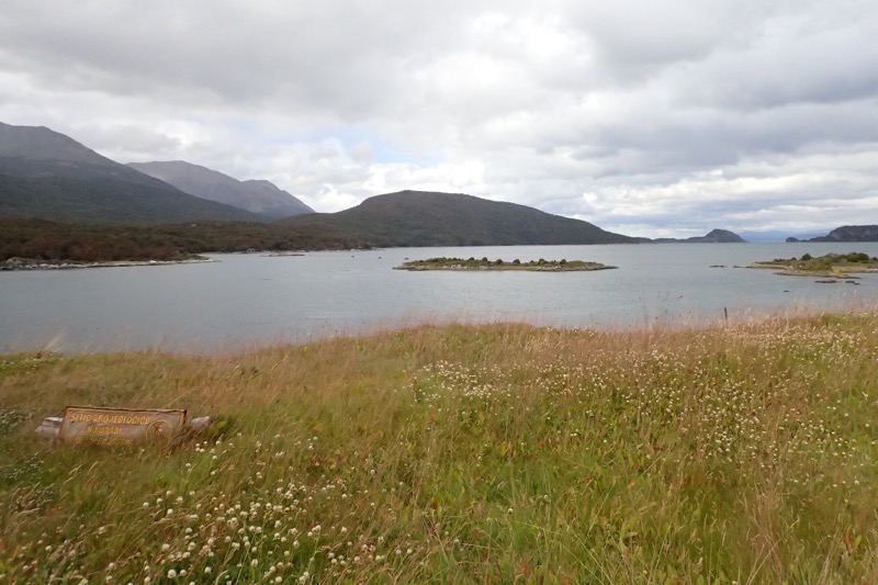
Here, for our viewing pleasure was some of the most stunning scenery I have ever seen in my entire life… it is a wide sweeping landscape of mountains, lake, river and low alpine vegetation. Impossible to truly capture with my dinky little happy-snap camera, but it was a truly breathtaking vista.
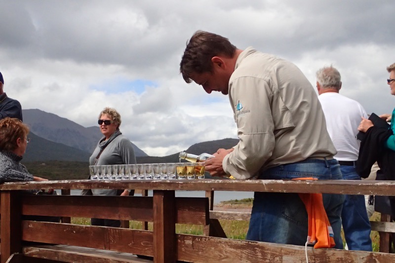
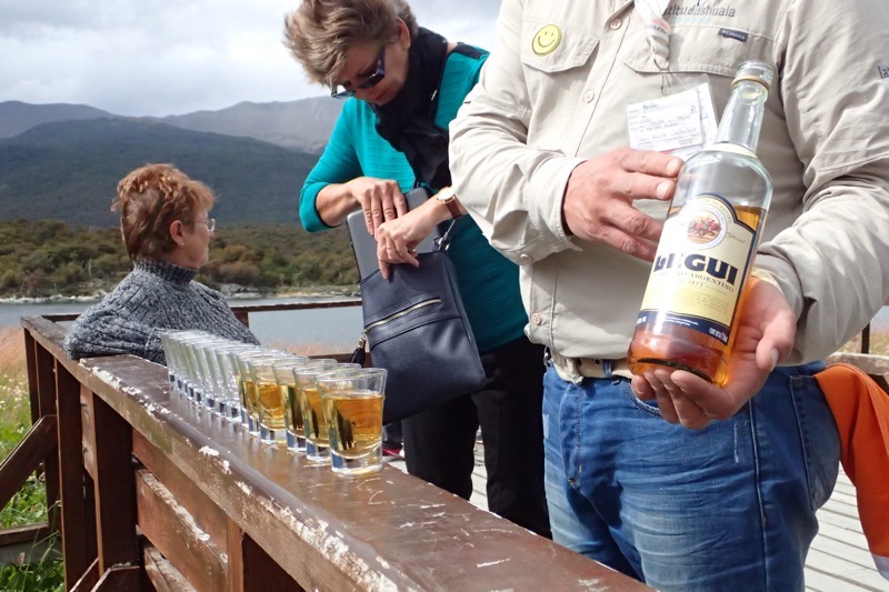
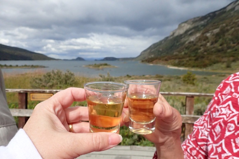
Also here, for our sensory pleasure, our guide, Andres, introduced us all to Legui – a local spirit made of sugar cane, oranges and herbs, so that we may all toast the occasion on our having travelled to the End of the World!
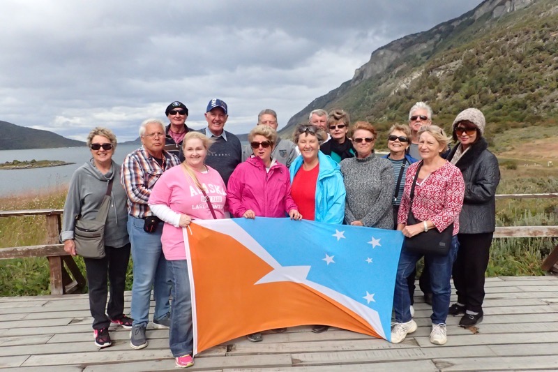
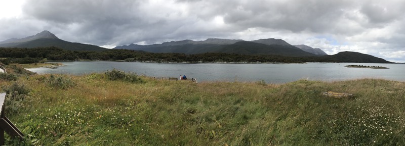
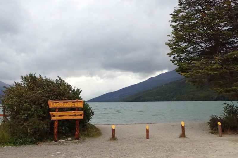
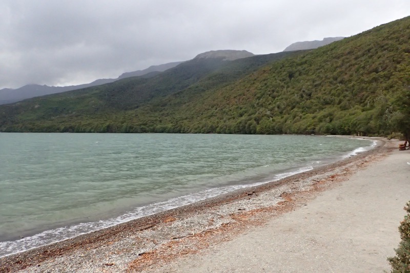
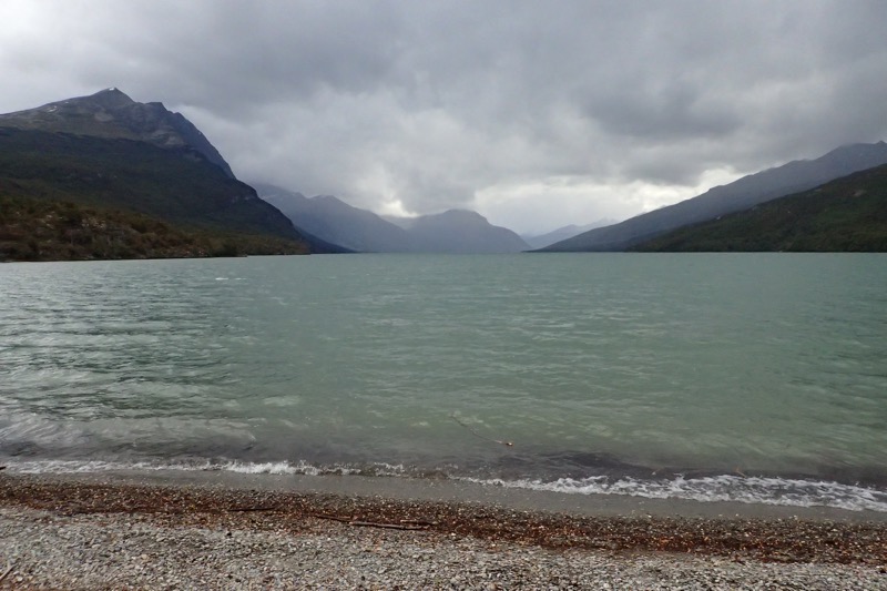
 After enjoying our Legui, the scenery and admiring the landscape, we returned to our bus and took a short drive through the National Park to a beautiful lake; Lago Acigami. On the way the the lake, Andres was telling us about a previous tour group that he took to this lake… he had 20 or 22 people, and when he got to the lake, three Russian men from his tour, all stripped down to their bare bums and went swimming in the lake, even though it is freezing cold all year round! He said, there was nothing he could do – swimming is not advised because of the risk of hypothermia and mostly the locals use the lake for kayaking, fishing and other recreational activities, but no one goes swimming there, and here he was – three of his passengers stripped butt naked went running down and dived on into the lake. Of his trying passengers, Andres said, “There was maybe ten tour bus going into Tierra del Fuego that day, and me? Why Me? Why I get the group with the crazy naked Russians!” While Aussies are usually up for a lark, and we all thought this story was hilarious; oddly none of us wanted to follow suit!
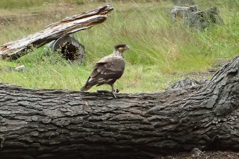
 Nearby at the lake we saw some caro caro birds – a native scavenging bird about the size of a smallish eagle. They didn’t seem to mind being surrounded by a dozen people with cameras and they appeared to have found something from the nearby campground to rip apart.
 Further into the park, we went to the post office at the End of the World, where they often drop tourists to get a special stamp in your passport to show your travels to Ushuaia. Of course being from a cruise ship, our passports were all safely stored in the ship’s administration office, so none of us had passports to get stamped – but they are normally happy to stamp papers as a memento of your having travelled so far. Alas, the post office was closed by the time we got there… but I have to admit I have never seen such a scenically located postal service, ever! Such a pleasant view from work everyday, wouldn’t you say?
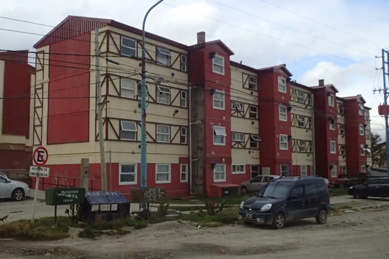
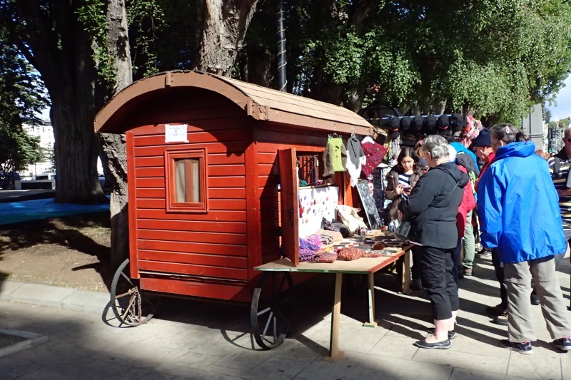
On our way back to Ushuaia, we saw more beautiful scenery, and then drove through town back to the port, where we encountered large housing projects and quite a quaint but thriving town, which reminded me of Queenstown in New Zealand, but with a stronger military presence loitering about… not sure what that was about, but there were both police and army seemingly posted on every other corner. Someone mentioned a strike that was happening in town that day and that banks were all closed, but this is one of the drawbacks of not speaking the language – things can be happening all around you and you can be completely unaware because you can’t read the headlines of newspapers or hear what is being said on radios or televisions.
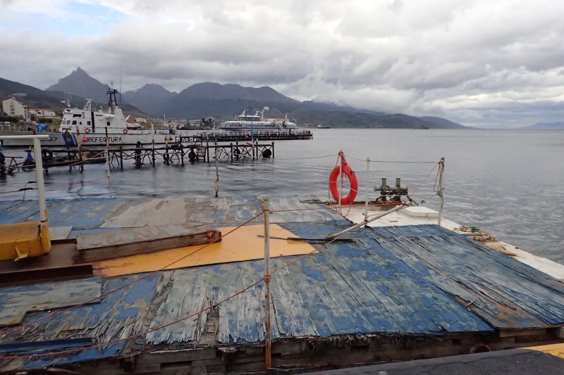
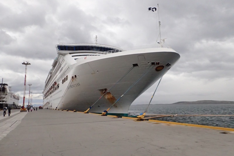
 After a short wander around town to pick up supplies (read: Legui to bring home!) we went back to the port and were swiftly back home on ‘ze friendliest ship on ze seven seass, ze beautiful Sea Princess’. 🙂 It’s strange how the ship becomes home away from home.

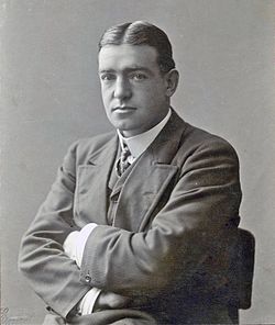 Sir Ernest Henry Shackleton (1874-1922) was a famous British polar explorer who led three expeditions to the Antarctic and is one of the principal figures associated with early Antarctic exploration.
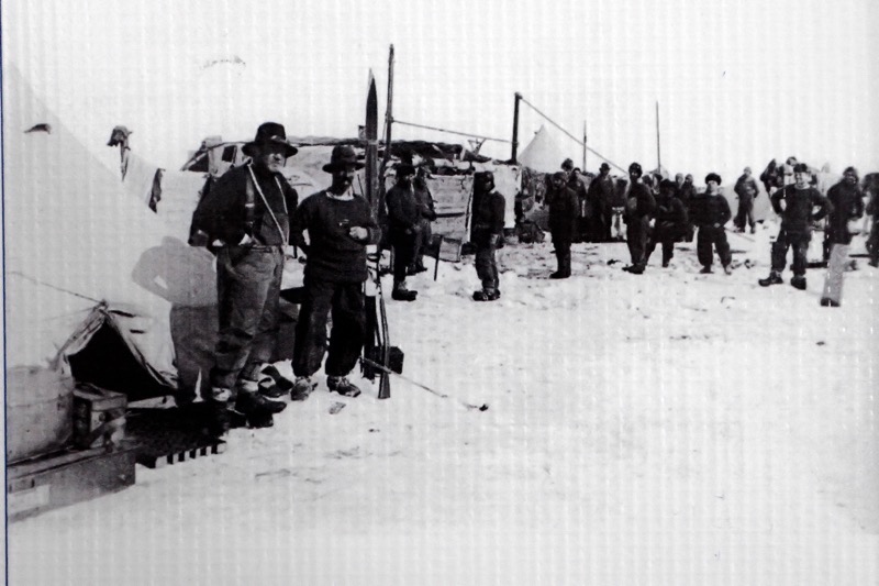


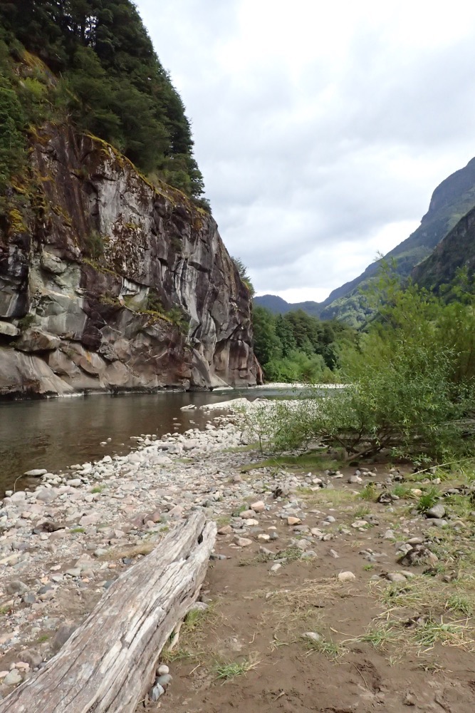
 We then enjoyed an amazing view on the way to the Simpson River National Park – which we were informed by our friend and fellow traveller, Jerry, is the fourth best salmon fishing in the entire world! Salmon up to 45kgs have been caught here – that is like, over two bags of concrete, or the equivalent of nine Alaska puppies!
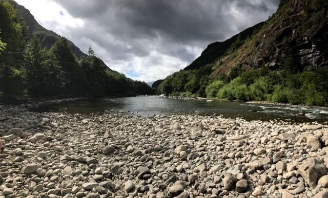 This whole area is comprised of sweeping landscapes created by volcanos and glaciers. It has a very dramatic feel around every corner and you find yourself taking hundreds of photos that will probably never see the light of day. Lots of speed-landscape photography today out the bus windows as we moved through some of the most gorgeous scenery I have ever seen.
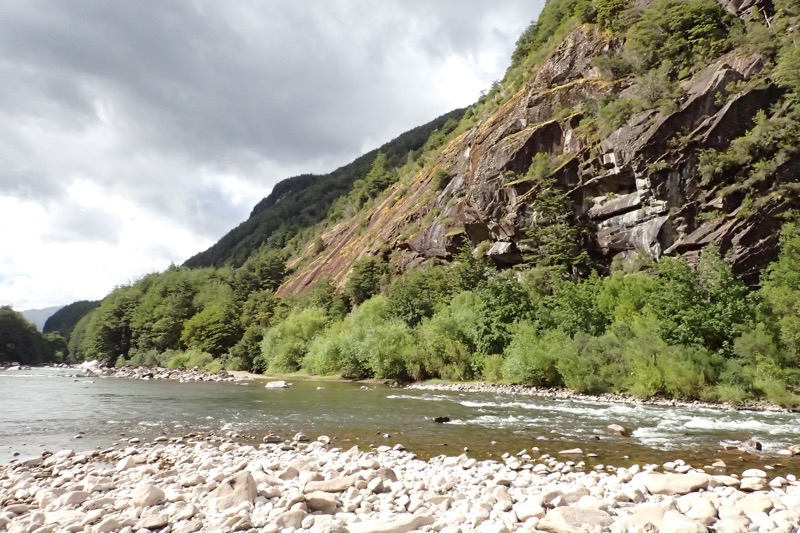
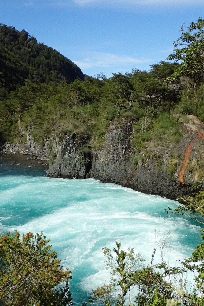
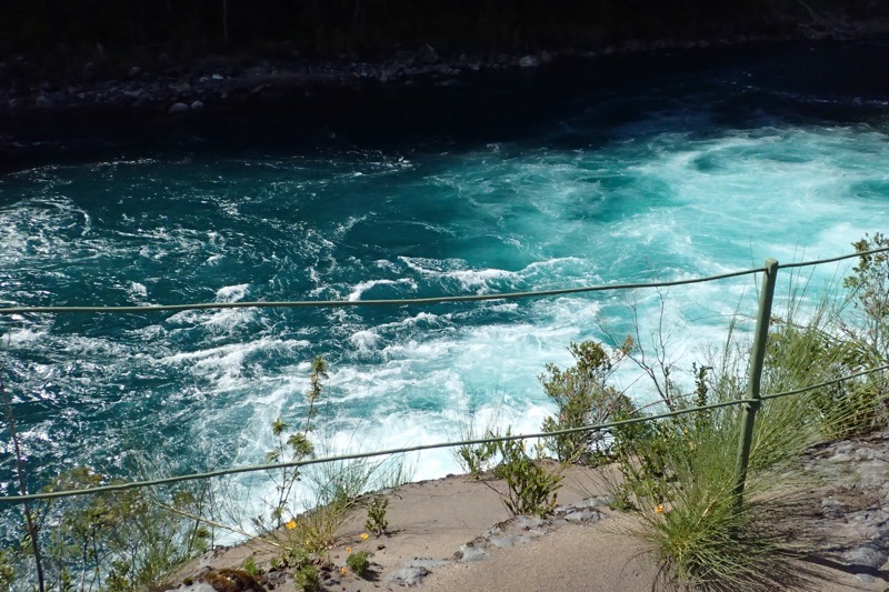
 I love the colours of the glacial rivers – it has a very distinctive, blue/green/grey. I’ve only ever seen it in New Zealand, Canada, and Iceland, but it’s always so beautiful.
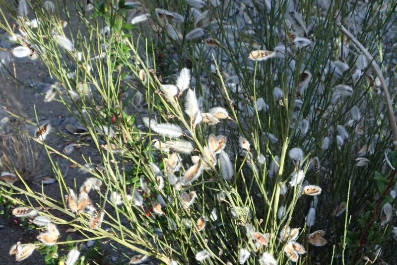
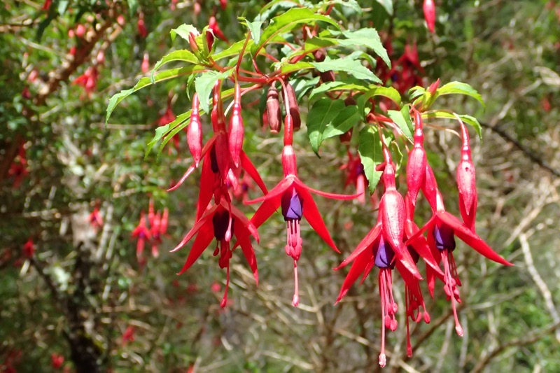 Denisse told me what this plant was called – but for the life of me, I can’t recall… and uncharacteristically, I forgot to write it down. I will endeavour to look it up and add it in later. (Edit: they’re fuchsias… *rolls eyes*)
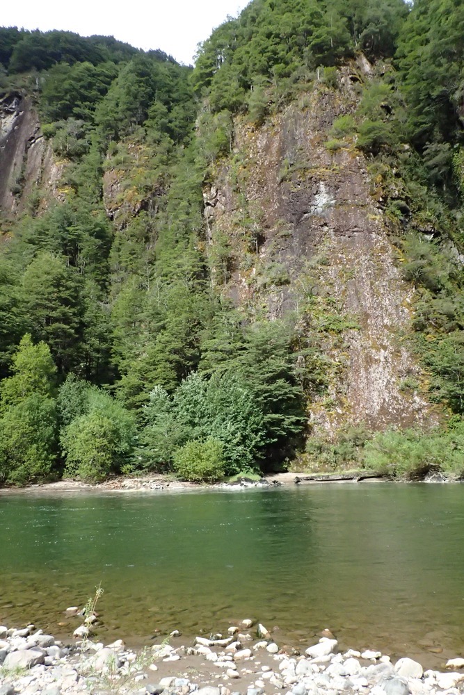
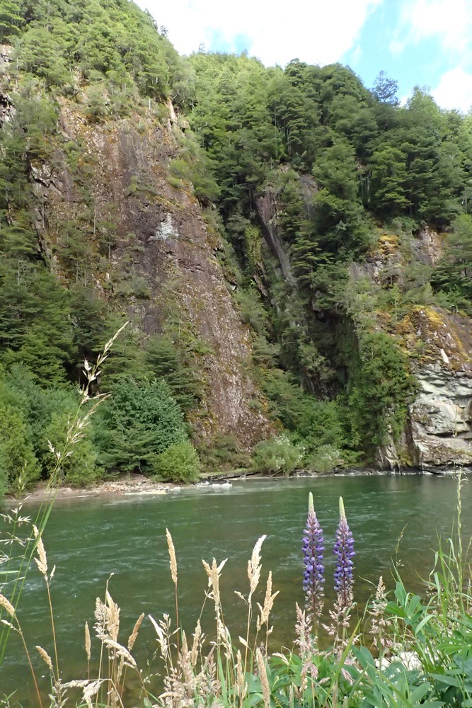
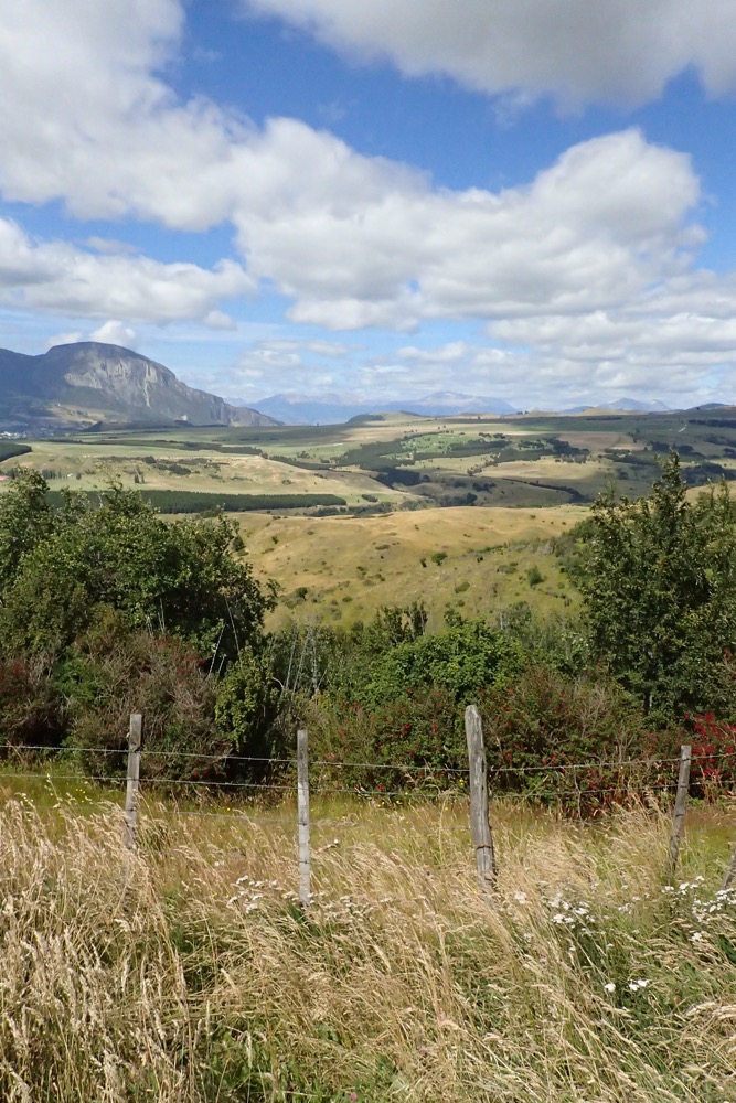
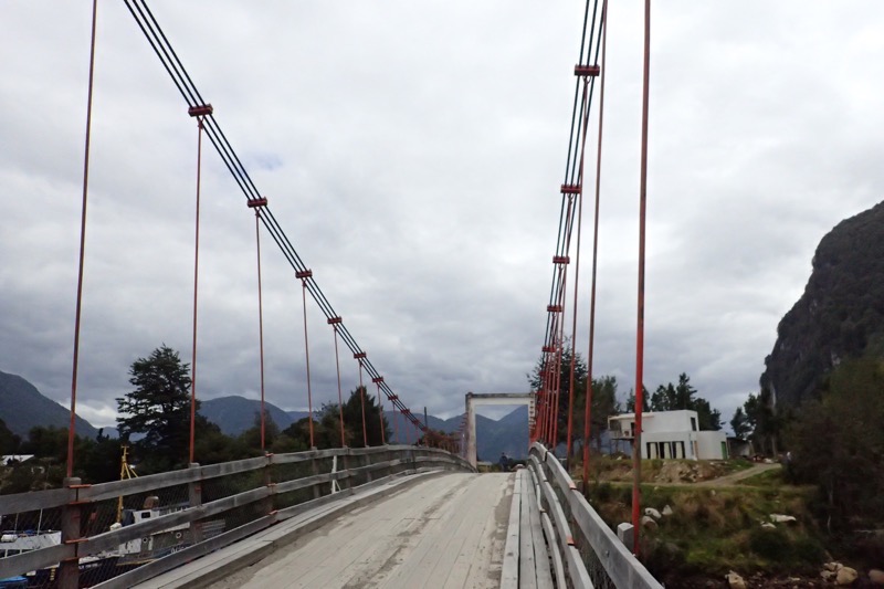
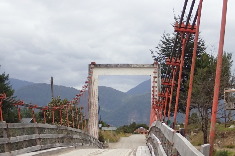
 Just so many beautiful views of craggy and jagged peaks, with snow capped mountains, as we moved alongside the river for a bit of a walk. Then back to the bus and we drove off towards Coyhaique (Ko-yay-kwi). The landscape is completely unspoiled, you can see why so many National Geographic covers seem to come from the pristine wilds of Patagonia, and why it is on every serious hiker’s, ‘Must Do’ list.
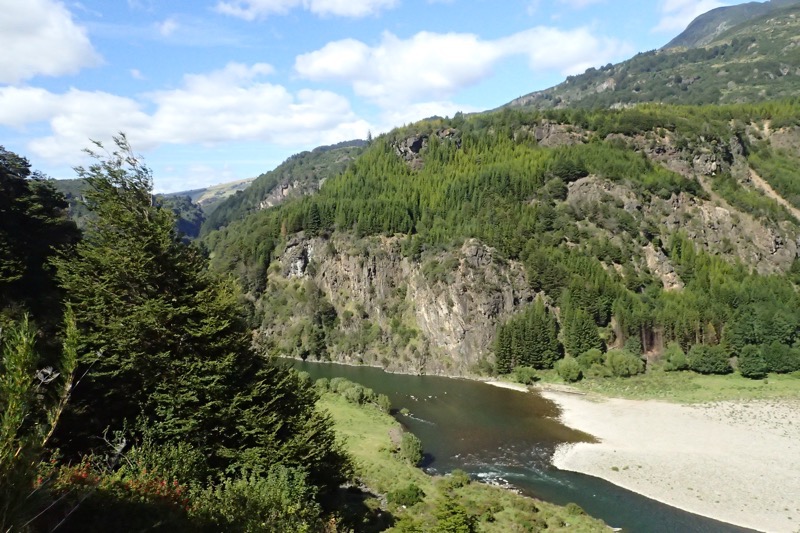 This is the view from a lookout that over looks Coyhaique. The enormity of it is not adequately captured, but you can get a rough idea from this panorama of how spectacularly beautiful the region is. Coyhaique is considered the ‘Capital of Patagonia’, and if all the NorthFace, Patagonia and Katmandu hiking stores are anything to go by, I dare say it lives up to its reputation.
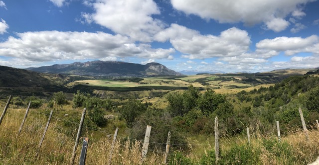
 There were cyclists and backpackers aplenty in the town and all enjoying a beautiful summer day. Coyhaique is a blend of modern and traditional architecture surrounded by the forests on every side. The Andes Mountain range surrounds you in every direction.
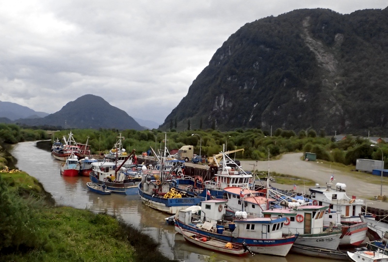
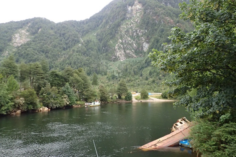 The ship in the pic above was swept this far inland during a tsunami, there are many ships and boats that are laying around wrecked as a reminder of how volatile the geography and the climate can be in this region – earthquakes, subsequent tsunamis, volcanos! I’m not sure how these people are as laid back as they appear to be living with these sorts of disastrous threats.
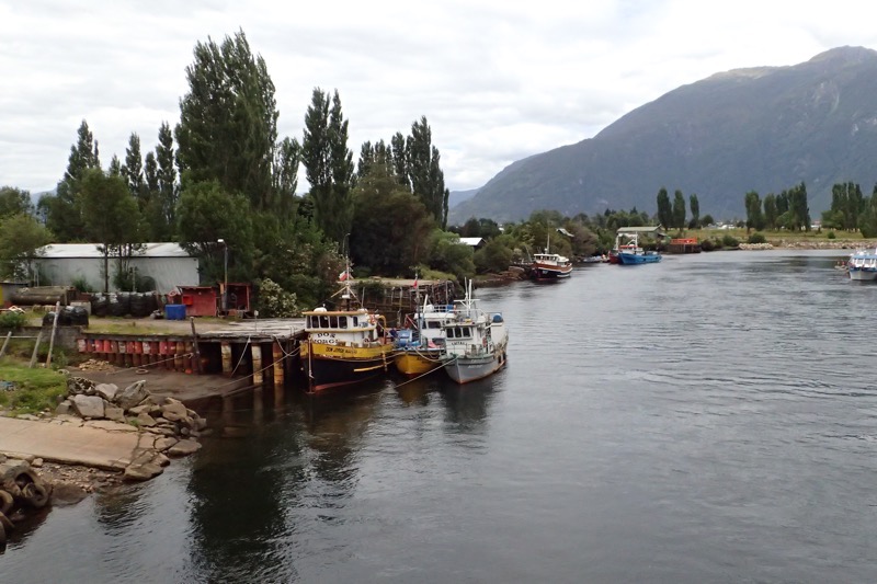
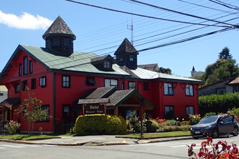
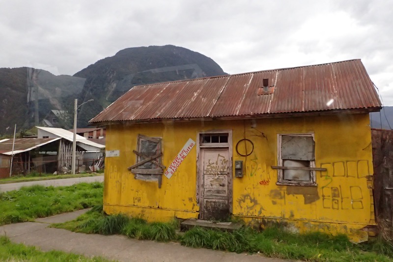 Look at this… it’s gorgeously quaint, but I can’t imagine what its occupants would think of our cookie-cutter suburbia with its manicured lawns, matching gutters and window frames, and identical driveways. So much character in this house, you almost wish it could talk; and then are immediately concerned for what it may have to say!
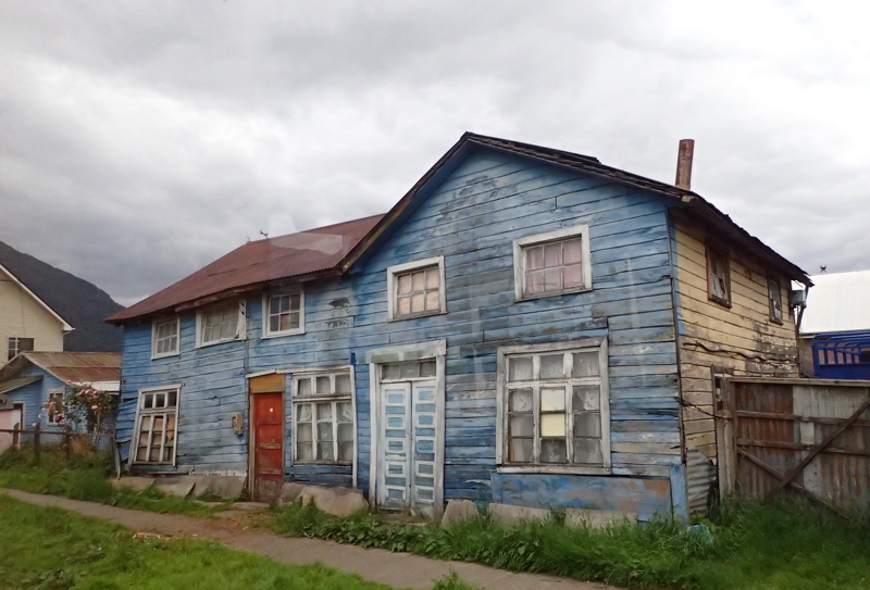
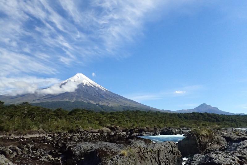
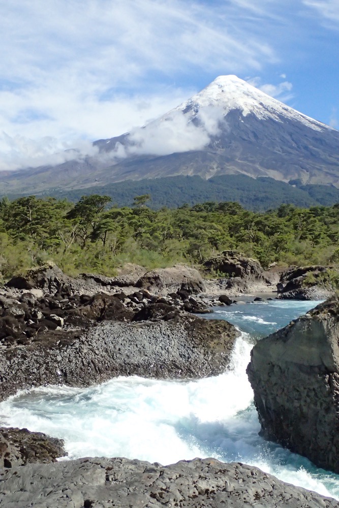
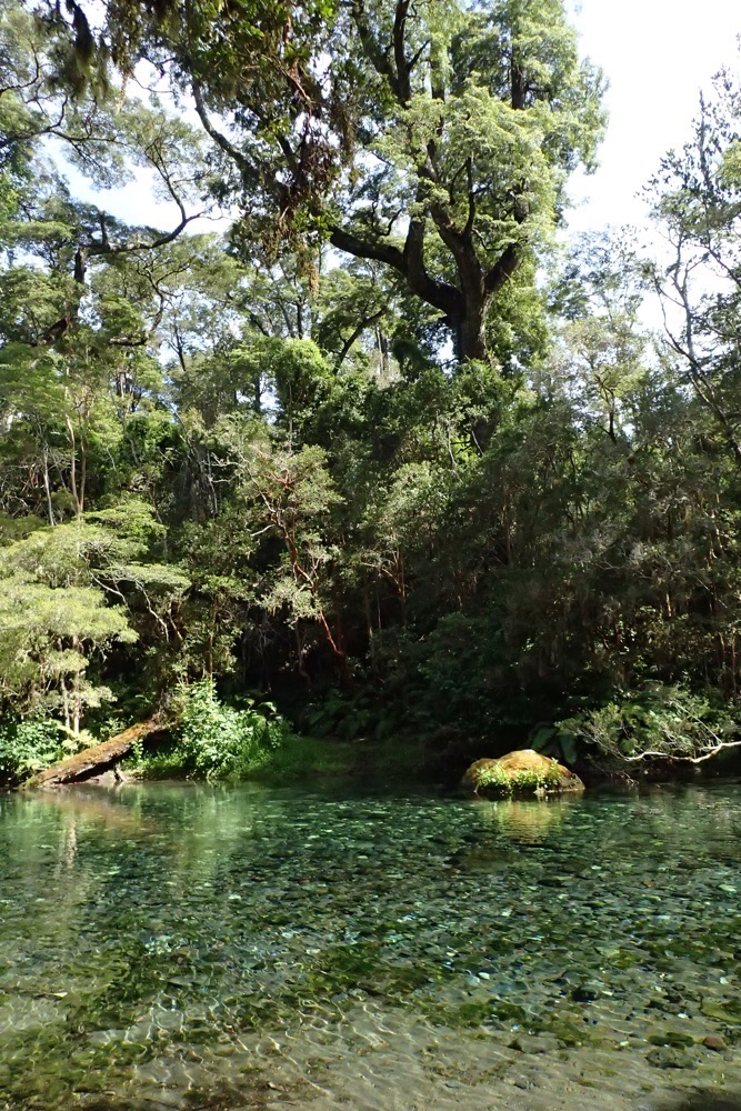
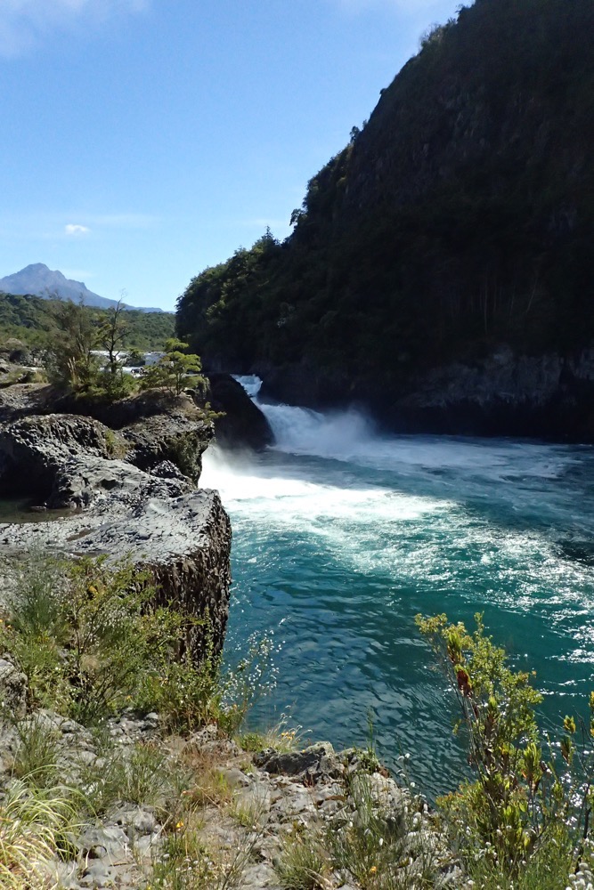 Petrohue River/Rapids
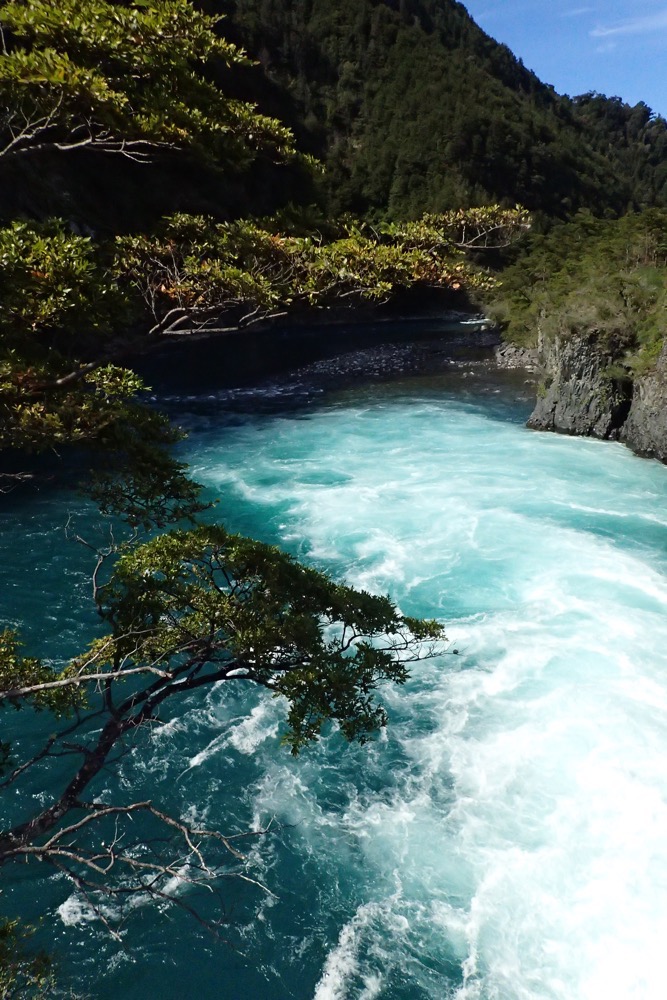
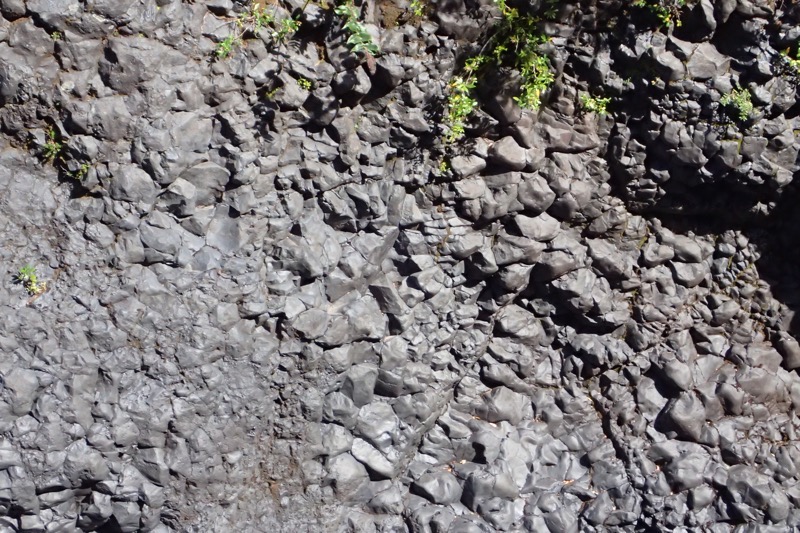
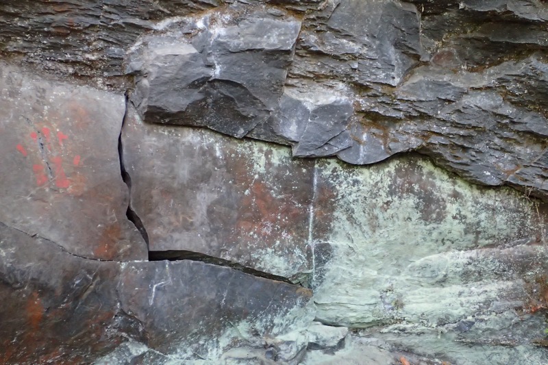
 Volcanic ash – above; volcanic rubble – below
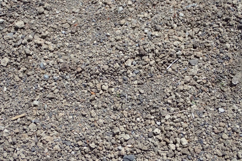
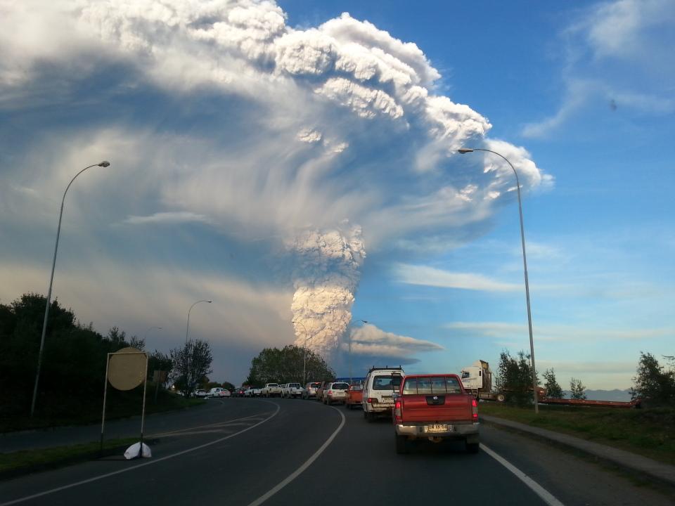 (pic above from Wikipedia)
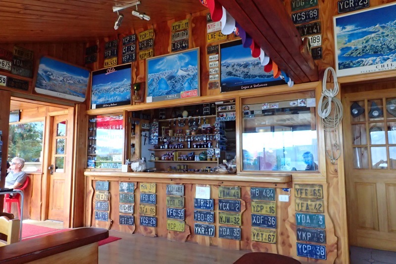
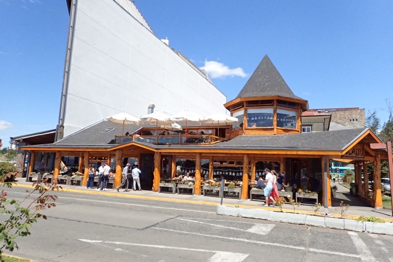
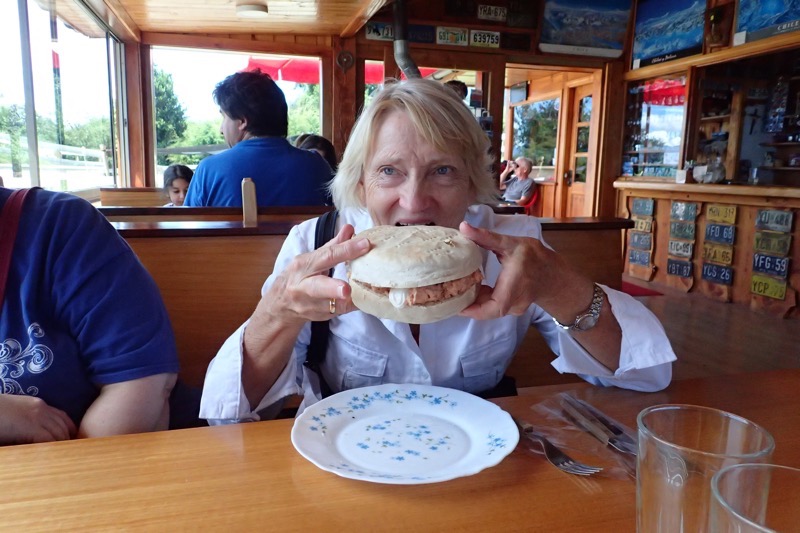 View from lunch: